
[This walk was completed on the 24th May, 2023]
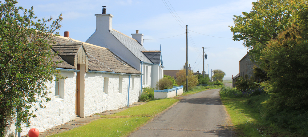
It’s a bright, windy day. I start my walk in Brough, and take a little detour to look at a cottage that once was owned by my brother-in-law and his wife. What a pretty little cottage it is, too! Idyllic. They must have been very sad to leave.
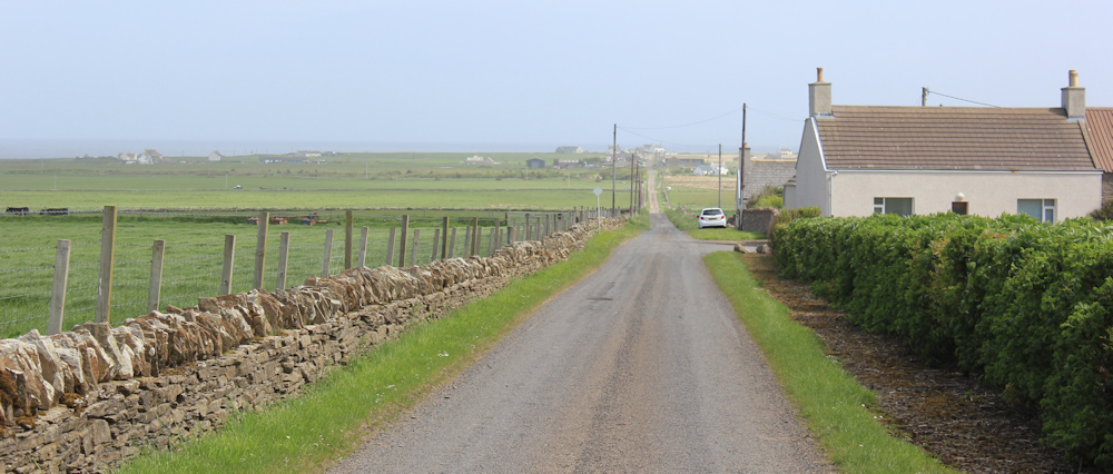
From Brough, I follow a minor toad towards a place called Ham. This narrow road is, unfortunately, labelled a “scenic route” and so I constantly have to dodge speeding cars and trundling mobile homes.
When I cycled along here this morning, the wind was blowing so fiercely against me that I had to pedal all the way using the highest power setting on my e-bike, even when going downhill. I made it to Brough with one bar left on the bike’s battery.
(Watching the bars go down is very rather stressful. If I ran out of juice completely, I would have to push the damn bike – and it weighs a ton!)
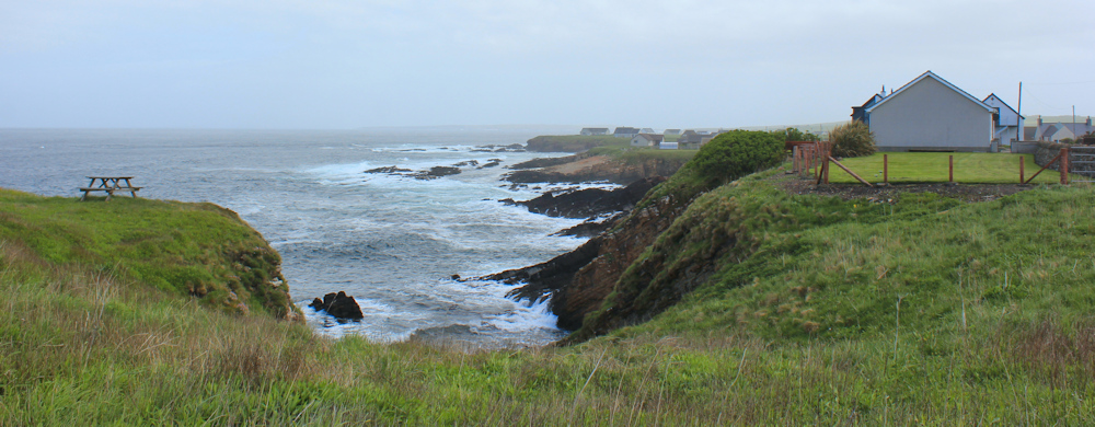
But now the wind is pushing me along and the walking is easy. As I get closer to Ham, I get a lovely view of the sea. Shame the view is spoilt by a thick haze.
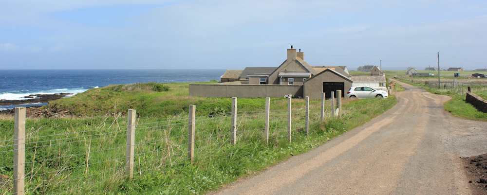
This eastern part of north Scotland is far more populated than it was on the western side. There is no dense housing – eveything is spaced out – but you are always within sight of a cottage, or a house, or a farm. And the landscape is no longer wilderness, but is now mainly grazing pastures for sheep and cattle.
Hello Mrs Sheep. Your lambs are growing up. When I first started this trip (a month ago) the lambs in the fields were tiny little babies, tottering about on uncertain legs. Now the lambs I see are fatter and more confident – cocky almost.

Ham seems to consist of a rather grand house and farm, and a large ruined building. Maybe this used to be a barn or a warehouse? Oh, no, hang on… it’s an old water mill.
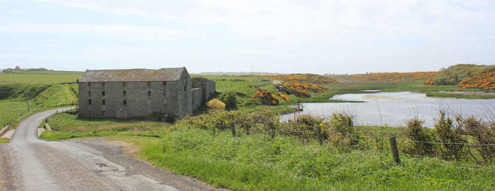
The mill is situated on the bank of a stream, called the Burn of Ham. I stop on the bridge over the burn to take photographs. The water empties into the sea shortly below the mill.
Looking upstream, I can see an artificially created watercourse that connects the mill pond above with the sea.
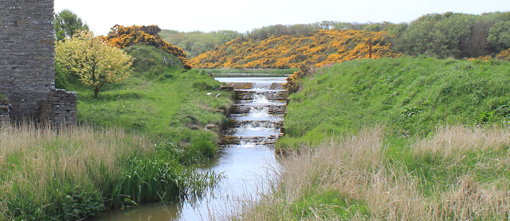
I wonder if the mill stone sat in the main stream, or in a separate waterway? There is no sign of the wheel now.
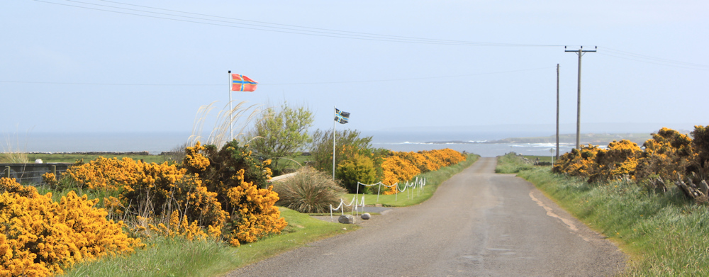
At Ham, the road bends away from the sea. I would prefer to follow the coast, but the fields are criss-crossed with barbed-wire fencing, so I decide to stick to the road. The sun has disappeared but the wind is still, roughly, behind me, and I make rapid progress.
About a mile along this road, I come to a school in the middle of nowhere. But the school is definitely being used – there are cars parked outside. Just beyond the school, I reach a side road which leads to a place called Scarfskerry.
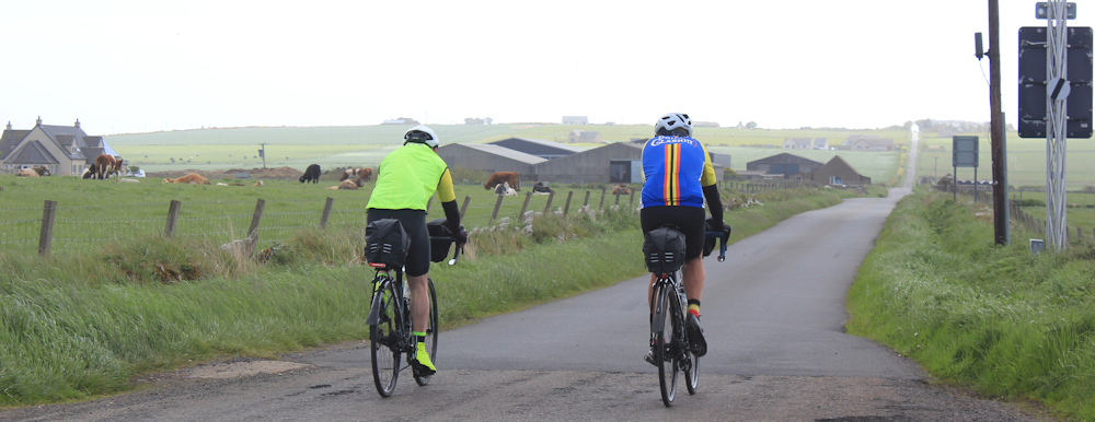
I’ve been aware of a couple of cyclists coming up behind me. At this point they overtake me and carry on straight, maybe heading towards the main A836.
But, I turn left towards Scarfskerry. I may not be able to walk along the shoreline itself, but this road runs roughly parallel to the coast and is the closest I can get.
What a great view! Looking back to Dunnet Head. The sun is still shining over there!

The road to Scarfskerry turns out to be a long one. The first section is uphill. When I check my map, I discover this hill has a rather grand name – Hill of Rattar.
At the top of the hill, I get a splendid view down the road to Skarfskerry – and it does look a long, straight and boring road. Oh well. At least I’m going downhill and the wind is pushing me along.
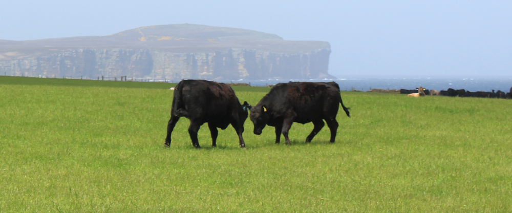
I pass Rattar House – a farm house, I think. There are cattle in the fields. Bullocks. One of them eyes me with suspicion and I am glad of the solid wall between us. Two others are having a tussle.
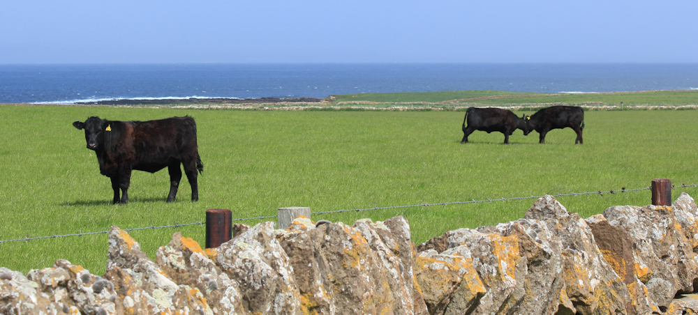
Several minutes later, they are still tussling. They make little charges and push each other with their foreheads. Naughty lads.
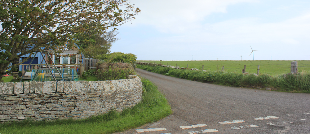
Scarfskerry is another one of those strung-out Scottish villages. Some of the houses are renovated and there are one or two smart new-builds. But most of the housing consists of small cottages in various stages of disrepair.
You can buy eggs for £2 a box. But I don’t need eggs.

Further along, a hand made sign outside a cottage reads, “Public Notice. Correct Facts!”, with a map showing the plot and a solicitors letter stating that there is no “express servitude right of access” through a gate to the west of the property. I suppose this is part of some ongoing dispute over access rights.
A short while later, I come across a dilapidated boat in a driveway. Maybe this is a renovation project? The boat certainly doesn’t look seaworthy at the moment.
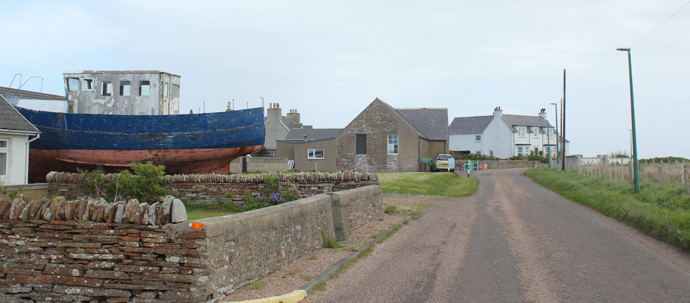
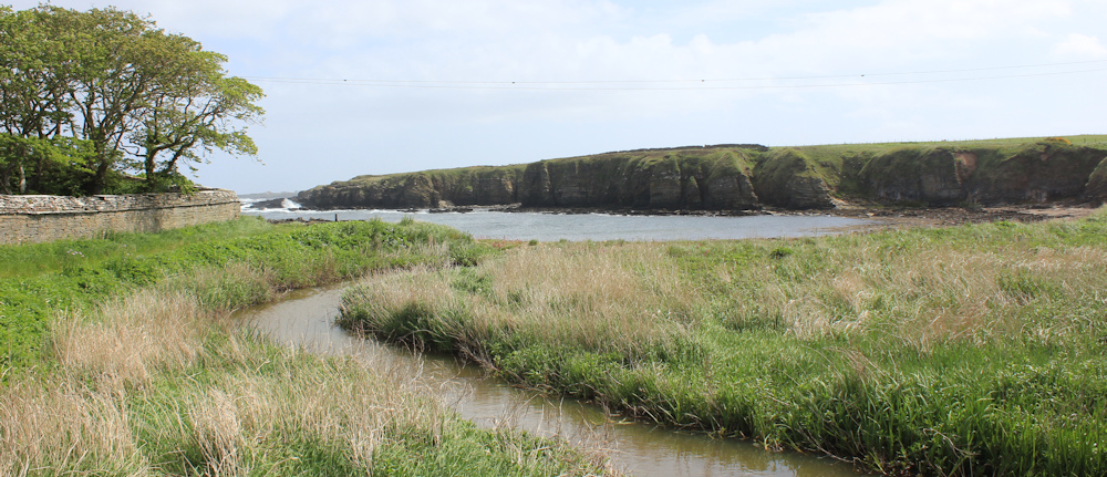
The boat is a reminder that I’m near the sea, and a few yards further along… here I am. Back on the coast. Dark rocks below me and swelling waves.
Unfortunately, a series of private houses prevent me walking along the edge of the cliffs, so I must stick to the road.
The sun comes out again and the landscape is glowing with unexpected warmth. Beautiful.
Why did the white cockerel cross the road?

To join its friends on the other side for a good natter!

Would I like to live here? On the plus side, there are uninterrupted sea views, wonderful light, good fresh air and plenty of space. I bet prices are relatively cheap too.
On the downside, you’d be living in the middle of nowhere. (I’m not even sure where the nearest shop is. Castletown?) And the wind today is ferocious. Think how bleak it would be in winter, and how short and dark the days.
So, no, I wouldn’t like to live here.
Onwards. The road turns away from the shore. I pass a house called “Rainbows End”…

… and, later, a “Caravan and Motorhome Club Certified Location”. A facility I couldn’t use, even if I wanted to, because it is for members only.
There are cattle in the fields. These mothers seem very friendly and come over to see me, bringing their tiny little calves with them.
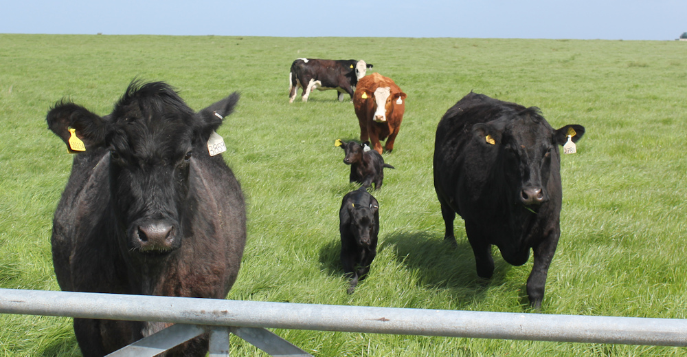
I take their photographs. And then realise the whole herd has come over. Perhaps they are expecting food?
They follow me for some distance along the fence. I really don’t like cows, but they do seem to love me!

I pass a sign that says “Rivendell”, and think of Lord of the Rings.
Here’s a traditional red telephone box. Sadly, many of these iconic structures are no longer shown on my OS maps, presumably because they no longer contain working telephones. But this this one has taken on a new use – an informal library or book-swap facility.

“Swap, borrow, donate,” says one sign, while another sign says, “Or just take a book and leave a donation!” It’s one of several such libaries I’ve seen in unused phone boxes in Scotland.
What’s that peeking over the hill. A castle? I check my map. It must be the Castle of Mey, where the old Queen Mother used to live.

I reach a turn off to the left, with a road sign that reads “Harrow Harbour”. Turn left, and almost immediately take a little road to the right. This road has an unofficial sign that warns me there is “No through road to castle.” That’s fine, I don’t want the castle.
The little road takes me back to the coast, where some holiday chalets overlook the sea, and the road bends sharply round to the right.
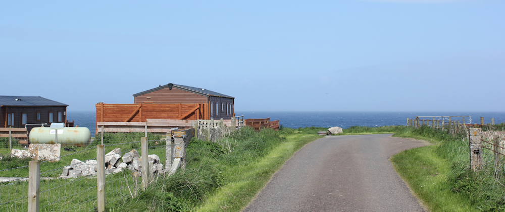
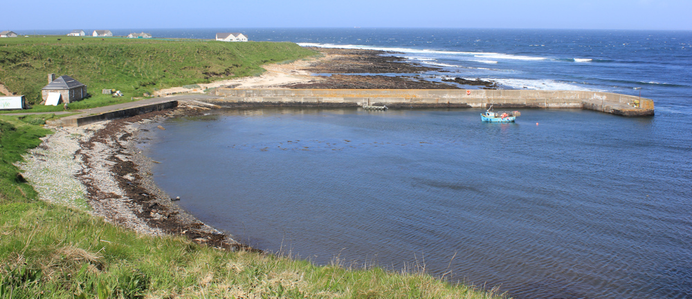
Ah, here is Harrow Harbour. The harbour is set in a natural bay (Wester Haven on my map) with a man-made pier giving extra protection from the rolling waves. Another one of those tiny fishing boats makes the harbour look much bigger than it really is.
Annoyingly, I begin to meet a constant stream of cars coming towards me. Not just cars. Vans. Motorhomes. And even coaches. Where are they all coming from? There is nothing much along this road – just great views over the sea.

When I get closer to the Castle of Mey, the mystery of the traffic is revealed. That is the castle over the field. This is the back end – I asume the front is much grander! And this may not be the route TO the castle, but it is certainly the route FROM the castle.

Beyond the castle, the coastal road comes to an end, but a farm track continues on beside the shore. I stop to let more traffic go past, and decide what to do. I think if I continue along the track, I can join up with a road on the other side.
Onwards. I’m heading in a northerly direction now, so I stop again to take photographs of the view back along the coast. Harrow Harbour is hidden around the nearest headland, but that must be Scarfskerry on the next headland, and the misty shape of Dunnet Head in the distance.

This might be my last view of Dunnet Head. I always feel a twinge of sadness when leaving a familiar landmark behind.
But, I really enjoy this section along the track. Seashore to my left and a high wall to my right. No traffic. This is lovely.

The main track bends away to the right, heading uphill towards the farm, I assume. But a path continues onwards along the shore. Perhaps I can walk further along?
I continue for a hundred yards or so, but then – uh,oh – I come to an obstruction. Can I climb over?
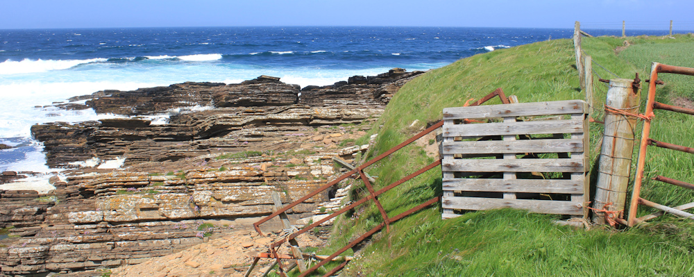
The gate post is too rickety to rely on. The obstructing fence section is made from an old wooden pallet and piece of rusting gate, all held together by string. The whole structure shakes and shudders when I test it with my weight.
I don’t want to wreck the farmer’s makeshift fence, and it seems dangerous to attempt a scramble down the cliff to get round it. No, I must turn back.
[To be continued…]
Route so far today:


What a lovely walk. The bright yellow gorse in your second photo is gorgeous, it must have had a wonderful scent too. I smiled at the cows following you along the fence line. We stayed on a farm recently and part of the herd (including a massive bull) came into the field next to our little holiday let most days. Such a delight to see them and their many calves. Harrow Harbour is a pretty place too.
I enjoy looking at cows and their calves – as long as I’m safely behind a fence or wall!