
[This walk was completed on Monday, 13th May, 2024]
Leaving Sarclet Haven behind, I carry on along The John o’Groats Trail. I’m tired now – this walk seems longer than I anticipated – but I must be nearly there. Another geo to walk around, fringed with pink thrift flowers. Turrie Geo, I think

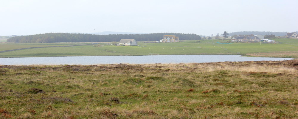
Looking inland, I can see a large body of water. Loch Sarclet. The sea fret seems to have moved inland, and the distant houses are vague shapes in the mist.
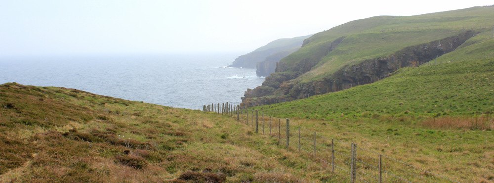
I MUST be nearly there. But the rocky coast stretches onwards, full of indentations and crevasses, its furthermost reaches hidden in the misty distance.
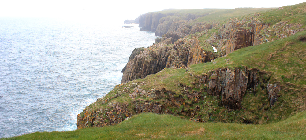
I lose track of where I am. So many geos to walk around. My map names them: Turrie Geo, Oily Geo, Lummers Geo.
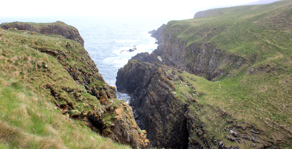
This is a blow hole. Once a sea cave, the roof has collapsed to leave a hole with waves sloshing around in the bottom. Soon, the bridge connecting the two sides will disappear, forming yet another geo.

Further on, a group of figures wearing backpacks are standing near the cliff edge. Walkers? As I get nearer, they put their packs down and begin pulling out lengths of rope. Not walkers. Rock climbers!
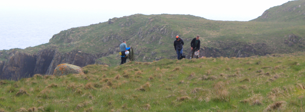
I should be above the Stack of Ulbster, although I can’t see any stack from this angle. Perhaps that is what the men are going to climb?
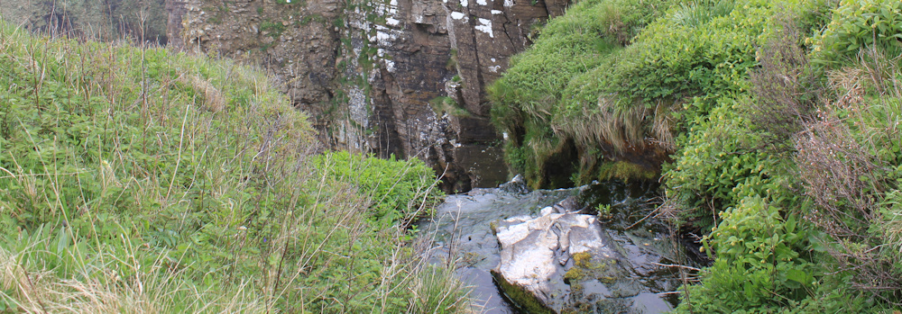
Heading inland to get around another indentation in the cliff, the path gets narrower and rather scary. Ah, a lovely, elegant waterfall. This is where the outflow from Loch Sarclet empties into the sea.
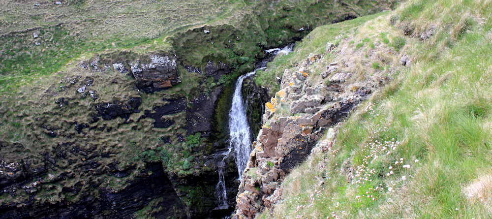
I edge my way gingerly round the top of the drop, wishing my legs felt stronger. Past the waterfall, I follow the burn upstream, looking for a way across. Will I have to wade?
Ah, a plank bridge. What a relief! But there is no easy way down the steep-sided valley. After dithering for a while, I sit down on my bum and slide down the grassy slope.

Glad nobody can see me!
Once across the burn, I follow the path as it climbs to the top on the other side of the narrow valley. Now I can see the Stack of Ulbster properly. Very dramatic.
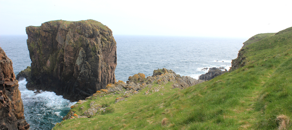
If those men were planning to climb the stack, they would have to swim across to get to it!
From here, the going looks easy. A wide swathe of green grass means I can keep well away from the steep cliffs. I’ve nearly finished the walk… I think.

Looking back, I take one last photograph of the Stack of Ulbster, with the graceful waterfall in the foreground.
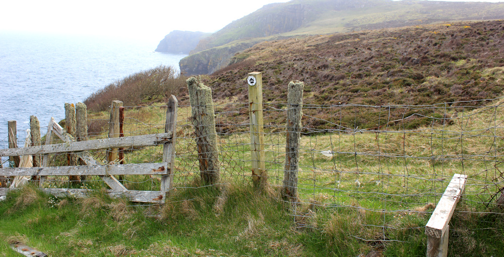
Reach a rickety stile. The stile is low, the fence is high, with barbed wire placed unhelpfully across the top. It sways as I try to climb over. My legs feel heavy with fatigue, but I manage to straddle the fence and land safely on the other side without ripping my clothes.
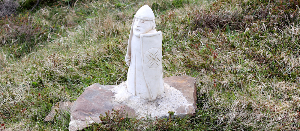
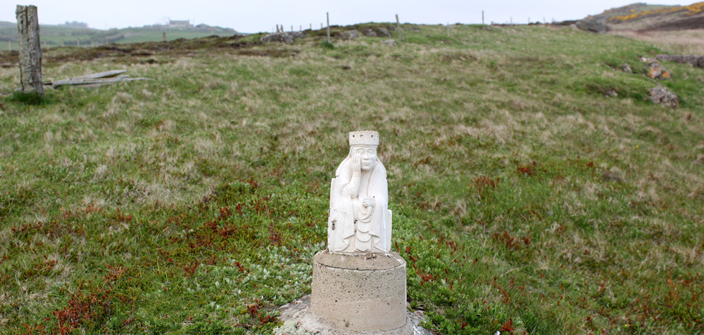
This next area is really weird. The usual mix of grass, bracken and gorse, but dotted around the landscape are some carved figures. Each about two or three feet high, they look undamaged by weather and I assume are fairly recent.
Here is a soldier or a knight, guarding the path.
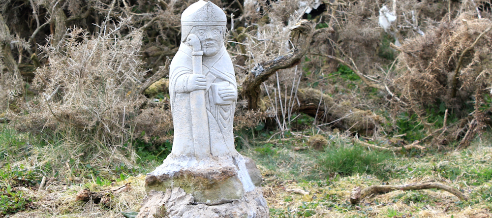
A man with a book and a staff. Maybe a priest or a bishop of some sort?
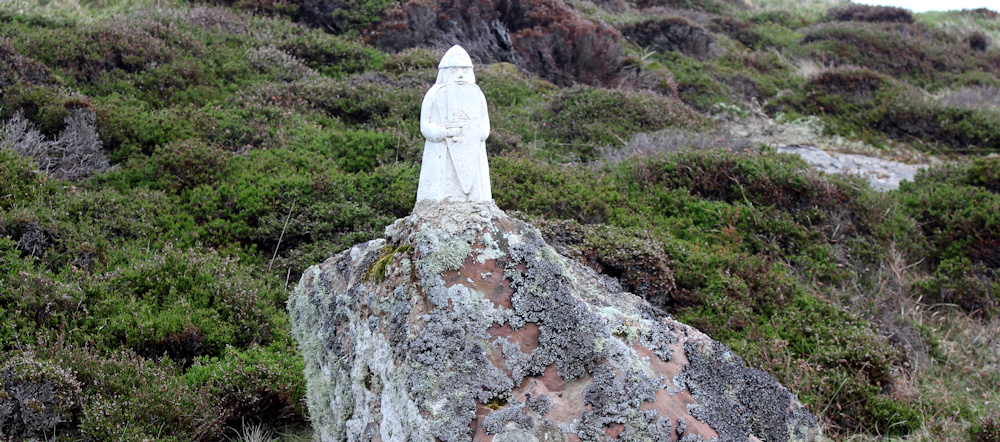
Further on, as I climb a slope, a wee little king holding a sword in front of him.

A knight, a bishop and a king? Do they represent chess pieces?
I cross a burn via a plank bridge and climb a hill. Pass another knight. Climb over a stile.
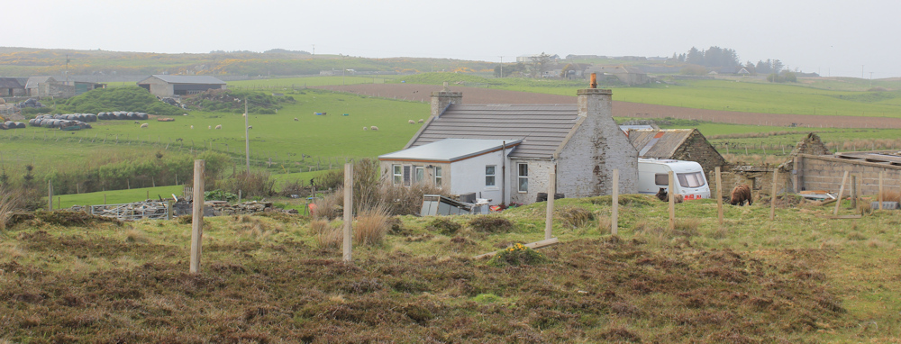
Am still pondering on the little statues, when I realise I must have come the wrong way. In front of me is a small-holding. I could climb the fence and wade across the muddy field… but surely this can’t be the official John o’Groats Trail? I’m lost.
I follow the fence up the hill, and soon spot a familiar waymark indicating the trail. That’s a relief. I am back on the proper path.

I pass another knight – or a pawn, who knows?
Then a bored looking queen.
Over the brow of a hill, I leave the mysterious statues behind and look ahead. This geo in front of me must be Whale Geo. The row of cottages, whose roofs you can just see peeking over the next rise, are in front of the car park where I left my van. I really am NEARLY THERE! Thank goodness. I’m feeling very tired.

But, it turns out I am not NEARLY THERE at all!
The geo I am walking round is not Whale Geo – far too long and narrow. I’m too tired to pull out my map, but later I realise this is called Ellens Geo. It is very beautiful, with lovely striated rocks in different colours: from golden yellow, through rusty pink, to a deep purple.

(Sadly, the misty atmosphere doesn’t do the colours justice in the photograph above.)
Down the next slope. That must be Whale Geo ahead. Please let it be Whale Geo.
As I get closer to the cliff edge, I spot a mysterious rope strung across the path. It disappears over the top of the precipice and, I assume, somewhere down there is a brave climber.

A little further along, I can look back and just spot the figure of a man clinging to the cliff face. Wow. He looks so vulnerable.

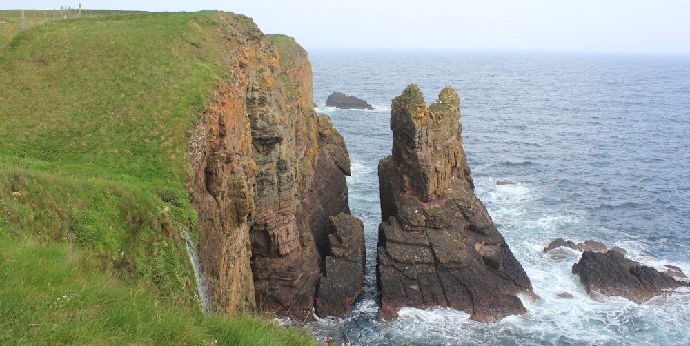
Now, I am definitely walking around the edge of Whale Geo, from which Whaligoe gets its name. (Or it might be the other way round.) The geo is wide and deep, and I can see groups of figures on the top of the cliffs, a sure sign I am somewhere near a car park.

Excellent. I really am NEARLY THERE.
But… oh dear. My way is blocked by a busy burn, rushing over slippery rocks, and dropping out of sight in a gushing waterfall. I take a cautious look over the edge. BIG mistake. The drop is enormous with horrible rocks below.
One false step – one slip on those slimy rocks – and I could be carried by the force of the water right over the precipice.
I sit on the grassy bank and ponder my options. The John o’Groats Trail has led me safely this far, but has let me down big time at this point. So close to my van. Yet so far.
Looking at my map, I realise I could walk inland, scale a few fences, and possibly join a track somewhere near the Mains of Ulbster. But, I am so close to my van. Come on, Ruth, don’t be pathetic… it is just one small step.
One small step for a fit young man, but one giant leap for a tired old woman.
I can see where I have to land. It’s a sloping, slightly cracked, finger of land sticking out above the water. Doesn’t look very stable.

If it wasn’t for the waterfall and the precipice, I would leap this without fear. DON’T THINK ABOUT THE PRECIPICE. Just do it.
First, I throw my stick over to the other side. Now I’m committed.
I take a deep breath and launch myself across the gap, land one foot, throw my body foreward, and grab onto the grass with all my might.
I’ve done it! Whew.
The rest of the walk is easy. I walk past a house, following the instruction on the website to walk up the side of the house, and not go round the front. The road with the row of cottages is directly ahead of me.
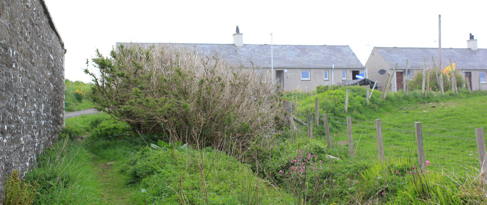
The little car park is around the back of the cottages. When I arrived this morning, there were only two or three vehicles parked here, but now all the slots are occupied and some latecomers are carefully reversing out because the place is full.
Here is my lovely van.

To my shock, I realise I’ve left it unlocked! First, I forgot my bike lock this morning, then I forgot to lock my van – what a fool!
I drive back to the Castle of Wick to pick up my bike, half-wondering if it would be still be there. Dear reader, it was.
Today was my first coastal walk since my cancer diagnosis and treatment. I am clearly out of practice, as I forgot to lock up both my vehicle and bicycle. Most of the walk was easy with beautiful scenery, but the final leap across the treacherous waterfall was very scary. I am hoping tomorrow I will be (a) more organised and (b) the walk will be easier.
Miles walked today = 9 miles (felt much longer!)
Total miles around the coast = 5,093 miles
Route today (morning in black, afternoon in blue):


Wow…well done Ruth….especially with that final jump…..very scary! Scenery looks wonderful
When I look at the photos, it seems a very short step. But at the time it seemed a huge gap and rather terrifying.
Well done for ignoring the precipice and making it across!
I never got that far as, after crossing a wobbly stile near Turrie Geo (so, earlier than yours), my head for heights – which is about as good as your head for cows – started to fail me. I made it as far as Ellens Geo and had to cut inland as I just couldn’t deal with cliffs any more. Courage is a finite coin and once it’s spent, it’s spent (at least for that moment; it does replenish, but slowly).
I honestly don’t know how those rock climbers do what they do.
Glad that leaving things unlocked didn’t become consequential!
Oooh, now I feel really brave 😂
Those statues are based on medieval chess pieces which were found on the Isle of Lewis.
I was up that way many years ago. Inland are the Neolithic Camster Cairns. I remember finding the entrances very narrow. No doubt shortbread was something to do with my difficulties.
Ahhhh. Thank you for the info re the chess pieces. Interesting.
I didn’t visit the cairns. One day, I plan to go round the coast again – in my car this time! – and visit all the places I missed.
More and more Geos. The John O’Groats Trail is not easy. Well done.
Geos everywhere! And more to come.
Brave to make the jump and brave to admit your fear on a public blog. You are an amazing person 😊
Kind of you to say so, but if there had been an easy way round that waterfall, I would have taken it! 😁
I hope that you took a look at the whaling steps. That is the highlight of that north east coast.
To be honest, I was too tired and shaken up by the waterfall-of-death to notice much about Whaligoe on that day!
Well done, especially for that final leap 😬 Did you visit Whaligoe Steps? Though they’d be very tiring after a 9 mile hike 😅
Ruth! You’re giving me palpitations with this walk – well done for completing it 👏
Congratulations Ruth – I would estimate all things considered those 9 miles in terms of achievement should be classed as at least 900 🙂
The little Knight statues reminded me of Noggin the Nog and the wonderful Oliver Postgate !
Good Health and Good Luck – Have a wonderful New Year – Cheers Russ
I recognize that feeling of tiredness when you think you are near the end of a walk but it never seems to come. But with walking there is no option other than to carry on until you get there. However, It’s all the more rewarding when you arrive especially if you have a comfortable vehicle to rest in, but the sting in the tail if you have to pitch your tent perhaps in less than pleasant weather. It was better that you had the campervan at this end and not the bike. Anyway, well done.
Lovely photos Ruth. You saw more of that bit of coast than I did because I did it in mist most of the way. Well done for making it safely along the narrow path. Whaligoe steps are worth a visit too although it is a long way down and back up! Spectacular though especially in the rough conditions I had.
so lovely you are back in your happy place Ruth, walking our beautiful coastline. We have found your blog so helpful for our coastal walking. It gives us so much information on the days walk ahead. We have now reached Scotland, Kirkudbrit. We have had such a warm welcome into Scotland and still loving the journey. Congratulations on your return 👏👏👏
Carol
Your walks are inspirational Ruth. I come back to your blog again and again. Looking forward to the next one! And very best wishes to you.