
[This walk was completed on Thursday, 16th May, 2024]
I walk down to the harbour at Lybster. It is a pleasant stroll along a road, in watery sunshine.

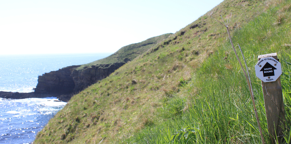
The next section on the John o’Groats Trail between Lybster and Dunbeath is marked ‘amber’ on the JOG Trail page – “conditions will occasionally be challenging”. As a result, I have decided to do only half of the recommended stretch today. In fact, I was so fatigued by my walk on Tuesday, that I took the day off yesterday!
Down in the valley, I spot the footpath off to the right. Time to leave the safety of the tarmac and head on up the cliffs.

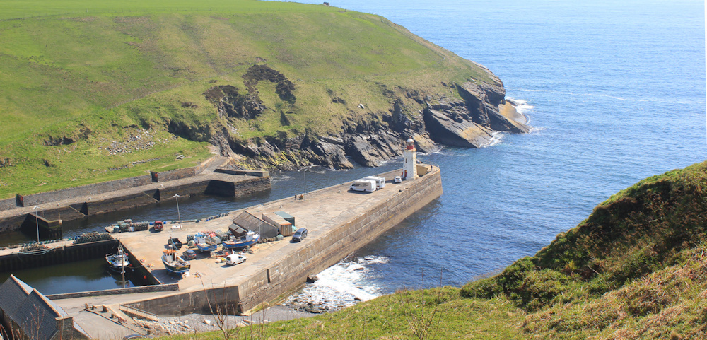
From the top, I get a great view down to the harbour. It has a lighthouse and fishing boats. A perfect place.
But I am soon sidetracked by another path with a sign that says, “Brethren’s Well”. Can’t resist a well. And here it is, hidden in a little dell.
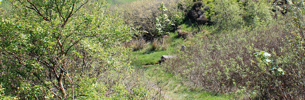
Apparently this is one of the oldest wells in continuous use in Britain – with a local family using it up until 1955. It was probably being used by local people long before the monks came and built a friary here.
The water in the well is, as is always the case, somewhat disappointing – a murky slimy mess of yellow and brown. Yuck!

Back on the cliffs, I reach an area marked as a whale-watching spot.
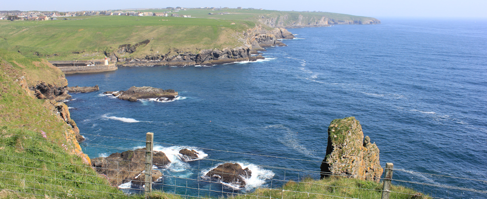
In fact, there is a man here, watching for whales. He has binoculars and a big camera mounted on a tripod. Now, all we need is the whales.
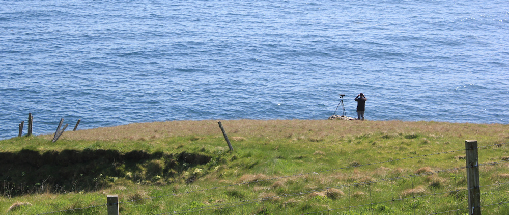
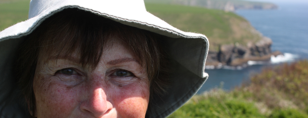
I stand and watch with him for about 10 minutes, before my patience wears out. No sign of whales today. In fact, I am so bored by the absence of whales that I take a self-portrait with my Canon camera. My face looks quite whale-like from this close up!
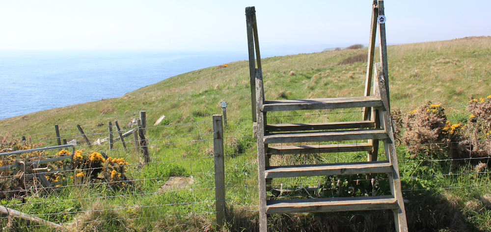
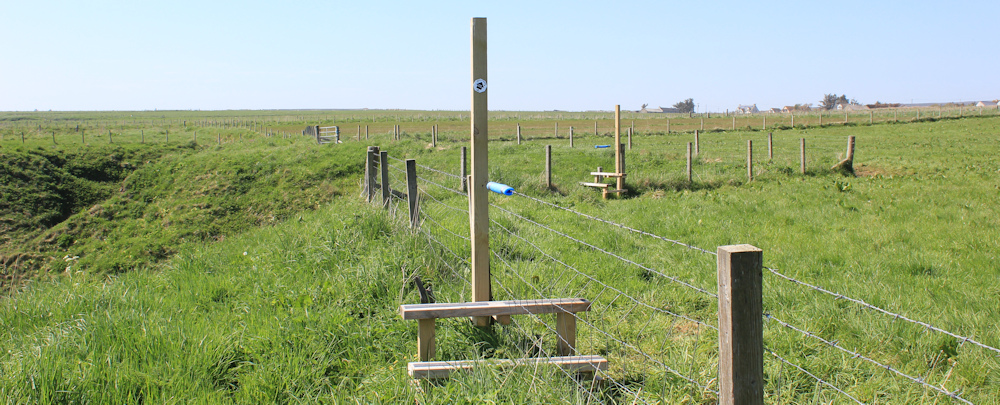
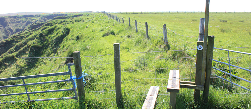
This section of the John o’Groats Trail is well marked, and is clearly being upgraded with a series of new stiles. This one is quite a climb.
I leave the whale-watching man behind and set off along the top of the cliffs. There is a path visible (just) in the grass, but I wonder how overgrown it gets during the summer. It’s such a wonderful path along a stunning section of coast – but I meet so few fellow walkers.

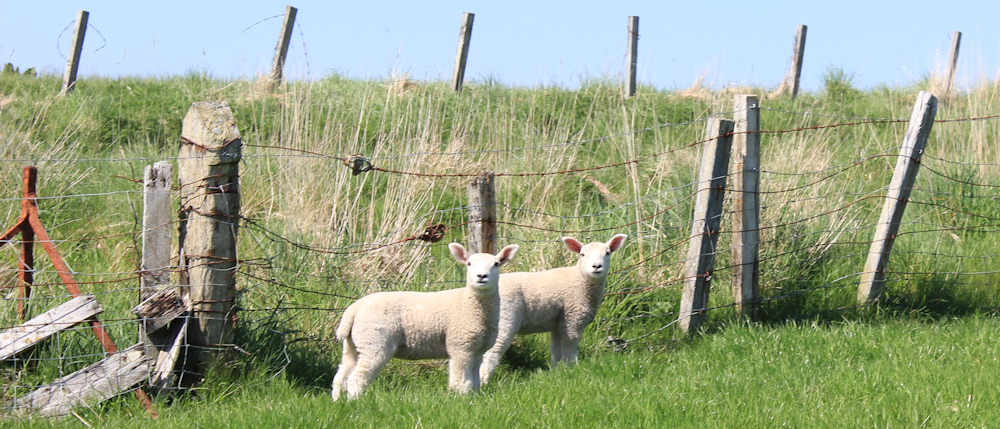
Today, despite the agricultural nature of the landscape, there is not another human-being in sight. Only a group of lambs to watch my progress. My word, you boys are growing up quickly.
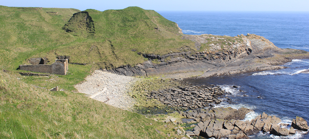
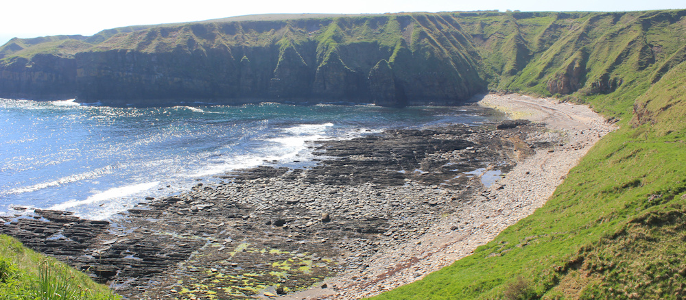
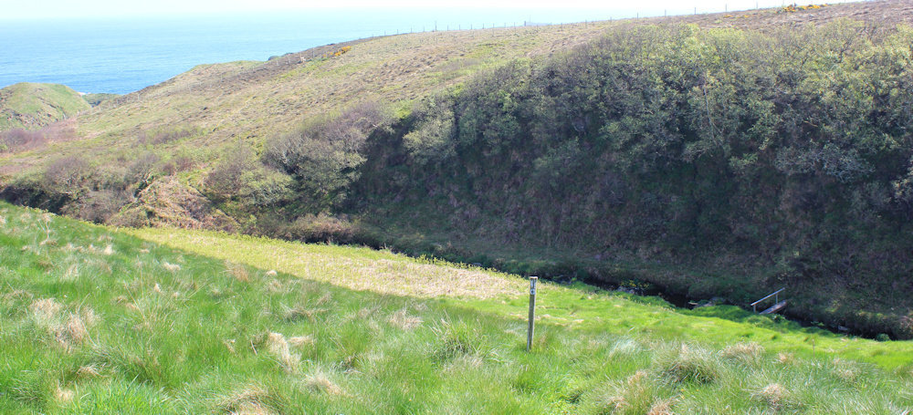
I reach a point where the path becomes a wide swarth and drops down to the shore. I think this is Achastle-shore. It is very quiet and peaceful.

A young man is working his way down the slope on the other side of the little bay. We pass each other on the beach and exchange a greeting. He looks a bit flustered and seems not to speak English. Shame, I would have liked to ask him about the state of the path further on.
There is a ruined building down by the sea. Maybe something to do with fisheries in the past? I sit by the rocks on the shade of the building – it is HOT in the sun – and have a quick drink and a snack.
The climb back away from the beach is hard work. Slippery and uneven grass, and the path traverses a steep slope. I’m glad of my poles.
Looking back, I take a photo of the bay and the ruined building. It was hard to capture the scene while I was down there because the sun was in my eyes. (It’s one of the downsides of walking southwards – the sun is in the wrong place for good photography!)
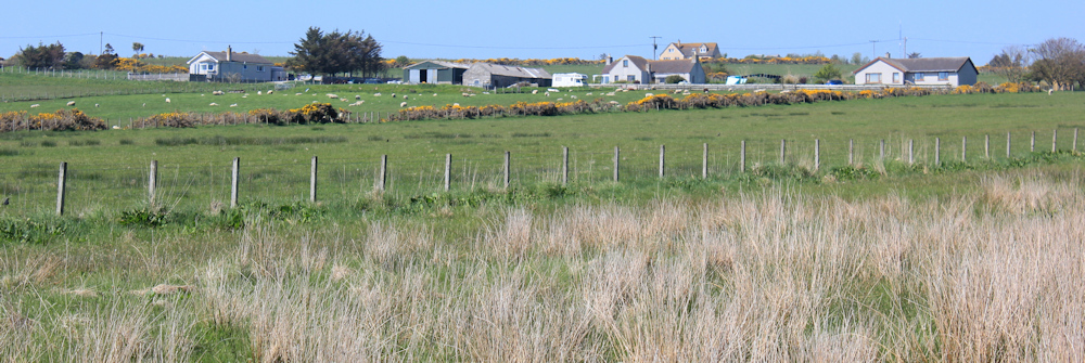
There is a collection of buildings to my right, visible aross the fields. Looks like a farm and some other bungalows. Burrigill, I think, according to my map. It looks sleepy and rural…
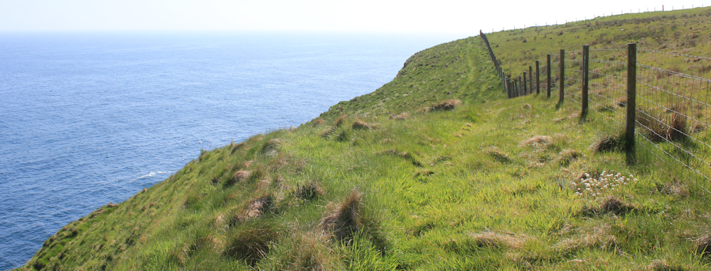
… all the real action is to my left, along this staggeringly beautiful coastline.
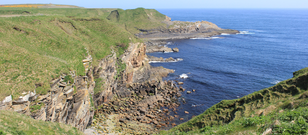
I was worried I would find the east coast of Scotland a let-down, after the tremendous scenery of the west coast. But I needn’t have worried. Yes, the land itself is much flatter and there is far more agriculture and less wildness to the landscape. But there is a proper coastal path here – and stunning views along the shore.
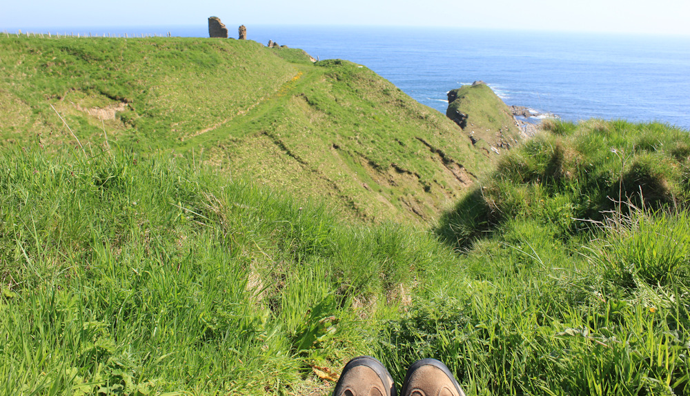
What’s that ahead? A ruined castle?
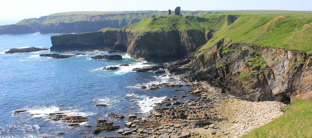
I must have already passed one castle – Swiney Castle – although I didn’t notice it! The one ahead must be Forse Castle.
It takes me some time to get there, following the indentations of the coastline. At times, the path runs very close to the edge of the cliffs, but a series of helpful stiles take me over the fence to safety, and then back over to resume the cliff edge walk.
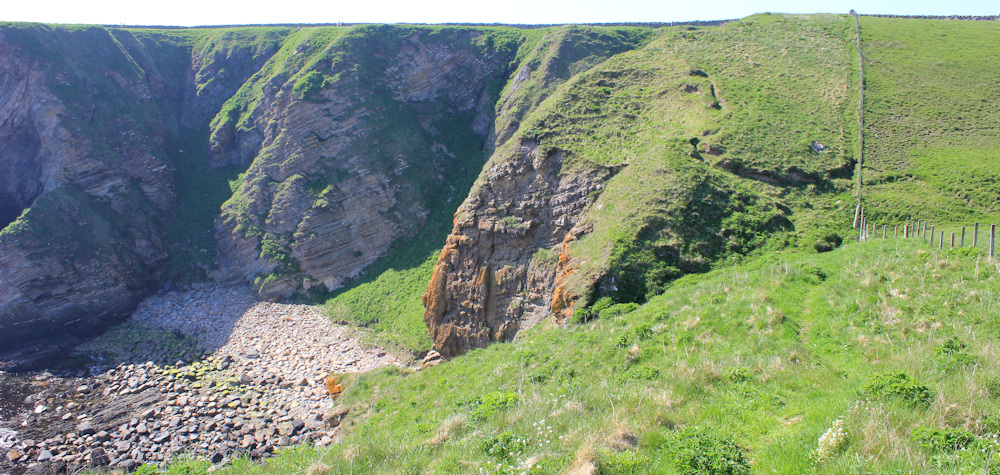
Below the castle, a wide slope of grass leads down to the shore. This is where the path goes, and so I follow it. A lovely broad bay ahead of me – but when I check my map, it doesn’t appear to have a name.
As I go down, I notice another walker above me. He is making his way gingerly down the slope. I think he must have lost the path.
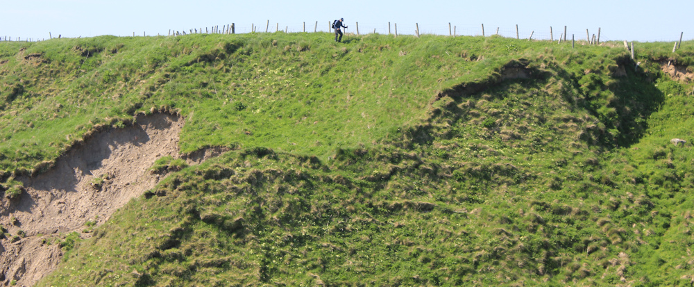
But, when it is my turn to climb up the slope, I realise the path has simply disappeared… and it is a terrifying slope. I have to climb on all fours, holding onto tufts of grass, while the ground slips and slides below me.
I meet the walker at the base of a particularly steep bit. He is sweating somewhat. “I came down this side,” he tells me in a European accent, “but it might be easier over there for you.” He points to a little gully where the grass is longer and would give me more of a grip. (You can see the gully on the far right of the photo above!)
Up the gully I scramble. At the top is a fence which offers the illusion of some support… but turns out to be very wobbly and worse than useless as a climbing aid.
When I reach the top, I am sweating too. Mainly from fear.
I sit on the grass, exhausted, but pretend I am having a little picnic. Open my rucksack for a drink and and a snack bar, while I recover! It is a nice view though.
Then, onwards, along the top of the cliffs. This is flat and comparatively easy, although the ground is quite uneven and I have to constantly watch where I put my feet.
I make rapid progress until I come to a steep-sided river valley. This is where the Forse river empties into the sea, I think. (To be honest, I’m pretty tired now and have given up looking at my map!) But I’m pleased to see there is a little bridge across the water.
The climb down to the bridge is steep and I slide most of the way down on my backside. Very undignified – but luckily there is nobody around to see me.
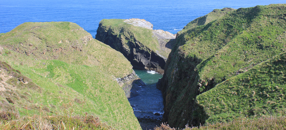
This geo has no name on my map, but the headland is called Robbery Head.
After this, the rest of the walk is pretty straightforward. In fact, a little bit dull to have such an easy amble after the excitement of the grassy cliff-scramble earlier.
But, as always, there are a few more unexpected twists and turns, and ups and downs.
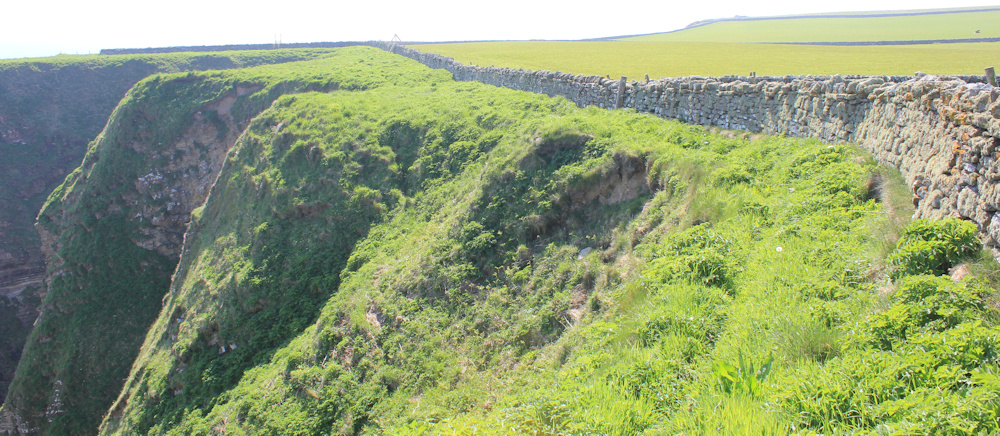
I end up walking along the seaward side of a beautiful stone wall. The path is pretty overgrown here, and I must concentrate on my feet. The cliffs below me are intimidating in their height and isolation.
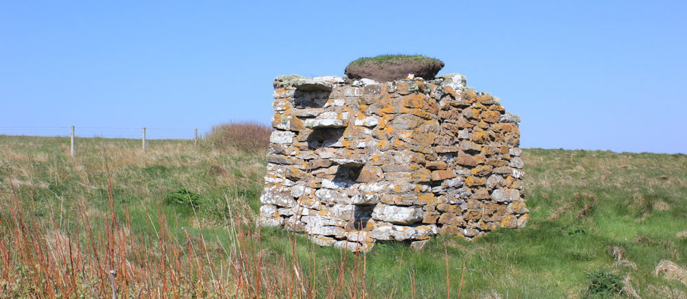
What is this stone structure? It has steps going up the side – so, maybe, an old stile over an old wall? Or the remains of a lookout post? My map is no help.
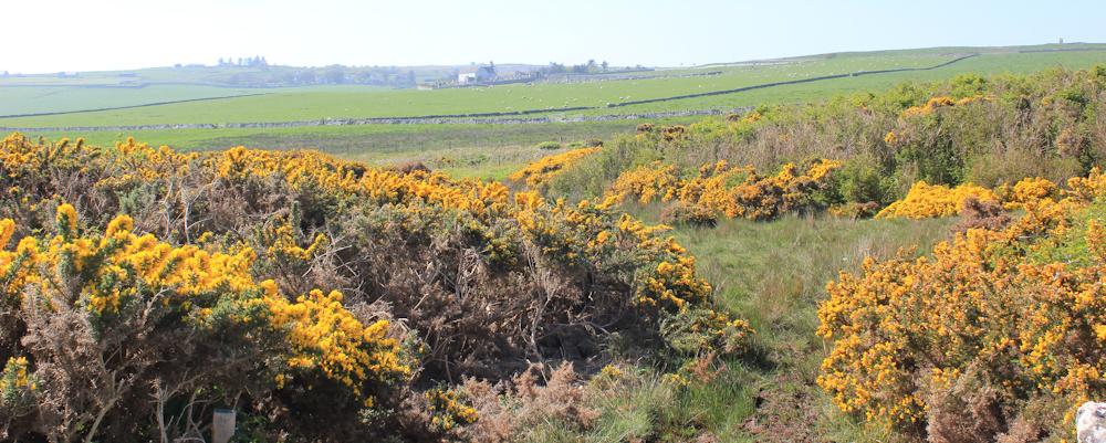
I walk away from the cliff edge, through an area of gorse and mud – luckily the mud is not too deep. The gorse smells delicious. Ahead I can see buildings. That must be Latheron.
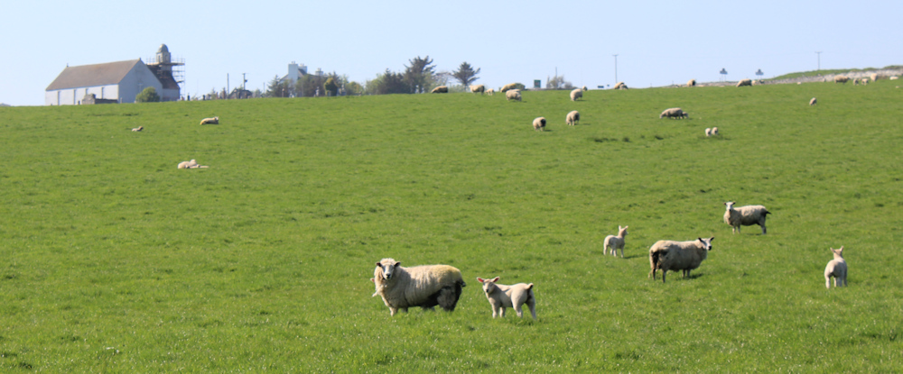
My van is parked in the access road to Latheron Cemetery, and I soon spot the old chapel (now a museum) on the brow of the slope. Below is a wide field of sheep, and I climb a gate and head up towards the cemetery.
The sheep are unused to trespassers. They baa and bleat and make a heck of a noise!
I half expect a farmer to appear and ask what I am doing to terrify his sheep!
At the top of the field, I walk along the edge of the cemetery – a mix of old and new graves – towards my van. It is a welcome sight, as always.

I’m pleased I completed the walk today without tears, and without feeling utterly exhausted at the end. But some of the trail was very challenging. Tomorrow, I might stick to the road.
Miles walked today: 5 miles
Total miles around coast: 5,106.5 miles
Route today:


Sometimes it’s the short walks that are the most difficult.
Yes. I found this one difficult.
Hi Ruth – I’ve read this blog about 3 times now and can not stop calling it from “Lobster to Litheron” 🙂 — great wring and photos as ever – Stay Well Ruth – Cheers Russ
Ha ha. Those are better names!
Excellent. A greeting often given me on French trips, “Bonne continuation.”
Here is hoping I can continue to the end of this walk, even if I can only do a few miles at a time.
Short but sweet. A magnificent stretch of coast. Wishing you well.
Thank you.
Wow. What an adventure . You are becoming one of my heroes.
I don’t feel very heroic, but thank you!