
[This walk was completed on Thursday, 1st May, 2025]
It’s been nearly a year since I was last in Scotland, and it is great to be back. I walk though the outskirts of the static-home holiday park at Embo, and head for the shore. A man on a mobility scooter is sitting facing the water… and I can’t resist taking this photograph. What a view!

We can see the huddled houses of Golspie across the water. And I can even make out the pale shape of beautiful Dunrobin Castle.
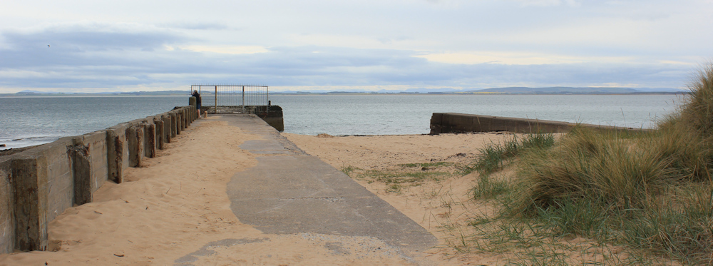
I’m heading for Embo Pier. There are a few dog walkers out, but the path to the pier is cluttered with barriers and signage…

…and the pier itself is rather decrepid and underwhelming, with a metal fence preventing access to the end of the pier. What a shame. With all the holiday makers who come here, I hope they will restore this structure one day – before it crumbles away.
I turn to take a photograph looking back at the holiday park, and can see the man on his mobility scooter still sitting there. I find this incredibly poignant.

It’s a reminder of my good fortune. With all the troubles of the past couple of years, I am very grateful that I am still relatively healthy and mobile.
I am walking along the shore of a wide bay, with Dornoch in the distance. Love the colours of the rocks, the clear stillness of the water, and the bright gorse on the opposite shore.

A woman is walking the shore with her husband and a dog, and she asks me if I publish my photographs anywhere. Apparently there is another woman who regularly photographs this area and publishes her work online. [I am sorry, but I have been unable to find the photographer’s site.]
I explain that I do post some of my photographs when I write up my walking blog, but that there is always a long gap between finishing the walk and publishing my blog!
Continue my slow progress along the shore. Slow because, of course, I stop to take dozens of photographs. It’s even possible to see snow-topped mountains across the water – but they don’t show up on my images.
I reach a small promontory, where a group of men seem to be standing around looking at the ground. As I get nearer, I realise they are golfers.

Scotland has so many golf courses!
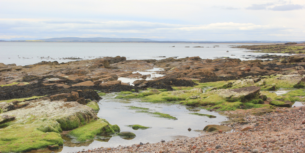
The promontory is covered in rocks, and I have to clamber over and around some of them to continue my way around the bay. Love the shapes they make – sculpted by tide and winds.

Beyond the rocks, the bay opens up into a sandy beach. Piled up boulders edge the shore – presumably to stop erosion. The smell of gorse is delicious and almost overwhelming.

The last section of the beach is absolutely beautiful. Despite the changing clouds, the light is pure and bright, the sea gently swooshes on the sand, and there is nobody around. Just a few people in the distance.
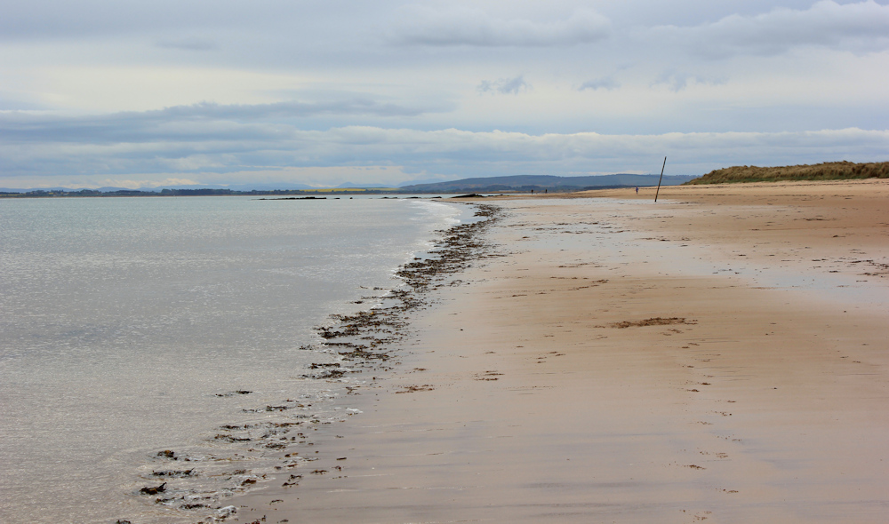
Another rocky promontory – and this one is a harder scramble – before the beach continues. This swathe of sand stretches all the way down to Dornoch Point…

… but first I’m heading inland. Past the beach car park, past an “Independent Lifeboat Station”, and through a children’s playground, to where my van is parked in a special car park for vans!

I’ve been feeling uneasy about my bike. When I left my Scooty at Embo this morning, I couldn’t turn the key in the bike lock. So I left the bike propped against the wall, with the lock hanging loosely in place, hoping that nobody would realise the bike was unlocked.
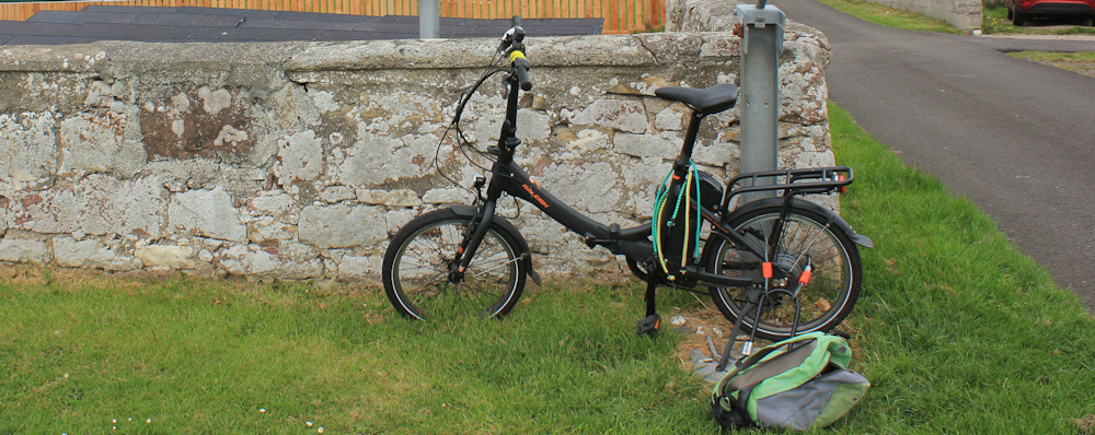
So I feel anxious as I drive back to Embo to collect the bike – yes, it is still there!.
Then, I drive back to my van-park in Dornoch and continue the rest of my planned walk. First, I must cross some lovely sand dunes, loosely clad in marram grass, and regain the beach.
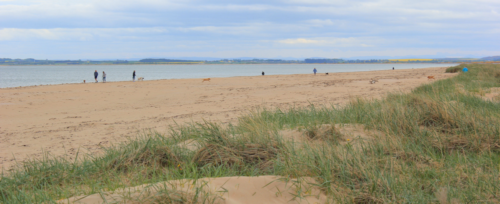
The sky has cheered up and there are more people about on the sands. Hardly crowded – but, as I continue walking towards Dornoch Point, I gradually leave everyone else behind.
There are just a couple of walkers ahead in the distance. I cross the shallow burn – Dornoch Burn I think – and walk on.

I meet the other walkers who are coming back. Nobody ahead of me now. Just the soothing sea, the drifting clouds, and the empty sand.
It’s quite hard to tell where Dornoch Point actually is. Just a gentle curve of coast, and…

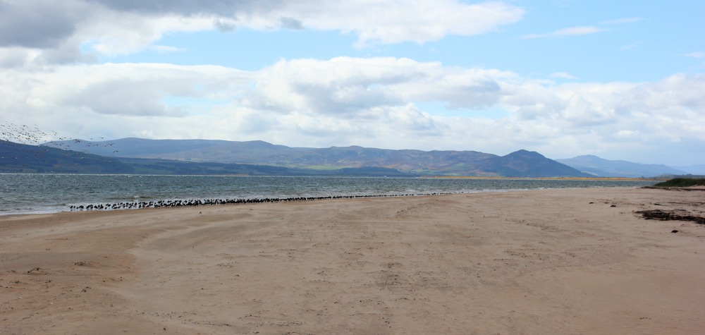
… a different view. I’m looking up Dornoch Firth. Hills in the distance, lit by sunlight falling through gaps in the clouds. The sea here is darker and rougher, busy water with short choppy waves. And the shore is lined by birds.
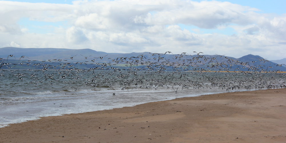
They are oyster catchers. Such cheeky little birds. They rise and settle further along the beach, until I catch up with them. Rise and settle again. Until they eventually take off in one giant mass of whirring wings with black and white beats.
I am tempted to walk all along the shore to Dornock Firth Bridge. But my van is in Dornoch, and the walk to the bridge and back is too far for my first day of walking this year.
Turning inland, I cross the bank of dunes that edge the beach. Marram grass holds the shifting sand together. I try to avoid treading on the fragile plants and follow tracks through the gaps wherever I can.

My OS map shows Dornock Point as a curved peninsula with an inland sea behind the dunes. So, I am surprised when I top the highest point of the sand banks and see… no sea! There is Dornock in the distance, brightly lit by the flitting sunlight. But no water.

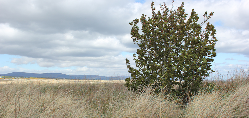
A lone tree stands among the marram grass. And I decide to mark it as a waypoint in my mind, because I know how easy it is to get lost and lose your sense of direction when down in the dunes.
But I needn’t have worried. The climb down from the high bank is easy, and the ground stretches in front of me as a relatively flat plain of grass.
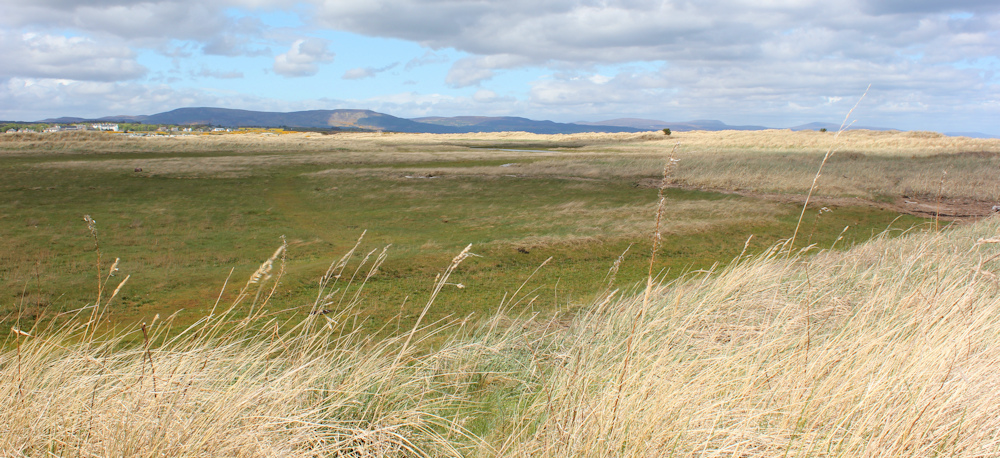
Where’s all the water shown on my map? I look to my left. Is that it?

I set off walking in the vague direction towards Dornoch. My aim is to join a road on the other side of the airfield and walk up to the town.
Airfield? Surely not! Is that it in the distance? I can see what could be an airfield building behind a mass of gorse. A lone figure is walking their dog over there. The first person I’ve seen for some time.
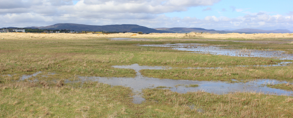
I follow a well-trodden path – and then I do come across some water. The person walking their dog is a tiny stick-like object on the other side of the bog.

The path runs parallel to the boggy area for a while, and turns into a wider, grass-covered track. The track veers left to head towards Dornock – and soon disappears underneath the marsh. I have to pick my way through by leaping from one grassy island to another.
I find a path on the other side and reach an area of flat, short grass. Ah… this must be the airfield.
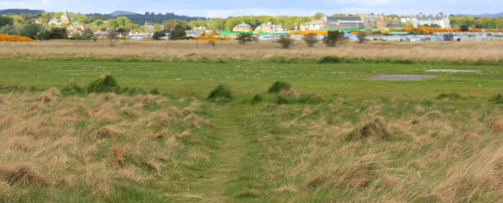
Perhaps I should walk round the end of the runway? But my trek across sand dunes and marsh has made me tired, and I take the quicker route right across the runway. Past some large numerals marked out in concrete in the grass. 82.
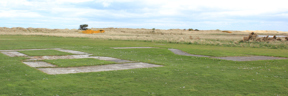
What does 82 mean? Obviously the number is supposed to be read by a pilot – so maybe it is an identification number for the runway?
On the other side, I can see my progress forward is blocked by a fence. Beyond the fence is an open field, and beyond that is a static-caravan park (more metal boxes in a row).
So, I follow another well-trodden path that leads to my left and takes me up to the buildings I glimpsed earlier.
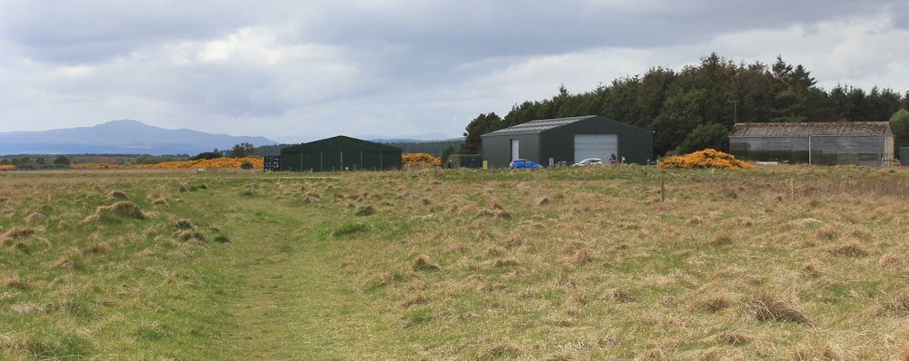
Yes, these are airport buildings. Hangers.
Here a minor road comes to an end in a car park. Several dog-walkers are meandering about. A sign tells us the area is for “EMERGENCY VEHICLE ACCESS” and we should keep it clear at all times. Across the airstrip a windsock is blowing, showing that the wind is coming from the land towards the sea.

How often is this airfield used? It looks well maintained and I guess it must be used occasionally by private planes.
I stop to read some information signs about the flora and fauna of the area. Sadly, apart from the oyster catchers on the beach, I haven’t met any wildlife on this walk. Not even a butterfly!
The road stretches ahead of me. Easy walking – because of the tarmac – but dead straight and, after the excitement of the beach, the dunes and the marsh, dead boring too.

The last mile of any walk is always the longest. And this one seems very long. At the end, it curves in a D shape to meet the main road to the beach. But, I take a shortcut across a golf fairway (nobody is playing) and cut out a few yards of extra walking.

I follow the winding coast road. Past the static-caravan site. Past a public toilet block. Back to the van-park where I have left my van.
At the end of the parking area is a food shack called “Highland Larder”. I had planned to have breakfast here, but they were late opening. So, on my return from picking up my bike I had lunch here instead – a huge portion of “north sea haddock wrap”.

I’m not too keen on wraps, but the haddock was very tasty. Deep fried, of course!
Miles walked today = 7 miles
Total distance around coast = 5,170 miles
Route:


Lovely to see you back on the coast trail. 🙂
Thank you, Tony. It was great to be back!
Great to see you are back up to date. Glad you had a wrap. I go there frequently when I walk the beach in Dornoch. The food is delicious whatever you have – I quite often walk to the end of the golf course and back again. When I walked the coast for real, I nearly got cut off south of the airfield, as the tide had come in and flooded the whole area and it was hard to find a way across the area. Thought I might have to do the beach in reverse. Couldn’t walk west either as that too was under water. It was quite scary. All best.
So it does get flooded at high tide?! I was surprised to see such a lack of water when I did this walk.
Hi Ruth, lovely to see you back walking. Looking forward to the next instalment!
Thank you 😀
Great to see you back – good health and good walking Ruth – Cheers Russ
It’s good to be back, Russ
Welcome back!
Thank you Conrad. Hope all is well with you.
Good to see you back on your travels after your troubling times.
Very best wishes Vivien & Clive
Thank you both.
Great to see another post. Here’s to many more ‘cow-free’ enjoyable walks in the future….
I will raise a glass to that… a strictly non-alcoholic vitamin-rich glass nowadays! 😀
A bit late but the runway number would be 28 not 82. It’s represents the approximate compass bearing of the runway when you put a zero on the end, i.e. 280 degrees