
[This walk was completed on Friday, the 2nd May, 2025]
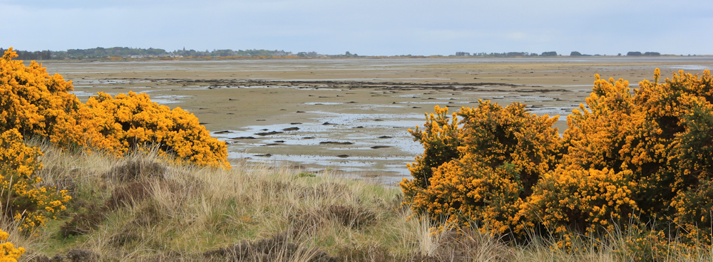
After a brisk lunch, I set off down the grassy path towards the shore. This is the edge of Dornoch Firth. I am sure it looks more scenic when the tide comes in!
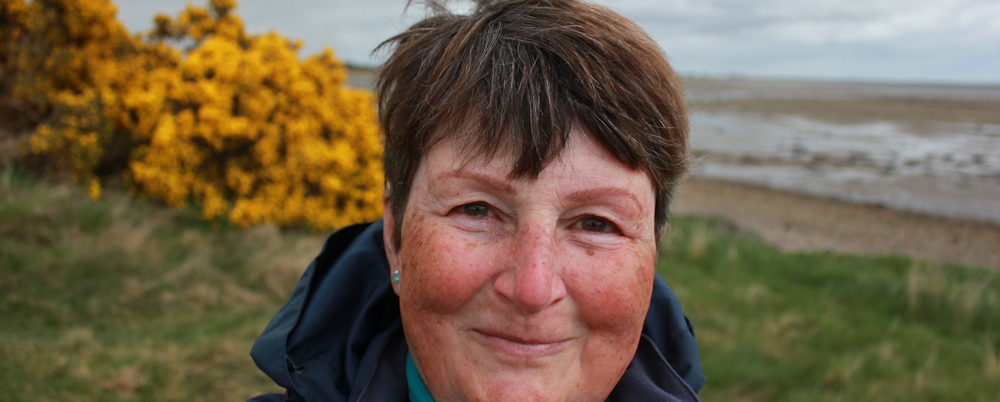
The rain stops spitting, and I take the opportunity to snap a self-portrait. There is nowhere to balance my camera, so I hold it at arm’s length and click the shutter. Always a bit hit and miss (because I can’t see what I’m doing) but this one turns out OK.
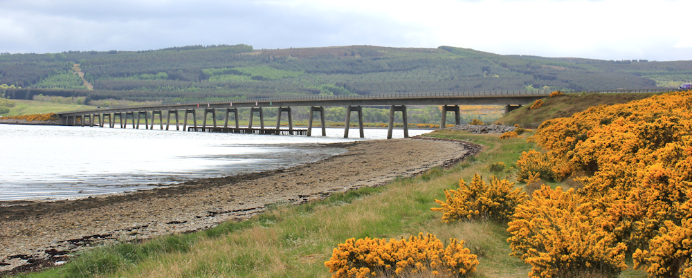
A brief amble along the shore – following a clear path – and the Dornock Firth Bridge comes into view. I do love the sight of bridges. They provide a means of crossing the water (of course) but I also find them quite visually stunning.
The way forward is barred by a mass of huge boulders. Presumably they are piled up here to protect the base of the bridge from erosion.

How do I get up to the road? A sign on a fence post shows the way. Yes, up that very, very steep slope.

I climb over the fence, using a very narrow and rather rickety stile. Then it is a scramble up the slope, using my hands to hold onto tufts of grass. I’m glad the brief rain shower hasn’t made the slope even more slippery than it already is!
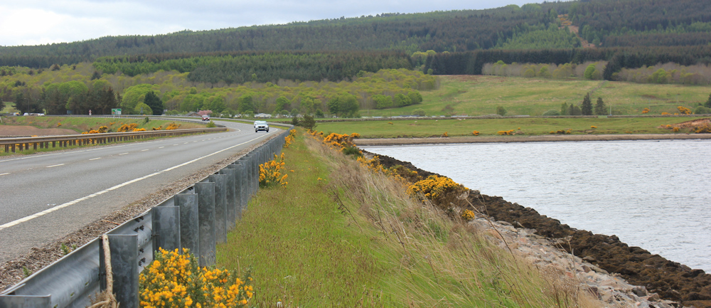
At the top, I stop to take a photograph looking down the bridge. The traffic seems light at the moment…

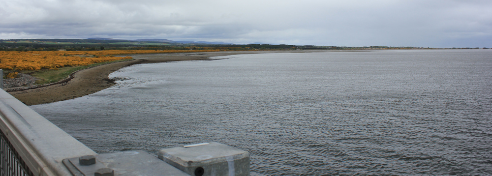
…but that soon changes, and a convoy of heavy lorries roars past. Luckily, there is a pavement along the side of the road. I take a photograph looking up the firth towards Dornoch. Sadly the skies are overcast and the resulting photo is dull.
Near the end of the bridge is a parking area. I wait for a break in the traffic to cross the road. An information sign tells me about an aircraft disaster in 1945, when an RAF Sunderland bomber crashed during a training exercise. Eleven Australian crew-members lost their lives.

My most immediate concern is not air crashes, but the risk to my life of walking along this road. I’ve reached the end of the bridge, but the Dornoch Firth crossing continues along a narrow causeway. There is no pavement – just a thin edging of gravel.
I decide my best bet is to climb over the barrier, where there is a flattish strip of grass. The ground is uneven, and a steep slope lies to my right – a fall could land me on some sharp stones at the base of the embankment. But this must be safer than dodging speeding vehicles.
Near the end of the causeway, I can see the peninsula of Ardjachie point to my left. It looks enticing.

But, I have already checked my map, and I know that on the other side of the peninsula the railway line runs close to the shore, forming a physical barrier. And, further along, is the Morangie Distillery whose grounds appear to go right down to the shore and will, I assume, be fenced off as private property.
One alternative is to continue my walk along the busy road. But I have another plan, and that is to follow the John o’Groats Trail as it goes up a hill to a little place called Tarlogie, before rejoining the road towards Tain. This will cut out over a mile of road-walking, and will be much nicer.
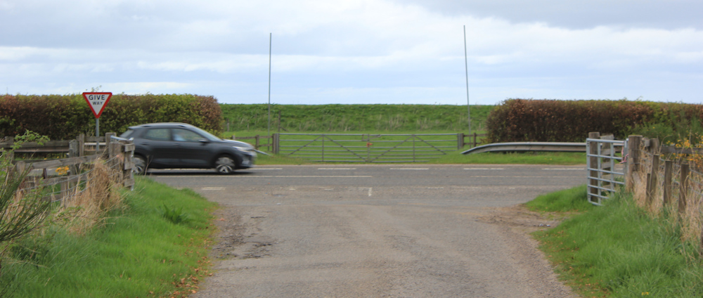
The final bridge over the railway line has a pavement. Hoorah! And there is the JOG Trail sign. At the next roundabout, I must go straight ahead.
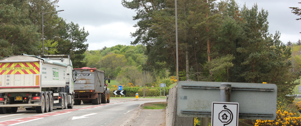
At this roundabout, the A836 meets the A9. But, straight over the roundabout is a little track – a private road – and I head down it.

After an initial dip, the track heads uphill. Up and up and up. I’m getting tired.
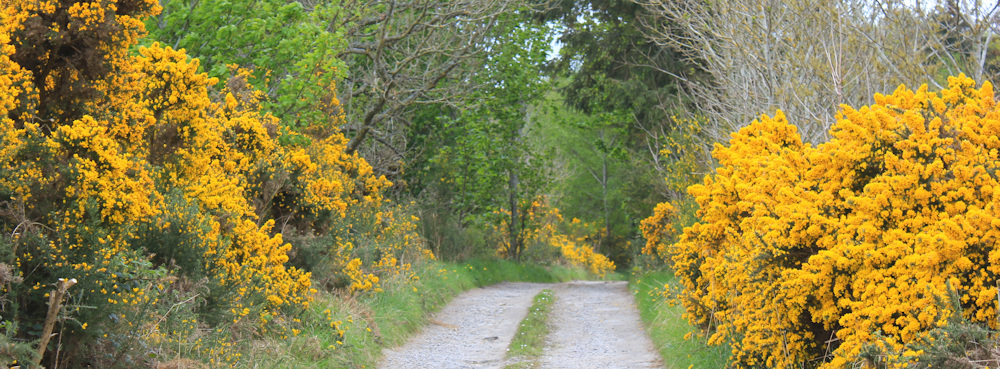
Through a gap in the trees, I get a great view over the Dornoch Firth Bridge, and the yellow gorse glows so brightly, it looks as though the countryside is on fire.

The track flattens out a little, but climbs up a final section to a row of white houses. This must be Tarlogie.

To my left, I can see a larger house surounded by trees. The track curves towards the house, but beside it is a grassy meadow, and to the side of the meadow is a narrow path. I can’t see a sign for the JOG Trail, and the path is not marked as a public footpath on my map. But I decide to follow it anyway.
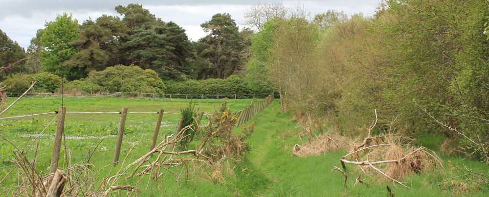
Turns out to be the right decision, as the path soon joins a lovely tree-lined avenue. This must be the driveway for the large house I saw earlier – Tarlogie House. It’s a lovely easy walk.

After a while, I become aware of houses on my right, and there are a number of little foot-bridges crossing the drainage ditch to the side of the drive.

Why are the bridges there? I have no idea, because the houses must have their own road – and I check my map to prove it. Yes, a groups of houses line a dead-end road. A modern development, I think. I catch glimpses of them through the trees. Nice houses, and what a lovely place to live.

My long driveway comes to an end and joins a little public road. “Private Road, Tarlogie House only” says a sign at the end. A John o’Groats Trail marker is on a nearby post, pointing down the road.

But I’m feeling tired and hungry. There is nowhere to sit, except on the ground, so I perch on the soft grass on the corner and eat a snack bar and drink some water.
The little lane is surrounded by pleasant farmland and is an easy downhill amble – only 1/2 a mile long – before it joins the main road.
I’m not looking forward to walking along the A9 again. Luckily there is a wide verge of flat grass, so I can stumble along beside the road and don’t have to dodge the traffic.
I’ve just left the Tarlogie turning behind, when a bus rumbles by. It is the X25 to Dornoch – the same bus I caught this morning. I turn round and snap a photo of its back end.
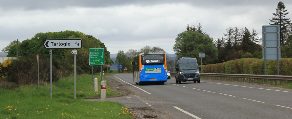
My detour up the hill to Tarlogie wasn’t exactly a short-cut, but it was a lovely deviation, and has cut out a stretch of road-walking. From here it’s only a couple of hundred yards to the turn off to Tain.

Tain is a “Royal Burgh” and much larger than I realised. When I set off for this trip, I packed my van with all the things that are so hard to find in the north of Scotland – pitta bread for sandwiches, sliced ham and cheese, soft fruits, plain yoghurt, snack bars etc. But Tain has several supermarkets, including the Lidl that I’m about to pass.
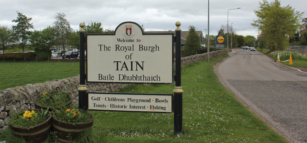
Later, I learn there is an Asda and a Tesco too!
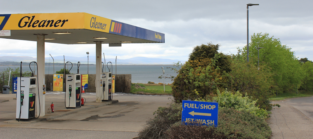
Just beyond Lidl, I take a left turn. It’s not the most direct route to the studio where I am staying, but it is the road that runs closest to the shore. I pass a petrol station with one of the finest views that I’ve ever seen from a service-station forecourt.
The road is a little disappointing – a new road, I think, to serve a small industrial estate. But, I do like the image painted on the front of this gym. “Silverback”.

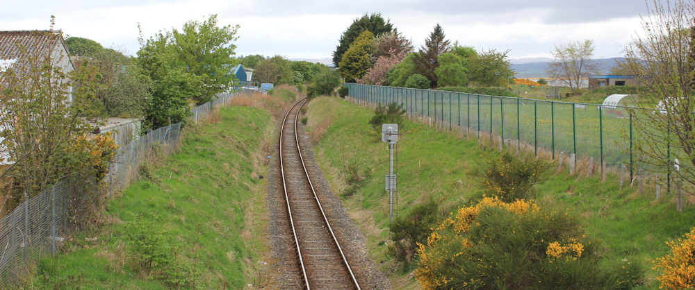
I take a short detour down a road that leads to the shore, and stop on the bridge overlooking the railway line. There is something profoundly reassuring about a railway line.
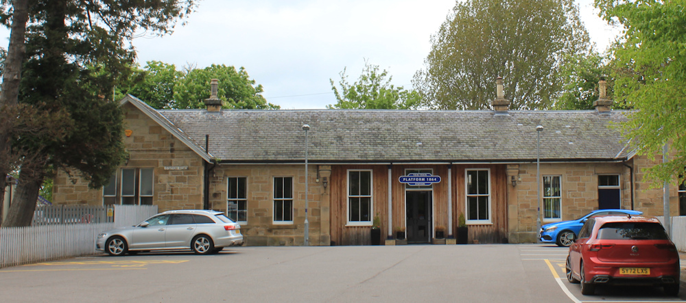
Further along, I reach the station, where the main station building seems to have been taken over by a cafe/restaurant. “Platform 1864”. Later I look the restaurant up, and it has good reviews, but I don’t eat there. (My studio is self-catering and I enjoy cooking in the evening.)
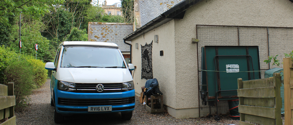
From the station, it is only a short walk to my rented studio, where my van is parked. Studio is the wrong word for this place, because it is a lovely two room annex with a sunny garden. (The photo below really doesn’t do it justice.)
Miles walked today = 9 miles
Total distance around coast = 5,179 miles
Route (morning in black, afternoon in blue):


hi glad to see you active again. I used your book when planning my walk around Britain. I’m 3000 miles into it and plan to finish on Halloween.
best wishes Tracey
You did well to take that scenic diversion. I trudged alongside the main road from Tain to the bridge in the rain. Fine views of the bridge though.
Why would they run a pavement along the bridge, and then stop it as soon as you get to the road? Box ticking I suspect.
That gorse is so good – like you said, it really does look like the landscape’s on fire!