
[This walk was completed on Saturday, 3rd May, 2025]
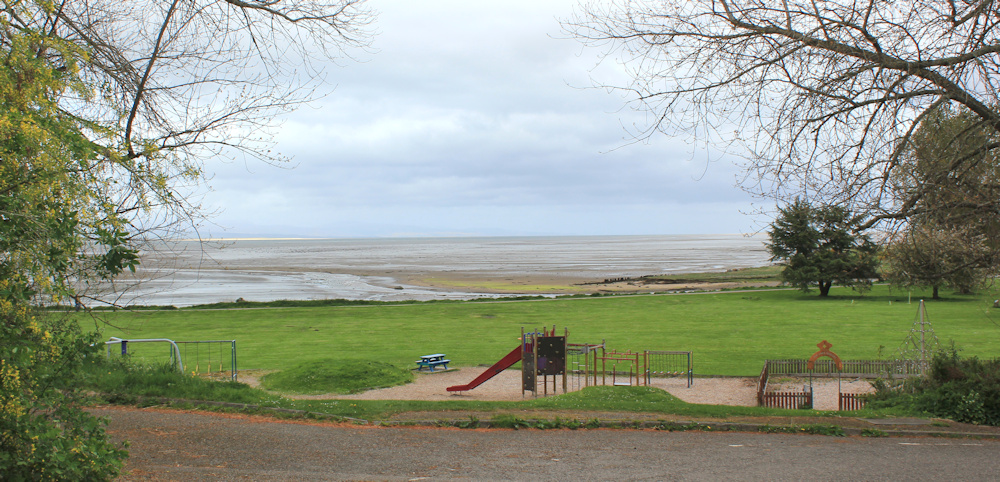
I catch the bus back to Tain, and it is a short walk through the town down to the shore, where an open green space provides an area to walk and play. I cut across the grass towards the water’s edge.
And, soon reach the footbridge that crosses the mouth of the River Tain. The Alexander Bridge is a narrow suspension bridge and, of course, I stop to take plenty of photographs. Shame about the dull light this morning.
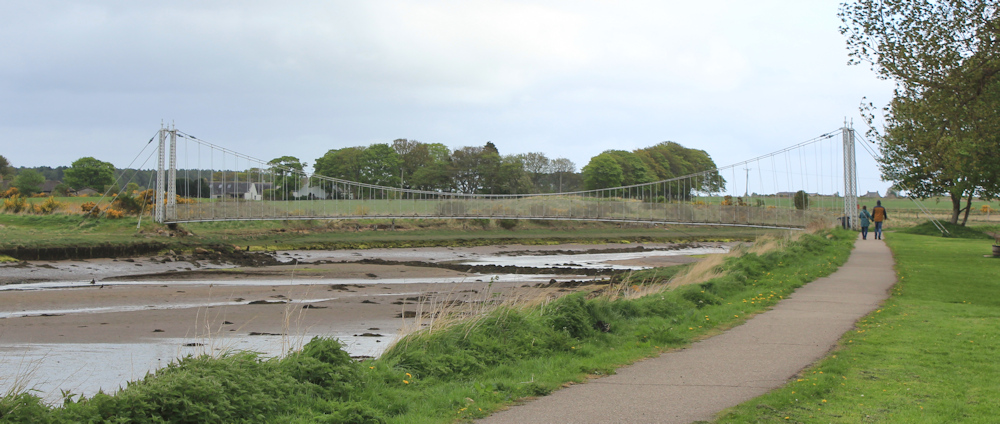
A sign at the entrance says “Warning. Weight Restriction. Maximum number of 2 people on bridge at any one time.” I wait for a couple to come across, and then begin walking slowly along the planks.
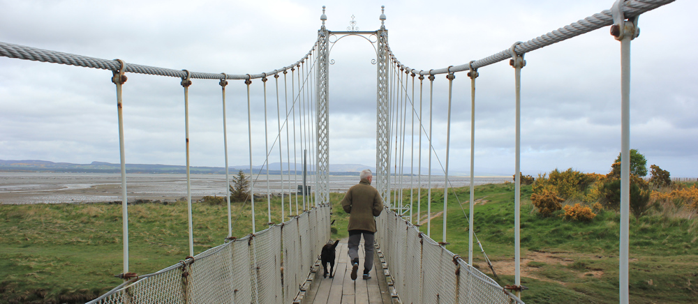
Suddenly, the bridge begins swaying alarmingly. Not swaying, actually, but bouncing up and down. Is it my weight? I turn round and see a man with two dogs striding purposefully along. Does the limit of 2 people include dogs?
I stop to let him pass, then follow him slowly towards the end of the bouncing bridge.
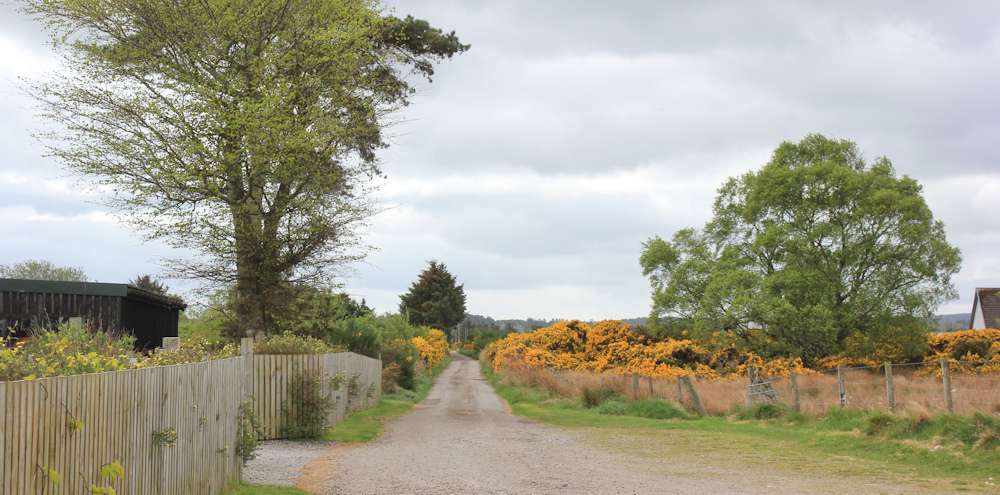
My OS map doesn’t show a path, but I’m pleased to see there is a clear route along the shore. I follow the man and his dogs.
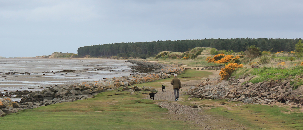
He has soon finished his dogs’ walk, and turns back. I am alone now, heading towards a wooded area where I should be able to pick up a track.
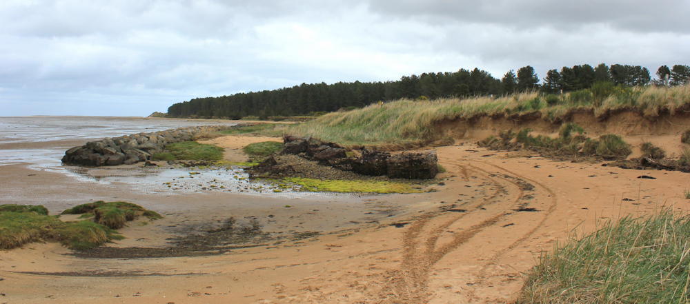
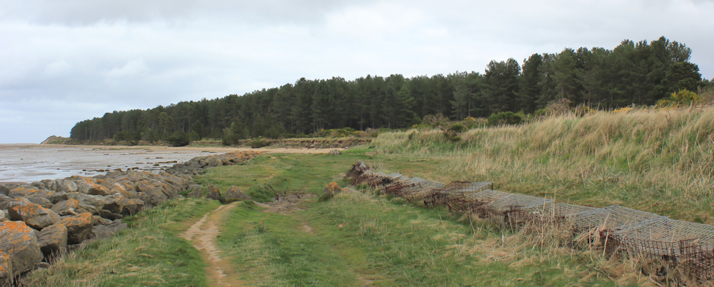
The tide is out. There is a bank of eroded sand dunes on my right, while a broken line of boulders – called rip rap – form coast defences to my left, with an expanse of mud beyond. I walk on a strip of sand past a series of little coves, interspersed with muddy areas where the broken rip rap has let the waves through.
I wonder if you can walk through at high tide?
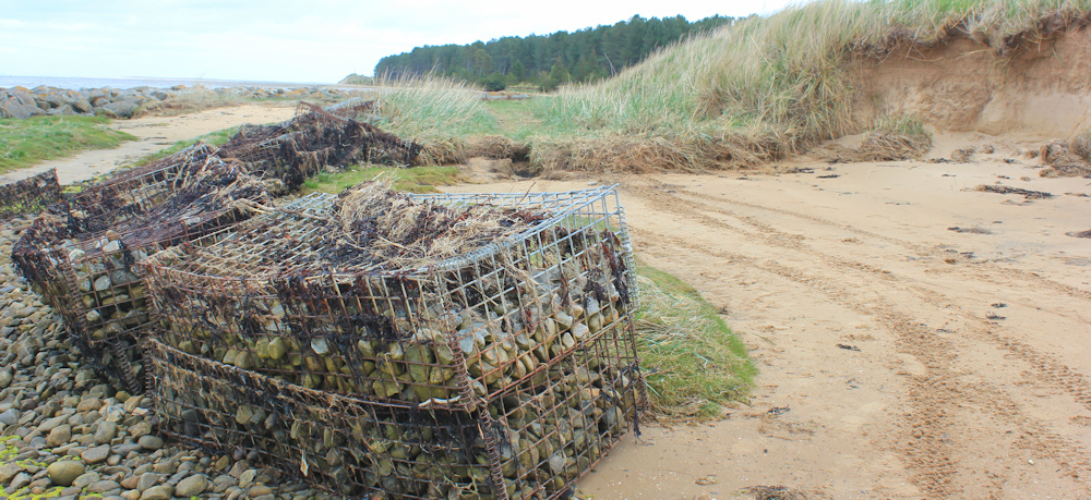
As I get nearer to the wooded area, I meet more sea defences. Rocks encased in wire cages – called gabions. Nobody around now, just some tyre tracks in the sand.
Sand gives way to a grassy path. I’ve nearly reached the trees.
Jon Combe walked this way (in the opposite direction) a few years ago, and this is how I know I can get through the woodland and back to the road. I head up a track and into the trees…

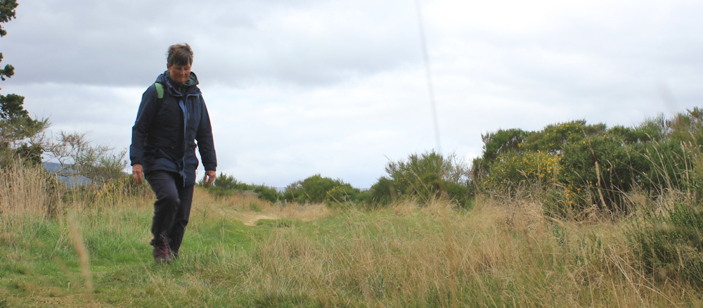
… stopping only to rest my camera on a tree stump and take a timed self-portrait.
There is a track that runs along the edge of the woods, and it is a beautiful walk. Tall scotch pines form an avenue. Birds are singing. There is horse dung on the ground.
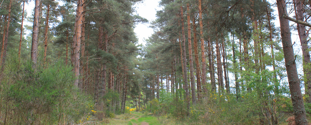
I walk past the inevitable golf course, but there is nobody in the woods. Lovely.
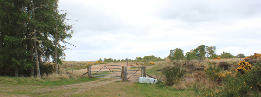
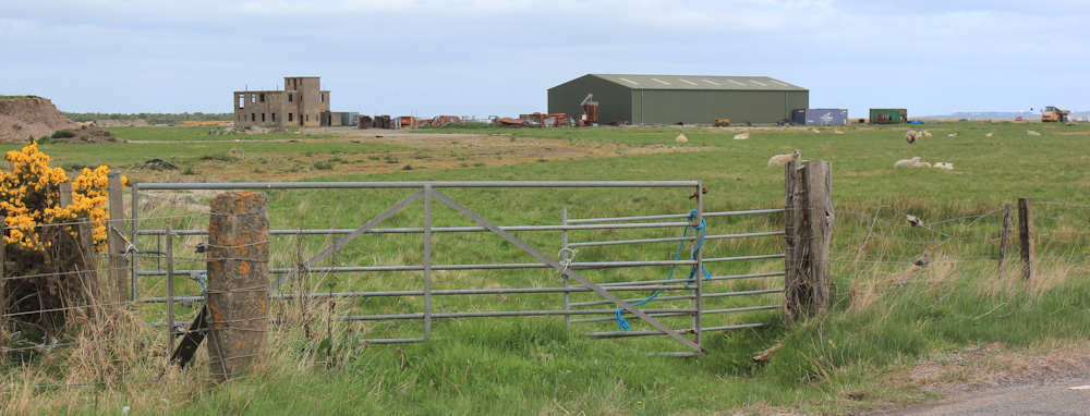
The grassy path gives way to a sandy path – hard going underfoot as you sink back several inches with every forward stride. Eventually, I reach a gate, and this is where I am going to leave the woods behind.
Broom is shining bright behind me. It doesn’t smell as gorgeous as gorse, but it still makes a nice splash of colour and contrasts nicely with the red trunks and dark leaves of the scots pines. I make use of the gate post and pose for another self-portrait.
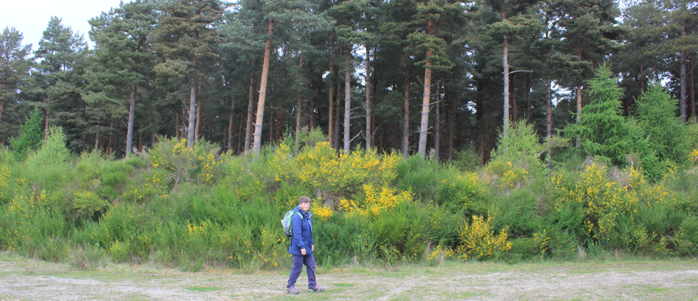
From here, a track leads towards a minor road. Gorse takes over from broom, and the smell is intoxicating. Despite the dullness of the day, I feel light-hearted and full of joy.
My map shows trees on the right hand side of the track, but I am a little disconcerted to find that in real life the trees are mainly on the left. There is evidence of felling on the right – stumps and broken branches – while the trees on the right are mixed decidious and clearly young plants.
It’s a reminder of how quickly the landscape can change and how quickly your precious map can become out-of-date and inaccurate.
I reach the road. Jon Combe carried straight on at this point (except he was coming the other way) but that direction requires climbing over a gate in full sight of a farm house, and he was nervous of being challenged. He wasn’t challenged, but I would rather avoid the possibility.
So, I turn right to head down the road. To be honest, it doesn’t look much like a road at this point…
… but I soon begin to pass scattered cottages. The fields are full of sheep and lambs, bails of hay, scattered farm machinery, and the occasional ruined building. There is a higgledy piggeldy air to the place. Small-scale farming, I imagine. I like it.
The static caravans are certainly not holiday accomodation. Maybe accomodation for farm hands or for farmers during the lambing season?
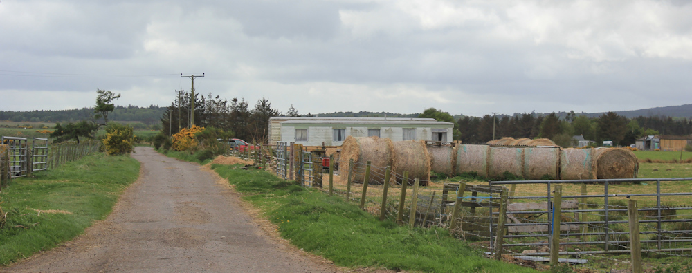
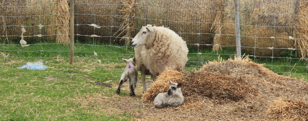
There are several very small, and very new, lambs in enclosures beside the road.
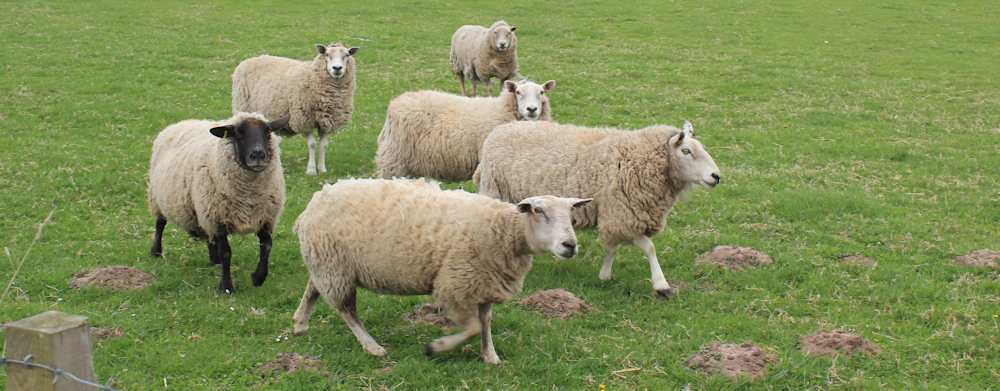
Further along, a group of sheep are very excited to see me. They come charging towards me, and then follow me down the road. Expecting food.
I reach the end of the road at a T junction, where it joins a larger B road. From here, I will have several miles of road-walking, so I am not looking forward to the next bit of my walk. I perch by the side of the road to eat my lunch, sitting on the only flat area of grass I can find, right next to some bins! Of course, at this point it starts to rain.
Holding my camera at arms’ length, I take a selfie. Do I look a bit fed up and miserable? That’s because I AM fed up and miserable.

How quickly my mood has changed.
Packing up my half-eaten picnic, I turn onto the road, cross over to where the verge is wider, and begin the long plod towards Inver.

Not much to say about this section, to be honest. I walk quickly, sometimes on the side of the tarmac, and sometimes hobbling along the uneven verge. It’s not a particularly busy road, but there is seldom a minute without a car going past and they come very, very fast.
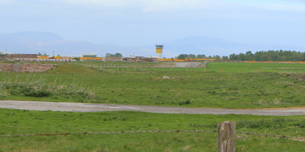
To my left are the military ranges. I don’t know if the ranges are in use or not, but they form a barrier to the coastal walk, and this is why I am on the road. Jon contemplated walking across the ranges, but was put off by mysterious vehicles coming and going. There certainly seems to be some sort of activity going on, although none of it looks military. Perhaps the ranges are used for farming now – I can see lots of sheep.
In the distance is a watch tower, and more substantial fences. I take a photo with my camera on full zoom. Beyond the tower is a patch of woodland and beyond that is a marshy shore.
Meanwhile, I continue my plod along the road. Look at this field – it is full of sand! Nothing can grow here. How strange. It looks as if someone has ploughed a desert.

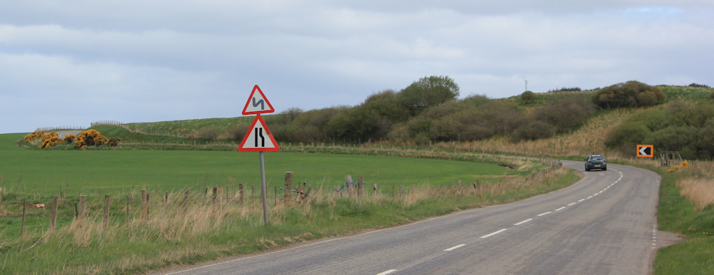
After 2 miles of relentless straight walking, I am approaching a bend, and a bit of a hill. I will be glad of a release from the monotony of this road. And the sun is coming out! Things can only get better.
On the wide curve of the bend is a stile. It doesn’t lead to a footpath, but must be something to do with access rights for Scottish Water. With the sun shining weakly through the clouds, this seems a good spot to resume my aborted picnic.

I sit on the middle step, and use the top step as a table. Perfect.
After a while, I decide I must get on with the walk. It’s not far to Inver now. Shrugging on my little back pack (lighter now that I have had my lunch!) I head round the bend and up the hill.
The road stretches ahead, dead straight again. But the air is clearer. Gorse bright on my left and a field of rape gleams a luminescent yellow on my right. The two scents compete.

I really don’t like the smell of rape. And it always reminds me of the hay fever season which, for me anyway, hasn’t started yet.
From this higher section of road, I can look down across the fields to Inver Bay. With the tide out, it seems very marshy out there. I know Jon Combe tried to follow the coast around the bay and got bogged down by marsh.

Further along, I see a collection of farm buildings and residential houses. That must be Inver. It is bigger than it seemed this morning when I parked my van there before catching the bus to Tain. I had just taken this photo (below) when two German Shepherd dogs come bounding up the field towards me (you can see them on the bottom left of the photo).
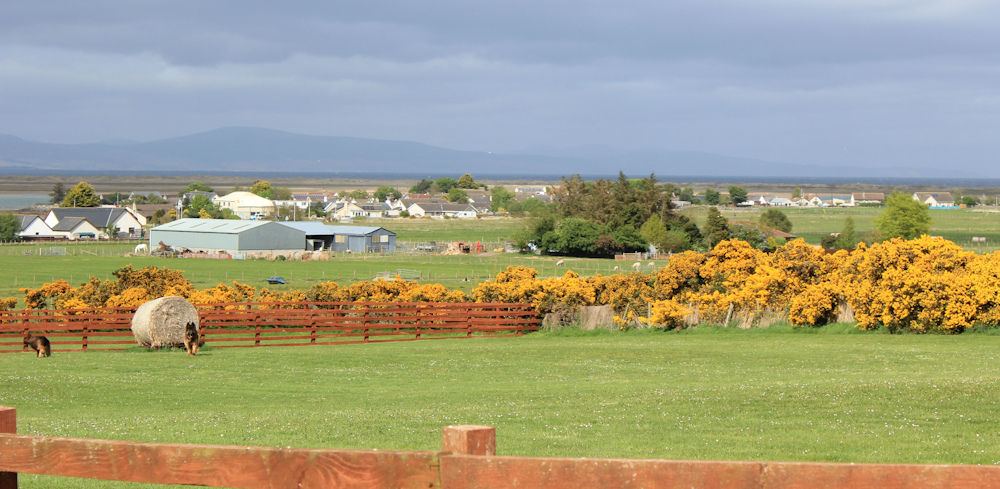
I like dogs, but German Shepherds are rather intimidating. The fence seems a low barrier, but they don’t try to jump over and soon lose interest in me.
Reach the turn off to Inver, and head down the road towards the village.

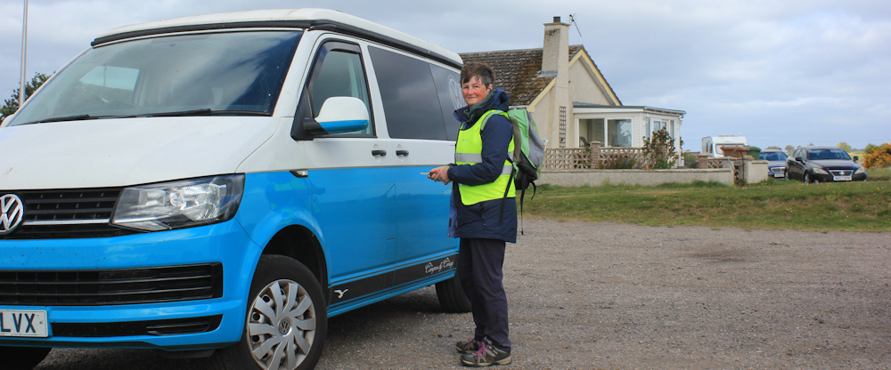
My van is parked in the first car park you come to, right on the shore of Inver Bay. I take a look around. A large stone bears a plaque which commemorates the evacuation of the population of Inver in 1943-44 to allow the army to use the area to practice for the D-Day landings.

I wonder what it was like to have to leave your home, not knowing when you could return?
It was a shortish walk today – only 7 miles, but it seemed long enough to me. Really, my fitness levels are NOT what they used to be! In reality, I could have walked a bit further, but the logistics of catching the bus this morning made Inver the perfect place to end today’s walk.
My van looks very cheerful. I balance my camera on a bench and take another self-portrait with the timer.
Despite the road-walking, and the rained-off lunch, it has been a good day today.
Jon Combe’s account of this same walk (but longer and in the opposite direction!) is here: Portmahomack toTain
Miles walked today = 7 miles
Total distance around coast = 5,186 miles
Route:


I’ll be walking that section next month as I fill in gaps. Public transport is very tricky round there.
Time to get an electric bike Tony!
Electric bikes are the best type of bike 😀
That looks a lovely landscape, shame about the main road. Straight roads are the worst, aren’t they, so depressing!
It’s very boring when you can see miles ahead.
Now that’s a proper stile. I have used them myself for dining. It’s ok until somebody comes long to pass through. It’s good to see you well on the move again, and posts almost up to date!
Ha ha. Luckily nobody interrupted this meal!
When you posted this I was reading it with my Sunday lunch in The Halzephron Inn at Gunwalloe ( did you ever visit ?) knowing I had only a 3 mile walk to Porthleven on the SWCP – so I did feel for you about the road walking section, it is just dispiriting. But hey you’re back with us in real time and cracking on – Best wishes Ruth – Cheers Russ
Thanks Russ. I did visit that Inn – while waiting for a bus!
I’m glad you enjoyed this walk and hope I didn’t send you too far astray!
Your account was very helpful!