
[This walk was completed on Monday, 5th May, 2025]
I’m back in Portmahomack, and it is looking beautiful in the sunshine. Today, I have planned a circular walk around the Tarbat Ness peninsula, so no cycling required!

Portmahomack really is a lovely place. A superb beach and a quaint place with interesting features. This ornate pagoda, with a cherub (?) inside, commemorates the introduction of “gravitation water” in 1887. I presume that means clean piped water, instead of the use of old wells and river-water.

Interestingly, this system was installed 50 years after a cholera epidemic wiped out half the population of neighbouring Inver.
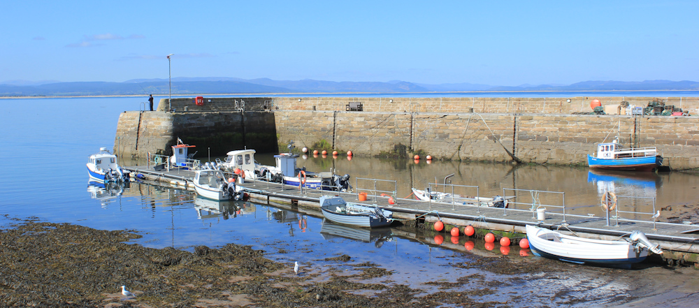
Portmahomack also has a reasonable-sized harbour. The boats are utilitarian looking – little fishing boats, mainly. Good to see.
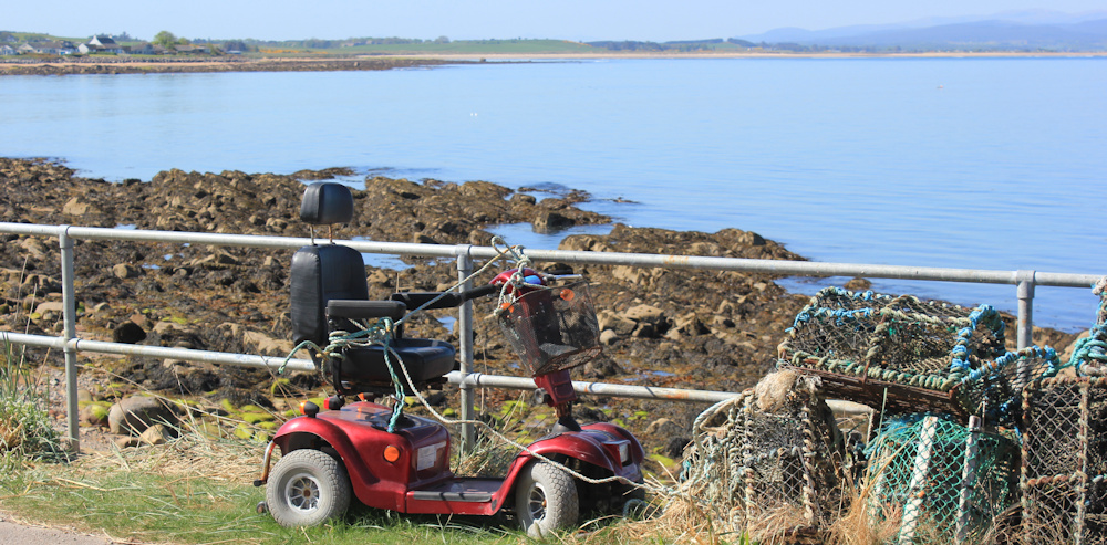
Walking along the road, I am struck by the juxtaposition of a mobility scooter with some piled-up lobster pots. The scooter is tied to the railing – like a horse – by a variety of ropes and twine!
Across the water, I can see the pale outline of beautiful Dunrobin Castle, and the string of houses that must be Golspie.

A year ago, I was walking that other coastline – seems a long time ago now. I haven’t got very far!
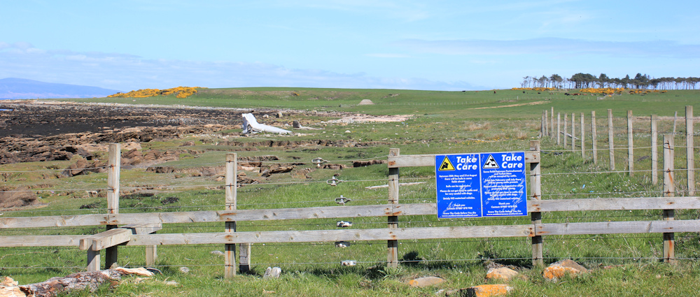
The main Portmahomack street comes to a dead end, with a number of modern-looking houses lining the final section. Here, I should be able to pick up a Core Path to take me all around the Tarbat Ness peninsula… and, yes, here it is.

“Take Care” says a sign, and goes on to warn me that some of the fields along the route will be occupied by cattle, and goes on: “Parent cattle can be aggressive when protecting their young.” Oh dear. I really don’t like cows.
Maybe I will have to turn back?
But I step through the gate and set off along the path. It winds close to the edge of the bank that lines the shore. Gorse on one side, a drop down to shingle and rocks on the other.

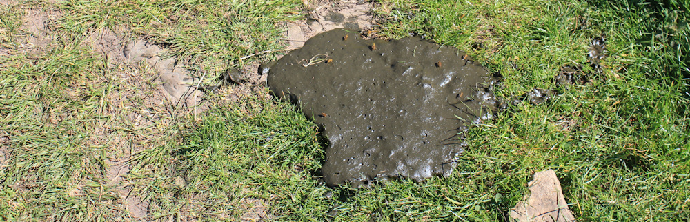
There is evidence of recent cow activity. A cow pat.
I approach every corner and every bend with caution, not knowing what I will find behind the screen of gorse or rocks. Would be very unpleasant to be trapped among the gorse bushes… but I don’t come across any cattle.
So, I soon begin to relax and enjoy the walk. Look at those views!
After a while, I come to a stile and another stark warning sign. This says the same thing as the previous sign. “Take Care”, etc. The good thing about the two signs is that they have the phone number of somebody to contact in case of difficulty. I assume the landowner or the farmer? This is a good thing, and something we are campaigning for on our Killer Cows site.
There are cattle on the higher field ahead, but they seem to be separated from the shore by a fence. I should be OK, so I climb the stile and set off.
I had seen a couple of strange white shapes from a distance. As I get closer, it becomes obvious that they are huge bones. Can only have belonged to a large whale! Amazing. Here is one…
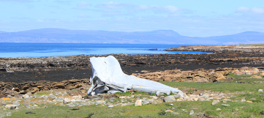
… and here is the other. I don’t know enough about whales to identify them. Maybe pelvis bones?

I wonder what happened to the poor whale. Beached? Alan Palin suggests one was washed ashore here in 2013, on his blog post of this section of his walk.
Leaving the bones behind, I continue along the shore, walking on the beach to keep as far away from any possible cattle-encounters as possible.

At the end of the sand, I take to the grass again. Hear footsteps behind me, turn, and am overtaken by a young woman walking briskly with her dog. She is the first (and only) walker I will meet today.

There is a building ahead, with no road access and no sign of any electricity wires. The windows are boarded up. Would make a lovely holiday retreat for someone who didn’t mind roughing it.

The dog-walker has disappeared ahead of me. Now, I am alone – except for a line of shags perched on a rock behind me – and the beautiful views.
I’ve left the fields behind, and walk between gorse bushes, glad the path seems well-trodden and is kept clear of the prickly plants. The smell of gorse flowers is, as always, glorious.

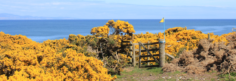
The paths leaves the shore, winding up through bushes to reach a higher point. Across a patch of open land, a yellow flag marks the gate where the path continues. Why a yellow flag? Helpful, I guess, but the same colour as the gorse!
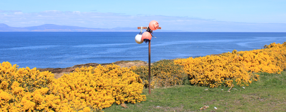
Back closer to the shore, and another strange sight – a couple of marker buoys strung on a pole. This seems to indicate the spot where a narrow path leads down to the shore. I’m tempted to go and see why this route is marked, but it is probably just a good fishing spot.
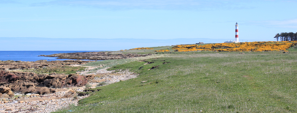
Onwards. I’m out of the gorse and crossing another grassy field. Ahead is the lighthouse on Tarbat Ness. Imposingly tall, and I love the red and white stripes – unusual, as most of the lighthouses around the coast are a creamy/orange colour.
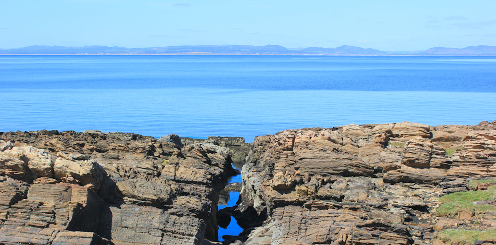
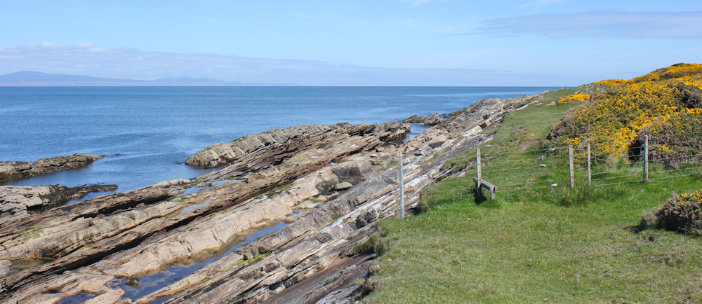
I’m walking due North at this point (strange to be going north again!). From here, I can see far more of the coastline that I previously walked. The rocks here are wilder and the wind is getting fresher.

My map indicates a small lochan to my right, with no name. Is this it? Really, nothing more than a boggy puddle. That lighthouse doesn’t seem to be getting any bigger either!

Through another gate decorated with marker bouys and, eventually, I draw level with the lighthouse. I’m on the edge of a small bay, and I go down to sit on a flattish rock – quite hard to find a comfortable one, as all the rocks are sloping and jagged.
It’s nearly 3pm and well-past time for lunch! What a beautiful lunch spot.

I’ve been warm during this walk, with only a slight breeze and bright sunshine. But, after sitting for a while, I begin to feel chilly. Time to get going.
Unable to go forward (there’s a wall in the way), I climb the grassy slope and find a gate that will, hopefully, lead me up to the lighthouse.

As I turn round to take one last photograph of the view behind me, I spot something that makes my heart thump… a herd of cattle are grazing on the slope above me! Crikey – I’ve been leisurely eating my picnic in a field full of cattle!
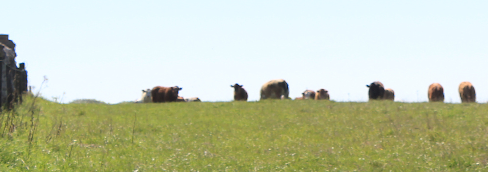
(Apologies for the poor photo above, but I was shooting into the sun and also in rather in a hurry to get out of the field.)
I walk through a gorse maze to reach the lighthouse, which truly looks magnificent and towers over the landscape.

I join a path that runs past the lighthouse and continues to the tip of Tarbat Ness. I walk to the end, where the path gets narrower and more rugged, before petering out before the mass of staggered rocks that mark the tip of the point. It’s windy here.
A couple are sat down in a grassy hollow, and she has a camera with a zoom lens fixed on a small tripod. They are both staring at the sea intently. What are they looking for? Whales? Dolphins?

Another man is sitting lower down on the rocks, sunbathing with a book. I sit down a dozen meters away from the couple and scan the sea in front of us… but I can’t see anything. After a while, the couple seem to give up, pack the camera away and stand up to leave.
Ah, well. No whales today then – I haven’t had any luck spotting them in Scotland so far, although I have seen a few dolphins. Time to move on and start the second half of my walk.
[To be continued…]
Route so far today:


I love that scooter tied to a fence – just like every cowboy film! 😂
So you’ve been duped by the Wildlife Spotter Candid Camera Team as well. I got tricked by them on Humphrey Head looking for a Peregrine Falcon that definitely wasn’t there. Pesky blighters 😒
One way to gather a crowd behind you is just to stare intently at something in the distance… 😂
A good way to gather a crowd behind you is to stare intently at something in the distance. People can’t resist trying to see what you’re looking at. 😂