
[This walk was completed on Monday, 5th May, 2025]
I give up my fruitless attempt to spot whales, or dolphins, at the tip of Tarbat ness. Walk down the path hugging the coast, then pick up the access road that runs past the lighthouse.

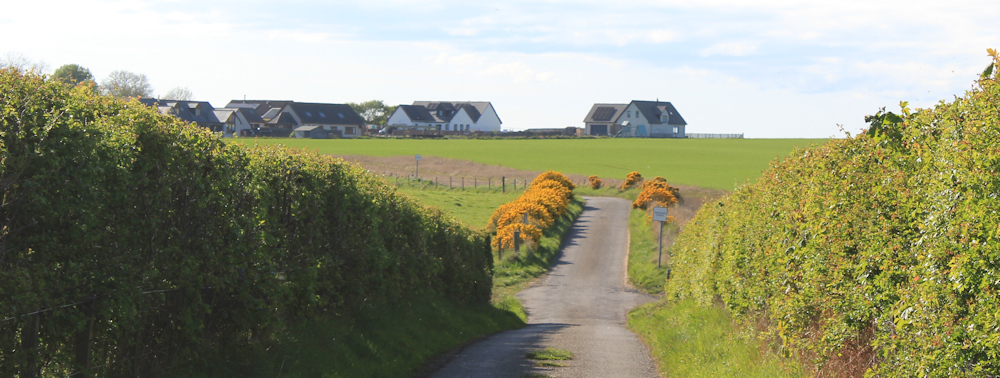
From here, a single-track road runs between two high stone walls. There are several family groups around. They haven’t been visiting the lighthouse itself (which is now a private residence) but must have come for a walk. I wonder if they had any better luck whale/dolphin spotting?

There are cattle in the fields to my right, and a big bull in the field to my left. I’m glad of the high walls!
I pass a small car park. Surprisingly busy – this is a popular spot. And then come to a junction with a signpost for the Core Path to Rockfield. Only 5 km to go – that’s 3 miles.

Portmahomack is only 5 km away too, says the sign. I’m half-way through my walk.
Down a steep little road, with an unnerving sign showing a car plunging off a cliff into water, and I am heading back to the shore again.

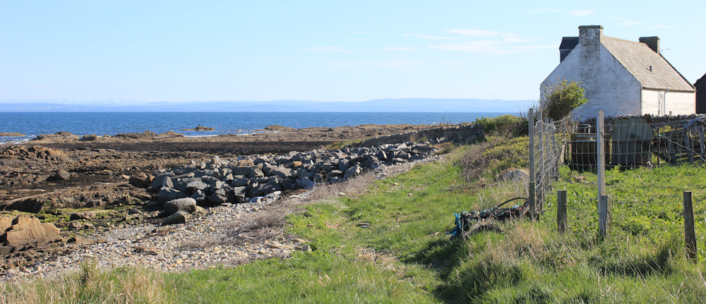
At the bottom of the road is a slipway and a building that looks like a public toilet. A man is erecting a wind break in the tiny back yard at the rear of the toilet… and I stop for a chat.
The man has an Irish accent and is probably in his 60s. He is renting the place as a holiday cottage (it’s not a public toilet after all!), and tells me he walked up to here from Balintore yesterday. It is part of his training for the Penine Way, which he is planning to hike later this summer.
I’m not going as far as Balintore, but he tells me the walk between here and Rockfield is “mellow”. This sounds like a good thing!
The weather on this eastern side of Tarbat Ness is quite different from the the weather on the west side. My walk this morning was warm and calm, but now I am hit by a buffeting wind. This is why he is erecting a wind break, in the hope of being able to sit out in the sunshine.
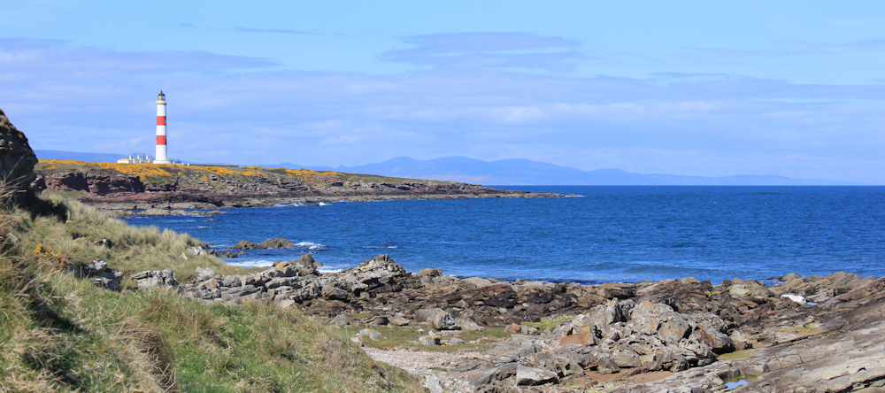
I strike off to the right, heading soutwards along the shore. Turn to take a photograph looking back at the lighthouse, and at the little holiday home that I first mistook for a public toilet.

His description of the walk turns out to be correct. Apart from the buffeting wind, the walk is a very “mellow” amble. The path is nice and clear. The sun continues to shine.
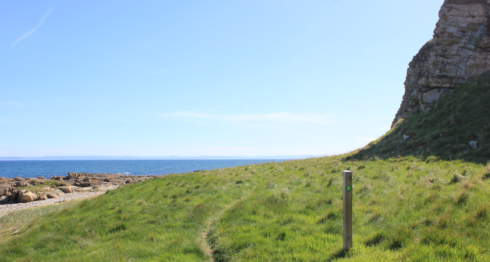
I reach an outcrop of rocks, and a marker sign directs me up the slope. I’m growing tired, and the climb isn’t particularly welcome…

… but the views from higher up the cliffs are excellent. There is Tarbat Ness lighthouse standing proud. [I later learn it is the 3rd tallest lighthouse in Scotland.] Beyond are the hills that lie behind Dunbeath and Helmsdale.
It is such a clear day! If I look southwards, I can see the low lying land of Nairn and Aberdeenshire. I can even see snow on the tops of distant mountains today. Maybe the Cairngorms? (Sadly, the snowy tops don’t show up on my photographs.)

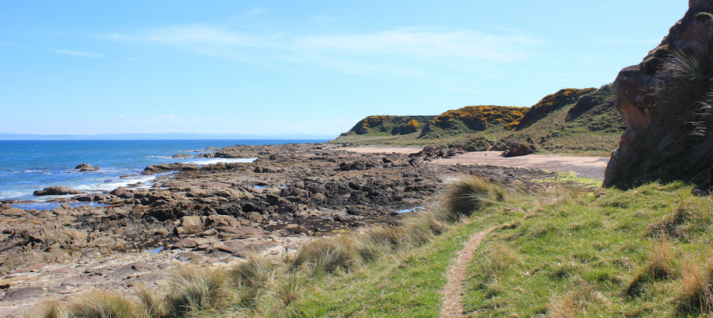
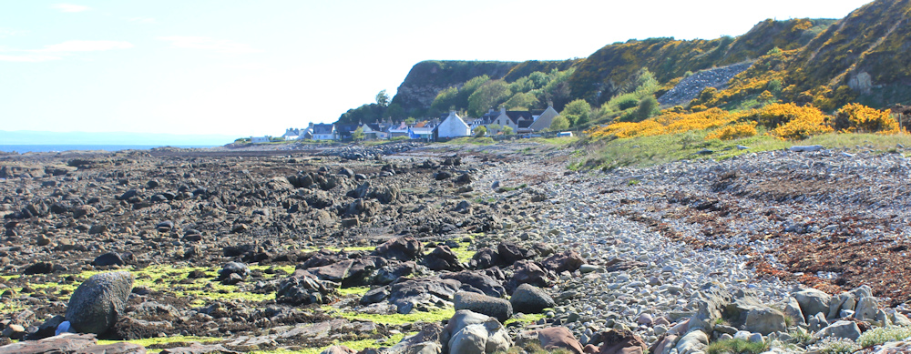
A short while later, the path descends a slope covered in gorse, and I’m back on the shore again. From now on, I follow a narrow strip of land, sandwhiched between the rocky cliffs on one side and the rocky shore on the other.
Because I’m walking southwards again, I’m walking into the sun, and that makes photography difficult. To be honest, there isn’t much to say about the path itself, which progresses fairly uneventfully.
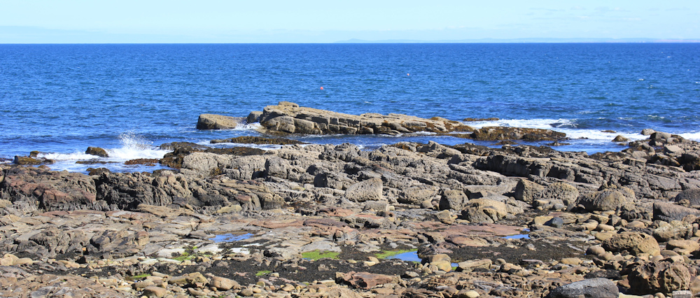
The best scenery is out to sea. Dramatic rock formations, craggy little islands, and the intermittent crash when a breaker bursts into a spray of foam.
I stop in a little cove, drag a couple of largish rocks together to form a seat, and sit down for a rest and a drink. Eat all my cereal bars and my last little orange. Can’t linger too long… the wind is chilly, and this rock isn’t very comfortable.
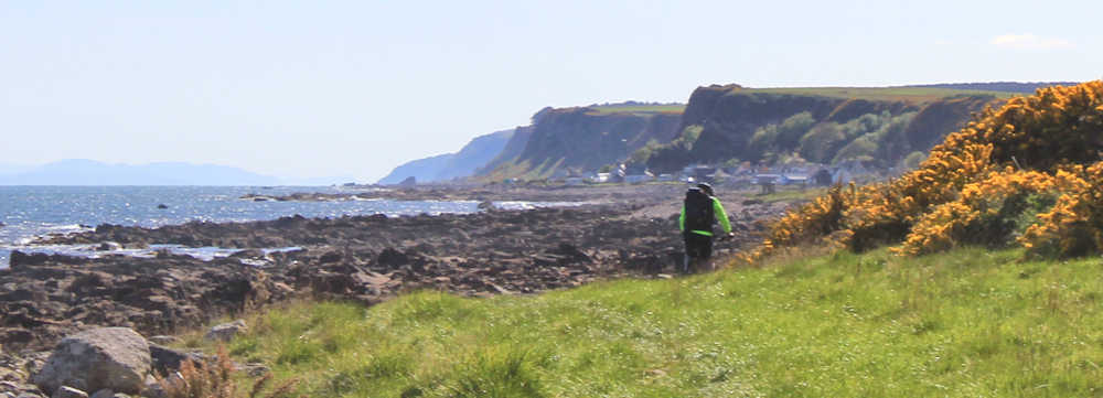
As I turn round to hoist my rucksack back on my shoulders, I spot a man walking along the path behind me. He disappears round the corner before I can snap his photo. That is only the second walker I have seen today.
Further along, I come across a bench. Wish I had known this seat was here, because it would have been a much more comfortable place to have my rest and snack!
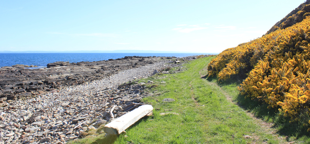
Onwards. Just me and the narrow strip of grass, the gorse and the cliffs to my right, with the rocky shore to my left, and the bright, deep sea.
A whirring noise behind me, and I turn round startled. It is a man on a mountain bike. I blink, and he overtakes me and he’s gone.
I think of my Scooty bike, and wonder if when I’ve finished walking the coast maybe I should try cycling the coast? But, on reflection, maybe a gentle tour in the car would be even better! I could vist all the places I didn’t have time to see first time round, and revisit the places I loved the most.
But I’m jumping ahead. I’ve still got 100s of miles to go yet. Possibly a 1,000 miles.
People keep asking me “How far now?”, and I reply that I am not sure. I’ve never tried to plan too far ahead on this mammoth trek. That’s partly because, when I first started, the enormity of the distance would have overwhelmed me if I thought too much about it. And, partly because I have been trying to keep my expectations neutral, so that every section holds surprises.
But I’ve certainly come over 2/3 of the way by now and I’ve completed the most difficult part. Everything ahead of me will be a piece of cake after the challenges of the north-west coast of Scotland!
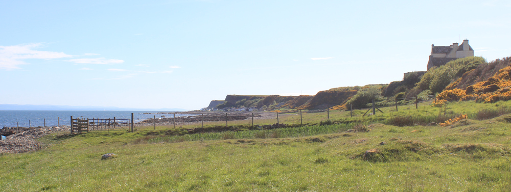
Onwards. The cliffs to my right have become lower, and the flat green strip broadens out into a wider meadow. There’s a large building ahead.
I check my map. The building is Ballone Castle (restored). It doesn’t have the French elegance of Dunrobin Castle, but it does have a certain style and a fairy-tale quality. The circular tower on the side is where Rapunzel would have let down her hair.
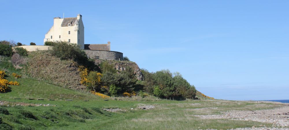
I take a photo of Rapunzel’s tower and send it to my granddaughter (via my daughter). She will love it, I think. But, when my granddaugher reviews the photo later, she is reported to be completely unimpressed!
Now, I can see the village of Rockfield in the distance.
Beyond the castle, a fence separates the grassy field from a shore of rough shingle. At this point, the path disappears. I walk along the field for a while – much easier going than over the difficult beach – but then become concerned about climbing over the fence when I reach the end of the field.

I find a rickety, one-plank stile hidden among the gorse, and climb out of the field and onto the shingles. This is hard going.
I reach Rockfield without twisting an ankle, and pick up a grassy path again. (Turns out that there IS a stile at the end of the field, and I needn’t have walked the shingle after all!)
The path passes in front of the first house of the village…
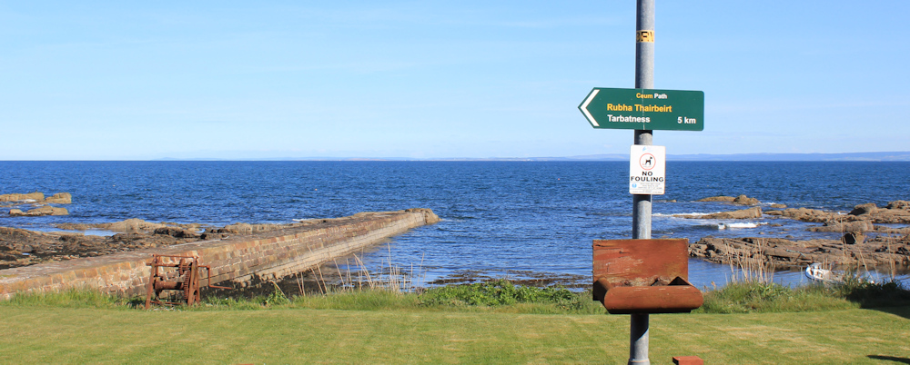
… and runs past (or through) people’s gardens to reach the road. Here is a stone jetty, a green space, and a sign telling me that Tarbatness is only 5 km away.
It seems to have taken a long time to walk 3 miles. And my journey isn’t over yet – I still need to get back to Portmahomack where my van is parked.
Rockfield is an eccentric sort of place. I rather like it, but I wonder who lives here permanently and how they cope with the weather over winter? The road is rough, the houses are small – mainly cottages – and they have little garden-areas on the other side of the road, with a mixture of sheds, summer houses, and green spaces backing onto the beach.

I take the first right out of Rockfield – actually, it is the one and only road going in and out of the village. The road winds up the slope in a series of steep curves. I stop to rest take photographs of the view looking northwards to Ballone Castle and the path I’ve just come along.

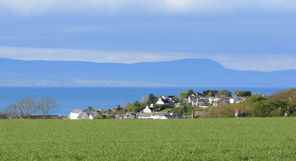
Looking southwards – despite the difficult light – I manage to take a decent photograph looking down over Rockfield.

At the top of the hill is a little green space. A white-painted rock sits proudly in the grass and says, “the rock”.

But I am more interested in the table and bench at the top of the space, with a fine view over the coast. I sit down for a rest, swig some more water, and find a last cereal bar at the bottom of my rucksack!
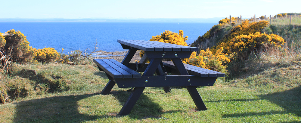
Take another good photograph overlooking Rockfield, with its tiny harbour and stone pier. You need to imagine the snow on the distant mountain peaks!

[Later, I wondered if the patch of grass belongs to a house called “The Rock”, but at the time it didn’t really occur to me that it might be a privately owned piece of land. I was just grateful for a place to sit and recover from the climb out of Rockfield!]
Last leg of my journey ahead, and it is mainly road walking. Round a corner and down a hill, towards a place called Seafield.
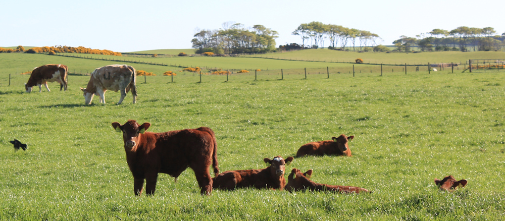
I am surrounded by fields of cattle, but the road is protected by fences. There is a bull at the top of the field, who is clearly having a romantic interlude with one of his cows.

The products of his amorous conquests lie scattered around the fields. Cute little calves, their coats glowing chestnut-brown in the evening sunshine.
Seafield is a collection of newish-looking houses. I pass through, and road begins to descend another hill. There is the outskirts of Portmahomack – I’m nearly there.
The last mile of any walk is always the longest, and the final downhill stretch is long and straight – and seems to go on forever. I see a hare racing across a field, and stop to watch him until he disappears.
Finally, I join the main road and walk into Portmahomack to find my van parked in the beach-side car park. It is a glorious evening, and the northwest-facing beach is lit up by the evening light. Beautiful.

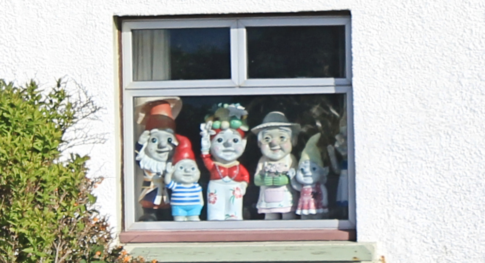
The gnomes are still watching me from a nearby window. They seem to be enjoying the sun too.
It has been a glorious day today. I left my bike behind and covered 9 miles on foot without too much fatigue (apart from the final mile!). Wonderful to be able to walk along a proper coastal path again – I have really enjoyed it.
Tarbat Ness Lighthouse sits on an old Roman fort and the site of a witches’ coven. More info: https://www.nlb.org.uk/lighthouses/tarbatness/
Ballone Castle was built in the 16th Century, but has been restored and is now a private home. Apparently they sometimes hold open days when you can have a look around: https://www.doorsopendays.org.uk/…/ballone-castle
Core Paths: Scotland doesn’t have a network of public rights-of-way footpaths, but it does have a series of paths that are designed to allow access to the glorious countryside. The paths don’t always appear on the OS maps, but can be found here: https://www.nature.scot/…local-path-networks
Miles walked today = 9 miles
Total distance around coast = 5,199 miles
Route today:


Good progress. I’ve been looking ahead and wonder about Inverness. I can’t remember what your rules are about ferries. Current Internet info. tells me that Nigg Ferry doesn’t open until 1st June. You don’t need to reply, it would spoil the suspense. I await with anticipation.
Ha ha, I shall keep you in suspense… Hope all is well with you.
Sounds like you had a fabulous walk. Tarbet Ness lighthouse is one of my favourites. I have a large 30″ *20″ photograph of it offset by the yellow gorse hanging in my kitchen which I took on my coast walk. I have been back three times to try to get another photograph of it but maybe with one more red stripe in view, and failed miserably – you never get better photographs in my experience – just different ones – because of the light / tides / clouds etc. Fun trying though. All best.
hi Chris, yes it really is a magnificent structure.
There were loads of people looking for whales and dolphins at Tarbert Ness when I was there too. They were sheltering behind the wall as it was very busy. I didn’t see any there either though.
There’s a Wildlife Spotter Candid Camera club??? 😯 Oh god.
“But I’ve certainly come over 2/3 of the way by now and I’ve completed the most difficult part.“
Yes, I’ve just taken a look at the map and it shows it’s all downhill from where you are👍
Definitely 😀