
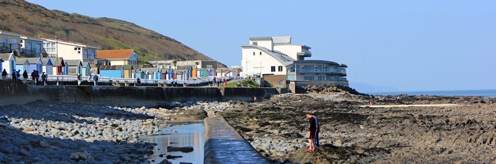
Westward Ho! looks nicer in the sunshine. The tide is low and there is a mass of rocky shore, with sand beyond.

There was a queue of elderly people waiting at the bus station in Barnstaple. I nearly got on the number 21A, but that would only take me as far as Appledore. When plain number 21 arrived, nobody in the queue moved. Strange. The bus was nearly empty and I bagged a prime seat (top deck, front row) but felt uneasy when we pulled away leaving everyone else behind. Did they know something I didn’t?
[Later I discover the over 65 free bus passes aren’t valid until 9:30am. Everyone was waiting for the next bus.]
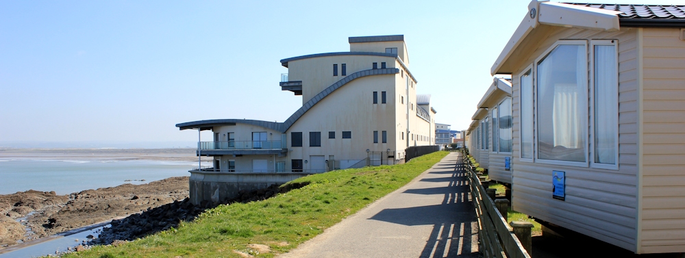
I walk to the far western end to pick up the path from where I left off my last walk. And to visit the toilets. Shame about the static caravan park that dominates this end of Westward Ho!
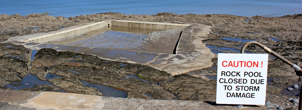
Down among the rocks there is an artificial pool made of concrete, but it’s closed due to storm damage. Doesn’t look deep enough for swimming. Paddling, maybe?
A concrete walkway runs across the rocks and I climb down to join it. It turns out to be the covering of a sewage pipe(?), torn away in places to leave the rusty pipe showing, giving me more of a slippery scramble than I anticipated.
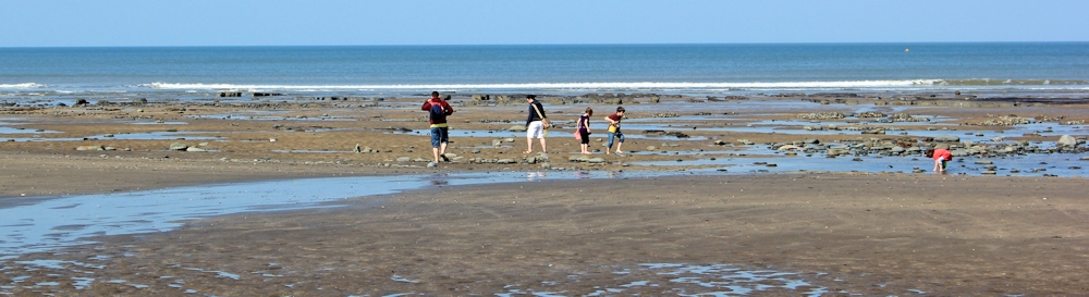
Beyond the rocks, a few families are erecting windbreaks just at the edge of the beach. The sea is miles away. I set off walking along the sand. I am making my way around the edge of a protruding hook of vegetated sand dunes, marked as ‘Northam Burrows Country Park’ on my map.
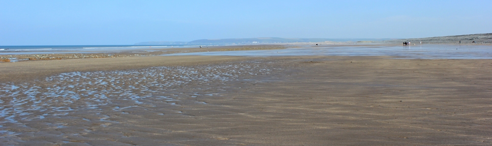
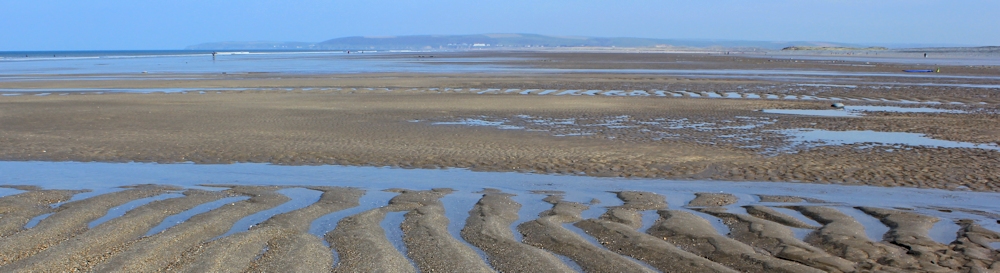
The beach is vast and empty. Only a few energetic people manage to make the trip to the water’s edge.
The sand has been shaped into geometric wave formations.
In the distance I can see firm ground. It looks far away and I suppose it must be on the other side of the river estuary.
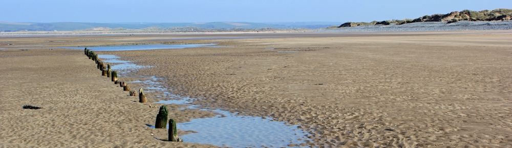
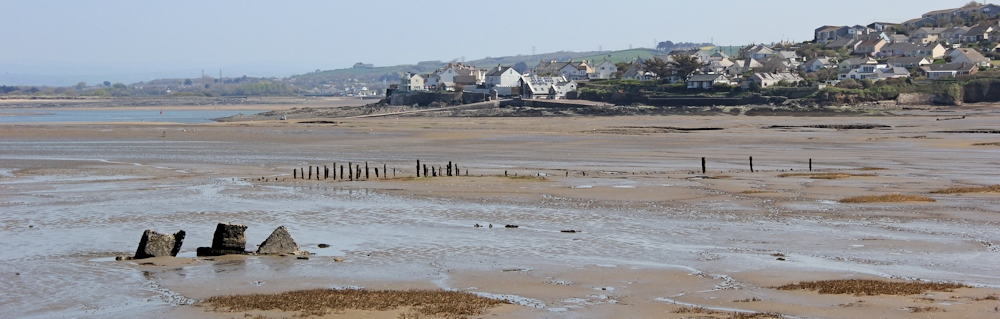
I walk and walk, keeping the line of dunes to my right. I come across the rib-timbers of a few wrecked or abandoned boats. This line of wooden posts looks like it might have been an old breakwater.
I reach the farthest northward point of the walk and my beach begins to swing round to the south-east.
Ahead, over an expanse of rocks and sands, I can see the deceptively narrow-looking mouth of the estuary and what looks like sand dunes on the far side. I check my map. Yes. The nearest sand bank has the ugly name of ‘South Gut’. Over the river is the beach of Saunton Sands and the dunes of Braunton Burrows.

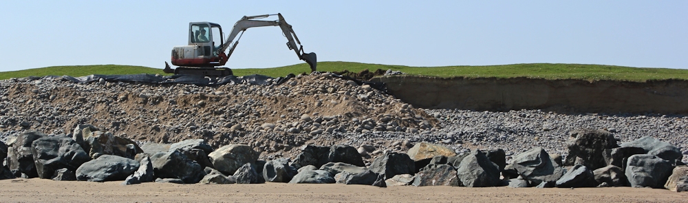
On this side, a digger is piling up a bank of earth behind a barrier of large boulders. The storm has damaged the edge of this coast and I guess the digger is making it safe.
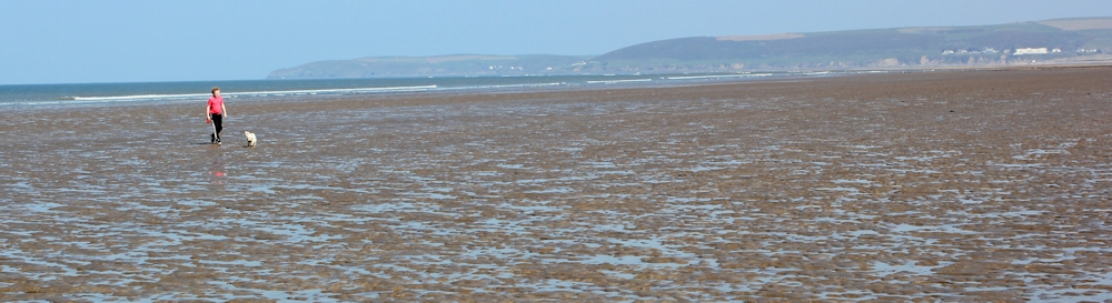
The sand comes to an end and, faced with a mass of irregular stones, I climb up the bank to find the official South West Coast Path and continue making my way around the curve of the coast. This is all part of Northam Burrows Country Park (there is a golf course here as well) and a car park area. I meet a few dog walkers and families out for a stroll.
The sea gives way to mud flats, marked with the name ‘Skern’ on my map. The warning sign says:
WARNING
The tidal waters and mudflats
on this estuary can be dangerous
if not treated with respect.
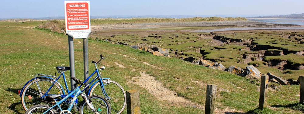
And just to make it clear:
DO NOT ENTER OR ATTEMPT
TO CROSS THE MUDFLATS.
I can see the village of Appledore is just a few hundred yards away across the mud. It is very tempting to try to wade across. But I resist.
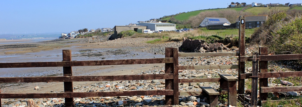
I walk around the edge of the mud and leave Northam Burrows via a bridge. It is a little difficult to work out the route of the South West Coast Path, but I find it running along the very edge of the shore. It is always a relief to see that friendly acorn sign.
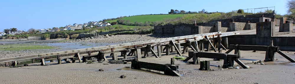
Still, I am unsure if this really is the right way. After all the dire warnings, I am nervous of crossing the mud and ahead I can see the remains of old buildings and a strange ruined slipway. But then I see a woman out walking her dog and I follow her.
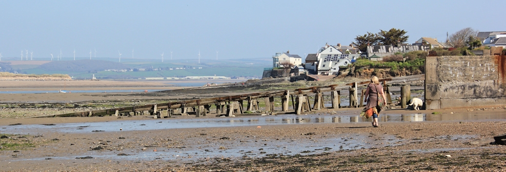
I think the slipway might be an old ferry crossing point. On the bank is what seems to be a roadway with marked lanes for cars.
I walk through mud and then up some steps, past a concrete slipway to the lifeboat station and into West Appledore.
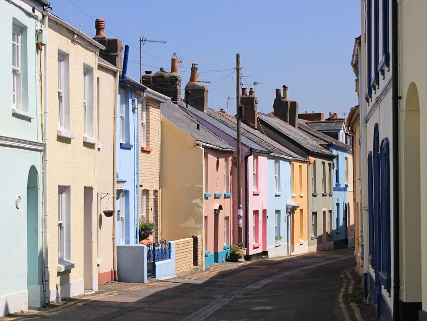
The streets here are narrow and lined with pretty pastel-coloured houses. It take me by surprise when I meet a car.
I walk past a couple of pubs. In retrospect, I should have stopped for lunch – but it is only 12:30 and it seems too early. This turns out to be a mistake.
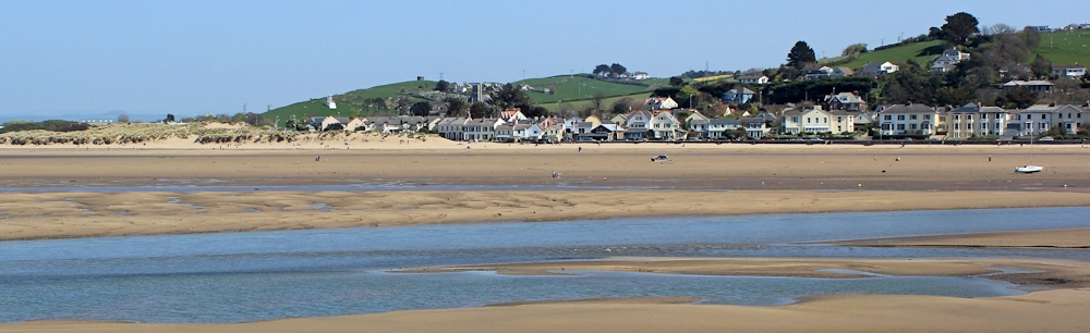
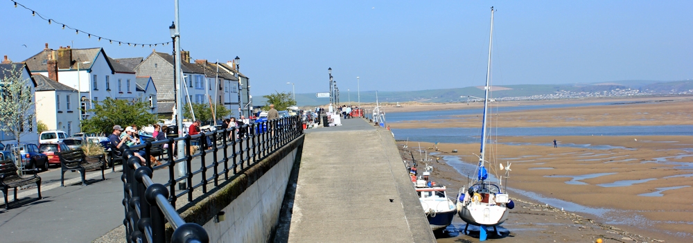
West Appledore leads into Appledore and here there is an esplanade and a lot of tourists milling about. Across the water I can see the village of Instow, where I plan to end my walk today. At high tide a ferry runs between Appledore and Instow, but today the tide is too low and I am planning to walk into Bideford to cross over the Long Bridge.
I leave the quay-side of Appledore behind, taking one last look back at the mouth of the estuary.
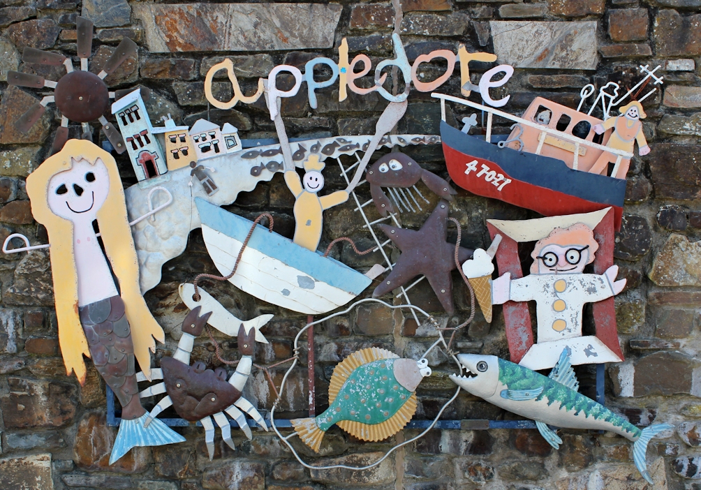
Walking along the road, I come across this wonderful sign.
From here I walk along the edge of a road, that winds away from the sea. I am growing hungry and already I am regretting not stopping for lunch.


Love your photos Ruth – the ‘letterbox’ style is most effective and I find myself clicking on each one to see a larger version.
Thank you Graham. The letterbox style (great phrase) came about because I found it the easiest way to format the text, with no worries about aligning left or right or how many words needed until I could slot in the next photo. Lazy really!
Why didn’t I think of something a simple as that? Good luck on your next visit to the coast path. We’re off to Cornwall 2 weeks on Sunday hoping to walk from Helford to Penzance in our 6 days down there.
I like the look of Appledore, it seems a pretty place although I’ve never visited.
It was pretty. Sleepy. Best visited on a sunny day.
Ruth – we live in Northam – next door to Appledore and we are reliving our continuing journey on the Coast Path through your blog.
The strange slipway you mention near Appledore is part of what was Hinks’ boatyard, now a motor garage. The boatyard was the birthplace of the replica ‘Golden Hind’, among others, launched down it in the early 1970s. Sadly, the boatyard is no longer in business.
What a lovely place to live, John. I’m jealous. And thank you for the information about the slipway. How interesting – and how sad the boatyard is now closed.