
I’m not expecting much from today’s walk: just a slog through industrial estates and along a busy road, until I get to Dunball wharf and a river footpath. Bridgewater is not the prettiest of towns, but any marina looks nice if the sun is shining.  This was once a busy port, but today the wharf only contains a few rusting remnants of its industrial past. At this point the River Parrett is tidal, and although it has more water flowing through it than yesterday, it’s still hard to believe this section was ever an important navigation route.
  I cross over the river at the road bridge and begin walking up the footpath on the other bank. This runs past an old industrial estate – around the back of crumbling warehouses and sheds, with occasional glimpse of yards, vans and trucks. The path is very overgrown. Not a route that’s used much. I feel a little uneasy, walking between high fences and the muddy river, among thick undergrowth. So uneasy – that I don’t want to stop and take my camera out and so have no record of this part of my walk. Further along and the industrial units give way to a short section of housing estate. People’s gardens back onto the river. The grass has been cut short. Residents have placed garden furniture – tables and chairs and a barbecue-set on the bank.
 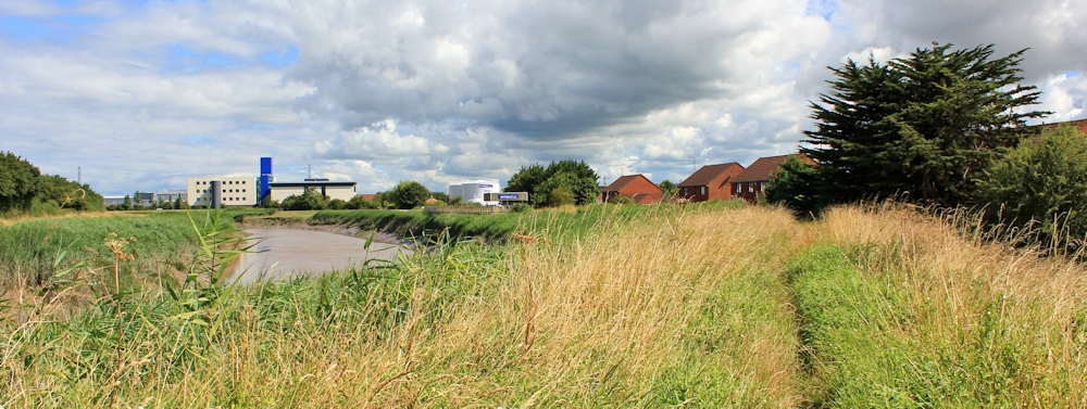 According to my OS map, the footpath ends among these houses, just before I reach a shiny-new industrial estate. From here, I am anticipating a couple of miles of road walking, along the A38 – a busy dual carriageway with fast-moving traffic. So worried am I about this stretch, I asked my hubby to drive along the A38 yesterday to do a ‘reccy’. I was reassured to discover that a footpath/cycleway runs beside the road. At least I won’t have risk my life dodging lorries. As I hesitate on the bank, working out how to get off the bank and onto the A38, a man calls out to me from his garden. The footpath goes down between those houses. He points the way. But, if I want to, I can continue walking along the bank. “It’s very nice walk. There’s a pond and swans.” “Really? How far can I get along the bank?” I ask. “You can go all the way to the sea, if you want to,” he tells me. “To Dunball Wharf and further.” I am very grateful for this information. Now I won’t have to walk along the road. Instead, I walk along a well maintained, manicured bank, running between the river and the new industrial estate. It’s not marked as a ‘right of way’ on my map, neither is it signposted as such, but it’s certainly nicer than the official footpath I’ve just left behind.
  Every so often I come across an old WW2 pillbox, sunk into the bank. I meet one other walker, dressed in a suit, maybe from one of the nearby buildings. Through tinted windows I can see large open plan offices. Jealous eyes watch me strolling in the sunshine.
 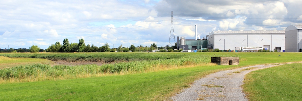 I pass the headquarters of my husband’s favourite shop. Toolstation.
  And across the river, I can revisit my route from yesterday. There is Pims Pill, still muddy. My old foes, the bullocks, are resting – perhaps waiting for the next walker to terrorise.
 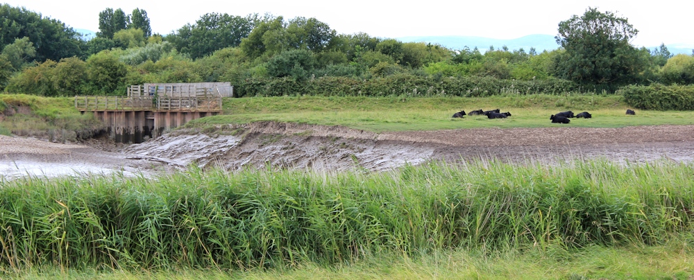 Inland I come across the pond, and swans. And a crowd of nearly grown cygnets.
 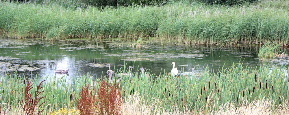 I leave the buildings behind and begin to cross farmland. Across the twisting river I can see Dunball Wharf.
 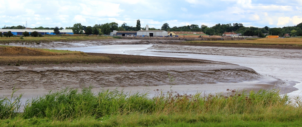 Looking across to the west, the Quantock Hills form a lovely backdrop.
  And ahead, I can see my hubby walking to meet me. He has parked the car at Pawlett. He warns me there is a short stretch of road walking ahead, in order to get past Dunball Wharf. And after that we can rejoin the river bank. But there is a bull in one of the fields ahead.
 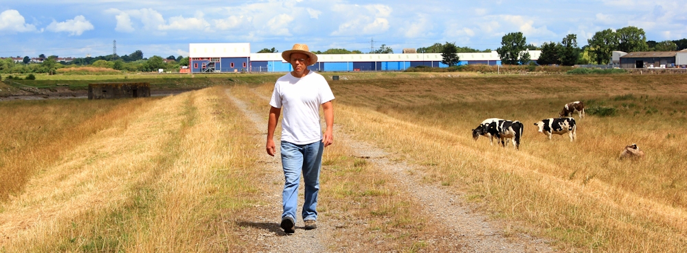 When I tell my hubby of my escapades with cattle, he always pooh-poohs my fear. So I am surprised to hear him mention a bull, and assume he is talking about a frisky bullock. There seems no official path off the bank and we have to climb over a farmer’s gate. Next to the gate, in the field, is the makeshift tent of a rough-sleeper. Beyond the gate, we join the road. A pub on the other side is still advertising Easter bookings. Not a good sign in July.
 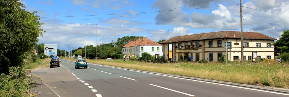 Dunball Wharf may still be used, perhaps for the transport of aggregates: sand and gravel. Beyond is a driveway to an industrial estate, consisting mainly of a plastics recycling plant. Apparently a public footpath runs through here. Can you see it?
  I would feel very unhappy walking through this site on my own. Luckily my hubby joined the footpath at Pawlett and has already been through here. He assures me this is the right way.
 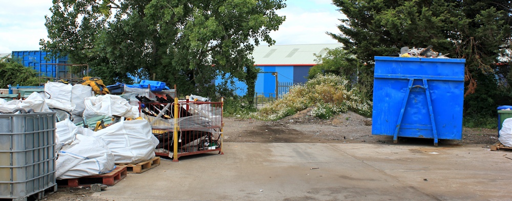 At the back of the recycling plant, we see a footpath sign. And we end up in a large yard with old railway tracks running across it, and a couple of parked lorries, their drivers sitting in their cabs. Again, I would feel very uneasy walking here on my own, but hubby says, yes, this really is a public footpath. Come on.
  We climb into the adjacent field. This contains the bull, he says. I take a quick photograph of what appears to be a group of cows, and we scramble over the raised bank and walk around the far side of the field to avoid them. Only later, when I enlarge the photo, do I realise my husband was right. There really is a bull. He’s sitting down behind one of his cows.
 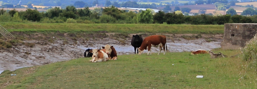 We cross the field without injury, only attracting the belligerent attention of one solitary cow, after we nearly stumble over her young calves who are lying in the long grass. From here onwards the walking is easy, following a track that runs along the top of the bank. The sun shines intermittently. The landscape glows.
 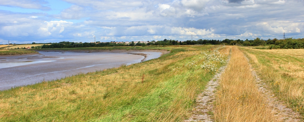 Ahead we see a beat-up old Landrover. I had noticed the same farmer yesterday, from the other side of the river. He drives along the bank for a while, and then heads off down into a field.
  We see him getting out to open a gate. He has a variety of dogs with him.
  But he is soon back on the bank and pulls alongside us. I’m feeling nervous, wondering if he will challenge our right to walk across his fields, and I have the map ready to show him it’s an official public right of way. But I needn’t have worried. He only wants a chat. It’s a nice place to walk, he says, although few people use the path. They’ve had trouble with dogs worrying sheep, and he lost a ewe and several lambs this year. But he knows who the guilty party is. A local woman who lets her dogs run free. Then he talks of townies who don’t understand the countryside, who leave gates open and allow livestock to escape. He describes an incident where a truck illegally dumped asbestos in a field, and left the gates open. The cows got onto the busy A38 and it was lucky no one was killed. He can remember boats going up and down the River Parrett – and talks of a journey on one when he was young. But the channel is dangerous, as the mud-banks constantly shift position. Now there is only one sand boat and a dredger. (They started dredging the river again after the recent floods.) He is busy. Driving around his fields and checking on his sheep. Recently a cow got itself trapped in the mud on the bank. They tried to pull her out, and the fire brigade came, but they couldn’t free her. The tide came in. They thought they were going to watch her drown and then – when the water was up to her nostrils – the river lifted her free. He continues on his way and we stop to take some final photographs of each other.
 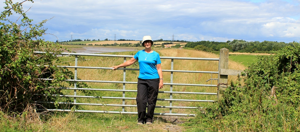 Ahead is Brick Yard Clyce, and we are leaving the bank at this point and heading up into Pawlett to find the car. Today was only a short walk, as we have a long drive home to Lincolnshire.
 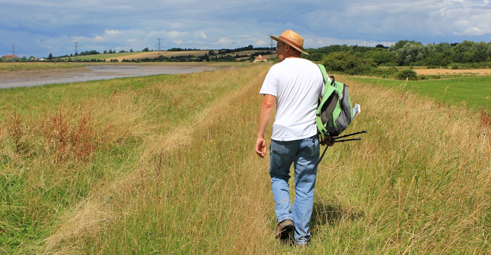 I was keen to get this stretch of walking over and done with, as I thought I would be really tedious and anticipated spending most of the day trudging along the busy A38. But, it turned out to be a memorable walk, with the bonus discovery of a wonderful riverside path. In fact, it was much more enjoyable than my battle with weeds along the terrible River Parrett non-Trail yesterday!
Miles walked today = 5 Miles since beginning = 1501 Route:


You walked the exact same way as me by the sounds of it. I remember doing that walk and it was pouring with rain, so I kept the map in my bag. It was only when coming to the locked gate (I presume the same one you mention) I got the map out and realised I was well past the end of the right of way, so I climbed over the gate to head back to the road. I also walked through that yard, which doesn’t look welcoming but did find the path the other side. Actually if you look at the OS Map the route of the Right of Way is going right through one of the buildings – I certainly wasn’t going to be pedantic enough to demand to walk through the building!
I find Google Maps Street View/Google Earth very good for checking if roads have a pavement, along them, or a wide grass verge – it saves having to drive along it first. I’m glad you enjoyed this walk. I must admit I found the walk into Bridgwater and back rather tedious but it was probably not helped that the weather was really bad for one of the two walks.
I was very grateful to find an alternative route to the anticipated road walking! Weather was good for me, but I confess I still found the walk down to Bridgwater and back pretty tedious too.
Congratulations on your 1500th mile Ruth!
Thanks. Can’t believe it!
Yes, congrats on your 1500th mile!
Thanks Ju. Why do I still feel such an amateur? 🙂
http://www.theguardian.com/travel/2014/aug/24/-sp-walking-england-new-coast-path-noth-east?CMP=EMCNEWEML6619I2
Congratulations with finishing the SWCP – I’m a bit stuck at the moment, mother very ill. Thought you may be interested in the article above – we’ve got that to look forward to!
All the best
Patricia
Sorry to hear about your mother, Patricia. Of course your focus must be on her at the moment. And thank you for the link. Interesting. It’s heartening to see many short stretches of the England coast path being created. But it’s going to take a long time before they’re all joined up!
I’m glad you had some company on that last stretch. I’d have been loathe to walk through the industrial estate. The farmer sounds like a real character though.
Yes, so glad we had a conversation with the farmer. Very interesting.
Hahaha, I love Toolstation too!! But I also experience similar fears from walking alone to those of which you’ve described – when a farmer’s approaching and you fear he’s going to challenge your right to walk there (especially if the waymarks are damaged or absent) and I could tell you stories about cows that might actually be bulls, and vice versa… But this is the countryside and, as you’ve discovered, it can be a rather isolated space where people simply want to communicate with a loss of civilisation. 🙂
Hi Olly, of all the hazards facing walkers, it’s cattle that seem to incite the most fear – in me at any rate!
The pub at Dunball’s Wharf -The Admiral’s Table- friendly and welcoming when I ventured in…. bar decorated for Halloween, so they are managing to keep up with events now!
Glad to hear it. Hope you had a good meal/drink there.
Dear Ruth
I walked Burnham to Dunball earlier this month. The worst stretch was the approach to the wharf where the landowner is allowing the path to get overgrown by nettles behind the new warehouse development. It was a bit scary ending up crossing the yard where the old rail tracks are still visible but it is signposted as coastal path.
I did not relish walking along to A38 into Bridgwater so caught the bus from The Admirals Table to The Clink. From there it is just a short walk to the railway station.
Hi Viv. It’s a shame to let a path become overgrown. The yard with the old train tracks certainly doesn’t look like a footpath. This isn’t a very welcoming path and I don’t blame you for missing out the road stretch, 🙂