
Next day, I’m back at Rhossili Beach. The sun is shining and the air is clear. It’s a perfect day for walking and a perfect day for photography.
Despite its popularity, this beautiful beach is virtually unspoiled by development. It’s only from higher ground that I get a glimpse of caravan roofs at the far end of the sands. Shame.

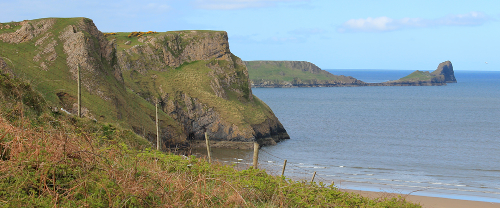
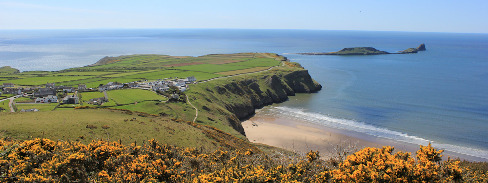
As I walk down, I can’t resist turning around and taking another photo of Worms Head. This is the closest I will get to this wonderful rocky peninsula today, because yet again the tide is high and it’s impossible to walk out to the end of the Worm. Maybe one day…
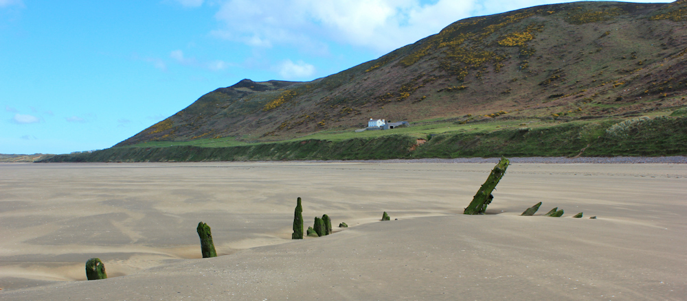
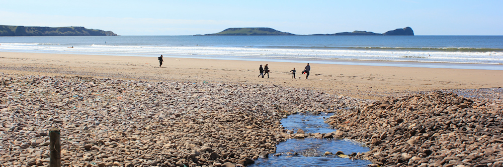
Rhossili beach is three miles in length. The long backbone of Rhossili Down forms a perfect backdrop. The only interruption to the sand is a skeleton of an old wreck and a couple of shallow streams. The only visible building is an old white cottage.
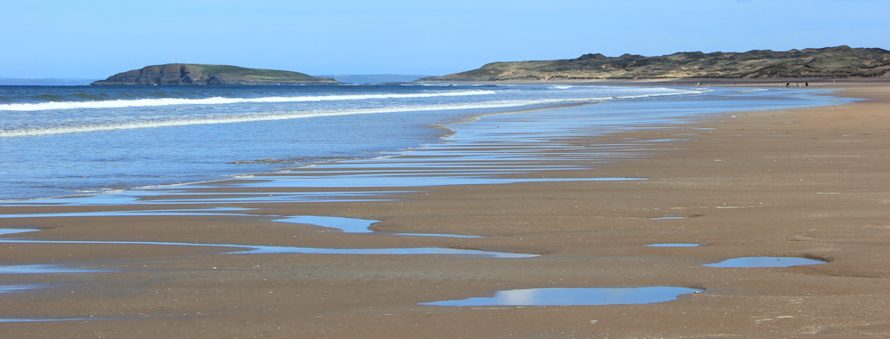
The sand is firm and the going easy. It only takes me an hour to walk the length of the beach. The headland at the far end is called Spaniard Rocks, and the island just off its tip is Burry Holms.
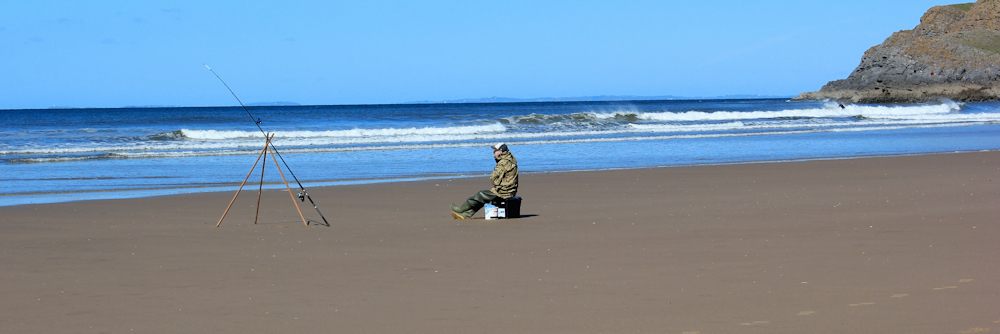
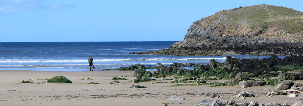
Despite the fact it’s a near perfect day, and a Sunday, the beach is remarkably empty. I see a solitary fisherman… What do they do all day?
And three surfers arrive. They get going with some warm-up exercises before heading into the waves, where a single surfer is already riding his board.
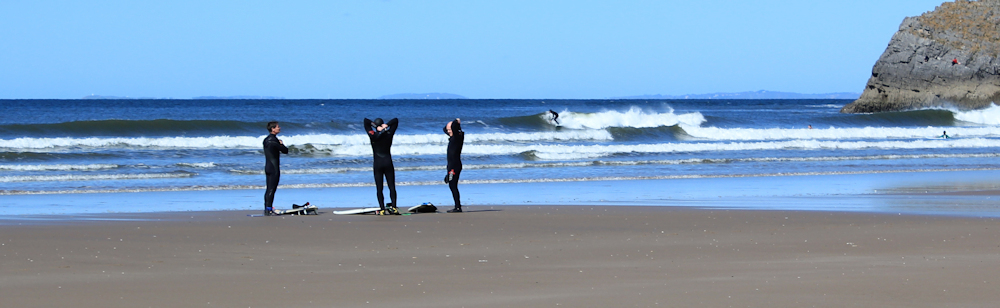
At the far end of the beach is a photographer. He is either taking photos of the waves, the birds, the surfers, or the person sitting on the rocks.
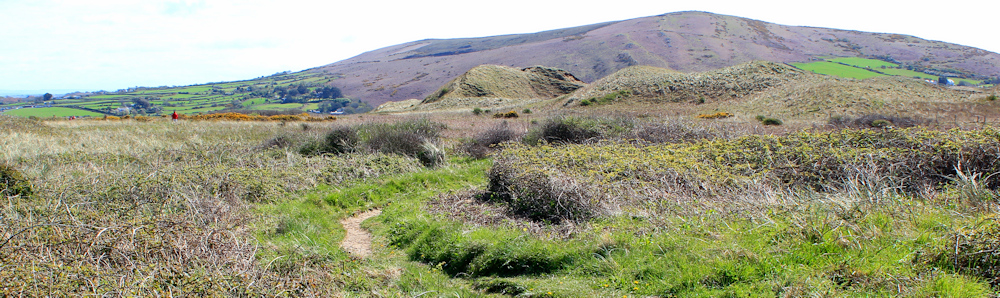
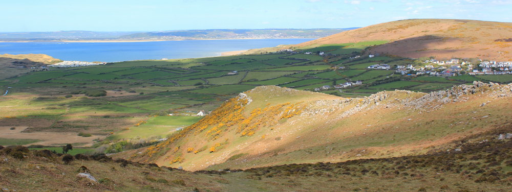
From here the path heads along the top of low cliffs, and along the edge of the Llangennith Burrows dune system. Ahead is the purple moor of Llanmadoc Hill. At 186 metres, it’s only just pipped by the highest point of Rhossili Down, which is 193 metres above sea level.
I soon reach the wide expanse of Broughton Bay, with Whiteford Sand stretching along the far shore. I look forward to tackling that beach.
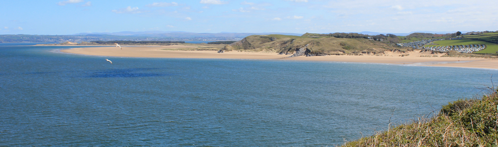
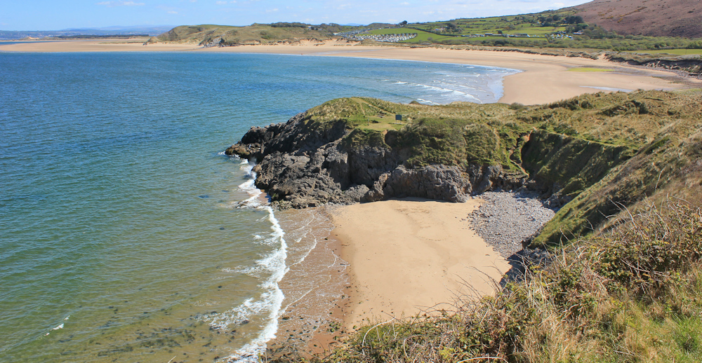
A pretty little bay lies at the end of the dune system. The bay is bounded by Foxhole Point at one end (where I’m standing) and Twlc Point at the end (the nearest promontory in the photo below)
The coastal part of my morning’s walk is ending here. Public transport is so infrequent in this part of Gower that I was unable to plan a linear walk along the shore. Instead, I have planned a circular walk and will be returning to my car, which I left parked in Rhossili.
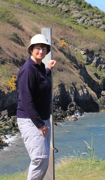
 But first I take a self-portrait of myself, standing on Twlc Point, alongside this dire warning sign:
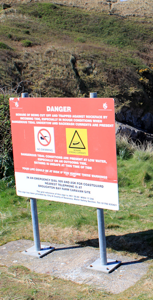
BEWARE OF BEING CUT OFF AND TRAPPED AGAINST ROCKFACE
also:
DANGEROUS TIDAL UNDERTOW AND BACKWASH CURRENTS
and in case you didn’t get the hint:
YOUR LIFE COULD BE AT RISK IF YOU IGNORE THESE WARNINGS
Crikey! I was planning to go down and look at the caves in the rocks. But now I don’t dare!
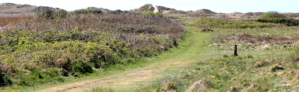
I’m going to walk back to my car following an inland route across the dune system. First I have to negotiate a static caravan holiday park and pick up the footpath on the far side. From here the route crosses the edge of fields and winds among some vegetated dunes. In places it is well-marked, but in others I need to refer to my Garmin.
I have to cross a stream. What was only a shallow trickle across the beach becomes a deeper obstacle at this point, and so I trek back towards the sands to find a crossing place – some handy stepping-stones.
The footpath takes me through yet another static caravan park. This is the one I could vaguely see from the height of Rhossili village this morning. But I welcome it now, because I’m hot and thirsty, and I can buy a drink (plus an ice cream) at a little shop on the site.
Then follows a hard slog up the slope of Rhossili Down. It’s steep and makes me puff and pant. A surprising number of people are making this difficult climb. On the way up, I meet a couple who recognise me from yesterday.
‘Are you the walker we met taking photographs near Port-Eynon?’
‘Yes,’ I say, knowing it must be me although I don’t recognise them.
It’s a better day for photography today, we all agree.
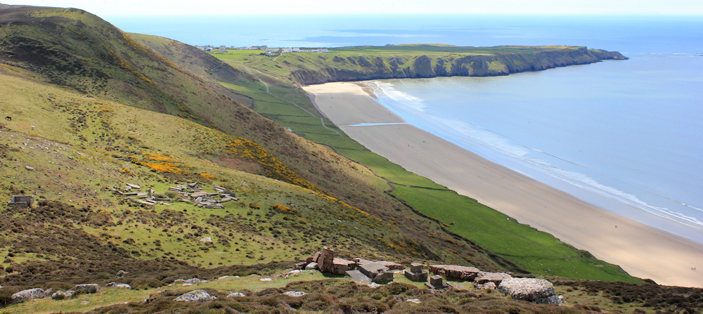
The view from the top – when I finally get there – is wonderful. Not only can I see right across Gower, but across the estuary of the River Loughor and the shore on the far side. Hard to believe I’ll be walking along there one day…
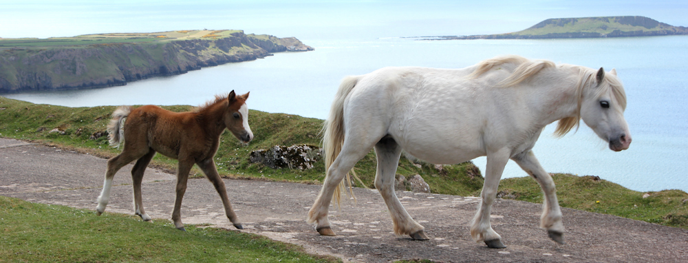
But today I enjoy the rest of my walk along the length of Rhossili Down. I come across cairns and the remains of radar stations from WW2.
And a beautiful white pony and her very-new foal.
I climb up to the trig point at the far end of the downs on a high point called The Beacon (193 metres). The gorse smells delicious. And I get a fantastic view down to the village of Rhossili and the Worms Head.
There follows a steep scramble down the other side and I return to my car.
I was planning on finishing my walk at this point. But I still feel fit and energetic. And the day is glorious. It’s only 3:30pm and I know the sun doesn’t set until 8pm, meaning it will remain light until 9pm, so I have no need to worry about being caught in the dark.
It just doesn’t seem right to stop now… [… to be continued]
Miles walked this morning = 9.5 miles (circular walk)
Total since beginning of coastal walk = 1,791.5
Route:


So you did get out to Worms head in the end then (I’m guessing…)! I made it. It is hard work but something I enjoyed very much. Burry Holms at the other end is also worth a visit, not sure if you made it there. Rhossili is most certainly deserving of it’s best beach title.
The logisitics of this walk are indeed tricky. I ended up starting from Gowerton Station, taking a bus to Scurlage, then another (connecting) bus onto Rhossili in the morning. Then walked along Rhossili, around Whiteford Burrows and to the village of Llanmadoc, where there was an (infrequent) bus back to Gowerton, but there was a bus at a suitable time. Might be worth looking into for your next walk (If I’m not too late!).
I remember that the path on the estuary side of Whiteford Burrows being very boggy in places. The path from “The Groose” to Tipins Well was listed as closed at the time due to a damaged sea wall, but was perfectly usable. Hopefully, it has either re-opened or is still usable.
Hi John, no, very sadly I didn’t make it to the end of Worms Head. Low tide was either too early or very late in the day, and I always just managed to miss the safe period for walking out there. It’s one of those places I tell myself I ought to return to, one day.
I was completely defeated by the lack of public transport (only a couple of buses a day and no buses on a Sunday, if I remember), and so had to complete this section by doing a number of circular walks. My landlady gave me a lift to Llanmadoc on the Sunday.
thank you for those glorious images!
Thank you. And love the photographs and poetry on your site too 🙂
What a lovely day for a walk. I’m with you on the fishermen, I really can’t imagine just sitting all day, even in such a beautiful place.
It was a perfect day, Marie. The sort walkers dream of 🙂
That bottom photo of Worm’s Head from the cliff top is taken from a similar view point to the one I took 40 or so years ago. These last few posts have been a lovely reminder.