
I eat lunch in a local café in Burry Port. It is decorated in funky-bright colours and has loud music playing – designed to attract a young audience. A group of school boys come in and order burgers, but the majority of the clientele are older women (even older than me) and workmen on their lunch breaks, so I don’t feel out-of-place in my walking boots. It’s a friendly atmosphere and good value for money.
Afterwards I walk back to Burry Port. The tide is well and truly out, leaving the boats stranded in mud. You would have to time your fishing trips carefully.

The main marina could be fitted with lock gates, I suppose, if there was both the will and the money.
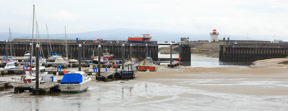
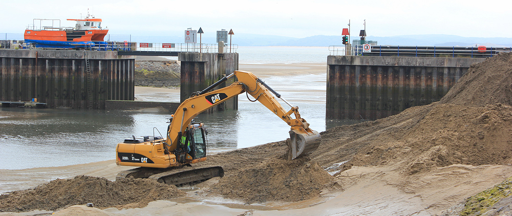
On one side of the harbour there are some excavations going on. Dredging? I don’t hang around to watch closely, because I am already worrying about public transport at the end of the day and want to get on with my walk.
Beyond the harbour is a large expanse of beach. Across the water, I can just make out the coastline of Gower and the long mass of Rhossili Down with Worms Head at its tip.

I’m disappointed with the weather today, with the mist and general murkiness of the atmosphere. It makes for poor photography. [Although the photo above turned out better than I expected.]
A dumper truck is making its way slowly back and forth below me. They seem to be clearing sand from the beach. Clearing sand from the beach? Why?
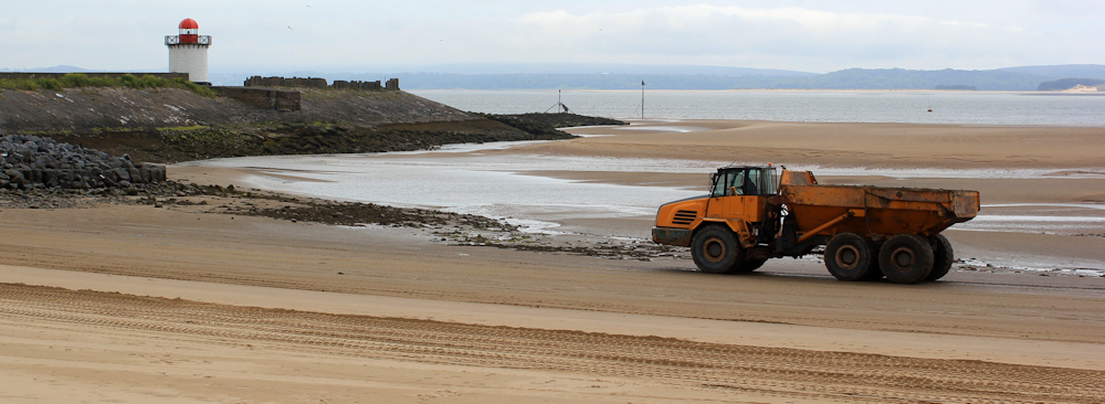
Maybe they need the sand somewhere else? But some nearby notices warn of soft sand, and I it occurs to me that they’re attempting to prevent further build-up of the dune system.
Hmm. If they’re battling against the will of the sea, I know who’s going to win in the end.
I walk across the dunes for a while, and then turn down a wooden causeway to walk along the beach.
 I walk on sand, and then on shingle, and then my boots start crunching on something else. Mussel shells. Thousands of them.

Nearby are racks covered in sacking, and within the sacking are mussels. This must be some sort of mussel farm. The harvest has been collected and is waiting for… for transport? There is a family walking further along the beach, but no sign of anybody in charge of the mussels.

I leave the sacks of mussels behind. From here the coast path continues along the edge of the dunes. Ahead is Pembrey, or it might be the west end of Burry Port – the two villages seem to merge into one.

But I’m not heading straight into the village. I’m going to follow the footpath/cycle track that loops around the edge of the dunes, before coming up through Pembrey Country Park and then I will follow the Park’s access road up to village to catch a bus back to the train station at Burry Port, from where I will catch a train back to Swansea.
Yes, it’s a complicated plan, but it should work!
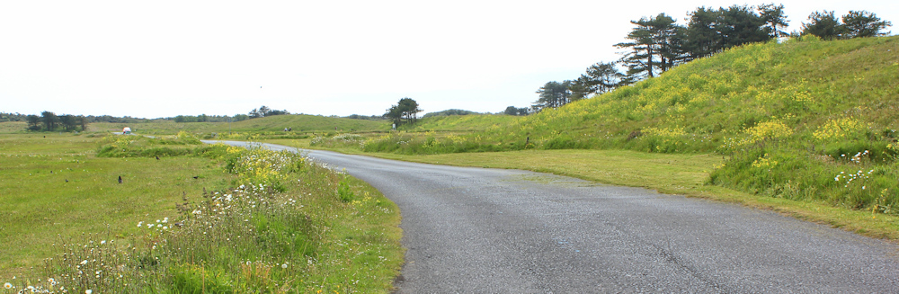
The track has a good surface and makes for easy walking. There is a grassy bank to my right, hiding a golf course. While on my left is a waterway and marshland, and the low-lying area of Pembrey burrows beyond. The sea has disappeared behind the marshes and dunes.

The walking is easy, but boring. At least the sun is shining and I get to experience the occasional cyclist whizzing past me.

I come across an old wartime pillbox. It’s the first I’ve seen for a while – maybe the rest have been covered in sand, or lost to the marsh?

And now I enter Pembrey Country Park. At some point around here I intend to leave the official Wales Coast Path, because it cuts straight through the park and I want to follow the cycleway instead. (The cycle path takes a slightly longer route but runs closer to the sea.)
But, somehow, I end up walking along a wide roadway surrounded by parkland The shore is nowhere in sight. This wasn’t what I was expecting. Is this really the cycle route?
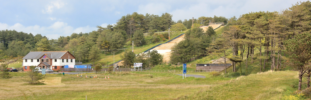
Despite the wide road, there is very little traffic about, no cyclists, and hardly any people. I walk past a few caravans parked in a field. And see an incongruously-placed dry ski slope.
By this time, I realise I am definitely no longer following the cycleway as planned. So I turn off the road and walk on grass just inland of a ridge of high dunes. I still can’t see any sign of a cycle way. I consider trying to make my way over the dunes to the shore, but I’m not sure of the state of the beach, or if I’d be able to walk along the sand. Warning notices are not encouraging: ‘beware of collapsing dunes’.

So I walk along grass and the occasional track, cutting across empty car parks, and heading in a vague north-westerly direction. I avoid entering woodlands, knowing I would soon get hopelessly lost. My aim is to get to the Visitor’s Centre marked on my map, where there are toilets and – I hope – a café.

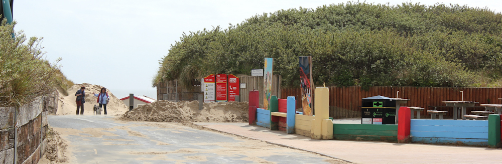
More by luck than chance, I stumble across the beach car park. This is where the Visitor’s Centre should be. There is a café, but it’s closed. Toilets are closed too. Disappointing. It’s a Friday afternoon in mid May!
At least the beach road appears to have been recently cleared of sand. I come across a few people at last, even if it’s just a couple of dog walkers.
I go down to look at the sea, and am surprised to see an official Wales Coast Path sign perched high in the dunes. I thought the official path went much further inland than this. Maybe it’s an alternative route? Or maybe a new route? Maybe my map’s out-of-date already? Anyway, at least I know where to start my next walk.

The beach is almost empty. There are flags flying and a lifeguard on duty, but just one man and his small boy on all that expanse of sand.
But my vision seems to be failing me. At first I think my glasses are misting up. Everything seems vague and indistinct. I can’t see where the sand ends and the sea begins, nor where the sky starts. Then I realise it’s not my vision or my glasses: real mist is rising from the wet sand, and rolling around in the breeze. It’s both lovely and slightly surreal.

It’s time to head inland. I turn away from the beach and follow the road through the park towards the village of Pembrey, passing a large Visitor’s Centre – in the wrong place – on the way. It’s a mile and a half of ‘wasted’ walking, but I have no choice because there is no bus service to the park.

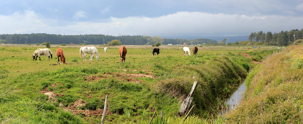
I walk quickly. There are dark clouds overhead, but the sun is low and bright sunlight streaks the landscape, heightening the colours. Inland the air seems clear, and every feature seems sharp and focused. It’s lovely. I walk past horses…
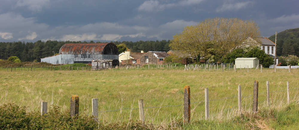
… and past rundown farm buildings, as the sky gets darker and darker.
And I walk, nearly running now, over the railway line, and along a road – until I find a bus stop on the main A484. I’m the only person waiting at the stop (I usually am!). I wait, and wait, and just when I’m convinced Traveline Cymru must have got it wrong, the bus shows up. It takes me to Bury Port station with 5 minutes to spare before my train arrives. Perfect timing.
[When writing up this afternoon’s walk, I was determined to keep the blog post short and sweet. I failed, of course! Sorry.]
Miles walked today = 13.5 miles
Total distance around the coast = 1,839
Route:


Hi Ruth,
Just a little note to let you know how much I’m enjoying reading your blog. Hubby Dave and I are way behind you on the coastal trail and are about to leave Dover for Folkestone. I find looking back at your previous writings really helpful when planning our next. Really useful info such as when you find a path inaccessible or when you find a cafe! I love looking at your photos too!
Best wishes,
Joyce
Hi Joyce. Good to hear you are still walking 🙂 You must have enjoyed the St Margaret’s Cliffe to Dover section – over those iconic white cliffs. I loved that. But I loved the Dover to Folkestone section too. And then you have the weird and wonderful Dungeness shingle to look forward to… Sometimes I wish I could go back and do it all again 🙂
Hi Ruth
Yes I did especially love the St Margaret’s to Dover walk and can’t wait to get back down to the coast (from Buckinghamshire where we live) to start the walk to Folkestone, hopefully within the next fortnight family commitments permitting. Keep up the good work with your blog, it really spurs me on!
Thanks
Joyce
Another great read Ruth. I love the scary getting lost bits and the worry about if the bus’ll arrive or not. Everything’s always worse when you’re on your own too! That’s the test – being on your own and waiting for a bus which may or may not meet the train and the heavens open. The minutes tick away and no one else but you is at the stop. The rain gets more and more torrential and still, as night falls, it hasn’t come…A bus passes and a wave of water is thrown at your already sodden body and you watch it vanish down the pitch black, now empty road…
Oooh, Mary, your sense of imagination is just as pessimistic as mine 🙂
Hi Ruth, just found your blog and loved seeing the south-west part of the Wales Coast Path – a lovely reminder of time living in the South. I live close to the northern bit of the Path now and blog about the nearby bits quite often but hoping to get further afield later in the year. Best wishes, Theresa
Hi Theresa and I think you are very lucky to live in Wales. I’ve finally got past the industrial sections of Newport, Cardiff and Port Talbot, and am enjoying the path immensely. Now I’m off to have a good nose around on your blog at http://theresagreen.me/ – looks very interesting.
That mist on the beach was strange. I can just imagine how worried you must have been about missing the bus. There are so few in rural areas and, because of narrow road and things like tractors and farm animals they are often late. thank goodness you made your train.