
My leg is much improved but still hurts. Frustratingly, I haven’t been able to find a simple bus connection between the start and end points of my intended walk, and so I drive into Beaumaris to catch one of the few buses that goes directly from there to Red Wharf Bay.
From the bus stop on the main road it’s only a short walk down the quiet lane, and I’m back on the coast path again.

I trudge along the edge of a wide expanse of marsh. Although I’m thankful the route is flat, no matter how hard I try I can’t help walking with a slight limp.
The weather remains dull, the air thick and heavy with humidity, and so the views are disappointing. If I look across the mud and water, I can just make out the village of Red Wharf Bay, with its pub and sailing ships.

As long as I ignore the hills to my right, this coastal landscape reminds me of Norfolk, of Sussex, and of Essex. It’s a patchwork quilt of flat-topped islands, covered in low-lying marsh plants, threaded through with channels of sluggish water – while the sea remains a distant streak on the fringe.
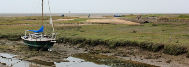
I come to a place where my map has planted an optimistic [P] symbol in an area characterised by ‘mud and sand’. Surprisingly, there are a couple of cars parked on the wet ground. I’ve heard of tidal islands. Is this a tidal car park?

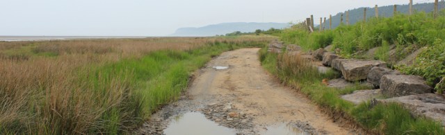
My path becomes a track. Are the puddles formed from seawater or from rain? I don’t know.
A three-way sign post labels this section of the coast path as a tidal route and suggests an inland detour.
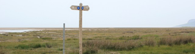
The detour would cut out a short portion of the low-lying coast of Red Wharf Bay, but not the whole thing and certainly not the stretch I’ve just walked, so I don’t know how helpful this alternative route would prove to be if the tide was high and the path flooded.
Anyway, this morning the tide is out, and I stick to the shore, walking along an area of raised boardwalk, surrounded by waving grasses.
After the wooden boardwalk comes another raised walkway, this one is narrow and made of concrete. It’s also very high – rising up to ten feet above the marsh in places – with a steep drop on both sides.
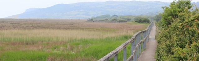
It’s an exciting walk, mainly due to the element of danger. The concrete is old and cracked. The wooden handrail only runs along one side, and looks flimsy. Because the walkway is so narrow, ‘passing places’ are provided and these have been decorated with shells and other natural objects.

I take photographs and wonder how these decorations got started. It seems such a remote place and the walkway is high above the surrounding land. You would have to pre-plan and bring the shells, driftwood and flowers with you.
Sometimes the arrangements are very artistic.

Behind me, a hundred yards or so away, I notice a couple with a dog are gingerly picking their way along the concrete path. I walk on at a renewed pace.
After the raised walkway comes another board walk.

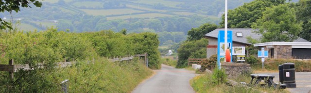
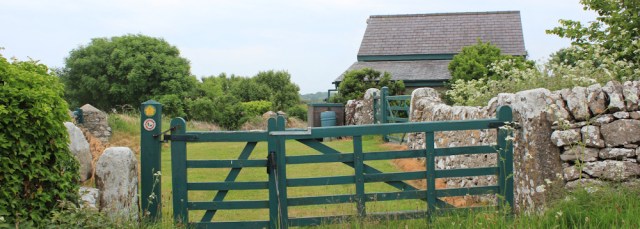
And then I join a road, losing sight of the sea. I come to another car park, but this one a proper tarmac affair, at a place called Llanddona, although the main village seems to be a mile inland.
I’m hungry, but the café is closed and the benches provided aren’t particularly appealing: close to litter bins and with no view of the sea.
I cut through to the beach, where marsh has been replaced by shingle and sand. It’s very pretty. Spring flowers cover the shingle bank. I perch on some stones and eat a snack lunch. It’s not very comfortable, but better than eating in the car park!

I reach the end of the beach and it takes me a few minutes to see the onward route of the coast path, until I spot a flight of stairs leading up the low cliff. The beach below is roughly strewn with large boulders and it takes me some time to work my way towards the steps.

Going up steps isn’t a problem. My calf is happy as long as my feet are on a flat surface.
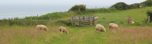
At the top of the steps I find myself in open fields, walking among grazing sheep.
The path continues to climb up, meandering through fields and woodland, until I’m 100 metres or so above sea level. The view is rewarding, although the atmosphere remains too murky for decent photography.

Somewhere up here is a flat area of high land, known as Arthur’s Fort or Arthur’s Table (or Bwrdd Arthur, in Welsh). I’m not sure how true the Arthur connection is, but the site contains traces of prehistoric settlements and an old Roman fort.
Although the official path skirts around the base of Arthur’s Table, I would like to get to the top. So I set off along a promising footpath… which becomes increasingly overgrown with brambles and nettles… until it, eventually, peters out among a thicket of gorse bushes. I’m unable to force a way through, and turn back.
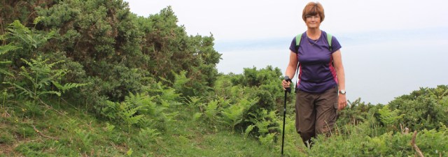
Perhaps I should try again? But my arms are scratched and my leg is aching and this puts me off having another go at finding a route though to the top. Instead, I take a timed self-portrait of myself climbing up through gorse and bracken.
The path seems to have abandoned any pretence at following the coast, and it now joins a track that curves around and takes me past a group of dilapidated farm buildings. Despite its state of decay, the place seem surprisingly neat, lacking the jumble of machinery and piles of manure you often find. I wonder if it’s still a working farm?

Across a field is a church. I realise the high ground above the graveyard is Arthur’s Table. Could I find a way up through there?

Maybe. But my leg is aching and I can’t see an obvious footpath, and so I can’t summon up the enthusiasm to try again.
The path leaves the road and I walk past a house…
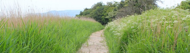
… and then along a lovely route through fields and meadows. My hay fever flares up again.

Eventually I join a farm track and the track soon joins a road. Somebody (the farmer?) has planted a pretty display of flowering plants at the junction.

The road is pleasant, with no traffic, but is… well, it’s just an ordinary country road. The only highlight is seeing a red post-office van (the only vehicle I meet). They really do get everywhere.

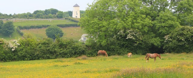
The van is driving incredibly slowly. Why? A couple of young foals are trotting along the lane in front of it.
I pass horses grazing in fields full of wild flowers, and see a windmill perched on the hillside.
After a mile of road walking I reach the village of Glan-yr-afon, a strangely un-centered place. The road divides. I chose the righthand fork and – more by luck than anything else – find the bus stop.

It’s always an act of faith to wait at a rural bus stop with nobody else in sight. But the bus does arrive, eventually. It’s full of school children who are fizzing with energy after hours of sitting still, and this makes for a noisy ride back to Beaumaris.
When I reach my car I discover I’ve left the front driver’s side window open. Completely and utterly open. And I’m intensely grateful for two things:
- It didn’t rain and flood the car
- Anglesey is full of honest people.
Miles walked today = 6.5 miles
Wales Coast Path so far = 973.5 miles
Total distance around the coast: 2,480.5 miles
Route:


Where you saw the cars parked on the sand is Pentraeth beach. Even at high tide I don’t think the sea would reach so far up as it’s such a huge expanse of the bay, so if there were any puddles they would probably have been from the rain.
I’ve walked along that narrow concrete walkway with two dogs on leads, not the easiest of places to walk with them and I wasn’t keen on it being so high up. It was quite a cloudy day at the time and I didn’t see any other people at all, it made me feel a bit uncomfortable so I turned round halfway along and went back. I may try it again sometime on a much nicer day.
Ah, so it IS safe to park there. I did wonder… 🙂
And I can’t imagine trying to walk along that walkway with two dogs. It was (now that I’ve finished it) a very exciting walk. Worth going back – maybe without the dogs – to look at the shell decorations.
I was a bit disappointed with Red Whaf Bay. I had expected from the map it to be a lovely sandy beach so I walked over the beach but soon noticed inland of me was salt marsh. I decided it was best to head inland back to the coast path. So I had to make my way over the salt marsh to that raised walkway and climb up onto it, not very easy. A shame you couldn’t have made it to the top of Arthur’s Table as much of Anglesey is quite flat so you would probably get good views. Glad you are able to cover larger distances again. I remember my ankle became very painful for a few weeks a few years back, though I’m afraid I didn’t consult any medical advice and just kept walking (albeit more slowly) and the pain did eventually go.
Yes, Red Wharf Bay wasn’t as I imagined it either. But after a while I felt quite at home, because it reminded me of Norfolk. I don’t know how you managed to climb up onto that walkway!
I realise the photo I posted above doesn’t really do the walkway justice because the brambles on the right appear as a low hedge. In fact, they represent the top of tall bushes and there was a terrifying drop down on that side too.
I have no recollection of that walkway and it took a bit of thinking to work out why. The tide was way out when I walked that section, so I strode out across the beach, rather than following the official path.
Ah. That explains it. I couldn’t see much of a beach that day – only marsh – so the tide must have been higher than I thought.
What a pretty walk. I love the walkway and the shells and flowers. I’m glad your car was OK too. I recently left mine completely unlocked and had reason to be glad no one stole it.
It was such a stupid thing to do. But, thinking about it, should be perfectly possible to leave your car unlocked all day, if only everybody was honest.
That walkway would be nightmarish for me, in fact I probably wouldn’t be able to do it. And definitely not if I had my dogs with me! My friend left her car window open the day we went to Brownsea – in a multi storey car park in Poole town centre! She was lucky too, the car still there and nothing taken.