
My leg is still painful, but my limp has improved – or maybe I’ve just got used to walking with it. In any case, dosed with painkillers, I feel I can manage a few miles today. So I drive to Moelfre and set off walking along the coast path.
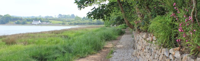
It’s a nice route, winding above low cliffs with a good view back to Moelfre.

I’m confident I can make the next 4 or 5 miles to the bus stop in the next village, Benllech. And, if I feel OK, I could even walk a further 2 miles to Red Wharf Bay where there is access to another bus stop.
But coastal walking is never straightforward. I’ve gone several hundred yards (it feels longer) when I come across a path closed sign. What?! Why don’t they put these notices at the start of the path? Anyway, the path ahead looks OK. What would you do?
I carry on, of course, climbing over the barrier that blocks off a wooden walkway…
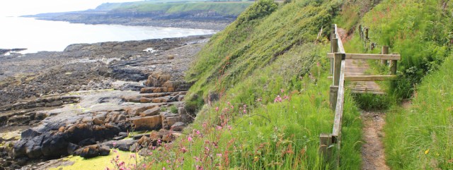
… and reaching the point where a landslide has carried away the path. Hmm. If I was feeling fit and strong, I would be tempted to scramble across. The cliffs are low. The ground is dry. It doesn’t look dangerous.
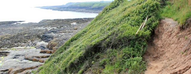
But I’m not feeling fit or strong. So I turn back and retrace my steps, all the way back to the beginning.
There is a deviation in place, of course, and it follows the road. After walking down the main street, I turn off into a residential area and, eventually, the road becomes a country lane.
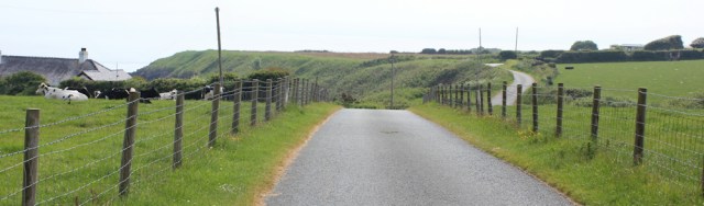
I’m relieved to find the coastal path again. It joins my lane. The blockage and the deviation is much more clearly signed at this end.

I look back along the coast. I’m sure I could have made it, if I’d only tried the scramble.

In fact, the total deviation, including the double walking I did at the beginning, amounts to just under a mile. It’s only a little inconvenience really. But is seems like a BIG thing today.
Onwards. I walk along a path lined with flowers and grasses, which sets my hay fever off.
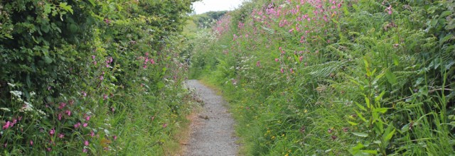
Now, I’m not only limping, but red-eyed and snuffling too.
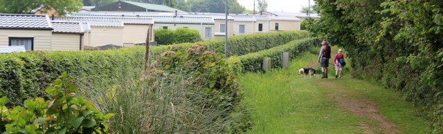
And, a few minutes later, am overtaken by a couple with a dog. They ask how far I’m walking and express surprise when I say ‘Red Wharf Bay’. Clearly, they don’t think I’m going to make it that far.
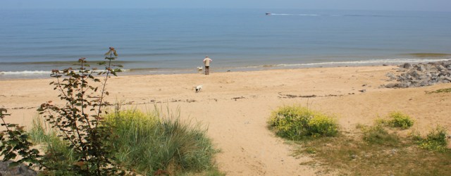
I reach a little cove. Porth yr Aber on my map. Pretty.

And beyond here I walk through a field radiant with buttercups and dotted with clover. Shame about the caravan park on the other side. And a shame about my hay fever.
The caravan park sits above another pretty beach. I’m walking south-easterly and into the sun, and so can only take a decent photograph when I round the curve of the bay and am walking up the other side.

Next, I limp my way around a little headland, Penrhyn, and past whitewashed holiday cottages.
The next section of coast is very appealing. It’s a shame the air is heavy with humidity – creating a muggy haze – because the view across to the hills on the other side of Red Wharf Bay would be stunning.

The murky atmosphere makes it hard to tell where the sea ends and the sky begins, and creates the weird illusion that small fishing boats are floating in air.

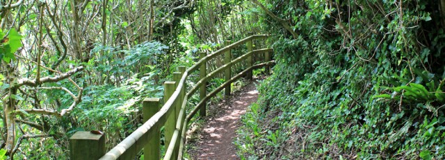
There are no woods marked on my map, but the path climbs higher and passes through a wooded area.
Below are rocks and the sea. And fishermen.

Although the path is easy to follow, I’m finding it hard going. My limp is not only slowing me down – although I am managing a speed of around 1.8 mph, according to my Garmin, which is considerably more than yesterday – but my stumbling gait is interrupting the natural rhythm of my walk. In addition, the heavy air and my hay fever add to my fatigue.
So, I am not happy when I come across another deviation sign. The map provided looks very clear and detailed, but doesn’t seem to tally with either my OS map or my Garmin map, and I can’t work it out.

Certainly a ‘you are here’ arrow would be helpful – but there isn’t one. Neither are there any helpful signs telling me which way to go and no obvious footpath to follow, apart from the one I’m already on.
Should I continue? Should I turn back? What would you do?
In the absence of a clear alternative, I carry on. And a short distance later come across some workmen who have been rebuilding the path over a recent landslip.

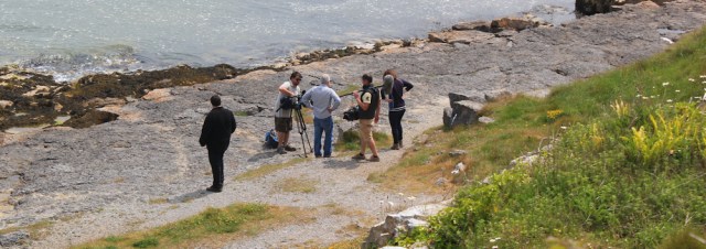
Luckily their work is nearly finished and I can continue without any difficulties. They do warn me there is a film crew ahead.
As I walk onwards, I see the crew below me. Are they filming a news bulletin about the recently opened path? It’s not clear and I wish I’d asked the workmen.
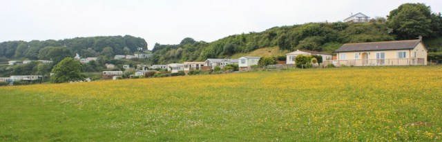
I’m approaching Benllech and go past yet another static caravan park. In the bay below are a couple of kayaks, little dashes of colour moving slowly across the flat sea.

At Benllech I stop at a café. It’s 1pm but I feel too hot for a cooked lunch. So I ask if I can have strawberries and ice cream instead? For lunch? Yes. No problem. Thank you.
After lunch, I walk along the promenade and follow the path as it climbs the low hill on the other side of Benllech. It’s a popular place and the first time I’ve seen a substantial number of people sitting out on the beach this year.

My path climbs higher. The beach is actually quite long and the further you get away from the car parks at Benllech the less people you see on the sands. The far end is practically deserted.
No woods are marked on my map, but I’m walking through trees again – and I notice the trunks are leaning downhill, towards the sea. Usually the prevailing wind bends the trees in the opposite direction, away from the shore. So this is a little odd. Maybe the ground is slipping?

I walk across a pretty beach and then around a flat headland covered in caravan pitches. Suddenly I realise I’m walking through a holiday park. And I’m trespassing.
The good thing about being a weird-looking old woman – with red eyes, a sniffling nose, and a limp – is that nobody comes near or challenges me.
I pick up the official coastal path again, which runs inland around the perimeter of the park.
A short time later I reach Red Wharf Bay. It’s the name of both a long, lop-sided bay, and the name of a small village. I’ve reached the village. It’s on the northern end of the bay.
I sit on a wall and watch a man struggling to pull his springer spaniel out of the water. The dog seems unable to keep its balance, repeatedly staggering and falling off the slipway. Is the concrete too slippery? Or is the dog putting up a bit of passive resistance because it doesn’t want to come out of the sea? Anyway, I find its antics amusing.
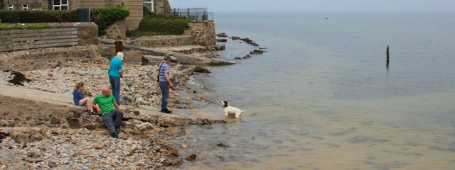
Later, sitting on a nearby bench, I strike up a conversation with the owners of the spaniel. Apparently it has a degenerative brain condition and can’t keep its balance. Now I feel a bit mean for laughing at it. A woman nearby joins in the conversation. She has an old retriever with her. It’s blind, deaf and has paralysis of its back legs, making it fall over too.
I don’t know whether to be depressed by this conversation or whether to cheer up. It makes all my physical problems seem minor.
I can’t see a red wharf in Red Wharf Bay, but I do see a shingle spit running out from the shore and forming a sheltered harbour. It’s a pretty place.

Unfortunately, whenever I think of the name ‘Red Wharf’ I can’t help converting it into ‘Red Dwarf’.
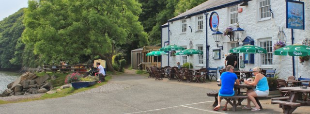
Now, where’s the footpath to get out of here? I wonder aimlessly for a few minutes, between the pub and a café selling ice cream. Perhaps I should give up and walk up the road instead to find the bus stop? But I’m reluctant to stop now. It’s only just past 3pm and I feel I can manage another couple of miles.
Ah. I spot the path – hidden between the big tree and the pub’s outhouses.
The path climbs and I’m alone in a narrow avenue of trees.

A short while later, and the trail dips down again to run along the shore. I look back towards Red Dwarf (sorry) Red Wharf Bay, with its shingle spit and the ships in the harbour.

The shore has changed from sand to a mixture of mud and marshland. I meet a couple of workmen and ask what they’re doing. Improving the path, they tell me. It’s too boggy.

I walk on the improved path. The new layer of shingle keeps my feet dry, but is rough and difficult to walk on. No doubt it will bed down with time.
Red Wharf Bay is shaped like a lazy tick mark, with a pronounced curve at its western end and a trailing flat line sloping off to the east. I’ve just reached the base of the curve and here, at the signpost below, I’m going to turn off the path.
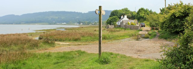
A quiet country lane leads upwards toward the main road and the bus stop. It’s only 1/2 a mile at most, but my protesting calf thinks it’s much further.
- Reasons to be happy: I can WALK, if only at the stately pace of 1.8 mph.
- Reasons to be miserable: my leg still hurts and on top of this I now have hay fever.
Miles walked today = 6.5 miles
Wales Coast Path so far = 967 miles
Total distance around the coast: 2,474 miles
Route:


Great post Ruth, really enjoying your increbible jounrey so far. Red Wharf Bay actually comes from the Welsh name, Traeth Coch which means Red Beach. Apparently its named so after a huge battle that took place there in the 1100s, leaving the beach red with blood.
Wow, what a gruesome image! I wondered why it was called ‘red’ and thought it might be the colour of the sandstone rocks, but clearly there was a much better reason. Thank you for sharing the story.
Glad things improved – a bit.
Onwards and upwards, Anabel 😀
Glad you’re back on your feet again, if a little more slowly!
Thank you, El. Luckily slow is fine cos I’m in no rush.
Hope you’re fully recovered by now….well done for ‘carrying on walking!’
As injuries go it was very minor indeed. But a major problem at the time.
Wow! I hope you feel better soon. I’m so impressed by your journey. The images you chose are beautiful, and I love that part about Red Dwarf. 🙂 I haven’t seen that show in ages.
Thank you, Tyrean. Now I have the Red Dwarf tune playing in my head… damn!
Glad you’re back walking and with sense of humour well intact. What odds on meeting two physically challenged dogs while you are struggling with your own leg.
It was a coincidence, wasn’t it. People often tell me I should get a dog to accompany me on my walks. But, apart from the challenge of looking after the dog as well as myself, dogs age much more quickly than humans. If I’d started walking with a dog when I set out on this trek, it would be 6 years older by now!
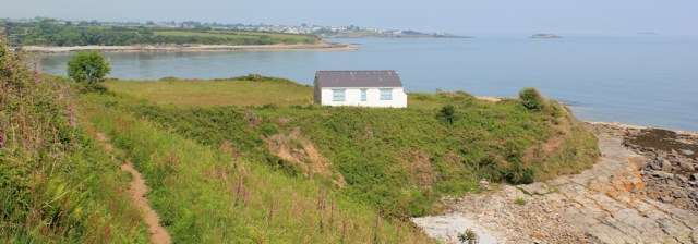
The little white cottage on its own on the small headland was, for many many years, a derelict shell with just four grey concrete walls. It’s only in the last couple of years that someone has taken it over, built it up and made it habitable. As you walked along the path through the wooded area after that cottage you would have been directly below the camp site where I stay – it’s right on the cliff top to the far right of your photo of Benllech beach, and the static caravans are on the sister site next door. One of my favourite early morning dog walks is from the camp site and down through the static site to the beach, along the beach to the site where you were ‘trespassing’ then back again to the tent – gives me an appetite for breakfast 🙂
Wow! What a wonderful place to stay. (I’m afraid I’m often rude about caravan parks on my blog, but have a totally different attitude to proper camping!) Now, Eunice, I feel we’ve been for a walk together 🙂
On the move again, that’s good. I like you tend to ignore path closed signs as I find that 90% of the time you can get through – though I have yet to encounter anyone actually working on the path I would be worried I’d get “told off” for ignoring the signs!
I do agree about signing path closures properly. Someone must have to walk along the path to put up the “path closed” sign so why not put one at either end of the path as well? So frustrating, you don’t see “road closed” signs half way along a road with no other route.
Just wish they’d use proper OS maps too, along with a ‘you are here’ arrow and some sort of idea of scale. At least this map was readable, but I still couldn’t make sense of it.
I’m glad you were on the mend by the time you got here and it’s oddly reassuring to know that doctors are as prone to wild self-diagnoses as the rest of us! You certainly need your sense of humour to cope with the come-day, go-day pace of the workings of Wales – similar to that of Southern Spain!
Doctors make the worst patients in the world. We are either in total denial of our symptoms, or we invent the most unlikely and most hideous diagnoses for ourselves 😀
Oh dear! As if an injured leg wasn’t bad enough. I’m always so glad I don’t get hay fever. Still, going forward is progress no matter how slowly. I think I’d have been thinking Red Dwarf in my head all day too!
One of the reasons I chose coastal walking was to try and avoid hay fever! But sometimes there’s no escaping the dreaded pollen 🙂
So sad to read about those suffering dogs.
I do find it irritating when someone posts a diversion sign up without a ‘you are here’ marker… I doubt many dog walkers carry an OS map with them. I was walking somewhere on Sunday where I found this very thing… But I couldn’t make sense of it. The redirection order was 11 months old but the route they’d drawn was no different to my three-year old map.
the solution is so obvious and ridiculously easy – a simple ‘you are here’ arrow and some idea of scale. I remember once looking at a diversion map in horror, thinking I would have to walk several miles out of my way, only to realise it was a mere 20 yards or so. The map was a large one!
I instantly converted Red Wharf to Red Dwarf! There were some very pretty views despite the haze.