
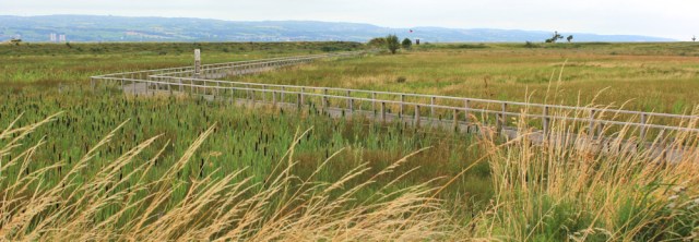
I’m back in England. The new cycle way winds through the Wirral marshland, first on tarmac and then along a wooden boardwalk surrounded by waving bulrushes.
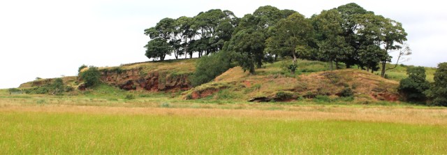
Ahead is the raised knoll of Burton Point. Was this once an island? Or a headland? Not hard to imagine the sea lapping around these sandstone cliffs. On this high point in the path (not that any of the path is high, but this is the highest place!), I sit down for a rest and a snack lunch.
I have to confess I’m feeling weary. A bout of shingles has drained me of energy and I’ve lost the fitness I gained after my 2 week trip around North Wales. That’s the problem with undertaking a massive walking trek in stages. If the stages are too far apart, you go back to square one from a fitness point of view.
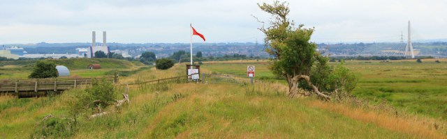
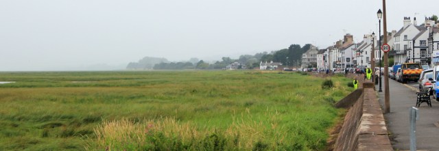
Anyway, I enjoy the rest and the view: wide marshes, with the red warning flags indicating the ‘Danger Area’ of the shooting ranges. And, in the distance, that’s Wales – Flint and Connah’s Quay.
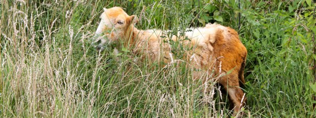
Onwards. I startle a sheep lurking in the long grasses. What a filthy animal! Is it pollen from the grasses? Or dust from the sandstone cliffs of Burton Point? I never find out because the sheep refuses to answer.
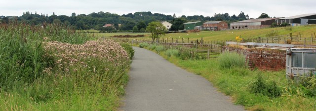
I pass a farm. Burton Marsh Farm, I think. Grazing land to my right, bulrushes and marsh to my left.
And now I begin to meet other walkers. We must be nearing a road.
Yes, there is a road, but it soon turns inland, and I continue walking along the edge of the marsh, following the cycle way. It’s a surprise to hear an engine behind me and I have to stand in the bushes to allow a car to squeeze past. Where’s it going?
A short time later I have to stand in the bushes again, as the car comes back towards me. Where’s it been?
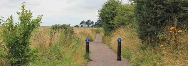
Further along I meet some bollards. That’s why the car turned back. It couldn’t squeeze between them.
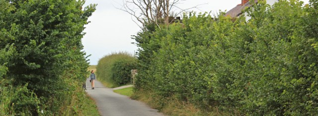
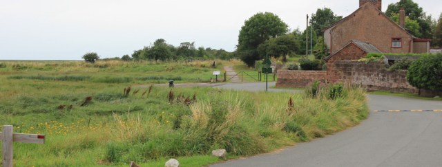
The next section is very pleasant and easy walking, with marshland to my left and hedges to my right. I reach another road and walk along a street with residential houses for a short stretch. This is Little Neston.
And here’s a tiny park on a piece of raised ground overlooking the marshes. I check my map. ‘Denhall Quay’. Was this once a proper quayside with ships? Before the water retreated? Maybe. It’s very pretty.
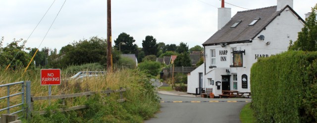
Onwards along the road, and I find a pub. It looks tempting… but I walk straight past.
A short while later and this road, too, along with the cycle route, swings away from the ‘coast’. But I carry on walking along a footpath that continues straight ahead.
I’m pleased to be off the cycle way and following a proper footpath. Nice and narrow – and very peaceful.
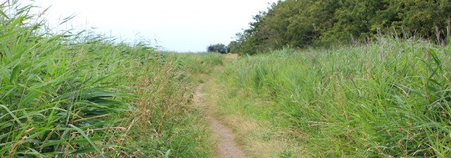
I reach an area of flat grassland, where a series of board walks to keep me out of the mud. Then I pass through a gate, and now I’m walking right on the edge of the marshes…
… and here the path practically disappears. I check my map. And pull out my Garmin. No, I’m not lost. There is a path here. Somewhere.
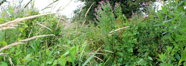
Doesn’t anybody ever walk this way? I battle through the tall grasses, grateful it hasn’t rained. And also grateful I’m wearing long trousers, although I still manage to get stung by nettles and scratched by brambles.
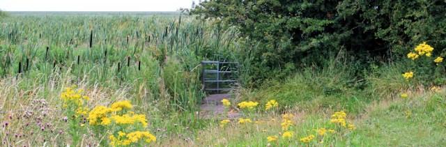
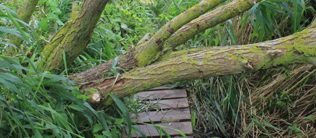
In various places there are old sections of boarding. I must watch my step, because many of the wooden slats look rotten. If I take a tumble here, nobody will find me for days! And a tree has fallen right across the path. I climb over it.
The board walk disappears. I’m slipping in mud, unable to see my feet. But there is a path of sorts. You can just make out its outline.
And then I hear voices ahead. Because of the tall grass, I don’t see the couple coming towards me until we’re a yard apart.
‘Is the path very muddy,’ the man asks.
‘Not very, but it’s quite a jungle. And it doesn’t get any better.’
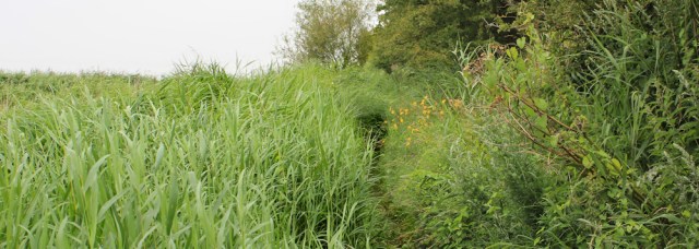
Shortly after I pass them, I suddenly emerge onto an open green space. Whew. I was getting a little claustrophobic fighting my way through the reeds and towering grasses.
There is no way forward. From here a footpath (a proper footpath) leads off to my right, running alongside a tall wooden fence, until I suddenly emerge on a residential street. This must be Neston.
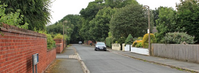
Down the street I go, and find another footpath off to the left. Now I’m back on the edge of the marshes and a short time later I arrive at the end of a wide promenade.
I realise where I am. This is Parkgate, which claims to be the only coastal resort in Cheshire. The street I’m walking along looks like a coastal promenade. It is even has the same type of name you expect in a seaside resort: ‘The Parade’.
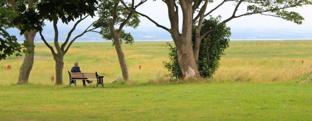
Further along I come across a seating area, with benches giving a view over the marshes. People are eating ice-cream. This is totally weird. It’s a seaside town without a seaside.
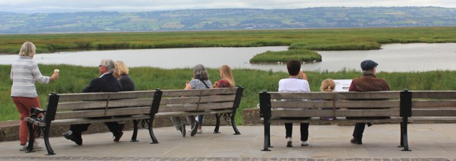
I was planning on continuing a little further today, to Heswall, but I feel too tired to continue. I sit on a bench for a while, and resist buying an ice cream – although the ice cream parlours here are, apparently, quite famous.
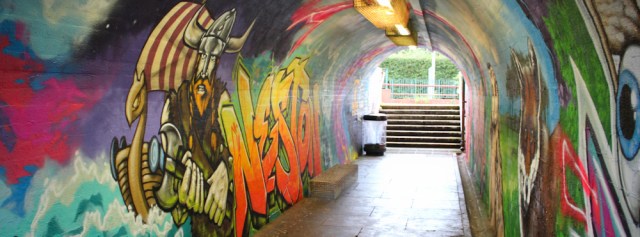
Time to head back to catch the train. I walk inland to find Neston’s station. A tunnel takes me through to the right platform – but, what a tunnel! It’s covered in art work.
I catch the train, feeling disappointed with my lack of progress today. But I decide I must be kind to myself. It’s a been a difficult few weeks with the shingles, and the rest of the Wirral coast will wait.
I don’t usually like walking along cycle routes – often dead straight and boring – but this one was very pleasant and it was an interesting walk.
You can see more of the wall art photographs on my Ruthless Ramblings blog: Neston Tunnel Graffiti.
Miles walked today = a miserable 8.5 miles
Total distance around the coast: 2,590.5 miles
Route:


A shame about that overgrown path with the broken and rotting boardwalk. When I walked that way it looked brand new and was in good condition and I was rather pleased to find this route. A shame it seems to have been neglected.
Neston is not the only place which seems to be a seaside resort without the sea. Grange-over-Sands is exactly the same when you get there. Perhaps there used to be sand, but now it should be Grange-over-Mud or Grange-over-Marsh!
It doesn’t take long for nature to reclaim our paths. But I was disappointed to find the footpath so unloved, when the cycle routes are obviously well maintained and still being developed.
Looking forward to seeing Grange-over-Sands/mud/marsh 😀
A very interesting part of the walk but a shame the path was so overgrown you had to fight your way through – I think I would have turned back at that point. I love the art work in the tunnel, it really brightens it up.
Re the above comment about Grange-over-Sands – I went there several years ago having been previously told that it was a nice walk along the promenade, however I couldn’t find the said promenade and when asking someone where it was I was told “This is it, you’re on it”. I was expecting to sea a typical seaside promenade and the sea but all I got was a long tarmac walkway and miles of mud and marsh! 😦
Hi Eunice. I kept thinking ‘this path must get better soon’, but it never did!
Hope you getting better Ruth, really knocks you for six shingles, doesn’t it?
Really interested to see what you made of this and the coming section. Well done for battling through the reeds like that, it’s not well trodden is it? Forgot to mention you might need a sythe!
Yes hard to believe that Parkgate was was once a thriving Port. ⚓️⛵️High spring tides bring the sea up over the marshes, wildlife lovers flock to see the surge of small mammals and birds 🐁🐀🐇disturbed by the flooding tide, it’s quite a local event, gets really busy. Great photos again. Not sure if you knew Burton point was an Iron Age hill fort Ruth, it’s accessible from the RSPB bird reserve at Burton.
It would be interesting to see the small mammals fleeing in front of the incoming tide. Must be quite an event. And, no, I didn’t realise Burton Point was an ancient hill fort. (On the OS map – I’ve just noticed – it says ‘earthworks’.) Now I wish I’d climbed up to it.
Hi Ruth, a few miles further on from Parkgate remember to look across the Dee Estuary, you may just see an old friend.
Got my binoculars ready 😀
Shame you didn’t try one of those delicious ice creams, the shop was even doing a brisk trade last December when I was walking round the Wirral.
There is a good cafe, Tanskey’s Bar, on the right as you come into West Kirby if you haven’t already reached there.
I’m on another diet (sigh) so gave the ice creams a miss. And I’m about to write up the walk to West Kirby but, yes, I did have a late lunch at Tanskey’s and it was wonderful. Good food and a great view.
Touché
I’ve been reading your posts with interest, enjoyment and admiration. I’m walking bits of the coast, but not in a methodical way like you. Your posts are a great reminder of where I’ve been and inspirational and informative about walks to come. Hope you feel a bit better soon. Even a few days off walking feels like starting again! PS. I share your fear of cows!
Hi Chris and thank you. I’m feeling much better now. Hope you are enjoying your coastal walks as much as I am and glad you find my blog helpful.
Fear of cows? Yes. All sane people are afraid of cows 😀
I always take note of people walking towards me. You can often guess that you are not far from a road if they are inadequately clad for walking or pram pushing etc. But the best things are a shopping bag, newspaper, or ice cream denoting the nearness of an open shop.
You’re right, Conrad. And another sign is an increasing amount of dog poo on the ground!
What a pity that path was so overgrown. It looked like it might have been a nice walk otherwise. The graffiti tunnel was a great find though.
We love good graffiti, don’t we Marie?!
Indeed, how odd to find a seaside town with no view of the sea… Are these people trying to kid themselves?
When I saw the wind sock, I wondered if it might be to do with Hawarden Airport but it appears not. I’ve always liked the fact that Airbus is actually on the Welsh side of their border and how their address says ‘Cheshire’ but they’re actually in Flintshire.
Hard to believe Parkgate was once actually on the sea. I’m always amazed by how quickly the coastline continues to change.
The graffiti in the tunnel looks fabulous!
Did this walk today 30/3/23. The part of the path you described as neglected now has signs up saying it is closed. We ignored them but it was severely muddy and the boardwalk was largely derelict. Fortunately the vegetation has not yet grown much this year. It seems that like much else the commitment to a coastal path was just talk.
That’s a shame. Very sad to hear of further deterioration.