
This was a walk of two halves. The first half was easy and pleasant. The second half… well, I’ll talk about that in another post.
It’s another dull day today, I’m sorry to say. But Silloth is a lovely place and – despite the dismal weather – I’m enjoying my stay here.
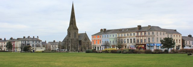
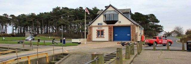
I cross The Green and head down the road to the shore, where there’s a small car park and a lifeboat station.
First I walk southwards until I reach the edge of entrance to the dock, just to make sure my coastal circuit is complete, then I turn back and head northwards along the promenade.
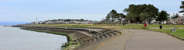
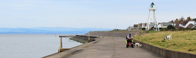
I pass a group of students on a field trip, huddling around a teacher, looking cold. A few dog walkers. Someone on a mobility scooter with two lively springer spaniels. And then the Cote Lighthouse, standing on stilts beside the promenade.
The promenade comes to an end, and I continue walking along the stepped sea wall. A warning sign tells me it’s not suitable for wheelchairs, etc.

Eventually the steps end, and I follow a footpath that runs along the back (or is it the front?) of a row of gardens. Meet nobody.
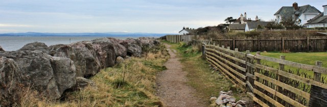
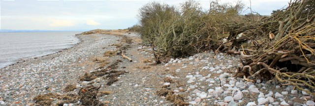
The path becomes more rural, and then peters out. I walk along the shore, across shingle and pebbles, and following a line of strewn seaweed. The bank of bushes at the top of the beach seems to have taken a battering. Perhaps the path has been washed away?
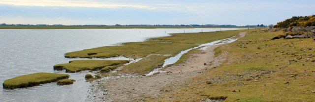
I’m walking out to Grune Point, along a shingle bank that stretches for a mile or so. On the way I stop to pick up pebbles, loving the wide variety of stones you find on this shore. Nobody in sight.
Eventually, as I approach Grune Point, I’m overtaken by a couple of men wearing rucksacks. Another walker appears in the distance, but turns back.
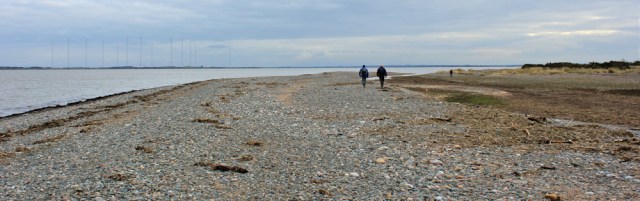
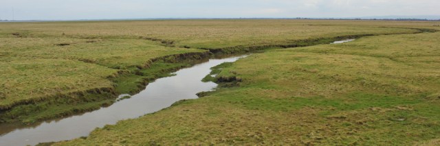
It’s nearly high tide. The spit of land I’m walking along is very low-lying, and the small channel (just visible beyond the walkers in the photo above) begins to fill up. Threatens to cut me off.
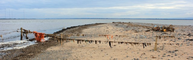
I reach Grune Point. At low tide I suspect you can walk even further out, but for some reason there’s a barbed wire fence across the Point. Seaweed and old fishing nets hang from the wire, flapping in the breeze, so that the fence looks like a washing line.
It’s time to turn around and walk down the other side of the spit of land. I’m walking alongside Skinburness Creek.
I join a track, and pass another group of students, standing around a woman with a clipboard. They look as if they’re on a field expedition and about to start measuring something. They have marked sticks, and the leader seems to be giving them instructions.

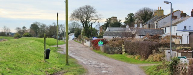
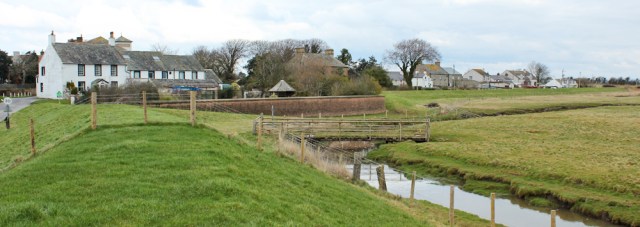
A mile along the track I come to the tiny village of Skinburness. It’s an ugly name for a pretty place. Several houses are for sale and I note the protective raised bank and wonder if they were flooded in the winter storms last year.
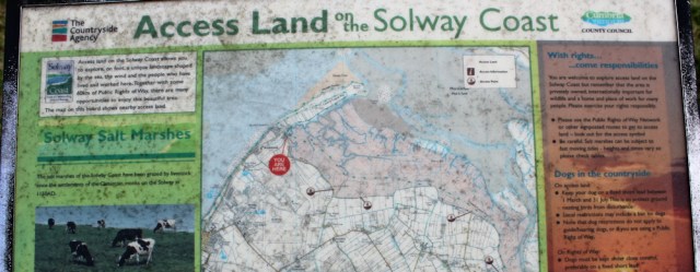
Skinburness Marsh lies ahead of me. An information board displays a map of the Access Land along this part of the coast, and the map – surprise, surprise – shows a public footpath running right through the marsh. The path would take me all the way to my intended destination, Abbeytown.
A footpath all the way to Abbeytown? I can’t believe my luck.
But why didn’t I know about the path when I was planning this walk? I pull out my paper OS map and discover no sign of the footpath. My map was revised in 2013, so is reasonably up to date, and certainly looks more recent than the map on the information board.
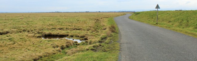
I can’t see any obvious footpath posts to follow either, although there is an old footbridge spanning a drainage ditch, which might be the point where the path runs onto the marsh. You can see it in the photo below.
Could I get through? Or has the footpath become unusable, and that’s why it’s been taken off the recent maps?
I stare out across the flat land, and can just make out posts sticking up, which might mark the route of the path. But between the marsh and the bank is a channel of water called, rather unpleasantly, Great Gutter. This barrier means that, if I come to a dead-end, I would be forced to turn and retrace my steps all the way back to Skinburness.
I really don’t want to battle through mud and swamp, or be forced to turn back. And it looks desolate out there.
So, after dithering for a while, I decide to stick to my original plan and follow the road instead. I set off walking along the raised bank. Called Sea Dike
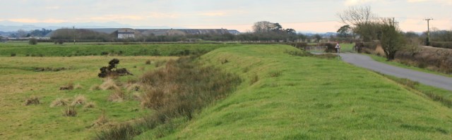
And then along the road itself. Straightforward but – to be honest – rather boring. Shame the weather is so dull.
The road swings inland and passes over a cattle grid and through farmland. Sea Dyke End. The Wath Farm. Hartlaw.
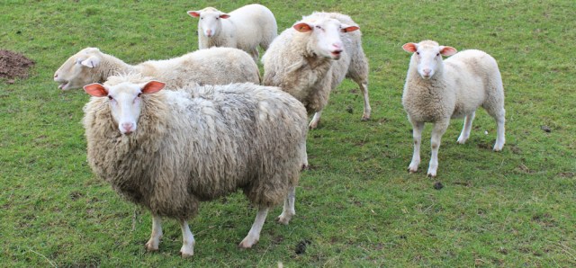
A terrible bleating noise starts from a field to my right. Sheep. Bellowing and protesting. At first I think I’ve scared them into a panic, and then I realise they’re chasing after me.
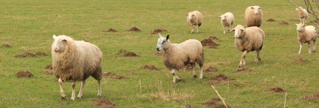
They follow me right along the field and, when I stop to take a photograph, give me pleading looks. One even starts pawing at the barbed wire fence that separates us, as if trying to barge her way through.
Odd behaviour. But I decide they’re hungry. It’s that time of year when many farmers will be feeding their sheep with extra grain or sheep nuts. They obviously saw me and decided I was the dinner lady. Sorry girls. I’ve got no food for you.
In fact, I’m hungry myself. But there’s nowhere convenient to stop for a rest or a snack. Everything is damp and the mucky roadside verges aren’t very appealing.
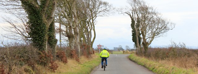
A cyclist overtakes me. I realise I’m nearing the main road.
The second part of my walk is about to begin…
[to be continued]


That path across the marsh is shown on the 1:50,000 scale map, Ruth, but as you say, there’s no guarantee it exists on the ground, at least as a viable thing for non-amphibious creatures 🙂
I’m waiting to see if anybody posts here and managed to do it. Then, of course, I’ll regret not having a go!
Hi Ruth – when I walked this stretch in 2015 I too followed the road. I was told about the path but even in June (it was very wet) I was told it was impassable on foot, so I think you were wise.
Hi Ruth, I think I know whats coming re:part 2. Looked at walking across the marsh, but with the tide in did not want a couple of miles of practising my long jump over the numerous creeks and gulluies.
Me neither. Maybe in wellies and fishermen’s trousers?
I really loved Silloth with its village green. I sat and had fish and chips on a bench on the green, it was a lovely evening and a place I would like to visit again.
It’s a nice place. I stayed there for 5 nights, and every morning I ate breakfast overlooking the green.
Well, you’ve created some suspense here by breaking this report, but at least I can deduce that you survived.
Hi Conrad. Yes, I survived. Just.
I hope you’re ok Ruth, don’t like the sound of whatever has happened in part 2. 😬
Just posted up the second part Di. Not dangerous. Just difficult.
oooh what a cliff hanger – hopefully not literally
No cliffs here, Jacquie. Marshes… 😀
The coast path across the saltmarsh has only recently been sorted – it had to be changed – and I expect details will soon be available. Coastwalker David Livermore had problems finding it, and the marshes are very hard-going. David’s post about the section a bit further North is here: https://solwayshorewalker.wordpress.com/2016/07/13/crossing-the-sulewath-a-guest-post-by-david-livermore/
Does that mean the path across Skinburness Marsh will be reinstated? And appear on the maps again? If so, wonderful news.
Now Silloth looks a pleasant place. I can’t believe you upset sheep after all the practice you had with them in Wales!
I loved Silloth. It’s pleasantly elegant, without tourist tat, and also a working town with a large flour mill. Friendly people too.
Hmm should have re-read this post before I set out! I walked from Kirkbride to Skinburness. This was the state of the footpath under the old railway line at Abbeytown. https://www.flickr.com/photos/joncombe/36255513856. Not surprisingly I went around it in the adjacent field (there is a gate you can climb over at the end of the field to get back on the correct route). At Brownrigg I spotted a near-identical to the sign you found showing the Cumbria Coastal Way across the marshes. If on’y I’d read your post (and comments) first! I decided this looked to be both a more coastal route and a short cut. What could possibly go wrong?
I found it was not too bad to to keep to the landward edge of the marsh as far as East Border, though there were plenty of cows to contend with, uneven path and ditches to jump over. At East Border I really should have given up and gone onto the road. There was no sign of any path and now I also had waist high grass all around and in almost every direction I soon came to boggy areas, streams, mud or ditches and it was uneven under foot the whole way and the grass meant you could not see what you were standing on. I pressed on though in the hope it would improve. In places I found a track (probably made by a quad bike), but then it would go through a ditch of deep water or abruptly disappear. I was wary of getting too far from the shore, so I battled through, soon getting wet feet and trousers. I did at least find some makeshift bridges (wooden planks) at some of the ditches, so someone else must have gone that way, but I wouldn’t call it a footpath and I would certainly not recommend anyone else to go that way! From East Border to the road at Sea Dyke End took about 90 minutes, so it would have been quicker, safer and easier to stick to the road. The Cumbria Coastal Way seems to be a “ghost” path. No longer on maps, no longer maintained and it’s a shame.
It was a shame to see the derelict hotel in Skinburness too (the bus stop there was listed as “Skinburness Hotel”) it looked a nice building but I later learned the hotel closed in 2006. I guess it must take the bus company a while to update the name of the bus stop! I found this about it, which is quite an interesting read : http://sometimes-interesting.com/2016/08/17/inn-of-insolvency-the-skinburness-hotel/
Oh, my goodness. What an awful trek through those marshes! Glad you survived. I really think there should be warning signs up at bothe ends of the path, explaining the footpath is no longer passable. And thank you for the link to the Skinburness Hotel article. Very interesting and sad.
I think I’d have given the marshes a miss too.
Hi Ruth, you probably won’t see this as it’s ages since you did this section. I always read your blogs before I walk a section of a coast path as I have the same fear as you about cattle.
I just wanted to let you know that walking over the marshes from Skinburness since the King Charles 111 England coast path has been commissioned is quite straitforward. It’s well sign posted with lots of bridges. I did read that there could be a lot of grazing cattle from the 1st May so we were hoping we’d miss them by doing the walk on the 30th April. Luckily we didn’t see any.
Hi Janet. That’s good to know, and fingers crossed there are no cows!