
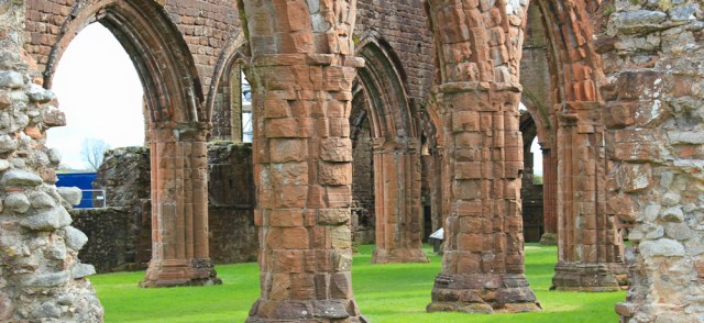
I return to New Abbey – and this time I have a proper camera with a full battery. Unfortunately, the light isn’t as good as yesterday, but I take some reasonable photographs of Sweetheart Abbey.

It’s in very good condition for an abbey that’s over 700 years old. Unfortunately, some unsightly scaffolding spoils the view a little.
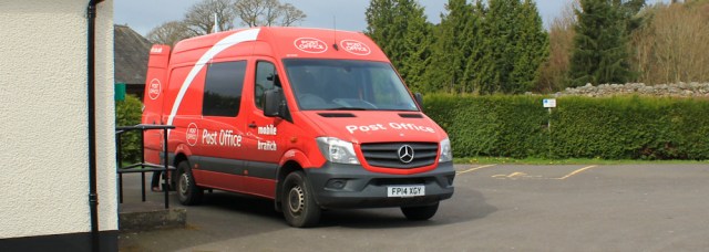
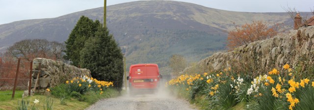
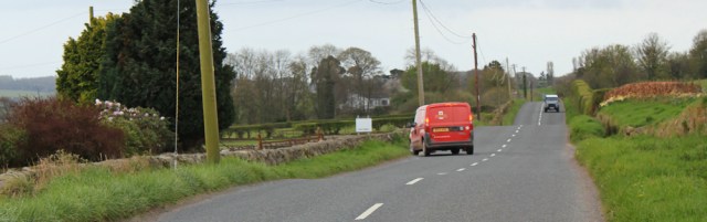
A Post Office van pulls into the car park. Not an ordinary delivery van, as I first assumed, but a mobile branch van. I’ve never seen one before. There’s a lady standing waiting and she goes round to the back to… well, I’m not sure what she’s doing, because it would be rude to go round to take a closer look.
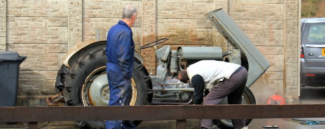
I set off walking through New Abbey. In a side yard, two gentleman are cleaning an elderly tractor with a pressure hose. (I remember how shocked my husband was when I snapped a guy cleaning his bike in this way. Is it a good method to clean a tractor? I don’t know.)
New Abbey is attractive, but I’m not looking forward to the first part of my walk today…

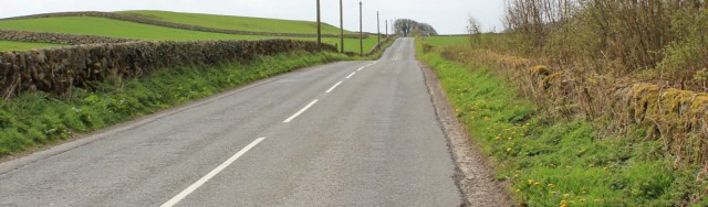
…which involves 6 miles of road walking. No pavements. But luckily the traffic is very light, with only about one car passing me every minute.

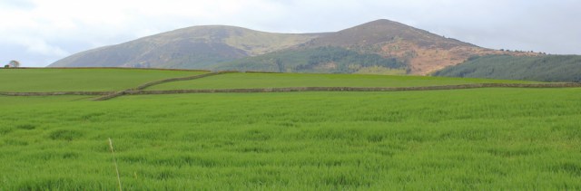
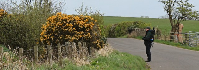
On my right shoulder is Criffel. This has been a constant feature in the landscape since Cumbria, and seemed such a LARGE hill from a distance. Now I’m almost walking around its lower slopes, and it looks less impressive.
A post office van comes past – a proper delivery van, not the mobile branch van – and turns down a dusty lane towards a farmhouse. I do love seeing these red vans in remote places. They’re a reminder of the network of services that makes our country… (ahem, sorry, forgot I was in Scotland for a moment)… that makes our United Kingdom such a great place to live.
I walk past a slurry tank. That’s been a problem so far in this area. Constant stink of cattle manure. At least the tank is pong-free.

The road goes on and on.
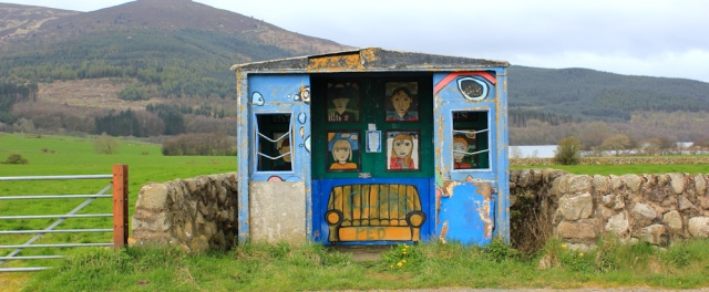
I come to a bright little bus shelter. It’s been decorated by the local school children, although the paint is now a little tatty and worn away in places. I do love it.
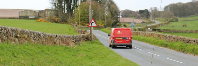
The post office van passes me again.
Over the brow of a hill, and I get a pleasant view. Yes, it’s the sea. At last. Or rather, it’s probably still the Nith estuary, but it’s almost the sea!
Across the little bay I can just make out a village called Carsethorn. An important landmark, because it marks the end of my road walking for today.

But I haven’t got there yet. Onwards.
The post office van overtakes me again and turns down a little lane. If we’re having a race, it’s almost neck and neck.
Ahead is a village called Drumburn. It’s a tiny place, so I’m surprised to see a traffic jam. As I draw nearer, I realise what’s happening. An elderly gentleman is trying to load his large lawnmower onto a trailer. The workmen in the yellow lorry were driving by when they saw him struggling, and stopped to help.
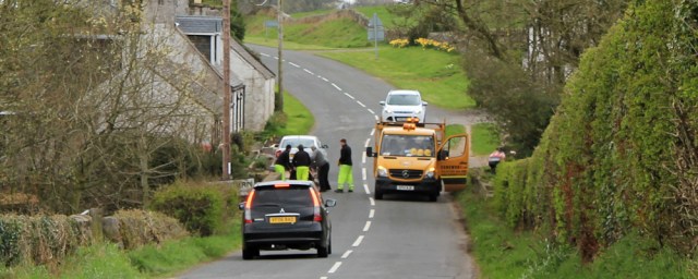
With the mower safely loaded, the workmen drive away and the jam is cleared.
Just past Drumburn is an official viewpoint. I stop to take a look across the estuary. Sadly, the light is too dull to pick out much detail, and too dull for decent photos, but I do manage to spot the Ward Law hill and its crown of trees.
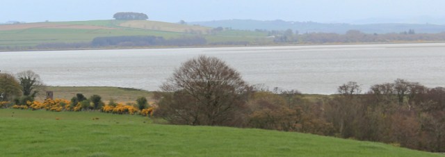
That view reminds me of the problem with estuaries. You can walk for many miles, and end up almost back in the same place as you were many days ago!
Onwards. I’m approaching Kirkbean, and the turning to Carsethorn.
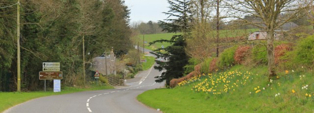
I turn off down the narrow land and spot the post office van ahead of me. How did it get there? It must have overtaken me, unseen, while I was admiring the views.

There is another painted bus shelter in Kirkbean. And a red telephone box which actually has a working phone inside, something you don’t see very often in England.
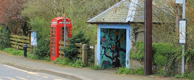
When I first started walking the coast – 7 years ago – my husband and I used telephone boxes as meeting places. They appear on the OS maps and offer shelter if its raining. Sadly, they’re a disappearing feature from our landscape. Shame. Like the red Post Office vans, I feel they’re part of our British identity.
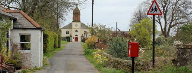
I pass an unusual and pretty looking church. It looks more American than English. [Later I learn Kirkbean Church has USA connection.]
I spot a man with a backpack and think I’m about to meet the first serious hiker I’ve seen so far in Scotland! But, when I get nearer, I realise he’s not a hiker. He’s a bird watcher carrying his kit on his back.
He’s staring at something across a field. All I can see are cows.

Onwards. I’m nearly at Carsethorn, and nearly at the end of my long spell of road walking. Good. My feet are tired of tarmac.

The sea front at Carsethorn is pleasant, but it’s difficult to access the beach because of private gardens.
Signs warn of strong currents. And I spot a footpath sign. Good. I’m planning to follow this Core Path all the way along the shore to Southerness. Apparently, only 4 miles to go.

At the end of the village, opposite a memorial garden, I spot a pub, and can’t resist going inside. Can’t beat a proper sit down rest and a meal.
After lunch, I walk down to the shore and take a photo of Carsethorn, with Criffel making a great backdrop.

Shame the light is still so gloomy.
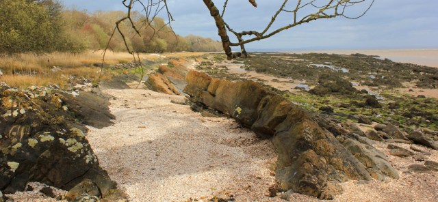
I look forward along the shore. This must be where the Core Path runs, but all I can see are piled rocks and a wooden groyne. The tide is high. If there is an easy way along the beach, I can’t see it.

I climb over the groyne and walk along the edge of the rocks. Luckily the tide has just turned, leaving a narrow strip of sand and shingle for me to stumble along.

I feel uneasy. Will I be able to find a way through? If the shore becomes impassable, I’ll be forced to backtrack and join that damn road again.
Despite my niggling worries, this turns out to be the best part of the walk. The sea might be shallow, and a dirty-brown colour from the estuary, but the lines of gentle waves rolling in are hypnotic and soothing.
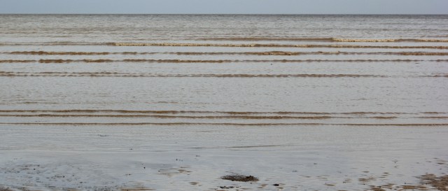
Below the narrow strip of sand and shingle are harsh lines of rocks. These gradually becoming more exposed as the tide recedes. I love the linear stripes they make across the beach.

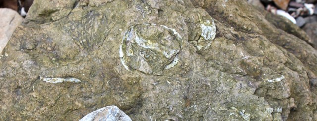
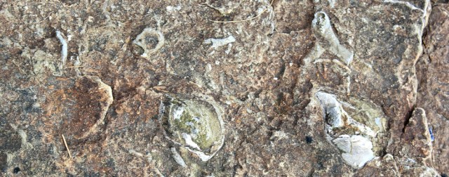
I see definite signs of fossils embedded in the stones, and take masses of photographs. Wish I knew more about fossils.
After a while, I round a point (Hogus Point) and the beach gets wider. I meet an elderly couple – the first walkers I’ve seen all day – with a frisky Labrador. The dog bounds up and licks my hands. We stop for a chat.

It turns out the couple are house/dog sitting for their daughter and her family, who live nearby. I ask if I can make it all the way along the shore to Southerness.
‘Oh yes. You just have to watch out for the sinking mud,’ says the man.
‘We lost several wellies, and we nearly lost a person the other day,’ says the woman.
Not exactly reassuring. Oh well, I’m sure I’ll survive. I grip my walking pole and stroll onwards. Round another point (Borron Point) and the beach is wide and reasonably sandy, patterned with rocks.

I find a small bay and a wonderful house. On my map it just says, ‘The House on the Shore‘. I wonder if this is the property the house-sitting couple are looking after? What a place to live!

I take photographs of more fossils in the rocks.
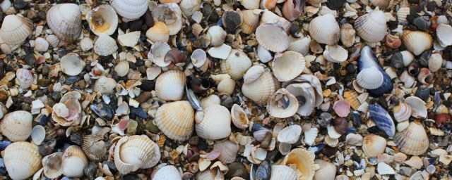
And I notice my boots are crunching. The beach here is made of shells, rather than sand.
Around the next headland, and the beach disappears, replaced by a mass of jagged rocks, covered in slime, and laced with deep pools. I scramble up to dry land and walk among grasses strewn with decaying seaweed.
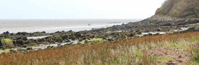
I’m reassured by the sight of people walking on the beach ahead. (You can just see them as dots in the photograph above.)
Making my way down towards the sand, I stop to take a photo looking back along the shore. The sun is coming through intermittently, and the lovely light makes such a difference to the views.
I discover the beach is actually made of mud rather than sand, and I have to keep moving or else my boots begin to sink. Onwards. Quickly.
Soon I reach a firmer surface, and walk past a large rock with a crack running through it. Thirl Stone, according to my map, with a ‘natural arch’. I look at the map again. No, not Thirl Stone. Thirl Stane.

[Later, I learn stane is the Scottish word for stone.]
Behind the interesting rock is a hidden beach and a car park. A couple of families are walking about. A young lady jogs past me. This is Powillimount, a local beauty spot. I’m sure the unusual name has made lots of school kids snicker!
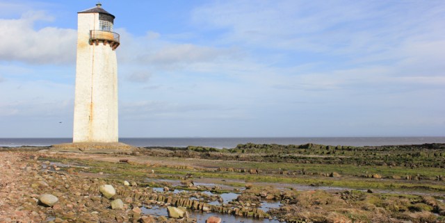
From here a wide bay stretches round to Southerness Point and its lighthouse. Seems more than 4 miles away from Carsethorn. Distances can be very misleading along the shoreline.

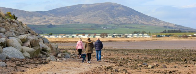
I don’t try to walk across the bay, because of the mud, and follow a sandbank that runs parallel with the shore. Southerness is really one giant holiday camp. At least these static homes are rather attractive, with wonderful sea views and Criffel behind.

I meet families out for a stroll. Nobody seems very friendly, and the people I meet barely answer my ‘hello’. (After hours of walking alone, I tend to greet total strangers like long-lost friends. They probably take one look at me and decide I’m just a mad old woman and best ignored!)
The light house is dramatic, with a rectangular back and a curving front. I’ve not seen one shaped like this before. [Later I learn it’s the second oldest lighthouse in Scotland, and is no longer active. Sad.]
My walk is at an end. I turn inland from the lighthouse and walk through Southerness and back to my car.

Southerness is a weird place – a mix of nice seaside bungalows, holiday park homes, decaying pubs, and chip shops. (Reminds me of Talacre on the north Wales coast, and of Sea Palling in Norfolk.) But it does have a bus service, and so is a good stop/start point for a coastal walk.
Miles walked today = 11
Total miles around the UK coast = 3,114.5
Route:


I love the Dumfries & Galloway coast. Quite remote and few people visit but very beautiful. You’ll be getting to Rockcliffe and Kippford soon – nice little villages and some tidal islands. If the tide is down its an easy walk along the causeway to Rough Island. I stayed at the Mariner Hotel in Kippford when I went there for No Boat Required. Hestan Island at the end of the next peninsular is much harder to get to. It’s some way from a road and the going quite rough just to get to the end of the peninsular. Great care is needed to walk tot he island and even then it’s only possible on some tides.
Hi Peter, and yes, Dumfries and Galloway is a lovely area. (I’ve nicknamed it the Riviera of Scotland!) Funny, I never really realised Scotland has a south coast, and never been here before. It’s gorgeous.
I was just thinking the photo of Southerness reminded me of Talacre Ruth when I then read in your next sentence you felt the same. With you about the read phoneboxes Ruth, my husband has always had an ambition to photograph all the remote red phone boxes and compile then in a book.
Ha ha, Di. Great minds 😄
I understand your husband’s obsession with red phone boxes. I have a similar love for post office vans in remote areas. And for old post boxes built into walls… which I can never resist photographing, especially if they are Victorian.
The painted bus shelters are really fun.
On the Wessex Ridgeway we came across a defunct red telephone box which had been converted to a Book Swap point.
Hi Jacquie, what a splendid way to use an old telephone box. Sounds wonderful.
your photo and comments brought a smile to my face,elderly gentleman!!!! but those guys were great
Was that *you* with the lawnmower? 😄 Apologies for the ‘elderly’ as you may well be younger than me. Honestly too far away to tell and making assumptions, as usual!
Fascinating fossils and that hose on the shore is a dream!
‘house’ on the shore, not ‘hose’!
Oh that road out of New Abbey goes on and on and on, doesn’t it. I was less lucky – it was busy when I walked it. Most of the drivers pulled well out but one totally ignored me and I had to dive against the stone wall, into a patch of brambles and nettles. Of course I leapt into the road afterwards and swore at him…. made me feel better anyway!
The walk from Carsethorn along the beach is very nice (until Southerness which is a dump), some lovely beaches with no-one on them. It was low tide when I did it too, so I had it much easier than you.
It’s a beautiful area, and I don’t know why it isn’t more popular.
Some car drivers are really inconsiderate. If the road is narrow and reasonably quiet, I tend to walk down the middle of the road until the car is quite close. Forces the driver to slow down. A wing mirror grazing your elbow at 60 mph could do a lot of damage.