
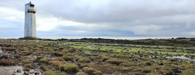
The day gets off to a wintry start. Stong winds and dark skies over Cumbria. I take a quick photograph of Southerness lighthouse and zip up my jacket. There’s rain coming.
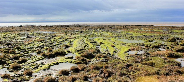
The beach doesn’t look promising. Shingle and slime-coated rocks. There is supposed to be a Core Path along here. I hope I can get through.

At least the tide is out. And the wind ensure a fast changing cloudscape. One moment the sky is grey, the next the sun comes streaming in and brightens up the view.
I pass a few dog walkers and soon leave Southerness behind. Now I’m alone. Ahead, on the other side of the bay is Sandyhills, where I plan to stop for lunch. Oh dear. That sky looks dark.
Some of the walk is easy, along pebbly beach. At other times, the foreshore becomes a muddled mess of mud and marsh. But I always manage to find a way though.
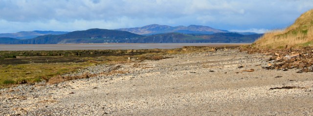
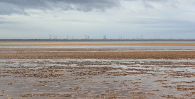
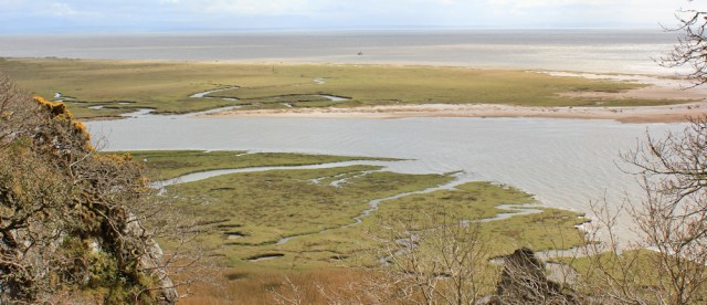
To my left is marsh and then a vast expanse of sand. The sea is a grey streak in the distance and, silhouetted on the horizon, is a wind farm. I think I must have seen the same turbines while walking the coast of Cumbria, but I have no recollection of them.
The sky suddenly brightens and the sun comes out. This sets the pattern for the day. One moment threatening rain, the next all blue skies and sunshine.
There’s a great view of Criffel, over green fields. I’m in the process of leaving the hill behind, and feel that familiar tug of sadness when an old landmark begins to fade from view.

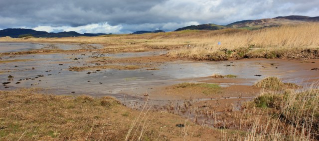
After a while, the shore becomes more settled, with an easy strip of sand to walk along.
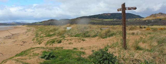
There’s a row of vegetated dunes to my right and I can no longer see Criffel. After a while, I spot a sign. ‘Mersehead’ it says, and other stuff in small print. What is it telling me? Don’t know. I can’t be bothered to climb up and read it.
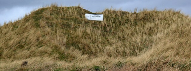
[Later I blow up a photograph. The sign says,’ Welcome to Mersehead Nature Reserve’ and ‘The Royal Society for the Protection of Birds’.]
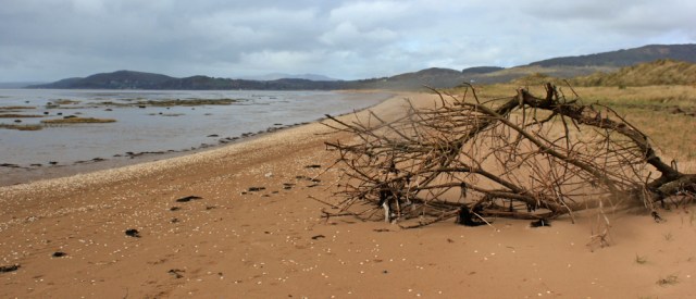
Rain spots begin to fall. I take a photo of driftwood on the beach ahead, and stow my camera in my rucksack.
I see a signpost in the dunes and climb up to read it. It points to the visitor centre, but it appears I can continue walking a little further along the beach. I pull my camera out and take a photo of the post, along with a few spots of falling rain!
Continuing down the beach, I see a group of people walking with dogs. They’ve the first people I’ve seen since Southerness.

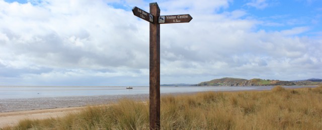
A short while later, the sky has cleared, and here’s another sign post. I’ve almost reached the mouth of a meandering river, and it’s time to turn inland…
…along an incredibly boring and straight track. Luckily the sun is shining, the gorse is flowering, and I’m still in a good mood. (But, come on good people of the RSPB, if you construct a route for walkers through your nature reserve, do you have to make it so darn uninteresting?!)
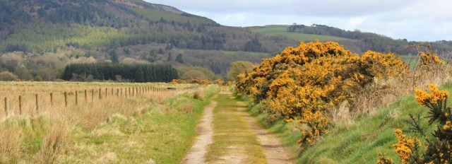
The track passes close to the official visitors’ centre, but I don’t stop. After that comes a long straight lane, up to the village of Caulkerbush, where I’m going to rejoin the good old A710 again.
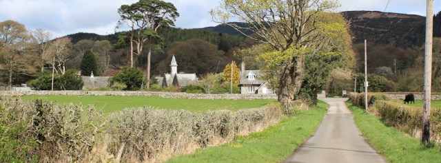
There’s not much to say about road walking, other than I try to avoid it if I can. But this is the only way to get to Sandyhills, and so I pull on my high vis jacket and get plodding. Actually, it’s quite a nice road, although narrow and with enough traffic to be irritating.
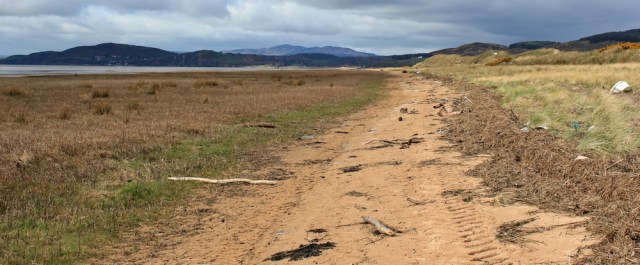
From the top of the slope, through gaps in the trees, I get a great view back down and across Mersehead Nature Reserve. I’ve had to double back on myself. You can see how the river has blocked the route along the shore.
Onwards. At least the sun is shining again.

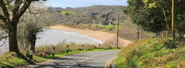
I round a corner and see Sandyhills below and get a shock. I wasn’t expecting it to be so pretty and so… well, so sandy!
Lunch turns out to be a disappointment. What I thought was a café turns out to be only a shop, and without anything hot for lunch. So I buy an ice-cream and a can of coke, and sit on the picnic benches.
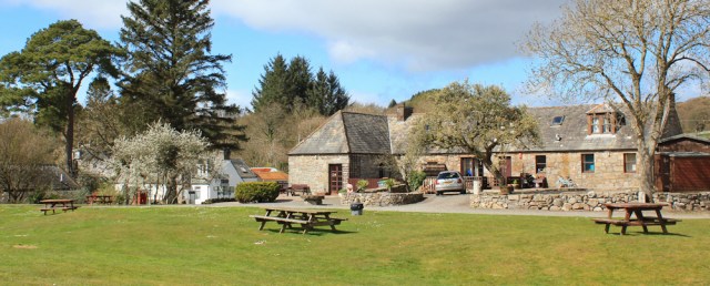
The ice-cream is delicious, but the wind is chilly, and I’m too cold to rest for long.
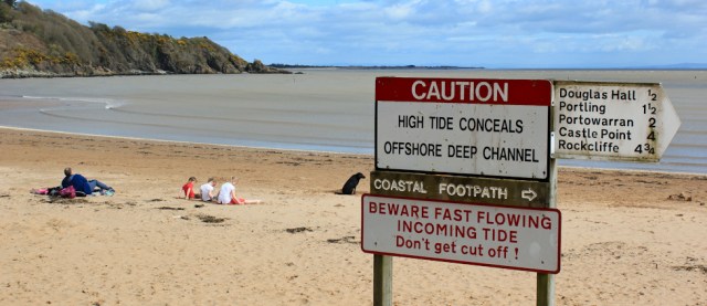
I make my way down to the beach. It’s more sheltered here, but a little off-putting to see lots of notices warning about dangers. On a positive note, it’s just under 5 miles to Rockcliffe says one sign. Coastal footpath says another one. Good.
Onwards. [To be continued…]


Hi Ruth, Snap! I remember finishing my walk at Sandyhills with an ice cream as as well. Looks like you have adapted to walking in Scotland very well.
Great minds… I saw footprints on that deserted strip of shore, and wondered if they were yours 😁
Love the view looking back to Criffel, and Sandyhills really does look quite pretty. A chilly wind would be too cold for me too eat ice cream though, I’m afraid I’d go without if there was no alternative 😦
Hi Eunice. Have to confess I could probably eat ice cream in the arctic! This was a lovely, local, creamy variety. 😋
the darn uninteresting path is a core path and part of an ancient walk way through salt marsh (or merse) made long before the RSPB adopted the land
Ah. Interesting. Can’t blame the RSPB then 😄
On no there is clearly an ice cream theme with this walk. I did it today and also finished with an ice cream. The path along the beach isn’t really a path is it? More a signpost at either end! The lighthouse at Southerness was open to the public today. It’s disused as you say so no light now but there are great views from the top. A £1.50 suggested donation to visit.
Hi Jon, and how wonderful to be able to go up the lighthouse. It seems that an ice cream at Sandyhills is compulsory for all coastal walkers!
I finally got around to sorting through my photos of this walk if you are interesting in seeing the view from the lighthouse : https://www.flickr.com/photos/joncombe/albums/72157706581791994
Hope to be hearing of more of your walks soon now that spring is nearly here!
A great set of photos, Jon, and you’ve really captured the wild emptiness of that stretch of beach. Thank you for sharing the link.
Lovely photos. I could eat ice cream anywhere, anytime!
If you had left the beach a little earlier (like I just did) you would have had a lovely meandering path to the RSPB visitor centre rather than the boring straight one, but then you would have had less beach, so you probably took the better route.
I didn’t have an ice cream at Sandyhills 😢