
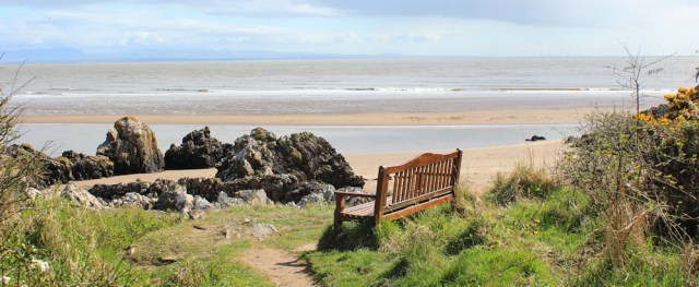
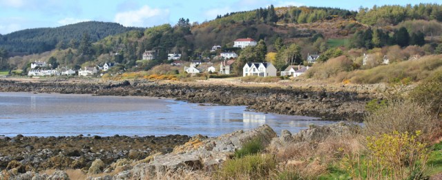
Sandyhills is a lovely place. And, for the first time for many weeks, I truly feel I’m beside the seaside, rather than on an estuary.

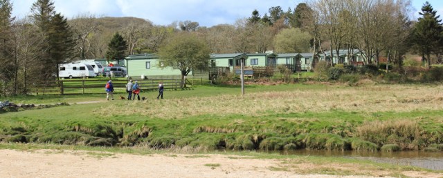
There are, of course, quite a few static caravans dotted around.
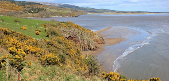
The tide is high, the beach is lovely and, just around the headland, is a mix of rocks and sandy coves. There, looking east across to the opposite side of the bay, is Southerness.

Looking south, across an even wider stretch of water – the Solway Firth – is the coast of Cumbria. England. I can even see the steam cloud coming from the paper mill factory near Workington. Great views. I could stay here all day…
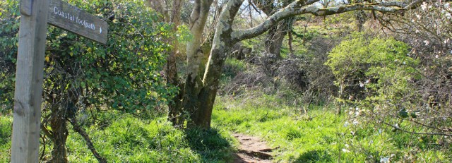
…but it’s time to get on with the coastal path, and I find a signpost pointing my way up a hill.
It’s a steep climb, but the views just get better and better.
Eventually I reach a place called Torrs Hill, and the view is spectacular. It’s as good as anything you get in Devon, or in Pembrokeshire. Just wonderful!
From there, the path drops down into Portling Bay. It only appears as a cluster of houses on my map, but turns out to be larger than it looks.
(I’m walking southwest and into the sun, so I apologise because my photographs of the views ahead are poor.)
Here I have to leave the coast for a while, due to private property. The walking route is well marked, with clear signs. I follow a lane through Portling. It’s only 3.5 miles to Rockcliffe. I’m nearly there, but I don’t want this walk to end.
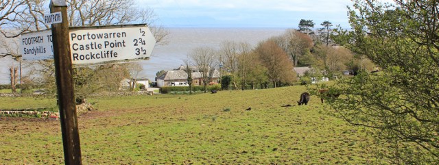
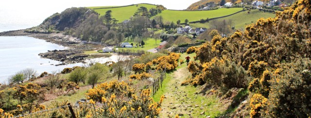
The lane rises up and then drops down to another group of houses. This is Portowarren. The road comes to a dead-end, but there’s a footpath off to the right, and I begin to climb up the slopes of White Hill.
The views up here are staggering.
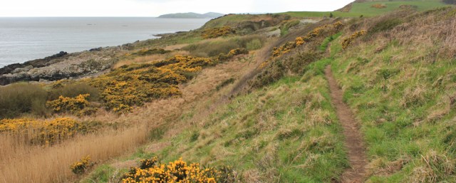
From White Hill, the path meanders up and down the cliff top. The smell of gorse is so powerful – honey and coconut – I feel quite giddy.

I make slow progress, partly because the path is rather strenuous, and partly because I keep stopping to take more photographs. You can never have too many, can you?

There’s been a couple walking behind me, but they appear to have turned back. So I’m alone up here. I’m always amazed by how little distance other people cover.
Ahead is another bay. I check my map. Rough Firth and then Auchencairn Bay. But how far can I actually see. Is that blue line on the horizon the Mull of Galloway?

Onwards, along this lovely path.
The views inland are lovely too. Criffel is still visible, just. The cloud shadows chase across the bright green, so the landscape seems to change every few minutes.

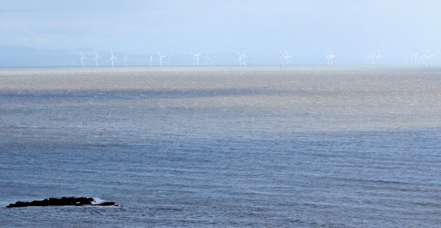
Out to sea, the wind turbines stand like an army of tall ghosts.
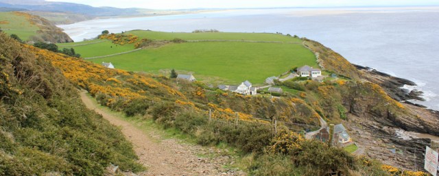
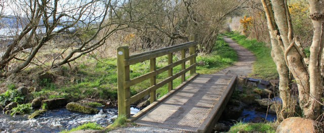
The path rolls along, with gentle ups and downs, and only the occasional steep little valley to negotiate. The route is clear and well trodden, and with useful little bridges across any streams. Ahead is Castlehill Point (according to my map), or Castle Point (according to local signs).
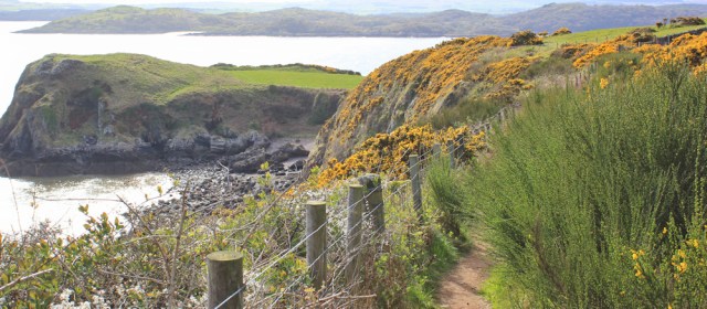
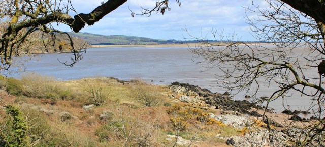
Castle Point guards the entrance to yet another estuary. This is where the river called Urr Water empties into the sea. Standing on the point, looking at a plinth, is a foreign family (maybe Dutch?) who have walked here from Rockcliffe.

Set into the plinth is one of those engraved compasses that tells you the distance to various other places.
- 8 miles to Southerness,
- 16 miles to Silloth,
- 24 miles to beautiful St Bees Head!
Oh dear, I seem to have walked so far, and still not got anywhere at all… but I remind myself it’s the journey, not the distance, that counts. Time for a quick self-portrait…

…and then I turn north and follow the footpath up the estuary towards Rockcliffe. I can see the village ahead and, alarmingly, a rain cloud seems to be heading this way. The foreign family must have seen it too, because they are hurrying home.

I walk along the edge of a field, and then through a thicket of gorse and bramble towards the shore. Here I come across a grave, strewn with a bunch of daffodils. Nelson’s grave? Was Admiral Nelson really buried here?
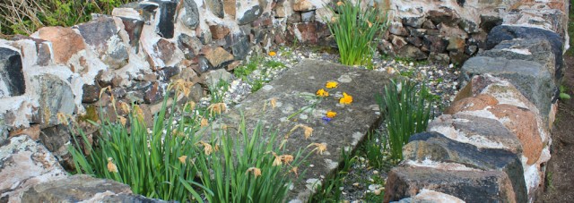
No. Turns out this is the grave of Joseph Nelson, who died when the his ship, The Ann, was wrecked near Castle Point in 1791. His was the only body found and he was buried near the Point. Later, his wife (also called Ann) installed this memorial stone for him.
The path runs close to the shore. Rockcliffe looks lovely. I’m growing tired.
Another little bridge, and my path becomes a track, running past gardens and houses on the edge of Rockcliffe.
I reach the road, and walk along the curving bay to the point where I caught the bus this morning. There is no sign of rain. The cloud I saw earlier must have gone somewhere else.
My walk is over. I sit on a bench in the sunshine, finish my remaining water, and eat a snack bar.

It’s been a fabulous walk. Not only was the weather decent with good visibility, but the terrain and the views were wonderful. In fact, it’s been the best day I’ve experienced walking in Scotland so far.
Miles walked today = 14 in total
Total miles around the UK = 3,128.5
Route: (morning in red, afternoon in green)


I agree with you, the view from Torrs Hill is wonderful – just the sort of view I like. It looks like that was a really nice walk – and no, you can never have too many photographs! 🙂
Hi Eunice. It was an excellent walk. 😄
lI’m oving your photographs and reliving it all from the comfort of my armchair! The coconut smell of the horse is so evocative.
I mean gorse!!!!
Ah, ha ha! 😄 I was wondering where the horse had come from!
I think the smell of gorse is one of the nicest smells in the world. Just love it.
Sorry but that typo just made me laugh 🙂 🙂
And that comment should have been in reply to treb 🙂
It looks beautiful & you’re making great progress. I’m not sure if you’ve seen any of the ‘Walks with my Dog’ programmes – they covered part of the Scottish coast – possibly this area? My memory lets me down these days!! Looking forward to reaching Scotland….my next stop is Suffolk in June…. Long time ago that you were there…..!
Hi Rita. I’ve watched a few of those excellent Walks with My Dog programmes, but didn’t see a Scottish one, or can’t remember if I did (what happens to our memories as we grow older?!) Hope you enjoy Suffolk. Some parts were a bit of a struggle, due to lack of proper coastal footpaths, and I do recall walking through a lot of pig farms! Yes. Seems a long time ago.
Yes, there were a lot of pigs, in the stretch I covered in March, so hoping there won’t be too many more! Though I tried to be logical, when passing them & the very low wire keeping them enclosed. If they could have got out, they’d have been everywhere…..but I wasn’t totally convinced!
I’ve just finished watching one of the Walks with Dogs & I didn’t imagine it….the presenter is actually walking to Sandyhills! It looks beautiful…..
wonderful scenery.
Yes, it was fabulous!
For others who are following your walk, perhaps they might find this useful since it shows many of the paths as well as the topology.
https://www.alltrails.com/explore/recording/rockcliffe-coast-to-beach–2
They have an app for your phone as well.
ray
Thank you. That’s very helpful. I did think it would be nice to spend longer exploring this area. Lots of wonderful walks and trails.
Looks like a super walk Val. I don’t know that part of Scotland but it’s inspired me to visit and to definitely do that walk.
I met an English family on the cliff further along. ‘This area is Scotlands best kept secret,’ they said. ‘Shhh. Don’t tell anyone.’ 😆
Wow. I can see why the Scots settled in Otago New Zealand. You could be walking somewhere near Dunedin. I felt homesick from the photos! Honestly, from the Robbie Burns memorial, the gorse, the shape of the hills, the stone walls … no fascinating ruins to come across unfortunately. The hills are higher but all the same – very similar.
Oh, how interesting that they look similar. For some reason, I didn’t imagine you had gorse out there. I would love to visit New Zealand.
Ruth I’m so sorry think I called you Val in my previous comment. I have a patient who is a long distance walker, she was one my mind whilst I was making my comment, my apologies.
Don’t worry about it Di. I assumed Val was riding the horse! 😆
I did this walk yesterday and it was indeed lovely. Sadly I had light rain, drizzle and winds for most of it, which spoiled it a bit, but it was nice to be off roads and on a proper coastal path.
Spectacular views along this stretch of coastline and wonderful photos – and never too many!