
It’s the last week in February and the BBC forecast looks reasonable. So I decide to take a few days away from the new grandchild, and get walking again.
I originally planned to ferry-hop over to Kintyre, via Arran. Unfortunately, because it’s the winter season, the ferry service is too limited to make this a practical option. So, yesterday I drove around to Tarbert from Glasgow – a 2.5 hour journey along the banks of Loch Lomond (yes, it really is very bonny) and then along the banks of Loch Fyne.
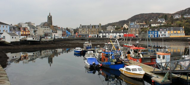
Despite a gloomy start to the morning, Tarbert is beautiful.
Today I will be following the Kintyre Way to Skipness. This long-distance path meanders further inland than I would like, but I can’t see an alternative route any closer to the coast. At least I won’t get lost (I hope) because I will be following a proper way-marked footpath.
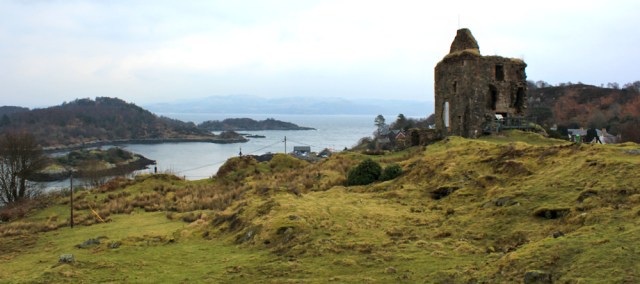
The Kintyre Way starts from Tarbert and takes me up to Tarbert Castle, a ruined medieval fortress that sits above the harbour.
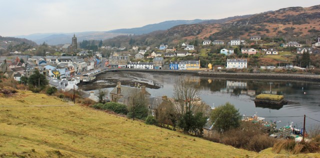
The views are wonderful. Tarbert has a proper working harbour, where boats bring in fresh fish. And, despite its small size, it seems more like a little town rather than a village, with a good selection of pubs, cafes and shops.
I wander around the castle. A herd of goats emerge from behind a ruined wall, and stampede towards me. But they soon lose interest when they realise I haven’t come to feed them. I guess they’re here to keep the grass cropped.
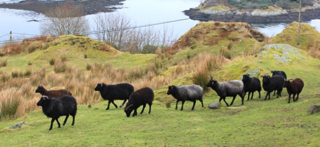
[Later I discover these aren’t goats at all. They’re Hebridean black sheep!]
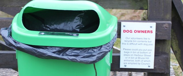
There is a real community spirit to Tarbert. For example, look at the sign about dog poo. These bins near the castle aren’t emptied by the council, but by local volunteers.
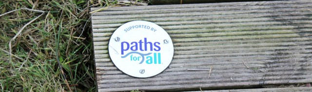
And, coming down off the castle, the boggy ground is crossed by wooden boardwalks. Again, a community project to create a walking area, supported by a Scottish charity called Paths for All.
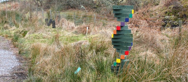
This little patch of communal land is brightened up by the addition of sculptures. Some traditional, such as this deer and fawn…

… and some brightly contemporary.
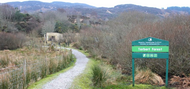
I’m entering a National Park – Tarbert Forest. The path winds up towards a range of hills.
I pass a wooden structure. “Orchard” says the sign, etched in the wood. And, yes, there seem to be plenty of newly planted trees in a fenced off enclosure.
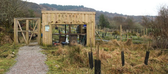
[Later I discover this is another local community project: the Community Orchard.]
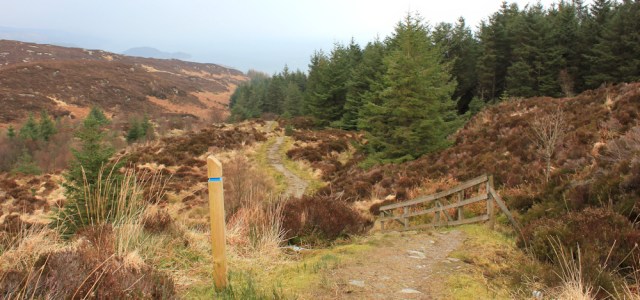
The Kintyre Way heads up the slope. It follows a green sward of grass, raised above the surrounding boggy ground, and is surprisingly dry.
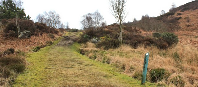
I’m wearing my heavy leather boots, because I was expecting bogs and swamps. Perhaps I could have worn some lighter footwear? The path really is in excellent condition.
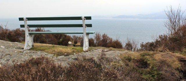
Every so often, I come across an inviting bench. This one gives a great view across Loch Fyne… but it’s really much too early to stop for a rest.
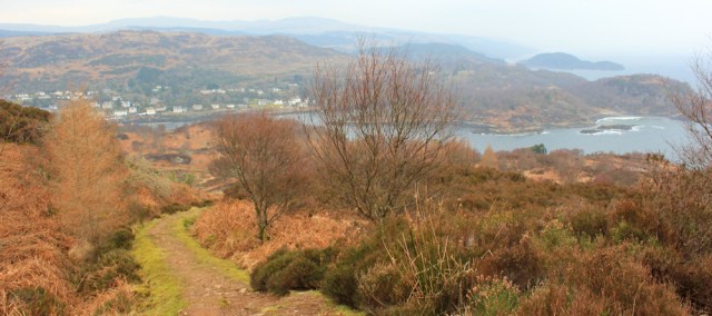
This morning, my B&B host said the path was relatively easy, but the climb out of Tarbert was hard work. He’s right. It’s relentlessly steep. But the views looking back are wonderful. Shame about the lingering mist, which spoils photography.
Sadly, I soon lose sight of the sea. The path takes me through logged woodland and over little bridges.
I reach the top of the climb, and come across a large cairn. This was something else my B&B host told me about. It was built fairly recently and is the work of one man…
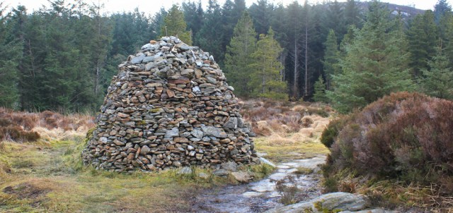
… yes, here’s the information plaque. A guy called Andrew MacDiarmid erected the cairn to celebrate the birth of his nephews. Were they twins? Ahh. Lovely thing to do.
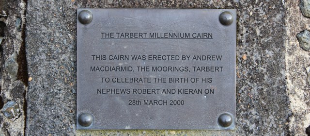
The cairn now appears on the OS maps, showing that the mapped landscape can be altered by the work of just a single man.
Onwards. Just beyond the cairn, my path joins a logging road. A sign warns me “Please be aware that timber lorries may be travelling on the forest roads.” Oh yes, I’ll keep my eyes and ears open. Don’t want to be squashed by one of those monsters.
I check my map, and turn left along the road. I thought I’d reached the top of the slope, but no such luck. The logging road continues going uphill.
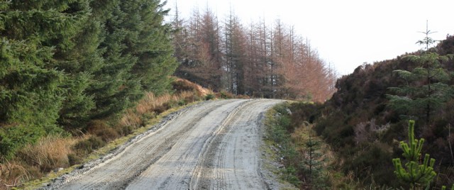
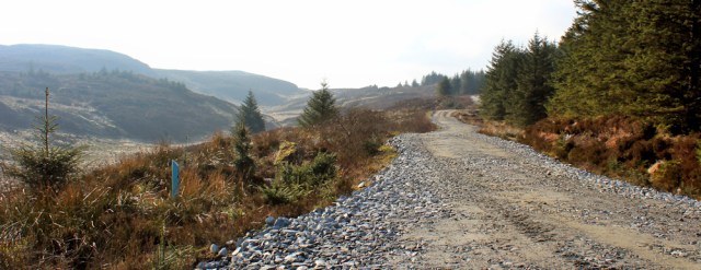
The best you can say about this road is that it makes for easy walking. The surface is practically mud free, and gentle on the feet. (These leather boots really weren’t necessary after all.) But they are boring, boring, boring roads. And the lack of a sea view is disappointing.
I hear the roar of an engine somewhere above me, and the hissing of brakes. I leap to the side of the road, and a yellow tanker trundles past.
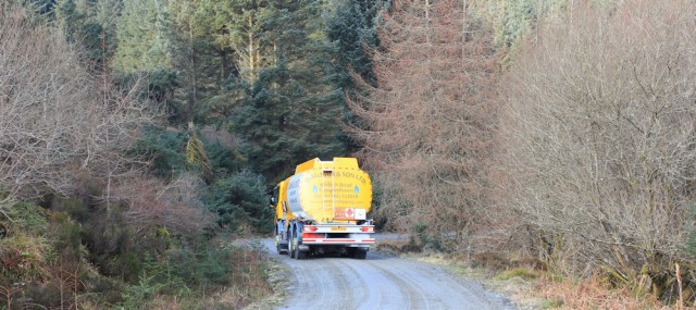
Oh. A tanker? I was expecting a timber lorry.
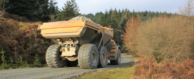
I’ve only just going again, when I hear more engine-noise. This time, it’s a lorry carrying stones – with enormous wheels – grinding slowly down the slope.
Moments later, an ordinary car passes me, going UP the slope. That’s a surprise. Twenty minutes later, the same car passes me again, going DOWN the slope. I wonder if they were lost. There’s nothing up here… only forest.
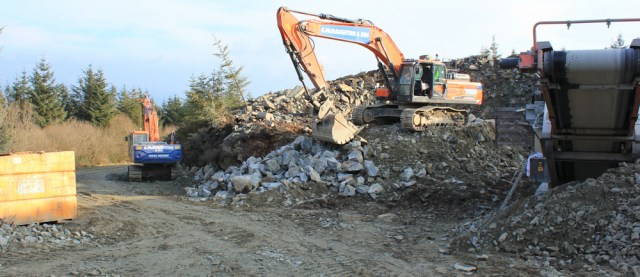
A short time later, I come upon a collection of quarrying machines, including a couple of excavators and a conveyor belt. Ah. That explains the lorry going down the hill laden with stones.
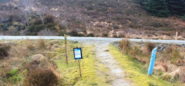
Onwards. A marker by the side of the road tells me I’ve travelled 3 miles from Tarbert. Only THREE miles!? It feels more than that.
I check my watch. It’s just gone 11am. The last bus from Skipness leaves at 4:30ish (the timetable is a little unclear) and I mustn’t miss it. This morning my B&B host told me about a couple of European hikers who did this same walk and missed the bus. They had to phone for a taxi. Expensive.
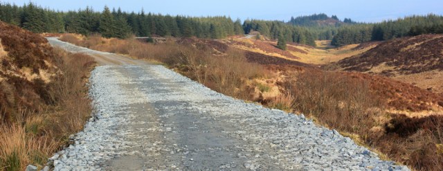
Onwards. I’m out of the thick forest and walking along the side of a shallow valley. The road is flatter here, but still takes me relentlessly uphill.
Ah. Finally, I think I’ve reached the peak, if you can call it that. After getting around the next corner I should start going downhill.
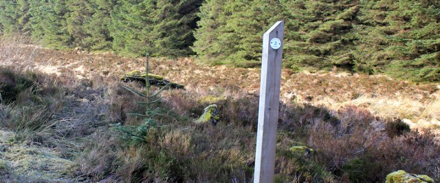
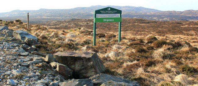
A nearby marker post tells me I’m only 4 miles from Tarbert. Is that ALL?! Meanwhile, a forestry sign says I’m entering Skipness. Hmm. Not really. Unfortunately, I know I’m still miles away from Skipness.
I stop and look around. It occurs to me that there is nothing representing civilisation in any direction. Only the signposts and the road. Otherwise… nothing. No building, no fence, no telegraph poles, no distant pylons… nothing. Wow.
I’m suddenly aware of my vulnerability in this empty landscape, as a not-very-fit woman walker in her early sixties with no phone signal and… and it’s February and very cold, despite the sunshine.
Well, time to cheer myself up. I sit down on a nearby rock. This morning I prepared hot chocolate in my brand new vacuum flask. It has one of those spouty things so you can drink while on the go. I put the spout to my lips and tilt my head back…
[To be continued…]


Interesting and I can feel that change of ambience now you are in Scotland. Are you planning to circumnavigate Kintyre one way or another?
Hi Conrad. Yes, I’m going to walk around Kintyre – down to the Mull and back again. Unfortunately, the Kintyre Way zigzags inland, and isn’t really a coastal path, so I will have to pick my own route.
Ruth
There is a coastal path parallel to the Kintyre Way between Skipness and Tarbert but I used the KW as I was wanting to complete it
I will be interested in your report north of Tarbert as I would like to do this as part of a Campbeltown to my home, Shipley Yorks, route. My son lives in Campbeltown and I like the idea of linking our 2 homes with a walk but I do not want to walk down a busy trunk road!
I am on with the English and Welsh coast paths
I have walked from Nairn to the English border – and on to Colchester. If you would like some notes of the east coast of Scotland, please ask. I think mine would be useful
Regards
Ray Wilkes
Follow me on twitter at @RWilkes1
Hi Ray. Wish I’d know about that coastal path. No sign of it on my OS map, so assumed there wasn’t one. Oh well, the Kintyre Way was rather nice. I’m heading down to the Mull of Kintyre first, but had a quick look at the map north of Tarbert and suspect there might be quite a bit of road walking 😦
“I put the spout to my lips and tilt my head back…”
Why am i sensing a mini-disaster?
It just wasn’t going to end well, was it?! 😀
When I saw your photo of the ‘goats’, and before I’d even read what you’ve written underneath, I thought ‘there’s no way those are goats, they’re sheep!’ 🙂 At least you had decent roads and paths to walk on this time even if they were a bit boring.
I am hopeless! To be fair, they were very goat-like in their behaviour.
Ruth is back – I have been looking forward to your posts again – it must be spring!
Your route is a lot more adventurous than mine (West Highland Way) and it will be fascinating to hear of your tales on the Islands and the Highlands…
I am just recommencing my coastal shenanigans this year (mainly North West England) – let’s hope we have some good weather to look forward too…
Best wishes, Gemma Barclay.
Hi Gemma. I think the West Highland Way sounds very adventurous. (I think I did actually follow that trail for a couple of miles near Port Patrick.) Best of luck with North West England. Lets hope we get a decent summer and good walking weather.
Hi Ruth – glad to hear you are back walking. Hope you made it to Skipness in time. The Post Office there is excellent for lemon sponge cake and a pot of tea! Looks like they have almost turned the path into a motorway since I walked it in 2016! Take care when you get around to the Mull lighthouse and make sure you know the lyrics to Paul McCartney’s ‘Mull of Kintyre’ – look out for those mists! I will be interested to hear if you manage the direct route from the Mull to Machrihanish or whether you follow the Kintyre Way. Whatever you do be safe. The Mull is a dangerous place to be on your own. All the best.
Hi Chris. Unfortunately the Post Office in Skipness was shut 😦 But I did manage to catch the bus. I remember your warning about the Mull, and was planning on following the Kintyre Way over that section. Yes, that wretched song keeps playing in my head every time I say the words ‘Mull of Kintyre’ – oh, no, I’ve set it off again!
This looks lovely, must remember it – not done any of the Kintyre Way.
It does look an interesting route, but it zigzags across the Kintyre peninsula in a drunken manner, not really following the coast, so I will only be doing parts of the Way.
Nice to see you back on the coast, it looks beautiful here. I’ve completed the Llyn peninsula from Nefyn to Harlech just over a week or so ago, fantastic scenery there, really enjoyed it. Off for more coastal walks soon!
Hi Jon. I loved the Llyn peninsula and was surprised how few people seem to know about it. One of Wales best-kept secrets.
Fabulous place isn’t it Ruth, but yes, it’s still not well known and I hope it stays that way! I love it when I don’t see another soul for hours.
Isn’t it just Jon? I’ve done it myself and absolutely loved it!
Looks great Ruth. I’ve not done much walking in Kintyre except for the Mull, but have toured in the car so great to see your wonderful walking views!
Might be worth doing the Kintyre Way one day. I only follow it occasionally when it coincides with the coast.
Tarbert is very pretty and looks a delightful place to live. I love those black sheep! I disagree about the mist spoiling the photography, I love the atmosphere that mist adds to pictures, The cairn is a lovely idea – I’m just a little surprised that he was allowed to build it. Here in the New Forest you’s probably have to apply for planning permission and I doubt that you’d get it! I’m now anticipating the hot chocolate disaster…………..
Pingback: 434. Tarbert to Claonaig | Round the Island