
[This walk was completed on the 13th July 2019]
A railway line runs from Inverness to Kyle, and follows the shoreline for the last few miles of its journey. This means I don’t have to use my astonishingly heavy electric bike (aka Scooty), but can take the train instead!
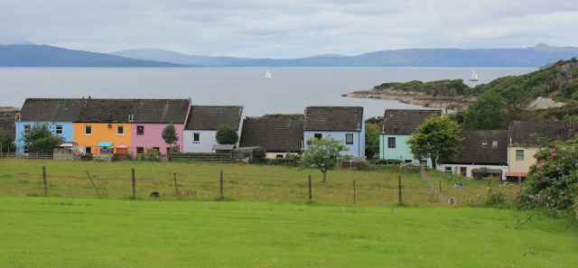
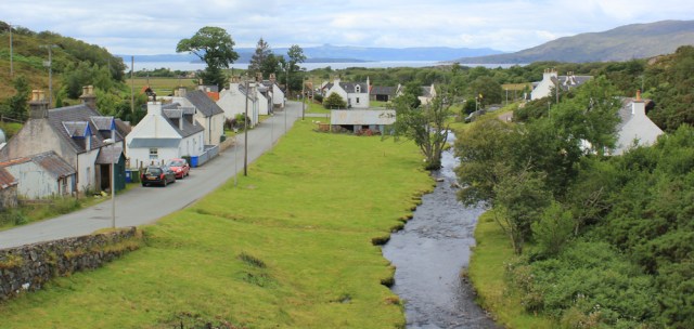
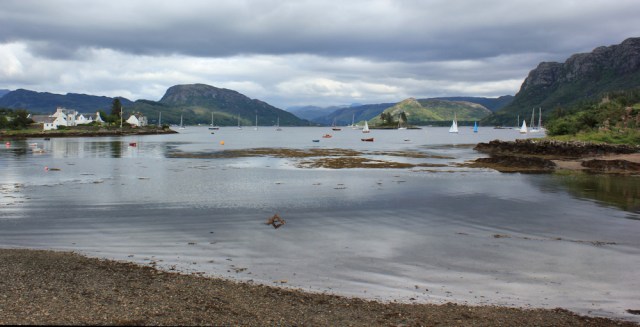
I park The Beast in Plockton. It’s a weird name – not Scottish-sounding at all – but Plockton turns out to be a staggeringly beautiful place. This was the view from the car park, looking up Loch Carron.
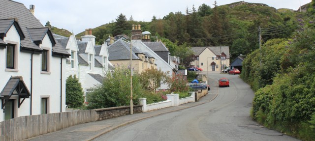
The main street is narrow, crowded with visitors, and lined by tourist shops, B&Bs, and parked cars.

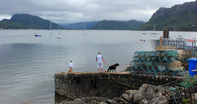
I walk to the end of the road, and go down to the pier where, according to my map, you can take a boat trip. I watch a group of people embark on a little boat, and then stand and take more photographs of the beautiful view.
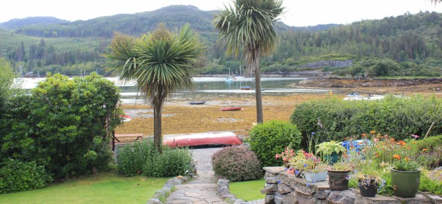
Plockton faces eastwards, away from the Atlantic winds, and boasts a temperate climate, with warm waters from the gulf stream lapping its shore. Famously, it has palm trees.
I was very excited by the thought of palm trees in Scotland, but they turn out to be underwhelming. Not exactly the tropical coconut palms I was expecting, but New Zealand cabbage palms (I look up this fact later on Wikipedia).
Plockton station is about a mile inland. I walk up the hill, passing a sign to an “Open Air Church”. Oooh. Now that sounds exciting. The entrance is an impressive arch, but the church itself… well, looks like an old grassy quarry, to be honest.

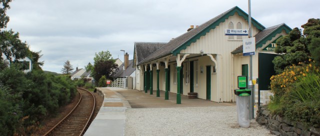
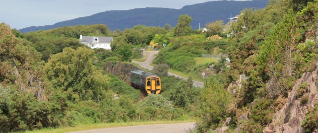
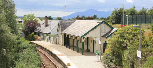
Past the school, and down to the little station. It is unmanned, but prettily painted. I’m breathless from rushing up the hill, not wanting to miss the train, and am disconcerted to discover I’m the only person on the platform.
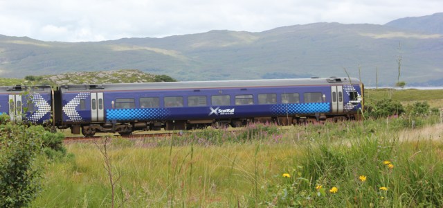
One other passenger arrives before the train pulls in. It’s Saturday, and the carriages are busy. I squeeze past visitors with huge cases, and young people with light backpacks – who sound Scottish and I think must be students coming home for the weekend – to find a spare seat.
We rattle and roll along the line to Kyle. The journey takes 15 minutes and, when we reach Kyle, we must “all change”. It’s the end of the line. The platform is already crowded with people waiting to board for the return journey.

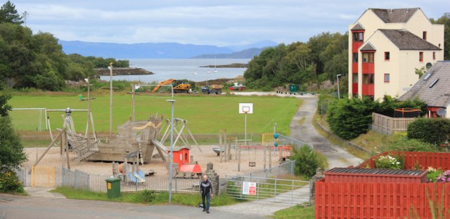
I walk through Kyle, past established houses and new-build flats. I really like this children’s playpark. Love the wooden boat and the painted train.
The road climbs gently up a hill, and I’m beginning to leave Kyle behind.
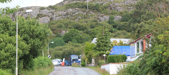
I pass a couple of squashed hedgehogs (now a rare sight on English roads) and bushes of raspberry plants covered with juicy fruit. Past a Masonic Lodge, a converted chapel and a Red Cross Centre. At the top of the hill is a coach park, with a motley collection of buses of various sizes.
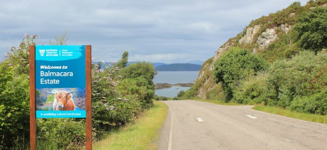
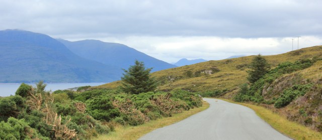
Round the bend, and the road slopes downhill. A sign welcomes me to the Balmacara Estate, which I find a bit confusing, as I’ve already passed through Balmacara.
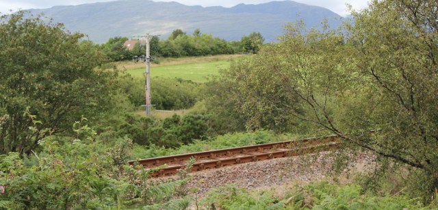
Well, I’m definitely on the right road. There’s the railway track below me, and now the train from Kyle trundles past, heading back to Inverness.
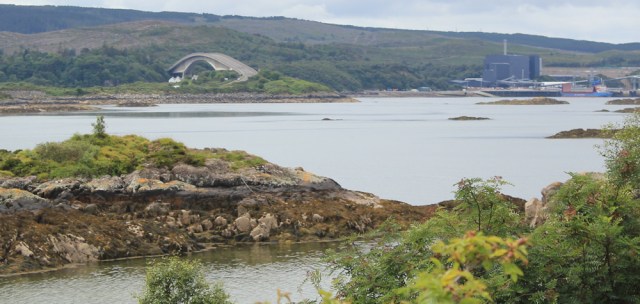
From another bend in the road, I get a view of the Skye Bridge. And, next to it, the large industrial wharf that I noticed yesterday.
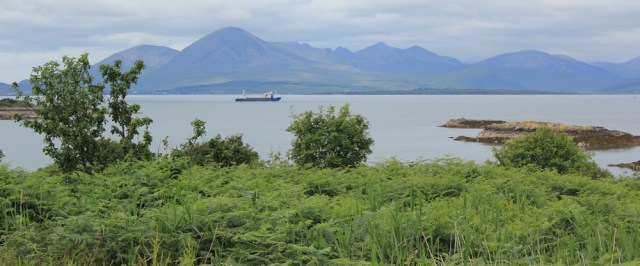
Out in the water, under the line of blue mountains. a cargo ship sails slowly past. I wonder what it’s carrying? Stones? Fuel? Fish?
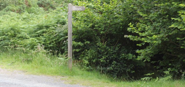
Through a little village called Badicaul, and I spot a footpath sign off to the left. “Footpath to the shore.” Of course, I can’t resist.
So I walk down a narrow path, pass under a railway bridge…

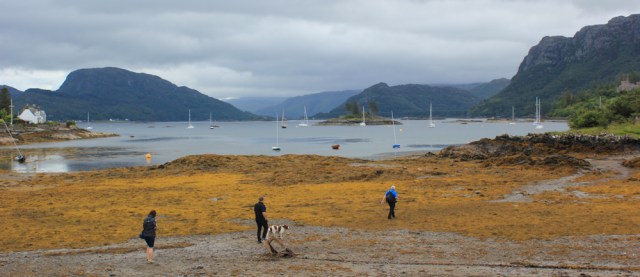
… and reach the rocky shore. I was planning to have my picnic lunch here and start looking around for a suitable stone to sit on – but then I spot something moving. It’s well camouflaged by the seaweed and surrounding rocks, so it takes me a minute or two to understand what I’m looking at – a baby seal.
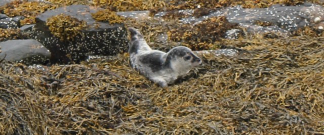
The little creature is obviously aware of my presence and begins floundering about. Oh dear. I don’t want it to hurt itself, nor do I want to prevent its mother from returning. I better leave.
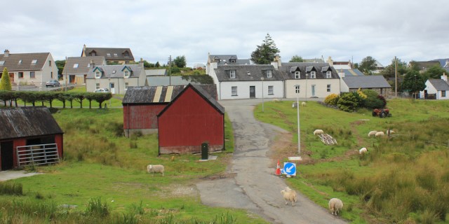
Back on the road, and the next village I come to is called Erbusaig. I head down into the village, which consists of a cluster of brightly-painted cottages arranged around a square. Very pretty.
I keep hoping to find a path to take me along the shore, but there doesn’t seem to be one, so I simply walk around the square and rejoin the main road. Actually, it’s a lovely road. Not exactly busy (there are sheep meandering along the tarmac) and with great views.
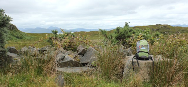
I stop at the top of a hill, shrug off my rucksack, and perch on a tumbled-down wall. Time for lunch.
The next village is just below me… I check my map… Drambuie.
Drambuie? The famous whisky liqueur? I’ve never tasted it, but I love whisky, so perhaps I’ll love it. Perhaps I’ll find somewhere to buy a bottle?
I turn off the main road and walk down into the village. Looks like a small, sleepy place. No sign of a distillery, or a shop. Just a lot of sheep.
Hang on. Didn’t the village sign have the wrong spelling? Check my map again. This is Drumbuie, not Drambuie. Silly me!
My map shows a vague footpath running from Drumbuie, across some fields, to a nearby railway station. I set off across a field, which gets progressively muddier and turns into a bog. I wade on, cursing the Scottish notion of a footpath, before I discover…
..I’m not actually on the path at all. There it is. Running across a neighbouring field.

I make my way over to the gravel track, and my progress becomes much easier. I cross a stile, walk over a hummock of rocky ground, and spot the railway line. Right on cue, another little train rattles past.
Duirinish station is still operating as a station, although the station-master’s cottage seems now to be a private house. It’s a funny place to have a station because, apart from the cottage, there is nothing else around.
From the station, I was planning to follow the road down to the shore, to a place called Portneora, where I was half-hoping I might find a coastal footpath. But the road to Portneora is a dead-end. Looking at the map again, there is no sign of a path and, I realise, I would end up on the wrong side of a little river anyway.
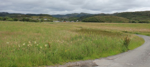
So, I decide to turn inland and follow the road across a wide, open plain, through delightful meadowland, surrounded by wild flowers.
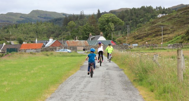
On the way, I’m passed (several times) by a trio of children on bicycles. They charge past me, return, and then come past again – laughing and shouting, and wildly excited. Their ride has no sense of purpose and they seem to have no idea where they’re going. A bit like me, really.
A sign on a nearby fence post catches my eye. Dated October 2018, it talks of untagged and unregistered livestock on the ‘Duirinish Common Grazings’ and the need to ‘resolve this breech of village grazing regulations’ with the grazings clerk.
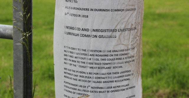
Common grazings? So, I guess this is somewhere where local people can release their livestock in a shared area of pastures. A traditional crofting arrangement?
I’m drawing closer to the village now. Ah, yes, there are some of the grazing beasts. Cows! Oh, no, the middle one is definitely a bull.
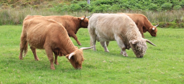
Luckily, the cattle keep munching their grass and totally ignore me.
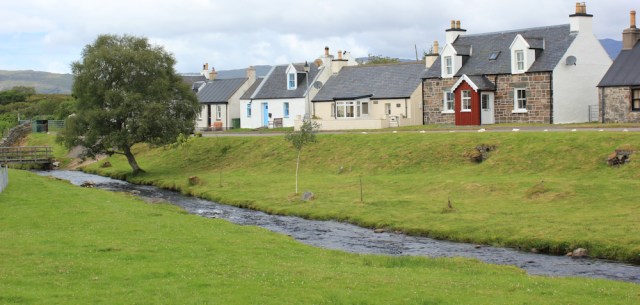
I walk past a little café, and turn into the main village street. This must be Duirinish, I guess (my map doesn’t give the place a name). Anyway, it’s very attractive, with rows of traditional cottages and a little stream that runs through the heart of it.
I walk past a warning sign for visitors. ‘Please keep your distance’ is always good advice – particularly when talking about cattle.

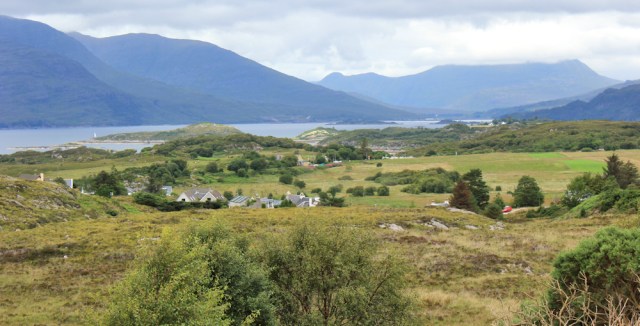
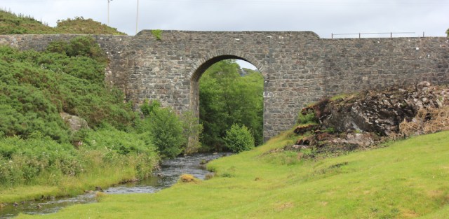
At the end of the village, my road rejoins the main road, which passes over the river via an impressive stone bridge. [Built by Thomas Telford in 1826, I later discover.]
I stop halfway over the bridge, and take a photo looking down at little Duirinish village. What a delightful place. So pretty and unspoilt.
I soon come to a T junction. Most of the through traffic is encouraged to turn right at this point. But I’m continuing straight on – to Plockton.
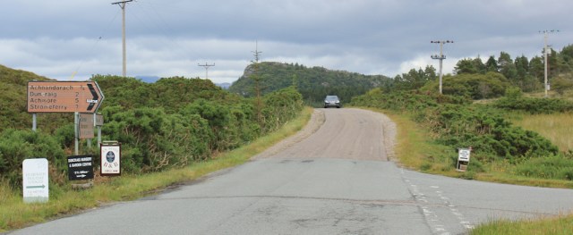
The little sign on the right of the junction (in the photo above) is for Craig Highland Farm, a little small-holding / hobby farm which offers accommodation in lodges. I’ve stayed there the past couple of nights, in a cosy little lodge right on the shore of the loch.
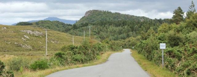
Onwards, along the road to Plockton, which soon narrows to a single-track lane.
BOAT TRIPS TODAY proclaims a sign. I remember the boat I saw embarking this morning from Plockton. Boat trips? To where?
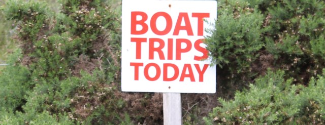
The purpose of the trips is revealed by the next sign. FREE IF NO SEALS.
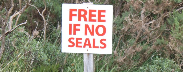
Ah. Trips to see seals. And you get your money back if the trip is unsuccessful.
The road sticks close to the railway track and I only have another mile to go before I reach Plockton…
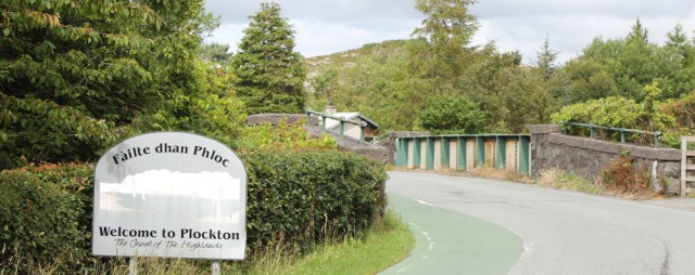
… where I cross over the railway line via a road bridge. “Welcome to Plockton,” says the sign by the bridge. “The Jewel of the Highlands.”
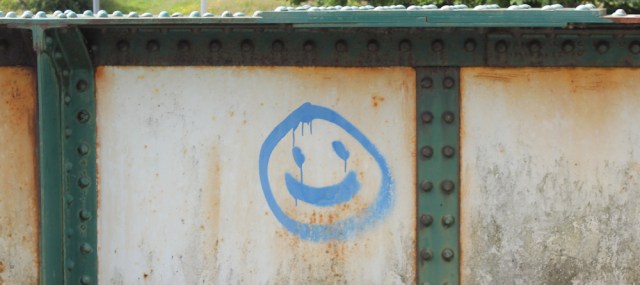
There is not much graffiti in this part of Scotland, but someone has painted a smiley face on the side of the bridge. Makes me smile back.
From the bridge, I take another photograph of Plockton station. Still nobody on the platform.
I carry on down the road, past the school, past the “Open Air Church”, and then past a footpath sign pointing to the right. That sign marks the beginning of tomorrow’s walk, so I pause to quickly reconnoitre the path. It’s a bit overgrown, but will make a nice change from road walking.
Down to the shore at Plockton, and I find The Beast waiting patiently for me. The tide has come in and patches of sunshine are lighting up the distant hills. What a fabulous view.
I’m using the train tomorrow, and don’t need an electric hookup tonight, as I don’t have to charge my Scooty bike. So I’m going to ‘wild camp’ tonight.
At Strome Ferry, high on a slope overlooking Loch Carron, I find an ideal parking spot and set The Beast up for the night.

I’ve just enjoyed a nice cup of tea, when I hear another campervan pulling up. Feeling a little disgruntled that my camping spot is being invaded, I studiously ignore the intruder. A good looking man climbs out and politely asks if I mind him setting up next to me. He saw this spot earlier and couldn’t resist camping here. Of course, I say “no, I don’t mind”.
We get chatting. He is Spanish, a professional photographer, and is spending a year travelling the world in his van. After Scotland, he has a passage booked on a cargo ship over to Canada, and he plans to drive through North and then South America. After that.. who knows?!
Wow! Makes my trip look positively tame.
I tell him about my wonderful camping spot on the Glenelg Peninsula. He says he’ll stay there tomorrow.
High spots: Plockton (of course) and discovering the beautiful village of Duirinish
Miles walked today = 7.5 miles
Total around coast = 4,340 miles
Route:
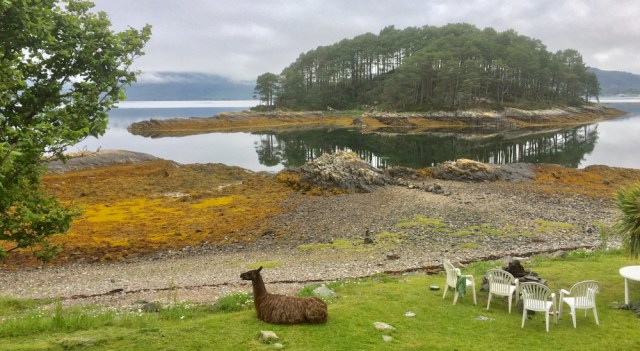
Thought I would include a photo of my view from the bedroom window of my lodge yesterday, at Craig Highland Farm. Yes, there really is a llama on the lawn.


A nice walk with some very lovely views. I love the seal and the llama on the lawn 🙂
The llama came right up to my window during breakfast. Hoping to be fed, I think.
Hi Ruth – I was amused you read ‘Drambuie’ for Drumbuie initially as I could not get the name of ‘Drambuie’ out of my head when I was there. Glad you liked Duirinish. For me it is my favourite place in Scotland even though it has no shops or pubs or anything – when I was there the cafe wasn’t even there. What I particularly liked were all the Highland Cattle. At the time they were all congregated around the telephone box and it looked as if they were queuing up to telephone home! I even went back another time to do more photography but sadly the cattle were out of the village second time around.
Duirinish was one of those unexpected and delightful discoveries.
Absolutely beautiful walk and Plockton is another place that takes me back about 50 years. My mum will love this blog post when I tell her about it. Such glorious views.
How delightful to see the baby seal and get such a good photo too. I smiled at the llama on the lawn.
The Spanish photographer’s trip sounds amazing – what an adventure.
Plockton is gorgeous. Hope your mum enjoys the blog post, and hope it brings back happy memories.
This was the day we arrived in Dornie and, as I’ve said before, I kept an eye open for you all week. But you were always just that bit ahead of us. I don’t think we did any walks beyond Plockton,
Yes, I was definitely one step ahead of you, Anabel. (I rarely get a chance to be a step ahead of anybody!!)
I have stayed at the pub in Plockton- langustine out of this world. It is always worrying when there is nobody else there on the platform or the bus stop when you alone have reserached and concluded that transport is due.
Yes, it always makes me nervous to be the only person there.
Wow palm trees in the highlands. I never knew that (even if they are not the best). I had hard Plockton was rather nice and it certainly seems that it is. This looks a really nice walk and looking forward to this one. Should be doing it in July (assuming we are allowed to go anywhere by then!).
It is nice to be able to take the train for this walk. The last place I walked on the coast with a station was Thurso and that is a long way around from Plockton (and the station not very useful for walking the coast as the line then immediately goes inland)
You’ll love Plockton, Jon. Worth factoring in some time to wander about and enjoy it. The only downside is that it is a bit crowded with tourists – damn them! And, yes, the train line is very convenient here.
The television series Hamish McBeth starring Robert Carlyle was filmed in Plockton. Beautiful place, and gorgeous scenery.
Hi Ruth. Thanks for the inspirational walk! I am planning to take the Inverness-Kyle train this coming Saturday, and I would like to do this walk, only the other way around, from Plockton to Kyle. My only concern is walking on the actual road… did you have any problems with passing cars? Is it generally safe?
Hi Claudio. It was a safe road when I walked it, although you do have to keep a look out for traffic. Hope you have a lovely walk this weekend.
I did this walk today starting from Kyle of Lochalsh (where I’m staying). I went up the Plock of Kyle first before starting the walk. Like you I also went down to that beach where you saw a seal – but no seal today. Someone seems to have tried to make some sort of tiny harbour but good luck getting a boat under that railway bridge. At Drumbuie there is (now, anyway) a signed coast path around to Portneora (or Port ne Ora as it was on the sign). It was quite good right around the coast either along the edge of the field just behind or over the back of a couple of beaches. Duirinish now has a cafe in that large barn the children in your photo are cyclying towards (it’s called the Croft Cafe and it was even open). Duirnish station is indeed quite far from the village but someone did get off there on the way back to Kyle of Lochalsh so it does get some use.
I enjoyed Plockton though it was still quite busy (probably not as much as it was for you last summer though). Sadly the boat trips to see the seals are not operating any more, whether they will come back next year I don’t know. I was hoping there might be a path from the end of the road round to that beach behind the airport marked on the map but there wasn’t so I headed back to the station. The station building is rented out as a holiday cottage, probably why it is so well looked after. The station at Kyle of Lochalsh is built out into the Loch like that so the boats to Skye could dock alongside the platform (before the bridge opened, of course).
Glad you enjoyed Plockton, Jon. Thought it was a special place, despite too many tourists! Well done for finding a coastal footpath at Drumbuie. Perhaps it existed when I walked there, but I missed it.