
[This walk was completed on the 6th August 2019.]
Today, I plan to follow a Core Path that links the dead-end road at Ardaneaskan with the dead-end road at Achintraid. It’s going to be a there-and-back walk. The final descent to Achintraid is supposed to be tricky – involving a slippery rock and a piece of rope!
I decide to start my walk at the difficult end, and walk the “wrong” way first, just to make sure I can get through.
In fact, the climb out of Achintraid is much easier than I expect, and the views from the top are wonderful. That’s Loch Kishorn below. Over on the far hills I can see a road winding up a steep valley.

Check my map. Oh crikey! That’s the road up the Applecross pass! I’ll be toiling up there tomorrow.
I reach Ardaneaskan without mishap. This is the car park where I started my walk to Lochcarron yesterday, and where I chatted with the farmer who was thinking of buying some woodland nearby.
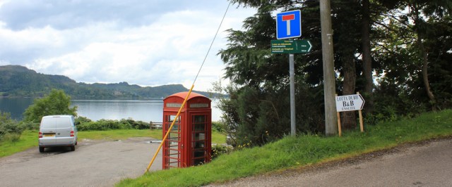
Turn round and look back up the hill. Time to head back the way I’ve come. Here starts the “proper” part of my walk today.
I follow the road up the hill, with glimpses of the shore between the trees.
Climbing higher, I have beautiful views over the mouth of Loch Carron towards Plockton, with the mountains of Skye in the distance. Look how clear the water is.
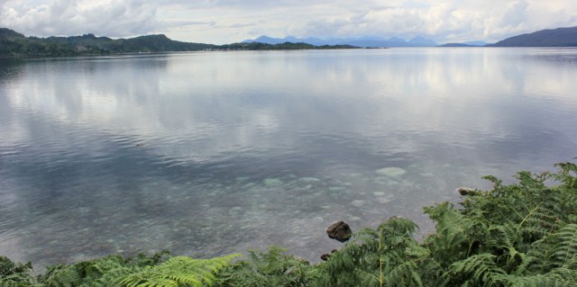
Yesterday, there was a dolphin playing in the water beside the shore. Sadly, no sign of dolphins today.
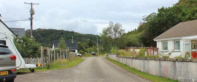
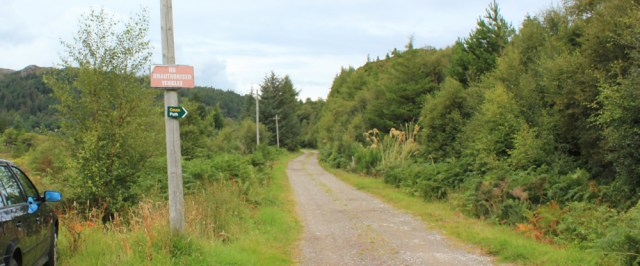
I lose sight of the sea and now the route is lined with residential buildings – a mix of pretty white cottages and larger houses. Soon, I’m approaching the end of the public road.
At the end of the road, the Core Path leads onwards along a gravel track.
The track gently rolls over the top of the rise, swings round, and dips down towards the shore. This is a really pretty part of the walk, as the track winds along beside the water, following the base of a rocky cliff.
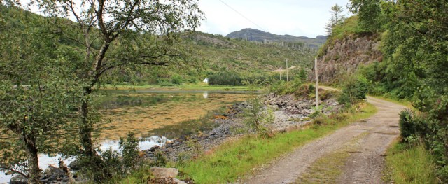
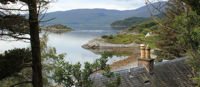
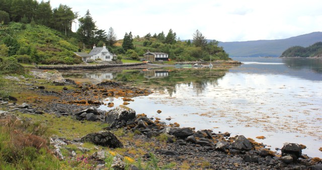
I’ve left Loch Carron behind. This is Loch Reraig – more of a bay than a loch, to be honest – and it forms a natural sheltered harbour. A few buildings are scattered around the shore and boats are moored in the still water. What a lovely place to live.
I’ve reached the shallow valley where the Reraig Burn joins the loch. It would be a pretty place too, but the hill on the other side has been scalped by logging operations. I watch a white vehicle slowly edging along the far slope. Ahead is a signpost.

I reach the post. A finger points the way along a grassy path. “Leacanashie,” says the sign.

I check my map. Leacanashie? Oh, there is a place back on the coastal road between Ardaneaskan and Strome Castle called Leacanasigh, and I guess it must be the same place. But that’s certainly not where I want to go. Luckily, earlier I walked the “wrong way” along this path, and so wasn’t confused by the sign, because I didn’t see it.
(Although I actually take a slightly different route back, I’ve decided to show the photos of my outgoing walk, in case anyone is following my route and wants to walk it this way round.)
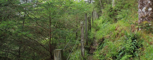
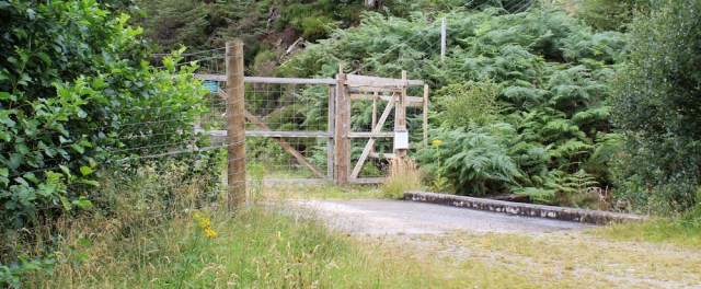
Following the grassy path towards Leacanashie (even though that is not where you’re actually heading), you’ll come to a fence with a little gate, at which point the path appears to disappear into a mass of bracken.

In fact, if you go through the gate, the path turns sharply to the left and follows the fence along the steep slope of the hill. The path is quite narrow and overgrown in places, and on the way along here I was nervous about twisting an ankle.
Further along, the ground is flatter, and the route is easier.
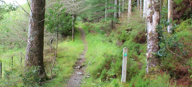
There are occasional footpath signs. The green sign with the yellow arrow is familiar, of course, but there is another interesting sign showing a flat scallop shell.
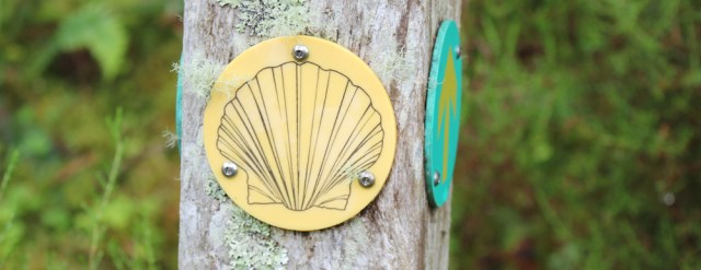
I guess this signifies a special path of some sort, but I’m not sure what it is.
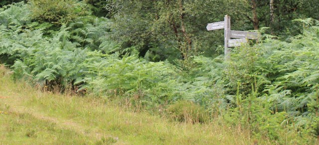
Further along is a more conventional fingerpost, half-hidden in the bracken. Apparently Leacanashie is 2km away, off to the right – along a very overgrown path which goes over the hill and down to Loch Carron. Continuing straight ahead is the route to Achintraid, and also to something called the “Reraig Loop Road”.
Continuing straight on to Achintraid, the path becomes a well-defined track. It follows the southern side of the valley, with Reraig Burn hidden in the foliage somewhere down the slope to the left.
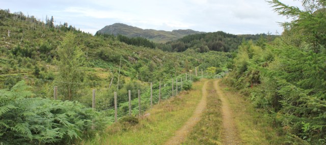
After a few hundred yards, the track dips down and joins a wider track at a tight V junction. Straight ahead is the way to Achintraid, but if you look back along the other fork, you can see the track crosses over the Reraig Burn via an ugly concrete bridge, and passes through a deer fence.
This must be the “Reraig Loop Road”, as promised on the finger post.
In fact, the Reraig Loop Road is the route I really take on my way back. So forgive my diversion, and let’s go back to Loch Reraig to pick up my actual return route…
[To be continued…]
This variant of the route, as described in this blog post:


It looks lovely – at the right time of year. I’m glad you’re doing it, not me. 🙂
Yes, Scotland is glorious in the right weather, and extremely intimidating in the wrong weather!
🙂 Yes, even in a car it can be tricky if you pick the wrong week.
It always gives me a lift to see a post from you in my inbox – and it does my heart and mind good to read about your walks in Scotland and see the beautiful photos. I do hope you can soon begin on this year’s adventures.
Ah, thank you Karen. Scotland is “open” again now, but I’m not comfortable about returning yet.
Love this particular area you’ve reached now, Ruth. Remember going to Applecross too!….. These posts are really brightening this lockdown, helping our sense of adventure even if unable to physically go there..
Hi Pam and glad you’re enjoying the posts. I realise I’ve been putting off writing up my last week of walking from last year because I’m still clinging on to the memories!
I’d love to be up there now – the ambience is palpable from your writing and photos. I looked back to see that I was doing at the same time last year: ticking off trig points on Sheet 91 up around Teesdale and Weardale.
I’m looking forward to getting up there again, but not yet. Still very nervous about travelling while this virus is still lurking about.
I think that is a very wise reaction. I respect your medical background. I believe that the whole thing was much underplayed at the beginning but they are now finding out that some of those with only mild doses are showing much longer, on-going problems ( so some of the media says) but who and what to believe is a problem, especially when some of the scientists have conflicting views.
Glade to see two new postings. This is numbered 433, what happened to 423 to 432?
Uhhh, thank you Mike! It was an error. I’ll correct shortly 😀
I hope you can get back soon Ruth, if only for the mental health benefits 🙂 but I know what you mean about not yet being sure if it is OK to do so. I desperately miss being away in my van, but I am not sure yet about sharing campsite facilities.
When you are back though, you have the most glorious area to explore – I think the land up through Applecross to Torridon is some of the most beautiful you will find anywhere.
We’re living through strange times, aren’t we Jayne? The virus is still here, and the important thing is to stay safe. Our adventures will just have to wait.
Loveely blog you have here