
[This walk took place on 5th August 2019.]
It’s raining by the time I pack up my lunch and leave Strome Castle. I walk back to the T junction, and turn right towards Lochcarron. It’s not wet enough to pull on my waterproofs. Put my head down. March through the drizzle.

Some time later, I see familiar ring shapes on the loch. It’s another fish farm. A nearby sign tells me this belongs to the Scottish Salmon Company.
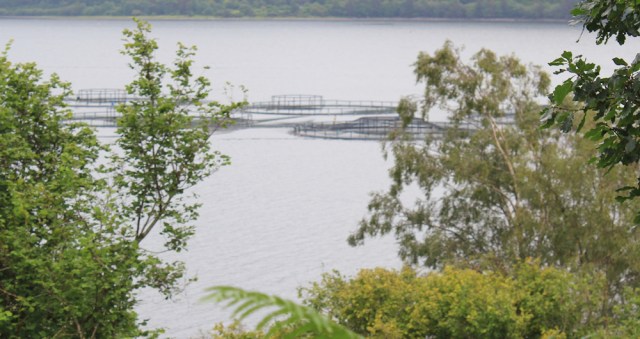
Fish and tourism makes up the main industry around here. Timber too, I guess. I haven’t come across a distillery for some time.
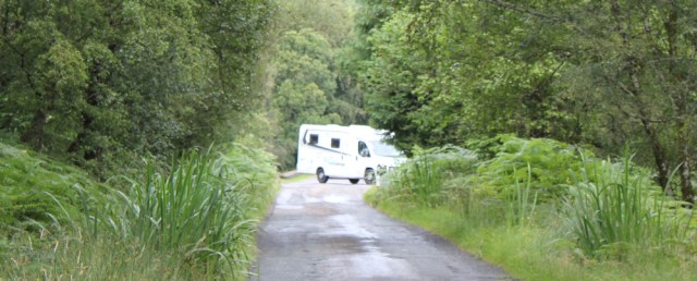
I am nervous about driving my van (aka The Beast) along this narrow road tomorrow, which I will need to do to pick up my Scooty bike. The sight of a large motorhome ahead, trying to manoeuvre into a small passing space, doesn’t fill me with much confidence.
The rain eases again. I’m passing more cottages now. Here’s a cheerful little place, which I think might be a café… but my hopes are dashed when I realise it’s a weaving shop.

“Craft Centre” says my map.
Onwards. Over a little river…

… and then over another cattle grid – although I haven’t seen any cattle, so maybe it’s a deer grid – and now I must be approaching the outskirts of Lochcarron. There are more cottages scattered about, the road is lined by street lights, and there are speed restrictions.

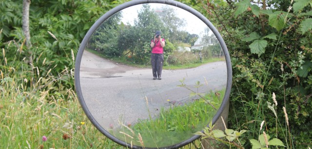
Can’t resist stopping beside one of those roadside mirrors. Time for another self portrait.
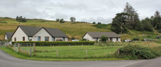
A sign tells me I’m in Port na Criche. Takes me some time to locate the name on my map, where it’s spelt Portnacrich in small letters. I walk past a row of larger houses, and then past a collection of neat bungalows.
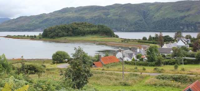
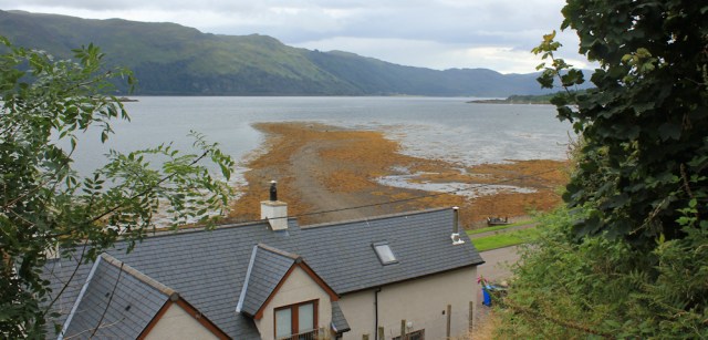
Ahead I can see more houses. Lochcarron. Rain clouds roll over the hills behind the village, but luckily no rain is falling down here .

To my right is a pretty little peninsula, jutting out into Loch Carron. Check my map. Slumbay Island. Probably a tidal island once, but now it looks firmly attached to the mainland.
Out in the loch are some moored yachts, and behind the boats is a strange shape. Crikey. A submarine?!
No, silly me, it’s only an island – Sgeir Chreagach, according to my map – but it does look a little like a submarine when your glasses are fogged up after the rain.
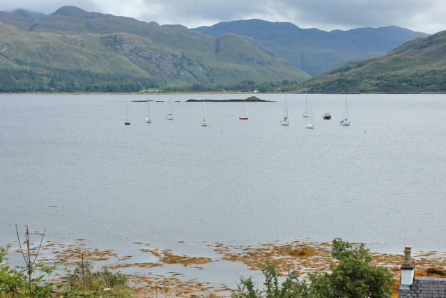
I remember spotting a rock that looked remarkably like a submarine when I was walking down the Mull of Kintyre. Turned out, it really was a submarine. Not this time.
There is Lochcarron ahead. It’s a very pretty village, and in a lovely setting. Lochcarron is looking beautiful today.

I seem to have spent most of the last few years of my coastal walk making my way up and down the shores of Scottish lochs. Every loch has it’s own characteristics, and it is hard to say which one I’ve enjoyed the most.
Loch Sunart was stunning, and had sea otters. Loch Moran was eerie and mysterious, and had its own monster. But my favourite so far has been Loch Hourn, with a wildness that was both soul-lifting and terrifying.
Anyway, I’ve enjoyed walking along the shores of Loch Carron. It’s taken me four days of hiking to get round the loch, but this part of my journey is nearly over.
A large white bungalow catches my eye. Turn’s out it is not an ordinary residence, but Lochcarron’s Free Church of Scotland. What a nice place to have a church.

I reach the T junction. Here my minor road joins the A896, part of the famous N500 touring route. This means the road is busier than you would expect.

I turn right, and head into Lochcarron. On the corner is an odd football field. I noticed it earlier when I cycled past on Scooty – odd because the goalposts seem wrong. I’m not a football fan, but the shape of the goals are unusual… I take a closer look.

Turns out the field belongs to Lochcarron Shinty Club. Shinty is roughly the Scottish equivalent of hockey, but is far more dangerous and involves a lot more physical contact. I would love to watch a real game.
Onwards. Someone has put up a homemade speed sign. It’s a reminder that the N500 has been both a blessing and a curse to the northern highlands.

The route is a blessing because it brings in the tourists, and a curse because of the dangers that come with increased traffic.
Lochcarron is a reasonably-sized village, compared to the average English village, but in this part of the world it seems like a full blown town. It even has its own police station…

… and a second church. This one has a sign saying it belongs to the Church of Scotland, which I guess is a different denomination to the earlier church I saw, the Free Church of Scotland.

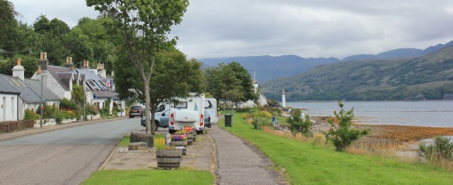
This is Lochcarron’s main street. So pretty. Only marred by the number of vehicles that park along here.
I walk past the Waterside café. It seems busy, but then I notice the group of bikers outside are packing up ready to leave.

I wait for them to leave on their bikes, and then pop into the café. Luckily, there is somewhere to sit inside, and I find a cosy corner and order a hot meal. After my rushed picnic lunch, eaten in the rain, it is nice to have somewhere dry to sit down. And a good meal now means I can just have a snack later in the van, and won’t have to go out to find food.
( I find eating in the evening is a trying experience when you’re on your own. You don’t really want a full-blown restaurant meal, but most cafes are closed in the evening, and many local pubs are now restaurants in all but name.)
An hour later, I leave the café, feeling nicely full.
Lochcarron really does have everything you need in a Scottish village, including a self-service fuel pump, a cash machine, and a Spar supermarket.

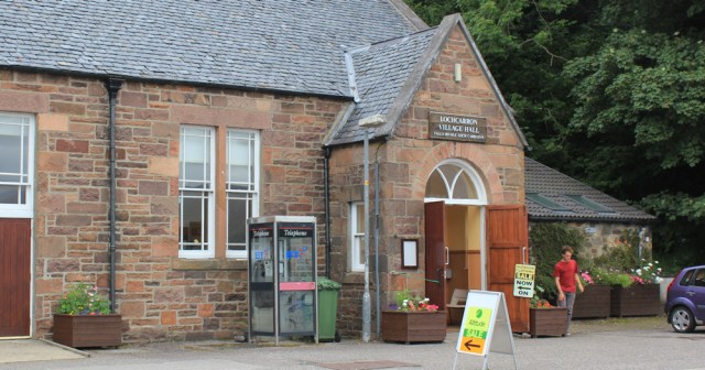
Further along, I pass the village hall, which is selling sports and outdoor clothing. It’s tempting to pop in, but I really have enough walking gear and don’t need any more.
Perched high beside the road is a war memorial.

Close to the memorial, I find a little path that takes me off the road and up the slope, where it will join a much narrower and quieter street, called Croft Road. On the way up, I turn to take photos of the view across Loch Carron.
The Wee Camp Site is situated on Croft Road. It really is ‘wee’, with a limited number of pitches on a stepped site. The facilities are pretty basic, but it’s perfect for small campervans, and takes tents too.
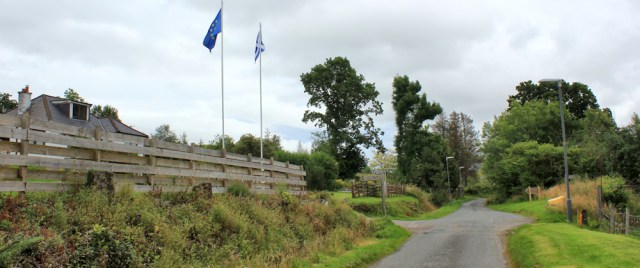
There’s my lovely Beast, parked in one of the best spots, with a great view across Loch Carron.

It’s been another short walk today. In fact, I’ve been frustrated about my distances recently, but when you have to cycle as well as walk – and despite having an electric bike – you really don’t want to go too far. Partly because of the effort involved, and partly the fear of having a puncture, or running out of electric charge, or some other mechanical failure with the bike.
Anyway, no problems today. It’s been a great walk.
Miles walked today = 7 miles
Total around coast of Britain = 4,374 miles
You can learn more about Shinty on Wikipedia.
Route today (morning in black, afternoon in red):


The normally excellent Ordnance Survey do seem to get a bit confused with some of the Scottish place names. It often seems to be the case they are spelt or punctuated differently on the signs than on the map which can cause confusion or the much more prominent name on the OS map is nowhere to be seen and another seemingly much more minor name is used.
As to the NC500 well it’s definitely a good thing for the local business owners. Not so much for the walker since it means a lot more traffic than there otherwise would be, which is not what you want when much of the coast walking has to be on roads. Some of the drivers do treat it as something of a racetrack too (I think there are some that try to do it in a day realise it’s too much and end up trying to rush). I will be glad when I’m off the route of the NC500 (which I nearly am).
Regarding the village facilities they often are excellent. You do come across a few of those self-service petrol pumps that are then open 24 hours a day meaning it can sometimes be easier to get petrol in a remote part of the highlands late at night than it can be in towns and even cities in other parts of the country. I don’t know why automated self-service petrol pumps are not more common in the rest of the UK (vandalism or risk of theft perhaps?) as I remember in Iceland almost all petrol pumps are automated self-service ones and there are few staffed facilities.
Nice to see more photos of such beautiful places and your write up. I do hope I will be able to go there soon….
Glad I’m not the only one who finds place names confusing. Wales was similar, I remember. The good news: we’re apparently allowed back into Scotland now, as they have lifted travel restrictions in the highlands and you can book self-catering accommodation and camp sites. I will be waiting a little longer before venturing up there. To be honest, I’m not sure how welcome English tourists will be while our COVID rate remains relatively high.
What a fabulous pitch for the night, I do hope you slept well.
The NC500 has turned into an absolute b****y pest and a nuisance. I hear mutterings in many quarters that are trying to persuade The Powers That Be to stop marketing it and let the stupid idea die. It’s a bit like Wainright and the Lake District fells – by over-popularising the area his little books of walks have ruined it.
Yes, I have mixed feelings. Sadly, I’m not sure the large mobile homes on the NC500 actually add much to the local economy, as they come fully equipped with supplies. And the infrastructure can’t cope – narrow roads, crowded cafes, overflowing campsites… Well, I guess COVID might calm everything down for a year or two.
Lochcarron village looks lovely, it reminds me very much of Arisaig village. The camp site sounds like just my type of place, and you certainly had a great view 🙂
It was fabulous Eunice. I thought of you when I was there, as I knew you would love it.
I have vague memories of Loch Carron, I know it was beautiful (as your photos prove) but that’s about it. Well, it was about 50 years ago! The village looks delightful and I’m glad you found somewhere decent to eat.
Another 7 miles added to that amazing total.
Such slow progress… but why rush when there is so much to see 😀
Just caught up with you again – I hadn’t realised how far you had progressed to the north, and maybe it is further with these belated posts? I was struck by your venture into Knoydart and the walk north from Kinlochhourn. Loch Hourn and the Knoydart Munros have special memories for me.
Yes, I read your blog post where you described your adventures on Loch Hourn and climbing the Munros. It’s a special place. Ironically, for a place that’s supposed to be one of the most isolated in the UK, I came across more fellow walkers on my trip to Inverie and back than I normally do!
Hi Ruth – I love the photography as ever – do you just write up your walks from the photos you take or do you make notes in the evening. I was just thinking while reading this latest walk how good and detailed your recall is- down to the minutiae such as the drizzle at a given time. If I was writing up one of my walks I fear I would struggle remember half of it and even make the best walk sound interesting. Stay well and I look forward to hearing from you soon.
Hi Russell. I make notes on my OS map. ‘Rain’ or ‘ate lunch here’, for example. But it’s the photos that bring it all back. I now take far more photos than I know I’ll use, just to document the trip. I think I can remember most of each day, but of course I might be fooling myself, as I can’t remember the things I’ve forgotten!
Your comments about the bike strike a special chord Ruth. I had to give up on my Silverdale to Sandside section when my bike broke. After driving an hour and half to get up there it was pretty depressing just to drive an hour and a half back again 😄!
Can’t wait til I’m allowed back on public transport, but I guess you don’t have that option up there in the wilds.
Oh no, sorry to hear about your bike. That’s my nightmare come true! I would much prefer to catch a bus or a train, but you’re right that’s not a common option in the highlands.
I think you’ve brightened many people’s day with more of your blog Ruth. It certainly seems strange not to be able to continue with coastal walking. I did a short stretch in Kent back in Feb…seems a long time ago. This week we should have been in Lincolnshire…. But I’m lucky to have lots of lovely Devon walks on my doorstep.
Hope you can get back to Scotland before too much longer…
Things are gradually opening up now, aren’t they? But I’m still nervous about travelling far from home, to be honest. We live in such an uncertain time and who knows when and where this virus will flare up again. We’re not free of it yet. 😦
Hi Ruth – glad to see you are back to updating your blog. Hope you get to continue with the walk before too long. I was interested to hear you say how much you liked Loch Hourn. That was one of my favourites too. I have heard it said that it is the most ‘ffjord’ (?) like loch in Scotland. Hope you have managed to stay fit during lock-down. Since I completed my walk almost a year ago now, I have become so lazy! I did however start walking Sheppey the other day, which will be the third of the 130 inhabited islands of Britain that I will have done.
All the best Chris
Well done for tackling the islands, Chris. As you know, I think I might do some of the islands after I’ve finished this. (IF I ever finish!) I was very fit just before lock down, walking 7-10 miles most days. And I’d done two challenging walking holidays in the Canary Islands over winter. But now I’ve lost all that fitness. It’s hard to keep motivated when you’ve walked all the local trails and they’re crowded with people – makes walking stressful. Never mind, I’m sure we’ll be back to normal fitness soon.