
[This walk was completed on the 14th August 2019]
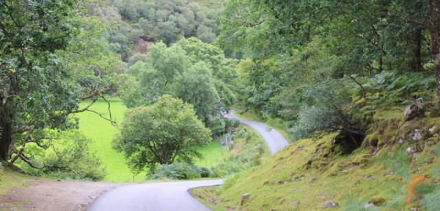
The road twists, turns, and dips up and down. It’s very pretty really but, after the excitement of the ‘proper path’ this morning, the rest of today’s walk seems a bit of a slog.
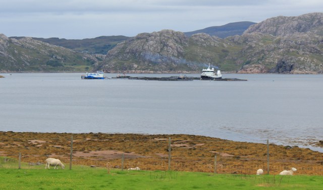
Finally, the road runs close to the water. Loch Shieldaig. There are sheep grazing on the seaweed along the shore. I wonder if their meat tastes salty? Or is full of iodine?
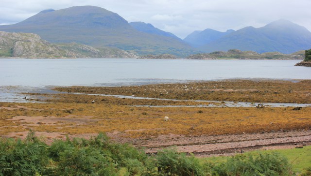
Out in the loch is the obligatory fish farm. Salmon, I suppose.
I’ve reached a place called Inverbain, where there is an information sign and a little hydroelectric station, and… well, nothing much else.
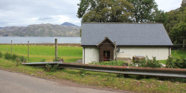
The information sign tells me the Inverbain Hydroelectric Scheme supplies electricity to 900 households. That is probably the total population of North Appleby, with some left over.
A bevy of cyclists pass me – all clad in Lycra with incredibly muscular calves, and carrying rucksacks on their backs.
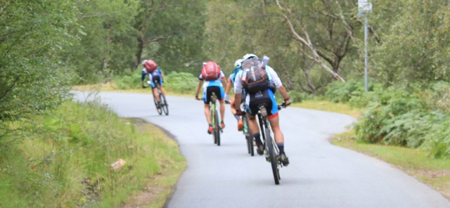
They’re free-wheeling down the hill at the moment, but there will have been plenty of steep slopes to challenge them. Must be very fit.
I remember how I rode my Scooty bike up here this morning, grateful for the battery-assisted power, and hoping I would make it up the hills without stopping. I did make it and, in fact, my trusty ebike has turned out to be one of my best purchases. I’m grateful to those fellow coastal-walkers who suggested it.
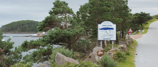
The road rises up again, running above the loch. I look down over a sheltered bay and a group of little islands – Eilean Dughaill, with Shieldaig Island beyond. The houses in the distance must be Shieldaig.

In fact, there are two Shieldaigs in this area of Scotland. This is the largest one, and the first one I’ve come to.
The road is quiet this morning. More cyclists overtake me – speeding round the corners and making the most of the downhill slope.
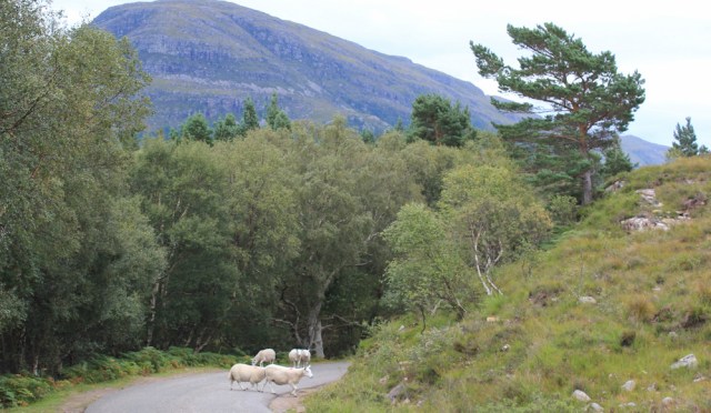
Round a corner, and a few sheep meander across the tarmac. Hope the cyclists managed to avoid them.
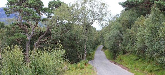
Owards. Through the trees. I do love this road.
Through gaps in the trees, I can glimpses over the loch. Shieldaig still seems far away, but I must be getting closer. Looks quite a big place.

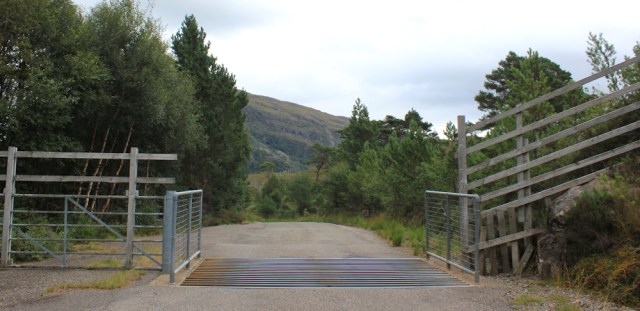
I cross over a cattle grid. Or is it a sheep grid? Or a deer grid?
Yes, I’m definitely getting closer to Shieldaig. Look at those mountains behind it. Wow. Scotland just gets wilder and wilder.

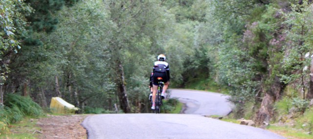
More cyclists. Quite a lot of traffic this afternoon!

The road is going downwards now, and more houses appear among the greenery. I definitely get the feeling I’m leaving the wilderness of Applecross behind, and entering a more built-up area.
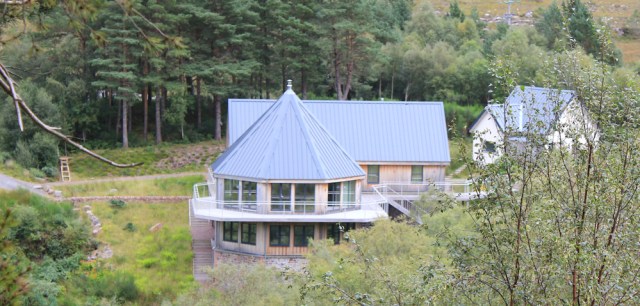
Ah, look at that house below the road. It’s a new build. nestled in a little river valley, with views over the loch. Love the balconies and the octagonal shape of the living room. Oh, what a wonderful view they must have.
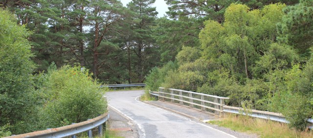
The road dips down into the valley, and crosses over the river.
Below is a mucky looking pool. Its surface is covered in scum and weeds, which have been corralled into circular shapes, like a frozen ripple effect.
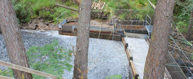
I wonder if it’s part of another hydroelectric scheme? Seems to be still under construction.
Spot a engraved plaque in a large stone, and stop for a closer look.
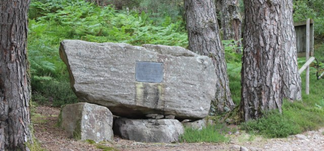
The stone commemorates the opening of the road from Shieldaig to Kenmore, which was opened in 1970 by Princess Margaret. How amazing to think this road only went a few miles along the coast, leaving the rest of Applecross cut off. (I remember the other plaque in Applecross Bay, which I saw a few days ago, and which commemorated the opening of the second part of the road in 1976.)
Beyond the stone is a flat open area, where a group of bikers seem to be erecting a camping site.
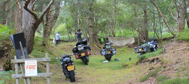
Are they setting up for the night? Hope they’ve got nets and insect repellent. There will be plenty of midges to keep them company!
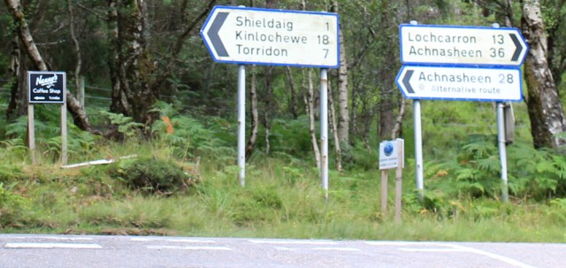
A few yard farther, and I reach the main road. Only a mile to Shieldaig.. but only 13 miles back to Lochcarron!
It seems a long time since I left the lovely Wee Campsite on the slope above Lochcarron. Just over a week ago, in fact. Crikey! As usual, I’ve taken a very long time to cover very little real distance!
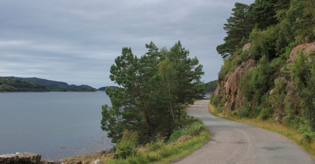
I turn left and head down the road towards Shieldaig. It might be a ‘main road’ – the A896 – but it’s still narrow and single-track in some parts.
The increased traffic is a nuisance. I have to keep stopping to let cars go by.
The loch is just to my left, behind a screen of trees. I notice a sign pinned to one of the trunks – “Red Squirrel Reintroduction Zone.” Ah, how lovely.
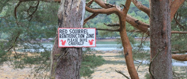
Now, I keep stopping to look for red squirrels, but don’t see any. They are far more timid than the grey variety, and hard to spot.
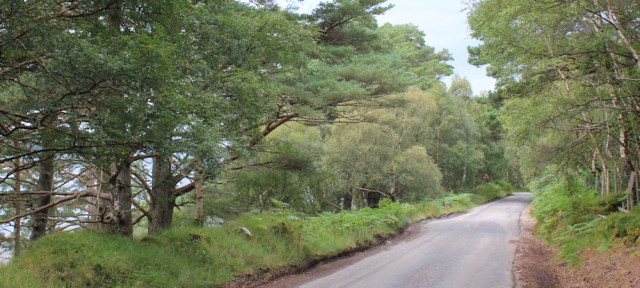
The road winds close to the shore. Rocky cliffs on my right. Water on my left.
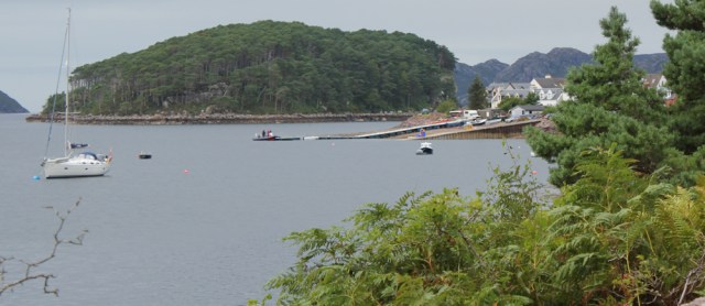
There’s Shieldaig, just a few more corners to go, and I should be there. The rocky island, covered in trees, is Shieldaig Island, which is apparently now home to several breeding pairs of sea eagles.
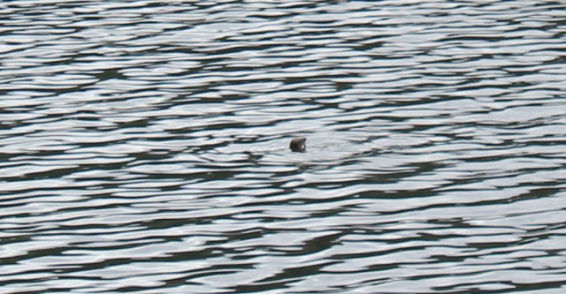
I keep looking up in the trees for squirrels, and up in the sky for sea eagles, but don’t spot either. Because I’m continually looking up, I nearly miss seeing the ripples in the water… oh, a seal?
No, it’s an otter. A sea otter.
I swing up my camera, but only manage a few blurry shots of a head that might be a seal, but was most definitely an otter. You will just have to believe me.
I’ve reached the turnoff to Shieldaig.
When I parked my lovely Beast in this little layby earlier, it was empty. Now there are several cars and vans here, with groups of tourists taking photos.
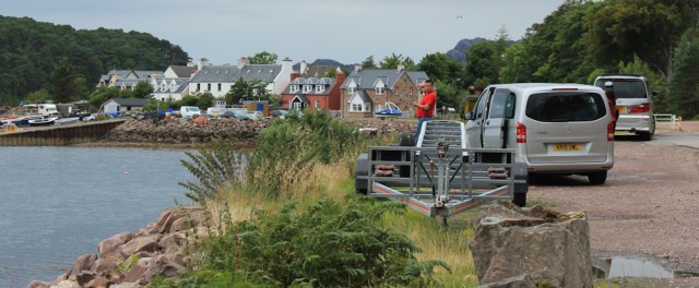
I walk through Shieldaig. The tourist information boasts that Shieldaig is a place to spot wildlife. Not with all this bustle going on! It’s a pretty place, but seems positively crowded compared to the northern part of the Applecross peninsula.
When I’m walking alone, I often yearn for company. But, I always find it an uncomfortable shock to step from isolation into the middle of groups of people. I head back to the safety of the Beast.
Miles walked today = only 7 miles
Total distance around coast = 4,439 miles
Route: (morning black, afternoon red)


Ruth, you have no idea how much I am looking forward to your next set of posts! Otter watching is my most precious memory of time in Torridon.
Looking at the photos again, I’m now wondering if my otter was really a seal after all, 😆
Hi Ruth, in photo No.10 is that the Shieldaig monster out there?
By Jove. I think you’re right.
I’ve only ever seen a red squirrel once, when I went to Formby a few weeks ago for a day out. I’ve been to Formby loads of times, including walking through it on my coastal walk, but never seen one before. Then one just appeared on the fence in front of us and hung around for a while. It was nice, although I’m not that discriminatory about them like some people – I like grey ones too 😊
I understand what you mean about appearing out of the remote wilderness into a town with loads of people. I feel like I’m a little bit more worthy than them, having walked there…. until I get in my car and drive home of course!
I remember seeing the signs about how those woodlands at Formby were a good place to see red squirrels, but I didn’t see any. I have seen them often on Brownsea Island however (located in Poole Harbour, owned by the National Trust) and also on the Isle of Wight. They are rather cute.
I’ve only ever seen red squirrels in Anglesey, while sitting in my parked car and (entirely by chance) next to a red squirrel feeding station. They are very, very shy creatures.
Yes, Paul, I also feel I deserve to have the place to myself, having made the effort to walk there 😀 Also, after hours on my own, seem to have a widened circle of ‘personal space’ and feel a weird anxiety about having people come so close – although they’re not close really! (I now have this anxiety all the time, but that’s because of Covid 😕)
Sadly I had to do much of this walk in the rain so I didn’t manage to spot as many things as you. Strangely I remember there were a lot of cement mixers going along the road when I walked here. I did like Shieldaig however perhaps it wasn’t as busy as when you were there or perhaps because I’d come from the other direction (Torridon) where it was similarly busy.
It’s funny how different place strike us differently. I loved Lochcarron, for example, and loved Plockton, but felt no real appreciation for Shieldaig on this brief visit. Think I was just tired after quite a long stay in Applecross and also frustrated because I’d taken a long time to get nowhere fast 😆
You say you don’t seem to have walked far in the time taken but you have really done Applecross justice which I’m sure you will always treasure. Now for Torridon.
You’re right, Conrad. I enjoyed Applecross, and in retrospect I’m glad I made the most of my time there.
I like both species of squirrel but definitely have a soft spot for reds. I’ve only ever seen them on a trip to Brownsea Island. As I read your blog posts of Scotland I have more and more admiration for your walk – Scotland is so huge and all the ins and outs along the coast must make it seem even bigger.
I found an interesting web link in an online forum, which gives some old maps of Scotland. See https://www.sabre-roads.org.uk/maps/
If you change the drop down “Select a Category” to “Maps hosted by NLS” (National Library of Scotland) by default you seem to get the Ordnance Survey maps from about the 1950s ish I think. There is a lot of interest I found. For example, there is no road shown between Shieldaig and Torridon. On the Applecross peninsula, the coast road you walked around on this walk didn’t exist (and interestingly it also shows the footpath I walked around the top of the peninsula between Kenmore and Cuaig that is no longer shown on the maps). The only road to Applecross is the Applecross pass and the road down to Toscaig.
Further south the road around the south side of Lochcarron doesn’t exist (so the crossing was via the Strome Ferry). No bridge to Skye or at Dornie, etc. It also shows a path all the way from Toscaig to Kishorn. Anyway I found it very interesting.
If you switch the category to “Os One Inch Maps it shows a version I’d guess is from the early 1970s. Now the road around the south side of Loch Carron exists and Strom Ferry is still shown (but appears to have been crossed out later with a pen) but the Applecross coast road still isn’t.
I found it interesting and it might be useful for planning since it seems to show a few more paths (though whether they still exist or not, who knows?)
Wow, thanks for this wonderful link Jon. What an interesting site! Yes, may be useful in finding forgotten paths, and also fascinating to see how places have changed and how the road system has developed. Just spent an hour exploring the various maps on the site.
That first section of road was where the idiot in the pick-up truck was driving so dangerously. Luckily, he encountered none of your sheep or cyclists. Shieldaig struck me as a lovely setting when we stumbled upon it en route for elsewhere and stopped for a quick look. Hopefully you found it as agreeable on foot (apart from the crowds!)