
[This walk was completed on Sunday, the 14th May 2023]
I’m going to follow another official “core path” over the hill and down into the next valley and through the settlement of Kirtomy. It’s only 1.25km away. Piece of cake!

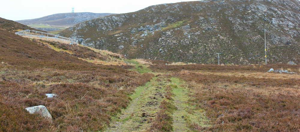
The path is a track really, with vehicle treadmarks in the dirt, but it is steep. I have to stop frequently to rest to admire the views. I love looking back at the route I walked earlier. There is Swordly West on the other side of the valley, the green lane slanting down through the trees, the strange little junk-yard I walked through a few minutes ago, and the public road to Swordly East just below me.

But I must press onwards. This walk is taking longer than I planned. Wow… it is really STEEP!

Another rest stop photography stop and a chance to admire the view again. Shame the weather isn’t better, but at least it is not raining.

Finally, I reach the crest of the hill, and the track begins to dip downhill. There is a strange enclosed area to my left with a metal fence around it, and beside the track are piles of stones arranged in rough circles. I consult my map… ah, yes, there are supposed to be “hut circles” up here.
I walk around and try to take some decent photos of the hut circles. To be honest, I think the more obvious circles are probably old sheep enclosures, possibly made from stones salvaged from the ancient huts. Anyway, the structures are covered in bracken and hard to photograph.
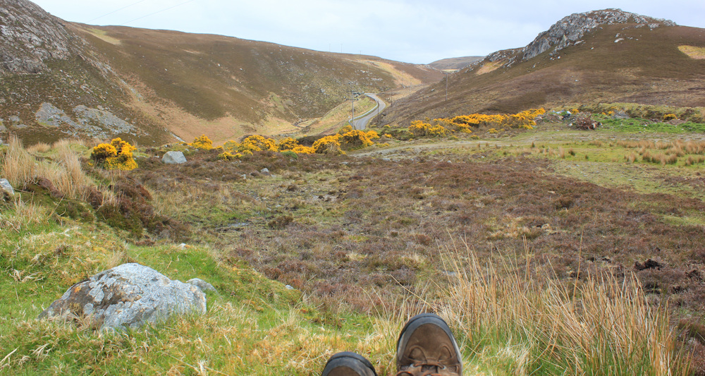
Making use of one of the larger stones, I sit down for a rest and to eat my lunch. It’s gone 3pm, and I should be ravenous but, strangely enough, I seem to have lost my appetite recently and am relying on my watch to tell me it is time to eat. Maybe I’m getting old? Anyway, it’s a great lunchtime view.
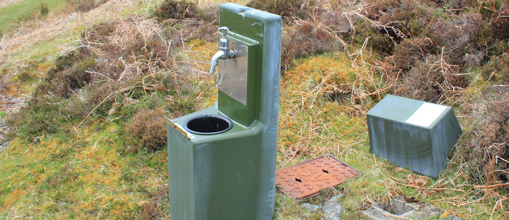
My map shows a spring nearby – Chalybeate Spring – but I’m disappointed to discover that the water source has been modernised. The strange, fenced-off area is probably where the old spring used to emerge. Here is the new version. An unromatic green pillar and a tap!
That must be the settlement of Kirtomy below me. I head off, following the track as it winds down the slope into the valley and towards the road.

There are quite a few houses along the road. I pass a North Coast minibus, parked by somebody’s residence. And then am overtaken by a noisy crowd of motorcyclists. They reach a bend in the road and stop. Are they lost?

After a brief discussion, they swing their bikes round and head up the road again, roaring past me. Yes, probably lost!
The settlement of Kirtomy lies spread across a fertile river valley, and the road swings around between fields to cross over the Kirtomy burn.
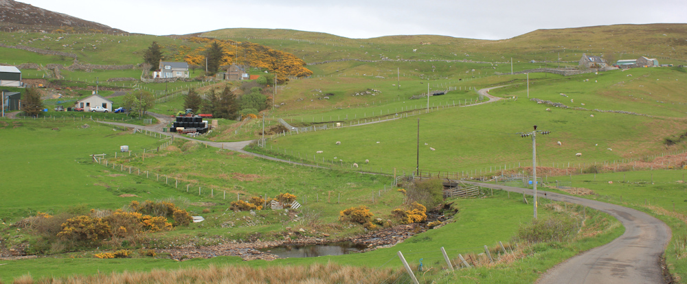
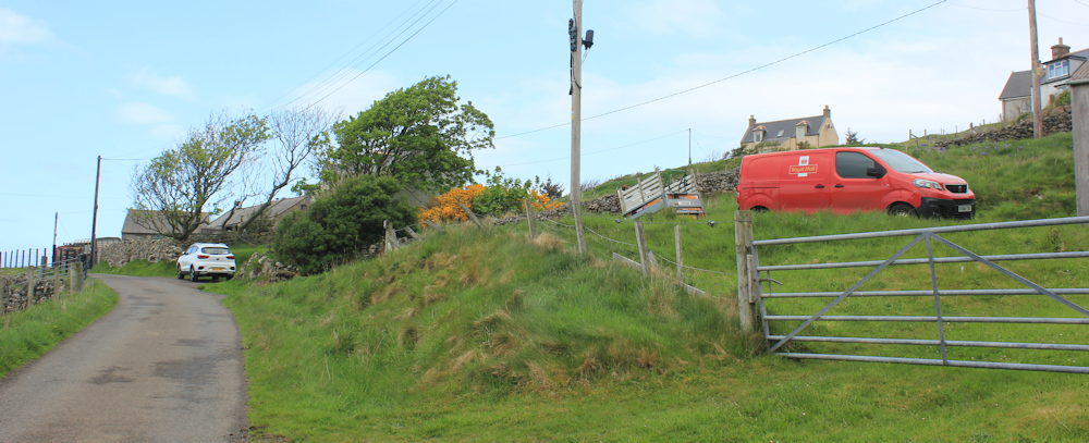
It’s quite a large place, in terms of the number of properties, but seems to have no shops or amenities. I pass a post office van which appears to be stationary – maybe parked outside the delivery man’s house?
I continue following the road as it takes me up the other side of the valley. The sea is below me – Kirtomy Bay. No beach, as far as I can make out. Just a rocky shore. I would love to walk closer to the shore, but the valley is divided into strips of fields with walls and fences. And there are cows…

… I really don’t like wallking near cows. But, from a safe distance, it is lovely to see the baby calves in the fields with their mothers.
Checking my map, I find the track I need. It turns off the road, heading further up the hill, and goes through a farm yard. I walk past a couple of barns. In one, a little lamb looks out at me from beneath an infra red lamp.

Chickens are rooting for food in the grass verge.

The track is stony and climbs higher. I pass a number of residences. Sea gulls wheel and screech above me. Wow, this is another STEEP hill.

The views are great, but the weather remains murky and my photographs turn out to be disappointing again. There is Kirtomy Bay below me. The next bay must be Swordly Bay, and the far headland is probably Ard Farr, with Farr Bay hidden behind it.

Meanwhile, the track keeps climbing. The fields have lost their arable appearance and now appear stony and barren. The wind blows stronger and chilly. I pass decaying farm machinery…

… and the remains of a dead sheep. It is now the middle of May, but still cold, so the winters here must be ferocious and cruel.

Still climbing. When I set off up the track, I could hear the sea gulls above me. Now, I realise the sea gulls are below me… I’ve climbed so high. Look at that wonderful view.

I’m not at the top yet. Onwards. Will this hill ever end?

Suddenly – a sound of barking, and two collies run towards me. Their tails are wagging and they give me a quick sniff and run back to their owner, who turns out to be an older woman. She expresses surprise, “We’re not used to seeing anybody up here!”

She asks if I have left my white van on the track over the hill, because she wondered who it belonged to. No.. She also asks if I’m heading for the abandoned village. No, I didn’t know there was an abandoned village near here. But, I am heading for the large metal pylon-like structure on top of the hill and then hope to follow the track down to the road. Does this track lead back to the road? Yes, she assures me, it does.
It was nice to meet someone and have a chat, if only to confirm that my planned route is feasible. We say goodbye and she heads off down the hill with her two excitable dogs.
I’m still climbing upwards. There’s the tall pylon structure. Getting closer.

From here, I can look across a wide, empty valley and down to the sea. Check my map. I think the abandoned village she mentioned is called Poulouriscaig, and is somewhere over the next ridge. Would be nice to go and explore… but it’s too far off my route and I can’t see an easy track.

Onwards and upwards. I’m getting closer to the top. This hill is called Cnoc Mor, which I think just means Big Hill!
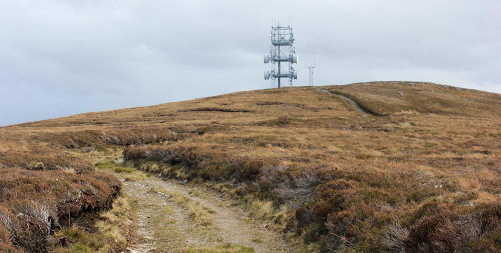
And here I am, at last. At the top.
I wonder what this structure is? I had assumed it was a mobile phone mast, but it doesn’t look right for a phone mast. Maybe a relay station for an off-shore structure? Maybe an early-warning station?

[Later, I try to look it up on the Internet, but can’t find out anything about the mast.]
I sit down on a rock to have a drink and eat a snack. I’ve spent so long climbing this darn hill, I’m determined to enjoy the views. Shame about the haze.
This is the view looking westwards towards Bettyhill, which is invisible at the moment. Check my map. The lake beneath is called Dubh-lochan. Ah, another one. “Dubh” just means “black” in gaelic! Black Lake.

Looking eastwards, I can see another lake – Loch na h-Imriche. Loch of the Migrant. Here the landscape is flatter, bleaker, and with fewer mountains visible. That’s the direction I will be heading in tomorrow.

It’s nearly 5pm. I’ve spent enough time up here and the air is growing even chillier. Time to head down.
This must be the access road for the mast on top of Cnoc Mor. The road has got an excellent surface and I make rapid progress down the hill.

Keep stopping to take photographs. Love the textures in this landscape. The white structures on the far ridge belong to a windfarm. Maybe the mast on top of the hill has something to do with the farm? – but it seems a long way away.

Further along the road, I spot a white van. This must be the white van the woman I met earlier was talking about. When I walk past it, I can’t help peering inside, and it looks empty. Wonder who it belongs to and where they are at this moment?

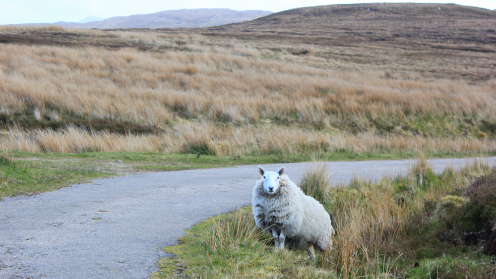
Other than the van, there is no sign of human beings along the road. No buildings. No other vehicles. Only sheep.
The end is in sight. I can see the main road ahead, and I can even make out my camper van – the blue and white blob just to the right of the centre of the photo below.

I was a little worried about what would happen at the bottom of my access road, where the map shows a “ford” as the road crosses over the Kirtomy Burn. But, I needn’t have worried, as the ford has been replaced by a substantial bridge.
Back on the main road, I turn right, and have another little trek uphill and back to my van, which is parked near the turn off to Kirtomy.

Finding places to park along this road was tricky. I didn’t like to leave my van so near to the turn off, on what is effectively an informal slip road, but there wasn’t much choice.
Now, I’m heading back to the Bettyhill Hotel, where I will spend a second (and final) night booked into my comfortable room.
Miles walked today = 7.5 miles (feels much longer!)
Total around coast = 4,984 miles
Route (morning in black, afternoon in red):


It sounds like this wasn’t an easy walk Ruth. Yuck to the dead sheep but the little lamb looks sweet.
It was tough, but beautiful.
It’s a communications relay station. They were also used in Australia in a daisy chain fashion to cover long distances between towns. They have since been replaced by fibre optics.
ah, thank you!
As your posts are nearly a year old you may well have finished by now or at least making inroads into the east coast?
As always these Scottish posts are uplifting for me and make me a trifle envious. You do seem to get good weather as well.
I do not wish to pry and respect you may have personal reasons for the long delay with the posts but I can’t help being curious.
Hi Conrad. I only walk in sunshine! You are right to be curious about the long delay. I have been very ill, but on the mend now.
As always I am in awe of your courage in taking on Scotland alone…..I am writing here because I can’t find any other way of contacting you. I have a blog and you have been so kind as to add it to your widget list of coastal walkers. However, you have me down as “Patricia” because for years I walked alone. When my husband retired he started to join me on the walks so I was wondering if you wouldn’t mind changing the widget to the name of the blog which is:
https://joiningthedotsblog.com
Thank you
All the best
Patricia
Thank you Patricia. Have changed the title of the link. How lovely to be walking with your husband… I hope he can keep up!
Oh, the dreaded cows! I think I get more nervous of them as I get older. The weather may be murky but it does add a certain atmosphere to the photos.
Cows are best avoided, unless served with chips on a plate!
This was very interesting to me as I skipped that path on account of it being very boggy-looking on the rainy day that I walked near it (I just returned to the road, which was less interesting but easier underfoot).
Nice to see all the various animals; that sheep looks perfectly posed!