
[This walk was completed on Sunday, the 14th May 2023]
This will turn out to be another day of wonderful walking, despite the dodgy weather. I set off from my hotel, past a car park with some smelly public toilets and an electric charging point for cars. (There are a lot of these charging points dotted around the wilds of Scotland, but I have yet to see a car using one.)
Follwing the road down the hill, I pass a campsite. This is the cheap site which I nearly booked for last night, but opted for the expensive hotel room instead.
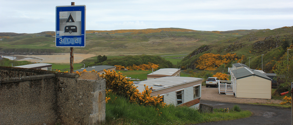
When I phoned, the owner said, “No need to book, just turn up.” This made me rather suspiscious, as most of the campsites on the NC500 seem to be booked-up days in advance.
I’m glad I avoided it. Really just a mobile home site with a few large camper vans… and with portacabin toilets! Yuck. To be fair, they do seem to be building a proper toilet / shower block, but at the moment it doesn’t look very appealing.

Just past the campsite, a path leads down towards the beach. This is Farr Bay. I follow a father and daughter down to the sands – she is optimistically carrying a fishing net.
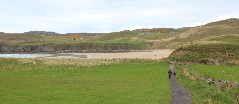
Farr Bay beach looks small on the map, compared to yesterday’s vast expanse of sand at Torrisdale Bay. But appearances can be deceptive. It’s actually a large and beautiful beach. More accessible than Torrisdale and so, in Scottish terms, positively crowded!

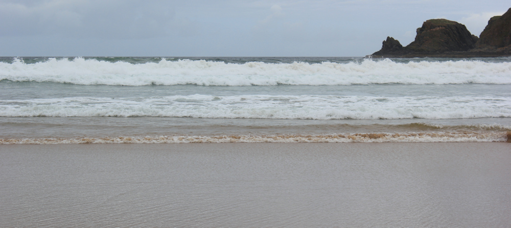
I walk near the waves, appreciating the power of the sea, but not so appreciative of the chilly wind that accompanies the rolling breakers.
At the far end of the bay, a path leads up onto the headland. This is my planned route today and I’m pleased to see there really is a path – there is indeed one marked on the map, but you can never be too sure in Scotland.
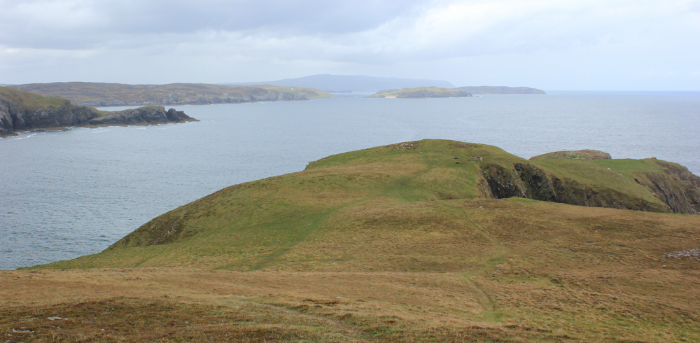
It is quite a climb, but the view from the top of the cliff is marvellous.

According to my map, the path heads inland over the headland and down into the next valley, to a place called Farr. But instead of crossing inland, the path appears to just follow the cliff’s edge.

When it does swing away, it is to reach the highest point on the headland – a hill called Ard Beag, where there is, of course, a cairn.

From here the path dwindles and becomes little more than a sheep trail. The point of the headland is called Sgeir Dubh (which means Black Reef in Gaelic). I don’t go right to the end, but near enough to appreciate the wonderful views. Shame the weather is a little too murky for good photography.
Turning the corner, I look into the next bay. This is a complete contrast to Farr Bay, being wild and rocky – and nameless on my map.

I’m planning to pick up the dead-end road that ends at the farm perched above the rocky shore. First I have to navigate a steep little river valley, and realise I must jump across the actual river. I travel some way inland before I find a place that seems safe to jump – and I make it to the other side without falling in.
Have I come the wrong way? This surely can’t be an official path?
I’m reassured when I walk past a sign saying “To the Beach” which points vaguely in the direction I’ve come, and I soon find myself at the bottom of a field, where a green, sheep-covered track leads up towards the farm.

I’m always nervous approaching a farm. Scared of being challenged. But the gate at the top of the hill is wide open and, despite numerous parked vehicles, I meet nobody.
Here is the road. It leads back to the main A836, passing through a place called Farr on route.
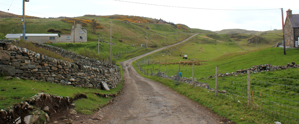
The road climbs uphill towards the place called Farr, and provides a great view back to Bettyhill. Even the unpleasant-looking campsite appears scenic from this distance. Yes, there really are two boats parked among the sheep.

Hello cow. Highland cattle may look fierce, but they are smaller than most breeds and appear very docile. This one studiously ignores me, and I take her photograph while safely behind a protective fence. (I really don’t like cows, even cute-looking Highland cows.)

I never get to see the centre of Farr. Perhaps this is it? A couple of houses along the road. I like this one – modern looking and with great views across the fields. Visitors seem to be arriving. Wonder if they are paying guests or visiting family members?
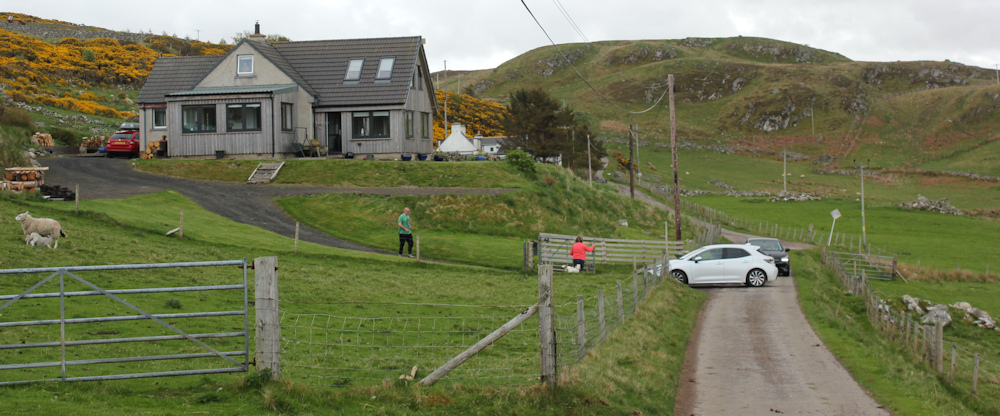
Beyond this attractive house, I come to a junction in the road. “Swordly West” says the road sign, indicating a dead end. I’m confused by the sign – my map just says “Swordly”. I check again, but this is definitely the road I need to take.

It begins to drizzle at this point. I stop to pull on my waterproof trousers – always a struggle over my walking shoes. As soon as I have them on, I zip up my jacket, stow my camera in my pack, put on my rucksack’s rainproof cover, and… the rain immediately stops. Ah, the weather is mocking me! I sling off my rucksack and pack away my waterproofs.
The road winds across an almost-empty landscape, dotted with a few houses. I meet no cars, only sheep. (The map promised me cairns nearby, but I’ve been flustered by the on-off rain, and I forget to look out for them.)
Now, over a cattle grid, and I’m looking down into the next valley. This must be Swordly. Or, more specifically, Swordly West.

The road has been vaguely heading towards the coast, but now it turns away to zig-zag down the hill, past a railway signal – a confusing feature as there is no sign of a train track. The bay ahead is Swordly Bay, but I only get a tantalising and distant view of it.

Here is another confusing feature – a gun mounted in the garden of a house! Is it intended to to deter lost English tourists?

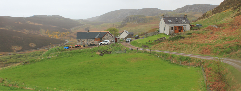
The public road is about to come to an end, but, down in the bottom of the next valley, I can see the next dead-end road that I’m hoping to join. That’s where I need to get to… and here is a promising sign… a core path signpost pointing to somewhere called “Swordly East”

There is no Swordly East marked on my map, but I guess this is the right way to go. More of a track than a path. Houses ahead.
At the end of the track, a new house is under construction – or an old house is being renovated. It takes me a while to find the continuation of the path, because the house appears to have been built directly across it, but here it is. Ah, a proper green lane. How wonderful.

This must be an old route connecting Swordly West with Swordly East. I doubt whether many vehicles use it now. Maybe just the odd tractor?
I’ve already negotiated one gate, but the second gate presents more of an obstacle. It is secured by twisted wire threaded through a barbed wire fence. I can’t open it, and have to climb over instead – so I assume not even tractors can use this route now.

On the other side of the gate, is further evidence that this was once a bonafide route between the two separated parts of Swordly. Here is an old ford connecting my defunct green lane to a track on the opposite side of a little river, the Sworldy Burn
The ford turns out to be rather deep. Oh dear, I’m not looking forward to wet feet! But, searching upstream, I spot a footbridge. It’s rather rickety. The handrails have fallen off and there are missing planks…

… but I cross the river without falling in and with dry feet. Success.
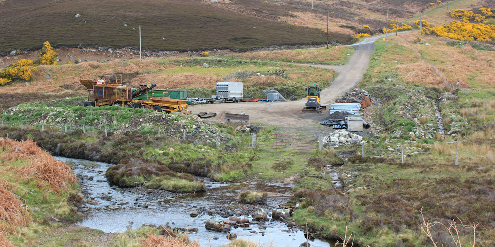
I walk through the yard at the end of the track, which houses a collection of odd vehicles, piles of construction rubble, and some strange-looking equipment. I’m not sure if it’s an official storage yard, or just a convenient place for people to dump stuff.
Head up the track and soon join the next road. Turning left along here would take me to East Swordly, I presume. But I’m hoping to pick up another path to take me over the hill and into the next valley… ah, there it is… another green lane leading up the slope.

Again, my map promises “hut circles” and even a “field system”, but it is unclear what lies behind the gorse bushes, and I’m too tired to go exploring. I have another hill to climb!
[To be continued…]
Route so far:


Farr Bay beach looks amazing! Oh, and that heather 😊. Your pictures really want me to get out there again!
You will. Soon.
so you’ve got magic waterproofs too Ruth ?😁
Yes! It’s amazing how they turn the rain off 😀
Bettyhill sounds like an elderly lady who always goes to church on Sundays :) I like the sheep and the cow, and Farr Bay beach looks lovely. I’ve stayed on some quite basic sites over the years I’ve been camping but I wouldn’t fancy that one, it doesn’t look very attractive at all.
It’s an odd name, but I like it. Hope I’m not doing the campsite an injustice – would be fine in a huge motorhome with your own toilet and shower!
I think you largely followed the same route as me. I enjoyed Farr Bay especially a lovely beach and Bettyhill seemed a bit of a local centre because although small it had school, hotel shops etc.
As to the electric car charging points I did make use of a few of them – when I could get them to work (but not an experience I would wish to repeat!).
I think they were working on the house you mentioned when I was there too! Maybe it has changed hands since or maybe they still haven’t finished!
I remember your story about the electric hire car, and still shudder when I think about it.
A pretty walking day, and not all on roads!
It was good to be on proper paths again. And I was very relieved to find the paths on the map actually existed (sort of!)
Even though you though the light was murky, your photos capture the beauty of the sea and landscape we can enjoy all over the British Isles – what a lucky band of pilgrims we are - Cheers Russ
Thank you, Russ. Yes, we live on a very beautiful island, and I never really appreciated it until I began this walk.
When we passed that impressive looking gun in 2009, the owner was standing nearby so we asked him about it. He told us it dates from 1917, is a six-pounder and was found in a wreck in Loch Eriboll. He also told us we were quite safe because it only fires potatoes these days!
Ha ha, that’s good to know!
The looked uninviting but good to know from Rosemary that it only fires potatoes! Good for you, climbing over the locked gate! I’m guessing it shouldn’t have been wired shut like that.