
[This walk was completed on the 8th May 2025]
The Nigg ferry is not supposed to start running until the 1st June, but the lady at the campsite told me it had started running early this year. Wonderful!
So, I drive to Cromarty, park the van, and wait for the little ferry to arrive. I LOVE ferries.
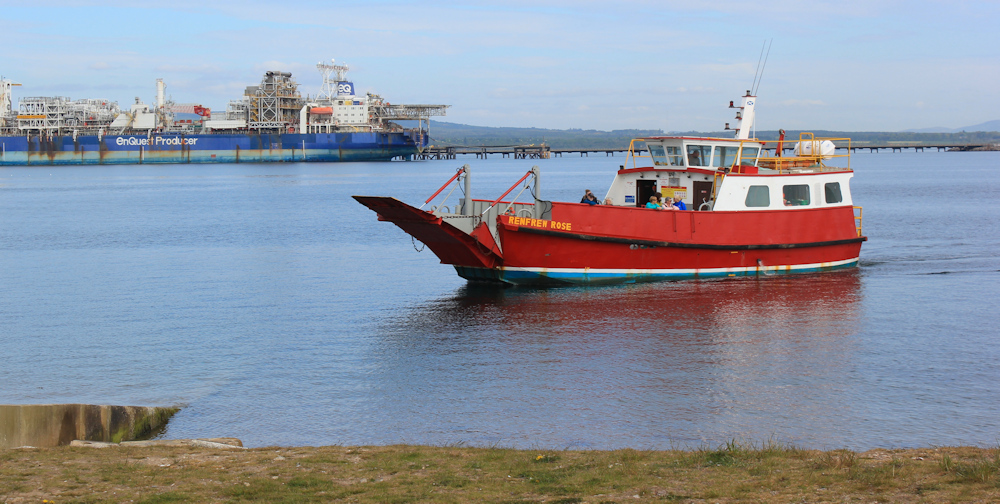
A return trip for me and my bike costs £15. A bargain really – it’s a long way round by road.
Once safely across, I cycle back to the secret parking area at Chapelhill (‘secret’ because not marked on the OS maps – I discovered it by accident!) Chain the bike to a post…

… and set off walking towards the church. Now, Nigg Old Church is fairly famous, and features on the Visit Scotland site. It even has its own signpost on the road.

To be honest, I can’t see what all the fuss is about. From a distance, the place looks more like a garage than a church – with all those vehicles parked outside!

When I get nearer, I realise some men are working on one of the vehicles – an old tractor. Anyway, the church itself looks shut, so I walk on by.
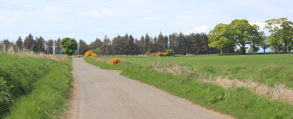
The road takes me past a few newish bungalows, and then past a farm. All fairly featureless, but a pleasant stroll in the sunshine.
(In fact, it was warm enough yesterday, and today, to sit outside in my t-shirt in the evening sunshine when I finished my walk. I think the first time I’ve ever been able to do this in in the Highlands.)
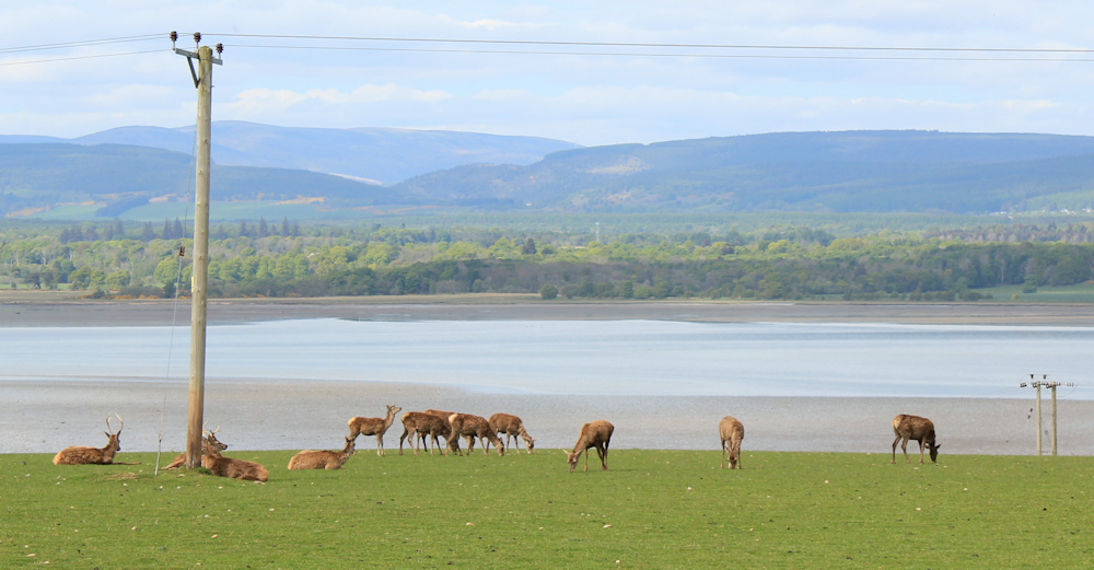
To my right is a gentle sloping hill. Arable fields and cattle. Look at the tiny new-born calves!

To my left, green fields slope down towards the water. This is Nigg Bay, while the broad sandy areas are grandly entitled ‘Sands of Nigg’ on my map. A herd of deer are grazing in the field. I don’t know if the farmer knows the deer are eating his grass.
There is a scattering of houses along the road. I pass through a place called Pitcalnie first, and then I will reach Nigg Village Not much here… apart from this impressive building. At first I think it is another church (perhaps it once was) but a sign tells me this is Nigg Hall.
Someone with talent – and a sense of humour – has hung a series of mini scarecrows along a fence.

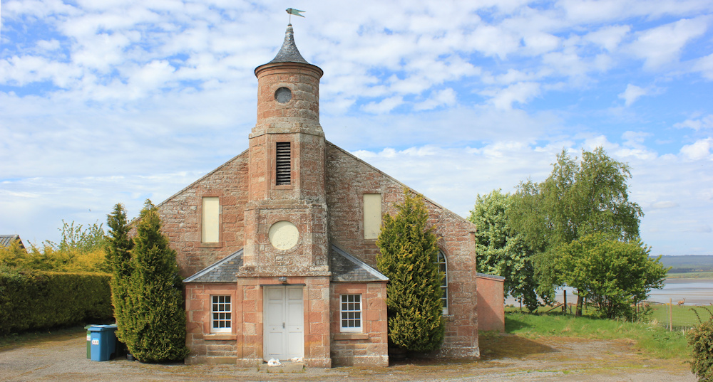
Trees line the road, there are houses on either side behind hedges. I reach an old church with a little car park and one parked car. ‘Nigg Old Church and Nigg Stone’ says a sign on the wall.
Ah ha! The penny drops. THIS is Nigg Old Church.

A couple are just leaving, and are full of praise for the little church and the Nigg Stone. I begin to tell them the story of the 3 Viking princes (as told to me by the local man in Hilton, and described on my previous blog post) but their eyes begin to glaze over. So, I shut up and let them get into their car!
The church is a low, whitewashed building, with an old cemetery in front. Very attractive.

Inside is the famous Nigg Stone. This is one of the three Pictish stones in the area – the replica stone at Hilton of Cadboll (the original stone is now in the National Museum in Edinburgh), the stone enclosed in perspex on the hill at Shandwick, and this one in Nigg Old Church. Three stones for three drowned Viking princes – according to the story.
The stone is protected by a curved rail and held upright by metal supports. Originally, it was in the churchyard, but blew down in a storm in the 1700s, and was moved into the church for protection.
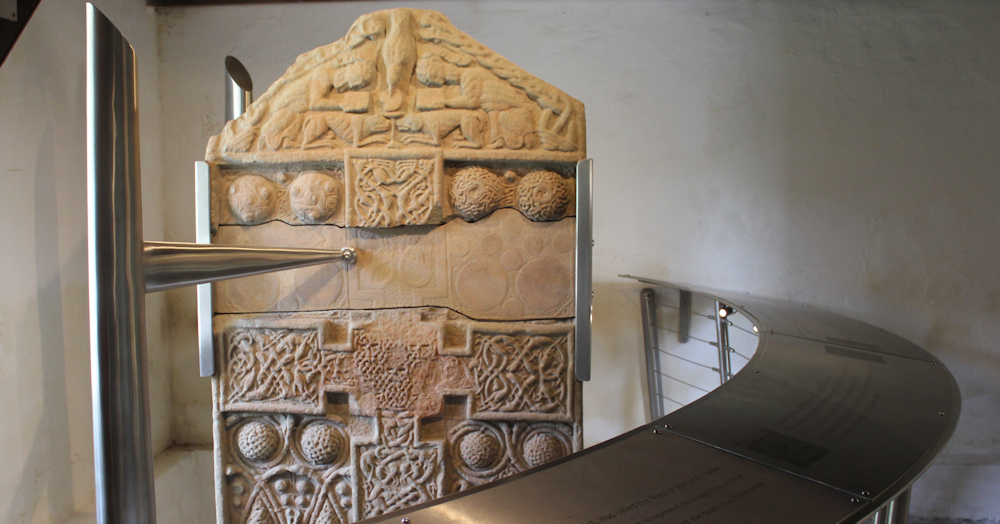
You can see how the stone has been reconstructed and put together from larger fragments. A fascinating object.
Inside the church, various souveniers are for sale. I’m not really interested in tea towels, but I buy a little bottle of locally grown, cold-pressed rapeseed oil. (Since my cancer diagnosis, I am very careful what I eat, and I only use cold-pressed oils nowaday.)
A sign in the graveyard catches my eye. ‘The Cholera Stone’. I assume it is an ancient memorial to villagers lost in the cholera epidemic in the 19th centure (like the cholera monument in Inver).
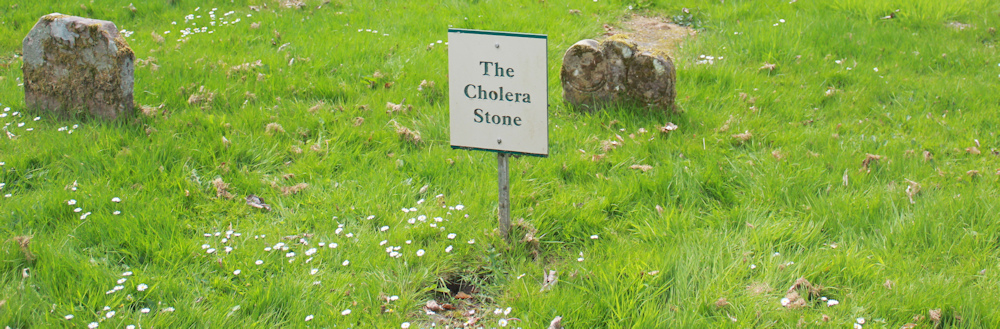
I also assume the Cholera Stone is the little squat stone behind the sign.
[Both these assumptions were wrong, as I will explain later.]
Leaving Nigg Old Church behind, it is only a short distance down the road to reach the turn off for Castlecraig. This is where I am heading next.

At this point, and despite the delight of discovering the Old Church and the Pictish Stone, I am feeling a little disappointed with Nigg. I was hoping there might be a cafe here, or somewhere I could have a cup of tea and a piece of cake. No such luck!
Onwards, up the road to Castlecraig.

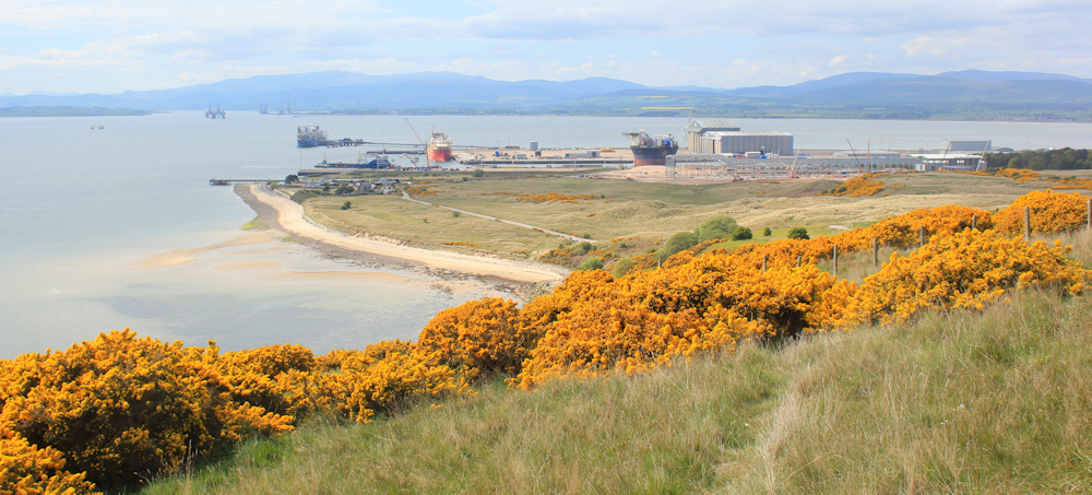
The road curves up the hill. Up and up. But it is a lovely walk, with fragrant gorse hedges, and sheep and catttle in the fields. I stop at a bend to admire the great views looking down to Nigg Bay.

A little further along – still climbing steadily – and I can see the Port of Nigg, where oil rigs are built and refurbished. I’m surprised by the sheer size of it (a size that was more obvious when I cycled past the site this morning on my way to Chapelhill). An important local industry.

My road is slowly climbing to the top of a ridge. Looking at my map, Castlecraig is tiny, and so I’m not expecting a cafe at Castlecraig either. At this point, I am very hungry. It is nearly 3pm.
I perch on the verge by the side of the road and eat my picnic lunch, before setting off again. Still going up… and up.

What a beautiful day! I’m quite hot!
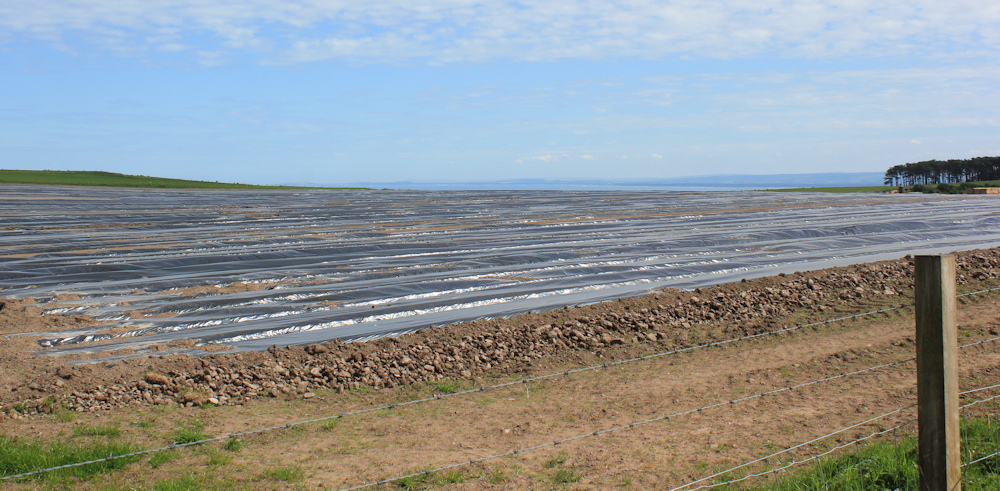
At the top of the hill, the road begins a slow descent. But just look at this field! Acres and acres of shiny plastic sheeting. I wonder what they are growing here?
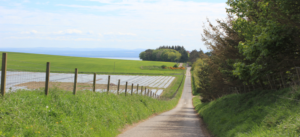
After a mile or so of steady climbing, it is good to be going downhill again. There is the sea ahead – not Nigg Bay, now, but the open waters of Moray Firth.
Castlecraig is really just one large farm. The road turns sharp right, and appears to go right through the farmyard. I hesitate. But a white van overtakes me and drives through the yard, so I follow him.
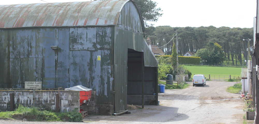
On the other side of the yard, the road surface changes to gravel. The van has stopped as if he is unsure if this really is a road, but then sets off again. I follow his dust cloud.

But I’m not following this gravel road for long. I soon reach the footpath sign for the headland of North Sutor, and I turn off up a side track.
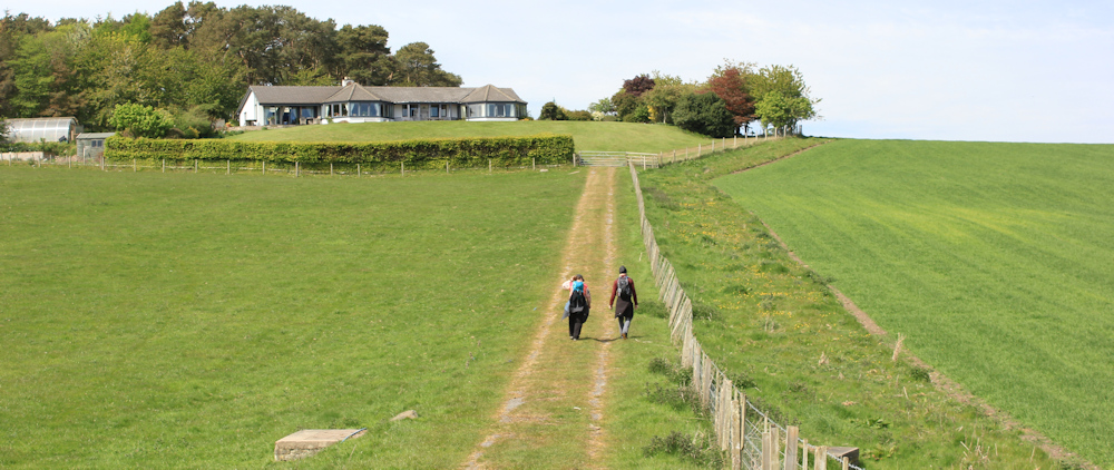
The track takes me uphill again. ‘Vehicular access to private residents only’, warns a sign. After passing a number of houses and going through groves of trees, the track tops the rise and heads downhill towards the sea.

There are two figures at the far end of the track. At first, I think one of them is wearing a kilt. But, when I get nearer, I realise it is an illusion – a tall bearded man with his sweater tied round his waist.
The couple tell me there are cows with calves in the field by the coast, and so they have been forced to detour and turn up the track. But, luckily, they indicate the cows are in the field to the left, and I am heading to the right. The woman says the path down to Nigg Ferry is fine, just a bit narrow with ‘prickly stuff’ on either side.
We part company, and I take a photo of them walking up the hill. He really DOES look like he is wearing a kilt from a distance, doesn’t he?
I turn right, and keep a wary eye out for cattle, but I don’t see any. I pass a number of concrete structures – left over from WW2, I presume.
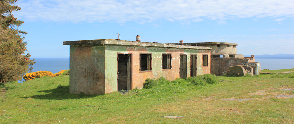
The path is no longer an obvious track, but remains quite clear. More structures. Hard to imagine a world war raging on a beautiful day like this.

The path becomes narrower and traverses a steep slope. Below me, the town of Cromarty is soon in view. The town sits on a low peninsula that juts out into the water, guarding the entrance to Cromarty Firth and the harbour beyond. It is easy to see why Cromarty was an important settlement.
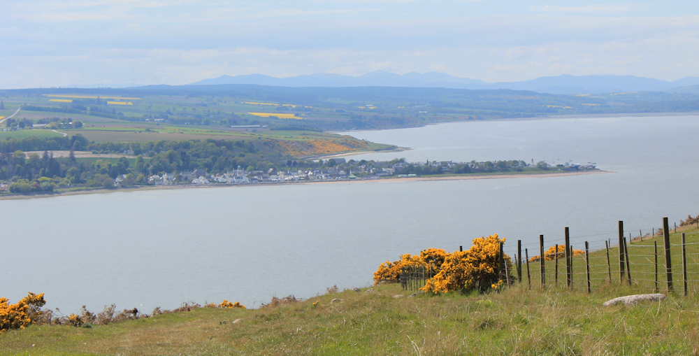
The track carries on, going gently downhill. A gate to navigate. Bright gorse on either side. The hazy outlines of Cromarty Firth in the distance. The Firth really is a huge body of water. I’m so glad the ferry was running today and saved me miles of road travelling.

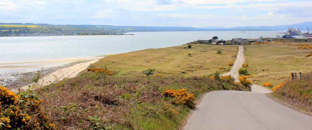
Round a bend, and further down still, the path narrows and – the woman was right – I have to fend off prickly gorse branches with my walking poles. Now, Nigg Port is visible.
Beyond this thicket of gorse, the path turns uphill to rejoin the road. This is the same track I started out on from Castlecraig – when I was following the white van. But the gravel track has now become a proper road. In the distance, ahead of me, are the tiny figures of the couple I met earlier.
But, as soon as I can, I leave the road and head down a path towards the shore. This is a truly beautiful spot – a beach of clean sand and a clear blue sea, with the gorse-covered headland called North Sutor. Other people obviously like coming here too. There are a couple of rickety chairs, and a few home-made benches to sit on.
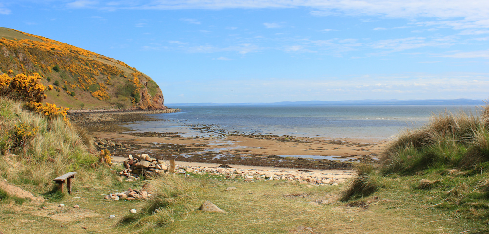
I sit on a wobbly bench, shrug off my rucksack, and take out the remains of my picnic lunch. Time for a rest, a snack, and just some time out to enjoy the view.
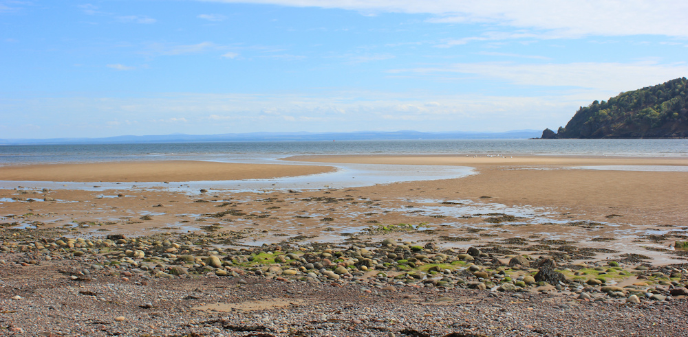
This is the entrance to Cromarty Firth. And where the water passes between the headlands on either side, it is frothy and white with dancing waves. A flock of gulls wheel and dive above the busy waters – there must be plenty of fish out there.
In the blue distance is the shore of… is it Aberdeenshire? Once I’ve reached there – and that I will do in a few days – I will have left the Highlands behind.
There is that familiar tug of sadness. Although I love making progress on my trek around the coast (and walking around the whole coast is what my quest is all about, after all), I still develop attachments to areas. I’ve spent so long in this lonely, savage, wonderful, wild and beautiful part of Scotland, it is hard to believe that one day it will all be behind me.
The beach stretches all the way from North Sutor to the slipway for the Nigg Ferry, nearly a mile away. While I am sitting, I see the ferry arrive and depart again. I’m not bothered that I’ve missed one ferry. It will be back soon.
Eventually, I pack up my rucksack and set off down the beach. Take my time. As I get nearer to the pier, I pass some dog walkers, and an elderly person slowly making her way over the sand. Will that be me in a few years time?
The ferry slipway sits in the shadow of an old, decrepid-looking pier. I arrive just in time… here’s the ferry.
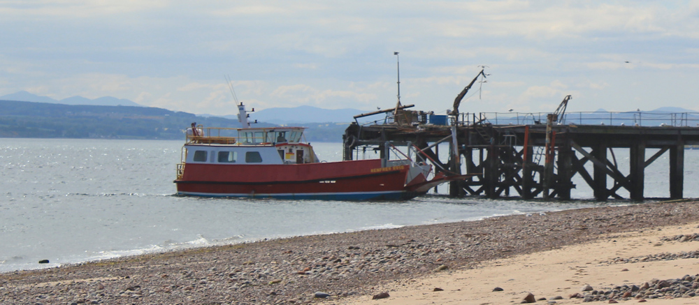
Sitting on the edge of the concrete slipway, I watch the two vehicles disembark (two vehicles is all the ferry takes). They have to reverse up the concrete slipway – a mildly terrifying manoevre with a stiff penalty to pay if you judge it incorrectly.
I watch carefully, because in a short time I will be bringing my van over before I go and collect my bike. Reversing in the van is not much fun – no rear-view mirror and no parking-assist cameras. Hope my reversing skills are up to it.
Follow up notes:
You can read about Nigg Old Church on the Visit Scotland site, and about the Nigg Stone on the Highland Pictish Trail site.
The Cholera Stone is not a memorial stone at all, but marks the spot where, according to local legend, a cloud of infected vapour was captured by throwing a piece of cloth over it and weighting it down with a heavy stone. The actual stone lies flat on the ground in front of the sign, barely visible in the grass.

My kind readers will be pleased to know that I managed to reverse my campervan off the ferry without hitting the sides of the ferry, and without falling off the slipway.
Miles walked today = 6.5 miles
Total distance around coast = 5,215.5 miles
Route:


So glad you got to see the stone!!
It’s wonderful to see your message in my email and know you are back on the track again. I took the time to look at some of Google Maps photos of Nigg Old Church and I see it houses a few Pictish stones.
Keep it up!
ray
Love your story of recounting the three vikings tale and their eyes glazing over… that’s a familiar feeling for me!
Lovely weather up there for you! I guess it’s not worth walking 5216 miles just to see the Nigg Stone then?
Sorry, I meant the Cholera Stone… I’d walk twice that to see that Nigg Stone.
Local ferries are so often the champions of transport for the walker, and I too am a great lover of them. So glad you made yours, and didn’t detour off the slipway when reversing 🙂 – Cheers Russ
I presume you had booked accommodation at or near Cromarty. Good business for the ferry with your comings and goings. Still a bit of Scotland left and I guess more suburbia and less of perfumed gorse, but all welcome for those who have the desire to see over the next hill or round the next bend. You are an inspirational adventurer.
Glad to see that ferry is still running. I can remember that when I walked this area it had been suspended for a year or more before I think due to the previous operator going bust and had only just resumed. I remember a lady being very nervous reversing her (hired) van off it, but she managed OK and glad to hear you did, too.
This is a beautiful stretch of coast and I did it in the other direction but I think it is nice to end with that lovely beach.
What a lovely walk this was – gorgeous views, a beautiful little beach towards the end, and lovely weather too 😊