
[This walk was completed on Monday, 12th May 2025]
Ormond Castle turns out to be a disappointment. I climb a grassy hill, and find a few stones and a flag pole. That’s all. Even the views are disappointing, as the sea mist has thickened and is drifting in a chilly cloud around the place.
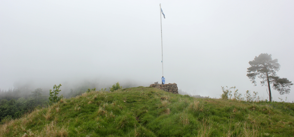
Never mind. I’ve seen much better castles in Scotland. Onwards.
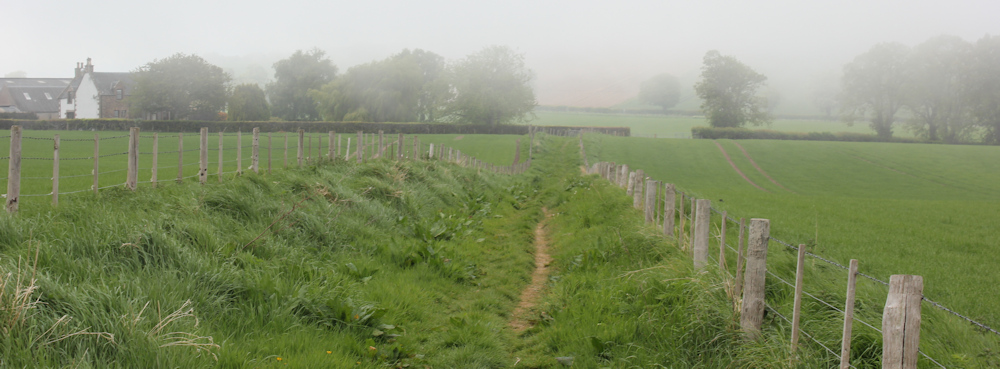
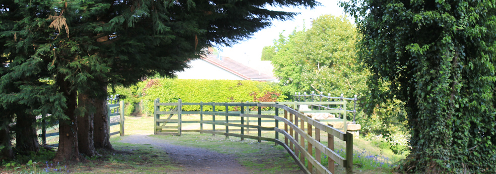
The path takes me off the hill, and leads through farmland…
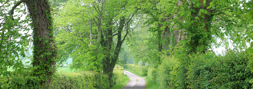
… until I join a quiet country lane. Grass growing through the tarmac. Trees arching overhead. This is a lovely walk and, despite the mist, I feel enfolded in bright greenery.
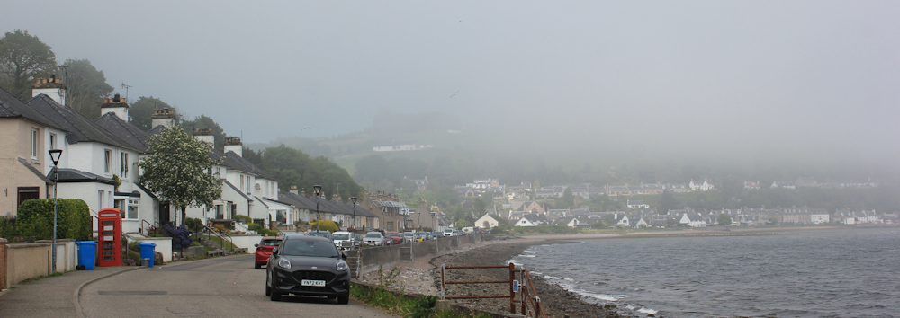
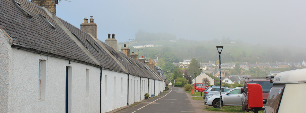
The little road joins a larger one, and I am back on the sea shore. This is the village of Avoch. On the bus this morning, the automated announcements called it “Och” – I have no idea if that is correct or not.
Houses line the coastal road. I’m guessing this bay is really attractive in the sunshine. Shame I can’t see much of it today!
I pass an old red telephone box. This one has been converted into a book exchange, and the sign implies the local council have been involved.
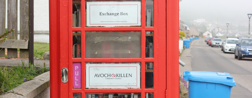
It is always sad to see these wonderful red phone boxes – such an iconic and British symbol – disused and abandoned. But at least many of them have been preserved and are being used for alternative purposes.
Avoch (or Och) is a really pretty village and seems to have kept its original character. A wonderful row of tiny white cottages lines the coast road. Do people still live in these? They are very small.
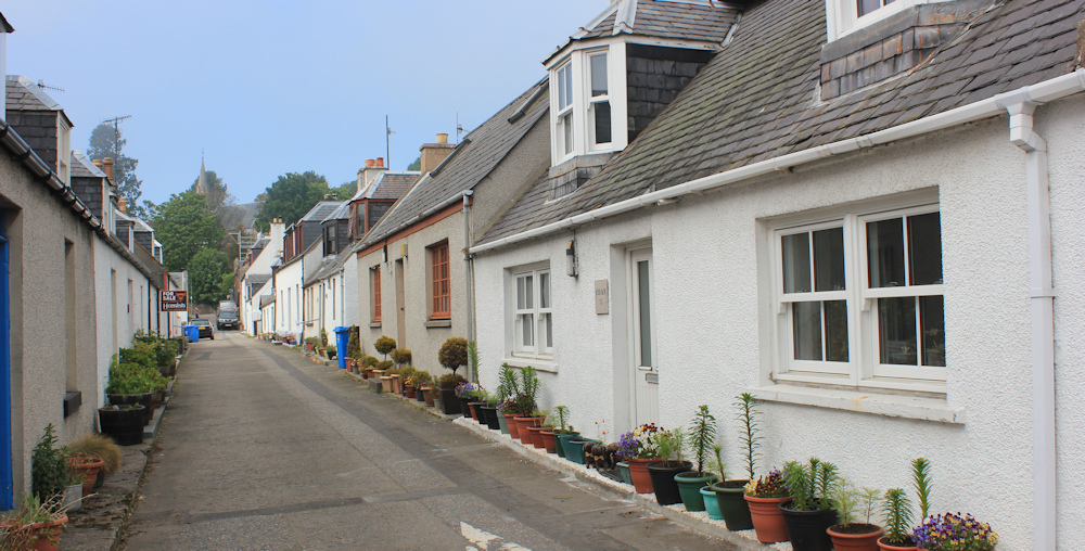
A glance up a side-street and the sense of careful preservation continues. More traditional cottages. Rows of flower pots outside. Everything neat and cared for.
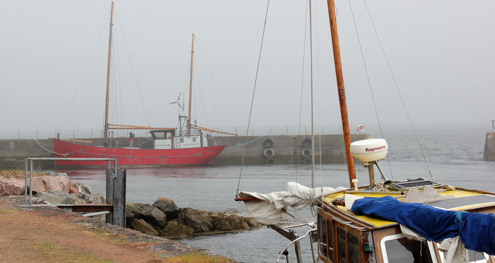
The coastal road ends with a communal garden, a children’s mural, a plaque celebrating the wives of fishermen, and a closed public toilet. I take some photographs of the little harbour. Is that a fishing boat? Do fishermen still bring their catches into Avoch?
Because the toilet is closed, I am forced to visit a cafe for a cup of tea, and a rather vile-tasting biscuit. Then I follow footpath signs up the hill. I’m looking for another Core Path (another one that follows the old railway line), that should take me into Fortrose.
Walking the road would actually take me closer to the sea (as per Rule number 2 of my rules for walking the coast) but I scouted the road while on the bus this morning, and it is narrow, with constant fast traffic, and no footpaths. So I have decided it is not “safe, legal or reasonable” to follow the road.
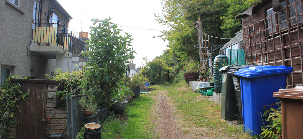
My walking route has an unpromising start – walking uphill past back gardens and bins, and apparently going in the wrong direction altogether!
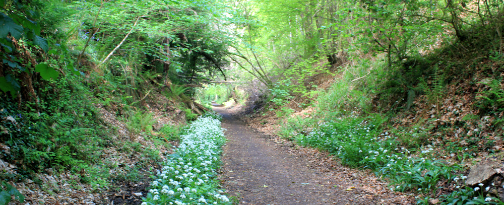
After swinging round in a tight bend, the signs point me along a tree-lined path. The dire warnings about motorcycles and dog poo are a little off-putting…
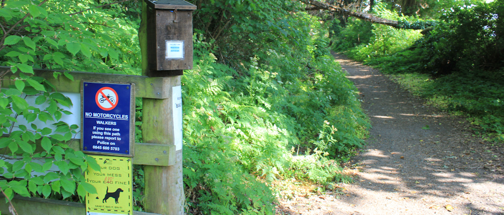
… but at least I’m heading in the right direction. And the path turns out to be truly lovely. A screen of trees hides the busy road beneath me. The bluebells are out, and looking gorgeous.
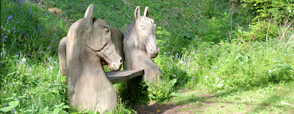
Love this seat. Kelpies? Hand carved in situ, I guess. But I’ve just had a sit-down in the cafe, so I don’t deserve another rest. Onwards.
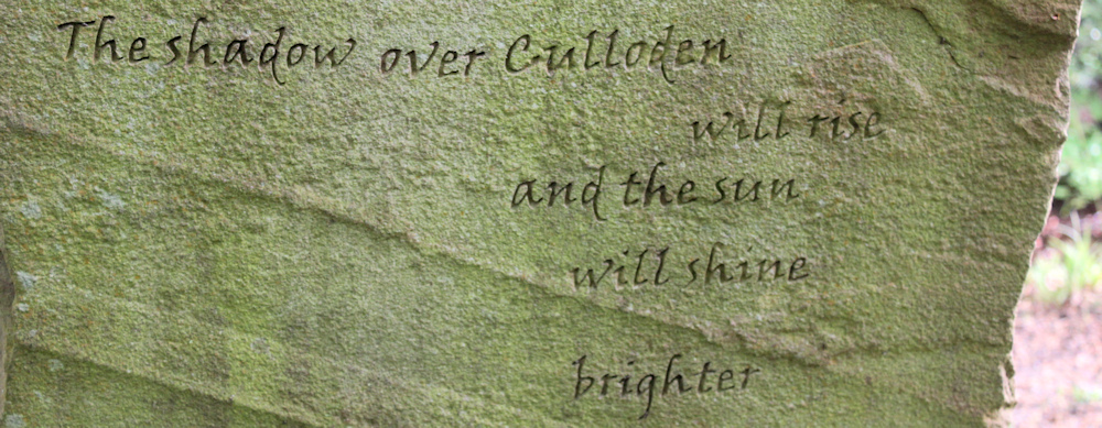
Another bench to tempt me. This one is close to a large stone with some inscriptions carved in the surface. At first I think the stone is a memorial…
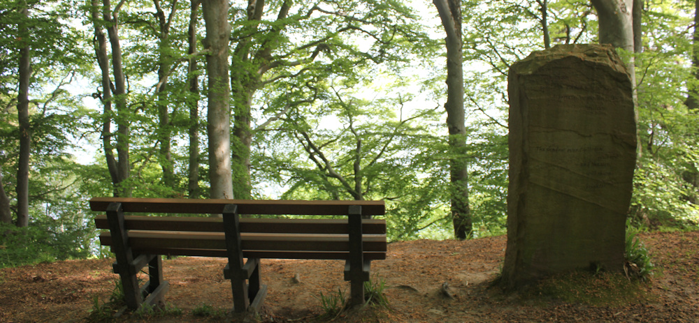
… but I read the writing etched on its surface, and it seems to be some sort of artwork. “The shadow over Culloden will rise and the sun will shine brighter.” Poetry? Where is Culloden?
It’s all a bit mysterious, but I’m too tired to linger. Must get on with my walk.
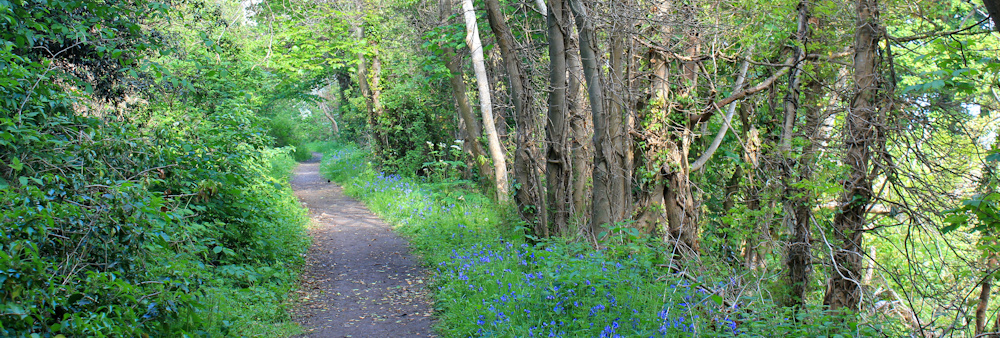
Like most routes along old railway lines, the way is long and straight and I’m now walking through a cutting with raised banks and no view. Usually, I would find this boring, but it really is a beautiful path. Bluebells have given way to wild garlic – and the smell is strong and heady.
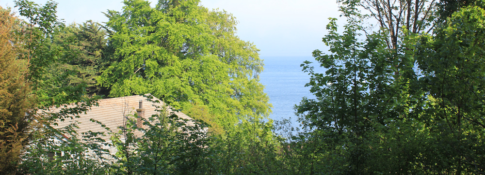
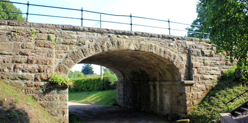
Finally, after another mile or so, I realise I must be on the outskirts of Fortrose. Garden walls on my left and rooftops beneath me on my right.
Ah, here is the end. The path passes under the deep shade of an old yew tree (I think it’s a yew) and emerges into brilliant sunshine.
I realise I am on an embankment, and must climb down some steps to reach the road. Here, I stop to take a photograph of the old railway bridge.
Fortrose has been a great base for me for a few days – with interesting buildings, shops and a chippy (which I’ve visited nearly every evening so far!). But it is plagued by traffic that funnels through its narrow main street.
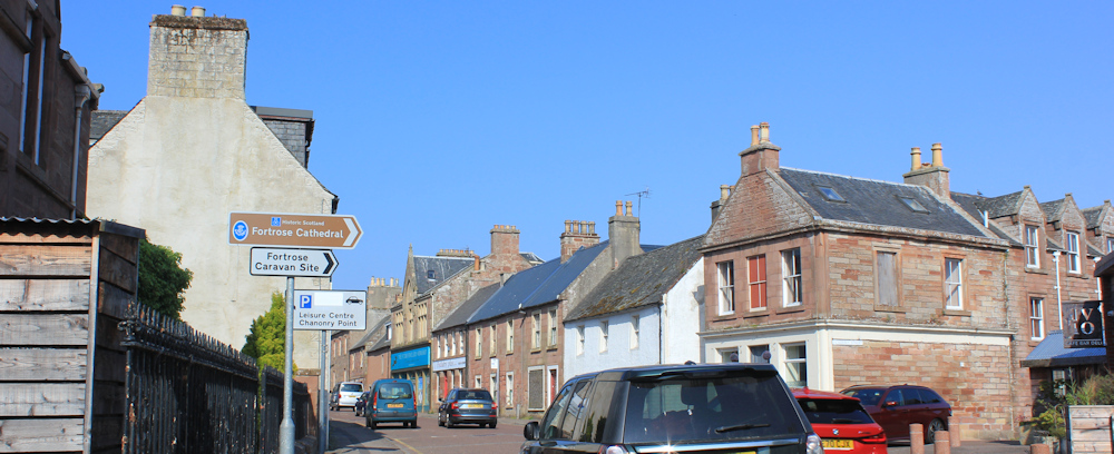
I’m heading for Fortrose Cathedral, where I have left my Scooty bike. A cathedral in such a small place? Yes, there has been a cathedral here for over 1000 years and the current ruins date from the 14th Century.
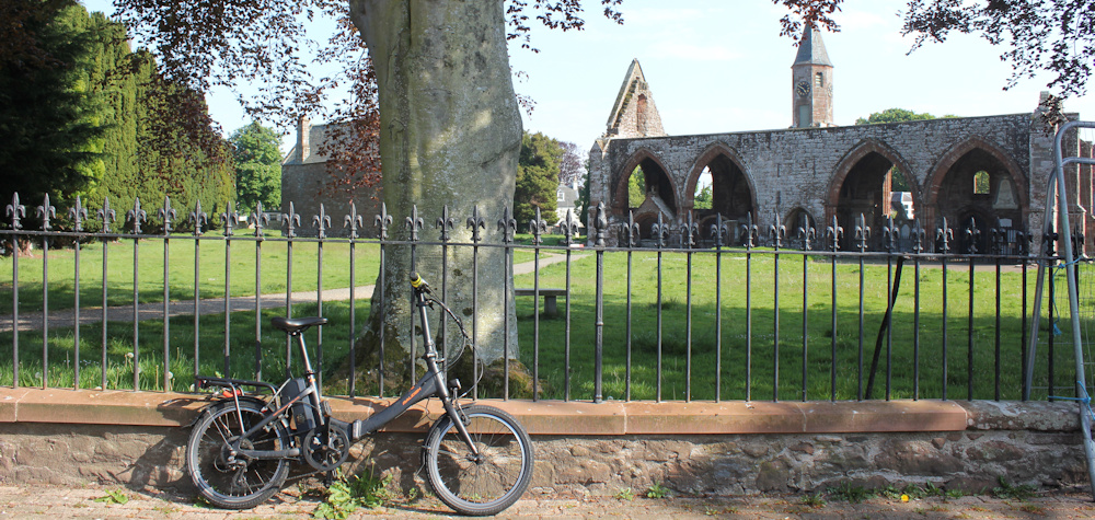
Fortrose is a place with dolphins and a lot of history. I am moving on tomorrow, and will be sorry to leave it.
I unlock my bike and freewheel down to the campsite. It has been a good walk today, but I am feeling very, very tired.
[Later I look up the mysterious inscription on the stone monolith. It turns out to be a phrophecy by a seer called Kenneth Mackenzie, a man who may or may not have actually existed. Brahan Seer – Wikipedia]
Miles walked today = 9.5 miles
Total distance around coast = 5,243 miles
Route today (morning in black, afternoon in red):


According to Wikipedia, Avoch is indeed still a fishng port https://en.wikipedia.org/wiki/Avoch#Industry
Ah, that’s encouraging. Thank you for finding out.
you might be tired but you did nearly 10 miles. You are doing well.
Not too bad for an old woman 😀
I loved that unusual seat.
ray
It really was a work of art.
Hi RuthI hope you are well.I always read your posts with interest. I am still plodding round Wales with the more limited target of just England and Wales. Only 400 miles to go.If you had time could you do a brief post just to say you are still going and where you have now got to.Best wishesJohnSent from my Galaxy
Only 400 miles? You’ll be finished in no time. Are you going to do Anglesey?
Yes, I am still here, and just about to set off on another walking trip to Scotland – hence the desperate rush of blog posts as I catch up from last year!
yes should be there next year. When do you think you will finish?
No idea, John. My mileage is very low these days. Maybe in the next 10 years? ;D
It’s all too easy to get fretted about the mileage, isn’t it. I’m doing so little these days I often get frustrated by it, and then when I do get up there to walk I get knackered after a short distance. But then I have to remind myself that it’s not about getting nearer to the end, it’s not about numbers. It’s about the journey, the enjoyment of being there, seeing new things, even rubbish things like that big stone ball in Creetown (that was great).
When you read a good book you don’t jump to the last page to see what happened, the enjoyment is in all the pages in between.
So it really doesn’t matter if you walk 2 miles or 20 (not that I could). Some of my most enjoyable coastal walks have been the very short ones. I’ll probably never finish the whole thing, but I don’t care, it doesn’t matter. You have achieved an amazing thing on your walk already, written a fantastic blog, so many people are in awe of you, and you should be very proud of yourself.
Love a coastal walk. Living in Rugby, Warwickshire, we are smack bang in the middle of the country with not even a whiff of sea air 😀
Hi Paul, I used to live on the border of Rutland. It was miles from the sea too, and I missed it so much. I think that’s why I started coastal walking.
Very well done! You are an inspiration. Keep going – we so enjoy your journey.
Thank you, Angela
Invisible archaeology and their interpretation sites marked on maps is one of my little niggles. I’m working up to doing as blog post about it. Good to see your increase in mileage, not that it really matters – just enjoy.
I live in hope of finding something very exciting. Sometimes you do, but often it is just a pile of stones!