This morning the sun is shining. The fine weather isn’t going to last for long, but I manage to photograph Maryport looking beautiful, with the tide in and the harbour full, and a line of wind turbines gleaming on the horizon.

This morning the sun is shining. The fine weather isn’t going to last for long, but I manage to photograph Maryport looking beautiful, with the tide in and the harbour full, and a line of wind turbines gleaming on the horizon.
I catch the train from Maryport to Workington. Today, due to transport logistics, I’ve only planned a short walk. So I can relax, take my time, and enjoy the day. And I’m following the official England Coast Path – so nothing could possibly go wrong, could it?
From the train station, I follow the England Coast Path signs along a road, and then climb a footbridge over the railway line. On the other side, I stop to take a photograph looking back at Workington. The Cumbrian hills make a dramatic backdrop.

Shortly after I pull my camera out, I realise I’ve lost the polarising filter from off the front of my lens. Not a good start. Continue reading
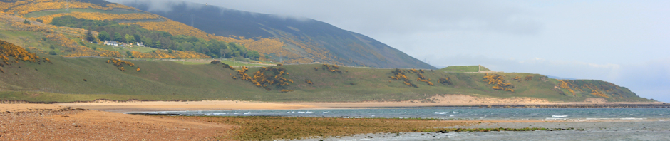
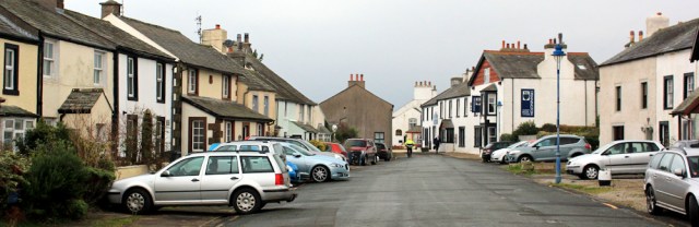
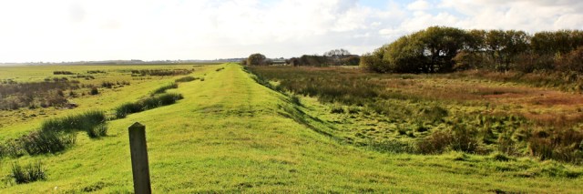
I park in Parton, duck under the railway line, and find the shore. This is Parton Bay and I think there might be a sandy beach here when the tide is low.
I catch the train to St Bees, an ancient village and once the site of a Norman Priory dedicated to Saint Bega, from where it gets its name. I pass her statue (I think) on the bridge as I walk towards the coast.
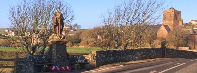
[Later I learn the statue is St George, not St Bees, after all!] Continue reading
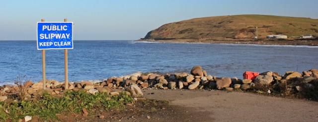
I catch the train back to Sellafield station. I can’t find a way to continue via the beach (the River Ehen is in the way) and so head inland along the road.
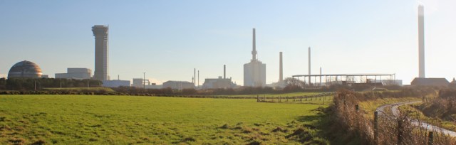
Sellafield’s high perimeter fence, checkpoints and security men are intimidating, and put me off taking photographs. I turn off down a track and, as soon as I’ve gone far enough and feel ‘invisible’, I turn around and take some shots of Sellafield’s skyline.
It’s a misty January day in Ravenglass, and I’m about to start my first coastal walk of 2017. It’s good to be back.
Ravenglass seems cut off from the rest of the world. Surrounded by water, it is the place where three rivers with weirdly short names (the River Esk, the River Irt and the River Mite) all empty into the sea. It was once a busy Roman port. Now it’s… quiet. Continue reading
Should be a short walk today. Only 4-5 miles from Stubb’s corner to Ravenglass. The only problem is… there’s a ford to cross. I’m optimistic all will be well – I’ve brought my waterproof socks with me!
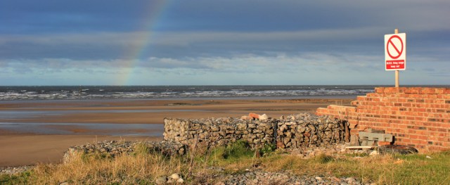
I begin at the southern end of the Eskmeals Range, where a beautiful rainbow hangs across the beach.
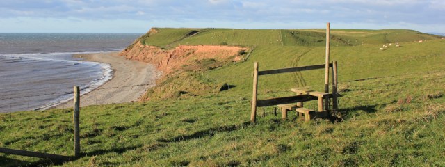
The farm track grows narrower and comes over a rise. The sea is ahead. Now I have a choice: (a) go down and walk along the shingly beach, or (b) stick to the footpath over the top of the cliffs.
I decide to opt for the route that’s easiest on my feet, and best for enjoying the views, and so I choose the cliffs.
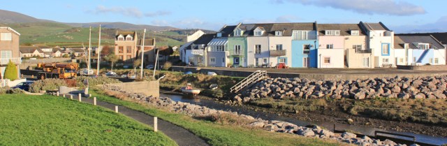
I start my walk from Haverigg, where pastel-painted houses line the little harbour. It looks very pretty in the clear light of a November morning.
Today I’m heading northwards, and my walk begins along a wonderful stretch of sand, fringed by dunes. The tide is low at the moment and the only thing to spoil my enjoyment of the beach is the fact the sea is nowhere to be seen! Continue reading
It’s another 3-4 miles to Millom, and after my snack lunch I resume my walk along the bank, heading southwards and into the sun.
On my right I pass a ruined brick structure, which at first I think might be some left over WW2 defences, but the rusting silhouette of a flying duck makes me think it’s probably used as a bird hide now. Continue reading


Click for further information


Response ID: 328,436,497 Report number: 1222 Location: Ceredigion Coast Path (part of the Wales Coast Path) between Gwbert & Mwnt Date: 04/02/26 2 walkers, no dog, meet about 40 Welsh Black bullocks Pips report: “On the return stretch of our walk we encountered extremely treacherous terrain and a herd of about 40 Welsh Black bullocks […]

Incident number:1220 Response ID: 328,248,081 Location: Back Forest Farm, River Dane, near Wincle & DaneBridge, Peak District ///wasps.promote.homelands Date 26/01/26 Single walker, no dog SY’s Report: “I was heading back to DaneBridge/Wincle from Gradbach/Black Forest. I’d walked by Back Forest Farm along the path between their fields and came to a gate/stile. As I crossed […]

Incident number: 1218 Response ID: 320,795,463 Date of incident: 29.12.2025 Location: Below Denston Hall, Denston Suffolk Status: Lone walker with dog on lead on PROW L.Cooper’s story “I saw a group of cows ahead and waited to see if they would move. As I couldn’t get past without going near to them I backtracked and […]

