
After lunch, I head out along the north bank of the River Taw, leaving Barnstaple behind. This is still the Tarka Trail, and part of the official South West Coast Path route. It’s both a cycling route and a walking route.
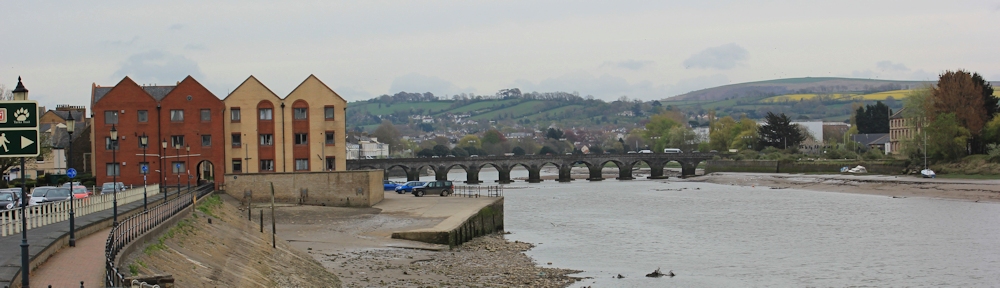
I pass a block of new flats, and look back to take a photograph of the Long Bridge.
I cross over a small river – the River Yeo – via a modern swing bridge – and then walk along beside an industrial estate. This part of the cycle-way is busy with people cycling to and from the industrial estate. Workers, not tourists.
There are, of course, a number of derelict boats in the mud. This one looks as if it is being half-heartedly restored.

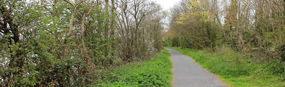
Was this part of the Tarka Trail once an old railway track too? The surface is flat and the path curves gently around the shoreline. On the other bank I can see the route I walked this morning.

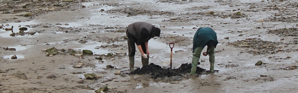
The tide is low – my map shows “Mud and Sand”. Further on I pass two men digging for bait. Looks like there is more mud than sand.
A runner passes me. A few minutes later and they must have turned round, because I meet them running back.
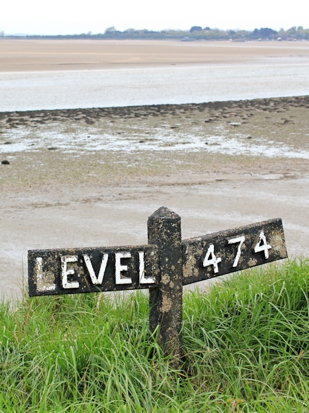 I see this sign: Level 474. No idea what it means but looks like something you would find along a railway line. The path is new, but the sign is old.
On goes the path. I have left the industrial estate and the cyclists behind.
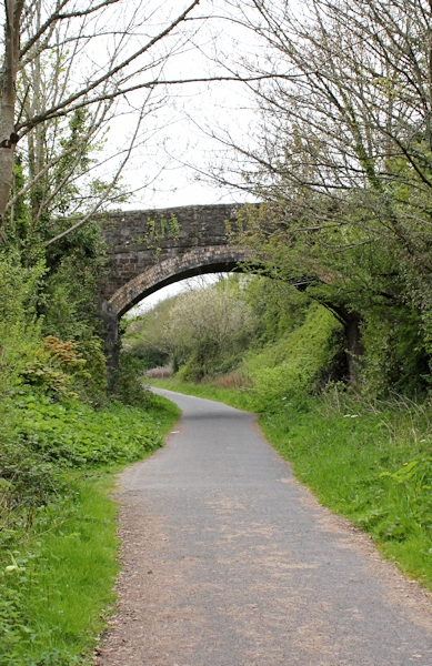
There is not much to see. Mud and Sand. A bridge brings a welcome point of interest. I pass the garden of a hotel and it looks enticing, but I have only just had lunch and need to keep going.
Originally, I was thinking I might get past Chivenor and go on to Braunton today, but the relentless slog of the path is beginning to wear me down. It should be easy walking – flat and a good surface. But I find it monotonous and hard work.
A collection of boats ahead cheers me up. Not exactly a luxury marina, but a sort of informal mooring of everyday boats, the sort I enjoy looking at.
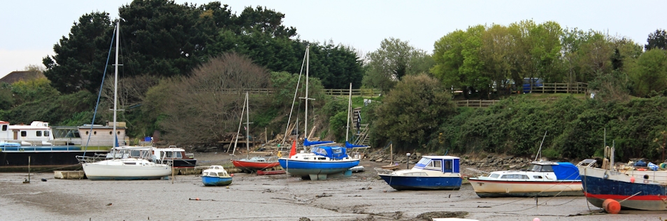
These patches of water along the River Taw have specific names. The main channel is called Fremington Reach, a lovely prosaic name because if you sail along here you will reach Fremington. These sidewaters have different names. Higher Strand, Lower Strand, Foxhole, North Gut.
I am not sure where I am on the map but I hope Chivenor is not too far away.
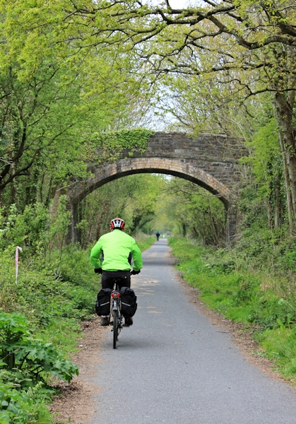
Another bridge ahead. Where do they all lead to?
 And a couple of cyclists appear. They must have come from Barnstaple.
From their outfits and laden panniers, I assume they are locals, maybe coming home from work or shopping. Not tourists.
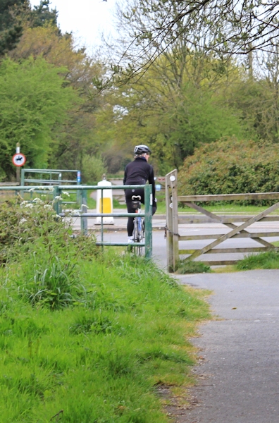
A third cyclist passes me. A woman. It is nearly 6 o’clock . Rush hour on the Tarka Trail!
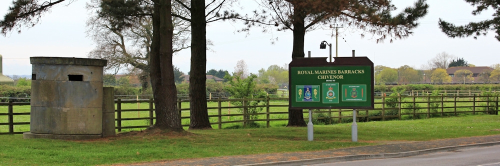
And then I see a road ahead and, suddenly, after three miles of cycleway, I am at Chivenor. Or, rather, I am at a roundabout and I see the sign to the barracks.
There is a bus stop at the roundabout but nobody around. Is the stop in use? Yes, after an anxious wait, two buses appear together. I get on the first one and the second bus overtakes us and zooms off. I am the only person on my bus, all the way back to Barnstaple.
Today has been another dull and overcast day. So I will end this blog post with a photo I took on a previous evening, when Barnstaple was glowing in the evening sunshine, its mellow stone looking similar in colour to the lovely limestone of my home town of Stamford. The tide is high and, if you look closely, you can see there are strange balls of foam floating on the water.

Miles walked today = 12
Miles in total = 1,383 since setting off from King’s Lynn, Norfolk.
Route:


Yes it is and old railway line and used to go to Bideford. It closed I think in the early 1980s. The level 474 is an old railway gradient sign.
Ah, so it WAS an old railway line. Old rail routes make for tedious walking, but my husband rides a bike and thinks the Tarka Trail is wonderful.
Shame that the weather let you down Ruth. No doubt the slog and monotony would have seemed less so if the sun had been on your back. That’s quite an estuary you’ve walked round – it’ll be good to get back onto the coast again.
I think I’ve been spoilt by the beauty of some of the more challenging cliff walks on the SWCP. And the weather didn’t help.
Many happy holidays spent here Ruth when my boys were little. We never walked the Tarka trail though.
My husband (who cycles) thought this section of the Tarka Trail was wonderful. A great surface for his bike. But, for a plodding walker, it seemed very slow and boring
It was the L&SWR’s Ilfracombe branch line, closed in the 1970s. I quite enjoyed that stretch when I did it, but then I’m an engineering nut.
http://en.wikipedia.org/wiki/Ilfracombe_Branch_Line
You also appear to have photographed a Pickett-Hamilton Fort at the entrance to the barracks (the strange circular concrete thing). These were buried on airfields, and were designed to pop-up if the airfield was attacked. Having them underground prevented them from obstructing landing planes. Unfortunately it also proved their Achilles Heel as they would flood.
http://www.pillbox-study-group.org.uk/index.php/advanced-pillbox-designs/part-2-o-z/pickett-hamilton-fort/
I sounds like you’re doing well. You’ll soon have finished the SWCP!
Hi David, so nice to hear from you. Is that baby born yet? I just remembered I promised to send you a copy of my finished Birkbeck assignment – an account of a walk in which you feature. Will be sending you email. x
Famously the Military Wives Choir was formed at the Chivenor barracks by Gareth Malone. The Chivenor wives had a massive hit and Christmas number one in 2011 with the choir’s debut single ‘Wherever You Are’ soon after performing it at the Festival of Remberance in front of The Queen. It went on to become the best selling single in the UK for many years.
Oooh. I saw that episode of The Choir, but didn’t make the connection when I walked through Chivenor. The singing gives me the shivers – in all the right ways! Thanks for posting the link.
Pingback: 141(am) Instow, Barnstaple, Chivenor | Ruth's Coastal Walk (UK)
I hadn’t connected Chivenor with The Choir either. I always watched the series and the song gives me goosebumps.