
[This walk was completed on Friday, 12th May, 2023]
After walking around the shore of Lochan Dubh, I turn back for one last look at Ben Tongue (actually, NOT Ben Tongue, but Cnoc an Fhreiceadain, but I didn’t realise this at the time!). What a pretty view.

A short time later, I come to another loch – Loch Buide. But the countryside has changed. Not only have I lost sight of the sea, but the landscape surrounding the loch is treeless and bare, without even a gorse bush to add colour.

I reach a cattle grid. Once upon a time, the sight of a cattle grid would have filled me with anxiety. But, I have learnt in Scotland that cattle grids are rarely to do with controlling cattle, but more to do with limiting the roaming of deer.

The warning sign on the other side of the grid is not showing a cow, as you might assume, but just a harmless sheep!
I had been looking for somewhere to sit for some time, but could see nothing but damp grass. Now, I spot some rocks just off the road – and I grab the opportunity to sit down and eat a very-late lunch.

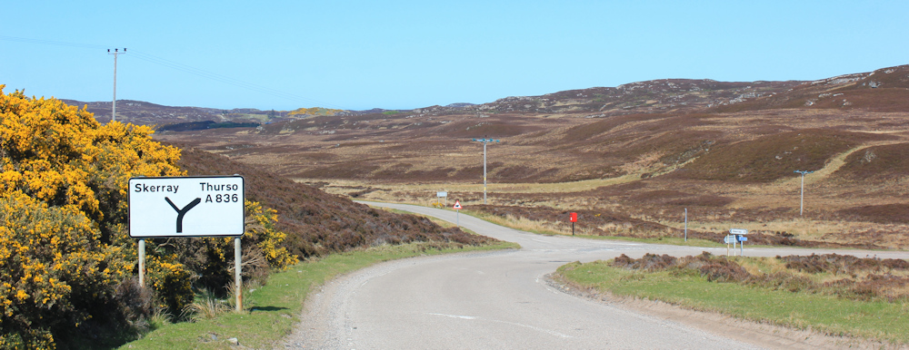
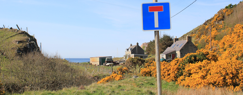
Onwards, along the road, until half-a-mile later I reach a turn off to Skerray.
The problem with parking at the end-point of my walk, is that I have already travelled this road twice – once in the van, and once on my ebike – so the route holds few surprises. I was expecting a barren and empty landscape, but it was a nice surprise to spot movement and see a large red deer.
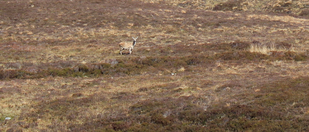
She seemed surprised to see me too. Apart from the occasional car, nobody is foolish enough to actually WALK along this empty road!
It is a looong road, winding through a monotonous landscape, with only a few flashes of colour where a gorse bush has managed to gain a foothold.
A couple of miles later, the road passes over a small burn. Alltan Dearg. It adds some interest to an otherwise boring stretch of this walk.

I pass a turnoff to a place called Strathan. As far as I’m aware, Strathan is barely a village, with just a few scattered buildings indicated on my map, so I am suprised to see a child’s bike leaning against the sign post. It doesn’t look broken or abandoned…
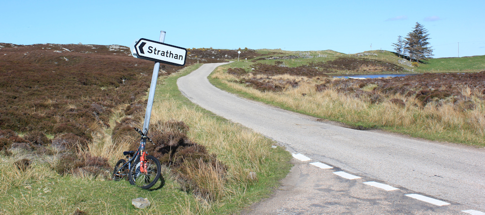
… and later I realise it is probably there to help a child get to and from school. Perhaps he/she gets picked up by a minibus, or a kindly friend, at this point?
Further along, I reach another loch – Loch Modsarie. My map indicates another small settlement nearby, but with a slight modification of the loch’s name – Modsary. Anyway, the loch is very pretty, with a backdrop of yellow gorse, and a colourful small boat pulled up near the bank.

A track leads to Modsary, and I can see the roofs of several houses. A man is sitting next to the track, doing something on his phone, while his dog keeps an eye on my progress along the road. It’s the first person I’ve seen for some miles, and I’m hoping he will look up so that maybe we can have a conversation… but he seems engrossed in his phone.

I don’t turn up the track, but continue along the road towards Skerray. A brightly coloured box proudly pronounces “EGGS”, but when I try to look inside the little hatch is broken and I can’t see inside.

No matter. I wasn’t going to buy any eggs anyway, as I rarely cook anything inside my van – the smells linger – and I’m hoping to eat at the Norse Bakehouse this evening.
Onwards. I pass a sign to a core path – in fact, TWO core paths. Now, I was thinking of going along the path to Strathan (the place whose sign I passed on the road a short distance back). I stop and look at the map.

Strathan is a dead end, but the path does appear to loop around and rejoin this road further along. It is not exactly a short-cut – more an extended diversion. I hesitate. Perhaps the path simply goes to Strathan and doesn’t loop back. Perhaps the route is blocked, or too boggy. The suggestion of two paths is an added confusion.
I’m feeling unduly tired – despite a rest-day yesterday and only covering about 8 miles so far today – so in the end I decide to stick to the road.
The road winds on, through a landscape of rocky outcrops and gorse bushes, until I am rewarded by a glimpse of the sea. (You might just spot the flash of blue to the left in the photo below.)

As I go over a little ridge, the landscape suddenly changes. Here there are cottages. And fields. And a hint of trees ahead. I pass a turn off to a place called Lamigo, where I think the core path would have eventually ended up and rejoined the road at this point. Ah well, too late to worry about that now.

This is a delightful valley. After the bleakness of the earlier part of the road, it is so wonderful to see proper hills, bushes, trees, stone walls, and signs of agriculture. Proper farmland.

I pass a field of cattle – and take a very bad photograph into the sun.

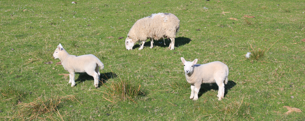
To my right is a pig shelter, but I see no sign of pigs. Further along is a field of sheep. The lambs are no longer tiny… these little chaps are almost grown up now.
I pass another turnoff. This leads to a place called Tubeg where there is a little pier. I hesitate again. Should I go and explore? But my van must be very close now… I stick to the road.
A pile of timber is perched rather precariously on a slope above me, where another track leads up to somewhere called Clashaidy. This is turning out to be quite a populated little valley.

When I drove along here this morning, I struggled to find somewhere to park because the roads were very narrow and single-track, with only the occasional passing space. But I now reach a stretch where there is not just one but TWO parking areas. There is my van, in the second parking spot.

It’s a relief to climb inside and settle myself into a seat. After nearly two weeks of walking, you would think my fitness levels would have improved by now!
I’m pleased to report that the Norse Bakehouse was indeed open. I stopped on my drive back for an early evening meal. Rather confusingly, the restaurant is actually a pizza parlour, and nothing to do with Norse cuisine or baking, while the decor is an odd mix of Italian trattoria and Scottishness – with fake vine leaves across the ceiling and stag heads on the walls. But I did have an excellent pasta dish and a delicious pudding. Well worth a visit if you are passing. Reviews on Tripadvisor.
Later, writing up these walks, I realise this was my 500th walk on my coastal trek!
Miles walked today = a miserly 9 miles
Total around coast = 4,971.5 miles
Route today: (morning in blue, afternoon in red)


The first part of this looks very colourless and boring, at least it got better later on and the parking areas look quite pleasant. I currently have plans for several canal walks, a couple of them combined with camping so I’m really looking forward to late spring and some better weather.
Roll on springtime, we are all fed up with the rain!
You are truly amazing.. So pleased to see you back on here.
I must admit I do like those barren landscapes, having grown up on the edge of Bodmin moor, it feels a bit like home.
I think they are an acquired taste. I remember my first visit to the Yorkshire moors as a school girl after living in Africa. I looked around at the treeless wastes and remarked, “I didn’t know they had deserts in England.” My school friends were horrified, but I just didn’t see the appeal. I appreciate moorland better these days, but I still like to see the occasional tree.
Congratulations on your 500th walk! You did have lovely weather for May – as I gaze through my Travelodge window in Dundee to the rain and wind outside. 😬
The weather has been dreadful this year so far! Can’t wait for it to brighten up.
Your 5000 mile mark grows closer! Some beautiful views during the early stages and in the latter part of the walk.