74. Durlston Head to Chapman’s Pool

old quarry works, Purbeck hills, Durlston Country Path, Ruth on her coast walkMy husband drops me off at Durlston Country Park. We were planning to have breakfast in the Visitor Centre cafe but it is not open yet and I am too impatient to wait. With no village or pub on the route today, I have brought a snack for lunch. I will eat it for breakfast instead.

I head down the track towards the Anvil Point light house.

I pass some old quarry workings, complete with a truck on a rail track and with the pulley system used to haul up the Purbeck stone. Many of these quarries were mined by the families who owned the land and dug out the stone with pickaxes. Everybody, including children, was expected to help in these dangerous family businesses. Continue reading

Posted in 08 Dorset | Tagged , , , , | 14 Comments

73. Swanage to Durlston Head

Today I plan a short walk before setting off for my long car journey back home. I park at the Visitor’s Centre in Durlston Country Park. Then I walk back towards Swanage. This is what I call ‘wasted walking’ – that is: walking in the wrong direction and not making progress along the coast. But, without any convenient public transport, I have no choice.

view over Swanage, Ruth's coastal walk round UK Continue reading

Posted in 08 Dorset | Tagged , , , , | 5 Comments

72. Sandbanks to Swanage

number 50 bus, from Swanage to Bournemouth, Ruth's coastal walkTo start my walk today, I have to make my way back to where I left off walking yesterday.

So, I catch the number 50 bus from Swanage bus station. I sit on the top deck, in the front, and have a wonderful view as we wind through Swanage and then across Studland Heath and over the ferry, to Sandbanks.

The beach at Sandbanks looks different in the morning light and without the rain of yesterday. There are a group of people on the beach, running about. A man barks orders at them. They drop to the ground and do press ups. It looks most energetic. I wonder if this is what they call a ‘boot camp’?

beach workout, Sandbanks, Ruth's walking around the coast, Dorset.

I walk back along the beach, towards the ferry. Unfortunately, the way ahead is barred by a hotel and I have to walk along the access road. Poole Harbour is wide and extensive. But the mouth of Poole Harbour is narrow and there is a ferocious current running through it. I wonder how the ferry manages to cross this hazardous stretch of water without being hurled sideways.

short ferry crossing, mouth of Poole Harbour, Ruths coastal walk

As I get nearer to the ferry, I realise it is a ‘chain’ ferry. This explains the loud clanking noise you hear when crossing over. But it also means the ferry is secure and is not going to be swept out to sea, or plunged into the inner water of the harbour, at the whim of the tide.

ferry across Poole Harbour, Ruth walking round the coast

Once across the mouth of the harbour, I finally reach the beginning of the South West Coast Path. This famous long distance path will carry me all around the twisting coastline of Dorset, Devon and Cornwall. I have been looking forward to reaching it.

The path follows the shoreline, heading in a southerly direction. The sun is low in January, even in the middle of the day, and I walk – squinting – into the light.

The first bay is called Shell Bay. Here are birdwatchers with enormous telescopes, mounted on tripods. They are silhouetted against the bright sea and sky.

birdwatchers Shell Bay, Ruth walking round the coast

As I get nearer, I realise the largest telescope has a camera attached. I have a moment of camera envy. Then I remember I am a walker. How could I walk with such a monstrosity?

Studland Bay, Ruth walks around the coast, Dorset, Isle of PurbeckAfter the small curve of Shell Bay, I come across Studland Bay.

This is a beautiful curve of sandy beach, completely undeveloped at the northern end. Inland are dunes and marshland and a lake. And further inland is Studland Heath, managed by the National Trust and crisscrossed with footpaths and cycle ways.

nudist beach sign, Studland Bay, Purbeck, Ruth walking round the coast of the UKI am delighted to be walking in great weather, along this beautiful stretch of sand.

Then I pass this sign and realise I have been walking along a nudist beach. Last time I inadvertently strayed onto a nudist beach with my camera, I was shouted at by a very rude, very naked, and very fat man. But, I have seen no naked bodies today. It is January, after all.

I look back the way I have come and I can see Bournemouth in the distance, across the water of Poole Bay.

looking back Bournemouth, Ruth walking round the coast, Purbeck, Dorset

At the end of Studland Bay is the small village of Studland. I reach a place called Middle Beach and climb up to a small cafe for a cup of tea and something to eat.

Redend Point, Studland Bay, Ruth's coastal walkingJust beyond here, the sandy beach comes to an end and the land rises up to Ballard Down and the high promontory of Handfast Point.

As I climb upwards, I come across a large WW2 bunker, called Fort Henry, built by Canadian Engineers in 1943 and visited by Churchill, Montgomery and Eisenhower in 1944, who came to observe troops training in a practice run for D-Day landings – known as operation Smash.

memorial stone, Studland, Purbeck, Ruth's coast walkUnfortunately, the training was so realistic, several men drowned when their tank sunk. Recently, a memorial to them has been placed here.

There is further information about operation SMASH on this BBC page.

Once up on the high land, I have an excellent view across to Handfast Point and Old Harry Rocks.

Old Harry rocks, from Sudland Bay, Ruth's coastal walk

This is a popular place for walkers and there are plenty of people about on this sunny Saturday – walkers of all ages, and cyclists.

walking to Old Harry, Ruth on her coastal walk, through Purbeck, Dorset

dog falling sign, on way to Old Harry, Ruth's coastal walkAnd here is a reminder that we are near precipitous cliffs – a warning sign about falling dogs.

I wonder if this is a popular suicide place for human beings. I see no signs advertising the Samaritans and no little memorials of the sort I saw on Beachy Head. Perhaps this place doesn’t attract ‘despondent’ people in the same way.

Old Harry rocks, from the top - Purbeck, Ruth's coast walkingWhen the sunlight falls on Old Harry’s Rocks, they look splendid against the sea.

Needles in background, Old Harry in foreground, Ruth Coastal WalkAnd, out to sea, I see another white headland. You can see it in the photo.

I realise it is The Needles at the far end of the Isle of Wight.

Once upon a time, The Needles and Old Harry were probably connected by a bridge of limestone rocks. The land between them has been worn away by the sea and they stand separated but still pointing to each other.

I speed up for the rest of my walk. It is early afternoon, but I know the light will fade at 3:30 and it will be dark by 4:30.

looking back, Old Harry, Ruth's coastal walkThis part of the walk has spectacular views. Although, I have to admit, Old Harry looks more impressive when photographed from sea level. It is hard to get a good shot of him from up here.

The land continues rising, as I follow the edge of the cliff, up towards Ballard Point. Two cyclists hurtle past me, heading down towards Old Harry. I hope their brakes are in good order.

From Ballard Point, I take a path and descend, via a winding route and many steps, to sea level again. On the way down, I meet a number of walkers coming from Swanage and also intent on visiting Old Harry.

I reach the sand of Swanage Bay and clamber over groynes, making my way towards Swanage.

I turn to get some good shots of Ballard Point. There are dark clouds across the sky and I get some dramatic photographs.

Ballard Point, Purbeck, Ruth's coast walk

A stylish young couple – who look Japanese – ask me the way up to Old Harry. I point out where the footpath starts and remind them they have less than two hours of daylight left. They seem unperturbed and set off. I am alarmed as they watch them go. It is nearly 3 pm. He is carrying a picnic basket. She is wearing high-heeled boots with platform soles. I worry they will be caught on Ballard Down in the dark. Then, as I watch her stumbling across the sand in her fashionable footwear, I reckon they have no hope in hell of making it to the top of Ballard Point, never mind onward to Old Harry.

With the sky darkening, and the sun low in front of me, it is impossible to take any decent photographs of Swanage. This is a shame. It is a lovely place.

There are plenty of beach huts, of course.

beach huts, Swanage, Ruth's coast walk

I walk through the town and follow the waterfront until I arrive at the pier. This is on the south side of the bay. Now, viewing Swanage to the north of my position, with the intermittent sunlight from behind lighting up the town’s buildings and the beach, I manage to take some decent shots.

Swanage in evening light, Purbeck, Ruths coastal walk

Finally, before I head back to my hotel, from the far side of Swanage bay I take one last shot of Old Harry – lit up by the rosy rays of the sinking sun.


Distance: 8 miles
High point: Old Harry
Low point: none!

Posted in 08 Dorset | 7 Comments

71. Bournemouth to Sandbanks

I start my walk today with a strange feeling of trepidation. It is my first day of walking the coast this new year – 2012 – and I should be excited to restart my adventure. But I feel surprisingly downbeat about it.

approaching Boscombe Pier, Bournemouth, Ruth's coastal walk Perhaps this is because, as I get farther and farther away from home, it takes me longer and longer to drive to my starting point? It took me four hours to get down here. And today I am on my own and need to use public transport at the start, or the end, of my walks. Plus, I have never walked the coast in January before but I reckon it starts getting dark at 3:30pm and will be definitely dark by 4:30.

I set off early and arrive in Bournemouth at midday. But, by the time I find – and park at – Sandbanks, and take a bus into the bus station, and walk to Boscombe pier, it is well after 1pm. There are only two to three hours of daylight left. I have a quick snack lunch and start walking.

The promenade today is a very different place from last time I was here. Then the sun was shining – the light and heat were relentless – and I finished my walk early because I was too hot.

Today, it is chilly. Grey clouds pile up and move across the sky. Only a few people are out and about. There is rain forecast.

Bournemouth Promenade, Ruth's coastal walk, UK

As I walk, I worry about a number of things. I worry about the late start and getting caught in the dark. I worry about finding my car again and, after I find my car, will I be able to find the hotel I am staying in tonight?

I take photos of beach huts, all deserted on this dull Friday in January. They appear newly painted and in good condition. I pass hut after hut after hut – each row with a slightly different design.

beach huts, Bournemouth, Ruths coast walking

When I get home, I discover I have taken numerous photos of the beach huts. I guess I was concerned they would be the only interesting things to photograph on my walk today.

Cliff Lift, at Bournemouth, Ruth's coastal walk Here is a cliff lift (Bournemouth has three of these lifts). They are closed for the winter. The carriages are motionless and parked mid way up the slope.

I try to imagine the place bustling with summer visitors. The promenade is remarkably deserted and there are few buildings – apart from the beach huts. I expected this resort to be busy – like Brighton – even in the winter. Above the walkway, the land slopes up and I suspect most of the development is hidden above me. It is quiet down here.

Now I can see the main Bournemouth pier ahead of me. It grows larger as I walk towards it. There is a theatre on the pier, but I don’t stop to go along and explore. Later, I learn the theatre was closed last year and will not open again.

Bournemouth Pier, Ruth walking round the coast

Around the pier are cafes and amusements. I was expecting the rest of my walk to be along a built up seafront. But, as I leave this area behind, heading towards Sandbanks, the promenade becomes quieter – just a long curving walkway at the top of a wide expanse of sand, lined with the inevitable rows of beach huts. Above is a wooded bank and above this must be the main part of Bournemouth. Down here it is surprisingly peaceful.

rain clouds ahead, Bournemouth beach, Ruth walking round the coast

Dark clouds begin to fill the sky in the south-west, over the Isle of Purbeck, the direction I am heading in. I feel the first rain drops fall and head for shelter under the porch of a beach hut.

rain coming down, off Bournemouth, Ruth walking the coastline

Despite the dim light, I can’t resist taking photographs. The sky is ever-changing. Great swathes of rain streak down from the dark masses above. The photo above shows rain falling on the hills of Purbeck.

rain clearing, skyscape over Bournemouth, Ruths coast walk

As the rain cloud sweeps overhead, I turn back towards Bournemouth and take photographs of the beach I have walked along. The sky is dramatic. Huge grey masses of cloud, with blue sky between, roll across from west to east. And the landscape below is lit up with intermittent, moving, patches of light.

rain clearing, looking back to Bournemouth, Ruth's coastal walk

Aware that time is passing and the sun is sinking ahead of me, I start walking again. But I keep turning back to look at the sky over Bournemouth. With the combination of rain and sun, I hope to see a rainbow. But I am disappointed.

Walking towards Sandbanks and the raised land of Isle of Purbeck beyond, the low sunlight is in my eyes. The rain over the beach has stopped but is falling out to sea, grey fingers reaching down to the water.

sea after storm, Bournemouth beach, Ruth on her coastal walkAfter the storm, sea at Bournemouth, Ruth walking round the coastI take photograph after photograph.

The dark clouds are lit from below and take on a dirty orange colour, their undersides outlined with yellow and gold. Clear sky, of deep blue – almost indigo – is showing through gaps in the masses of glowing clouds. A strange yellow light is reflected off the wet sand and the rolling waves of the sea.

The colour of the waves is constantly changing – swatches of gold and silver on a backdrop of deep blue-green, speckled with white foam.

amazing light, Sandbanks, Bournemouth, Ruth walks the coastNear the end of my walk, the sky begins to turn from gold to red. The colours are amazing. Despite the fading light, I take numerous photographs.

This photograph is untouched, apart from some minor cropping. I have not enhanced the colours, increased the saturation or manipulated the image in any way. The colours are incredible – but real.

In the far distance, out to sea, there is a small white shape – lit up by the low light from the sun.

I realise I am looking at western end of The Isle of Wight and The Needles – chalk face gleaming white against the dark grey of the horizon. Typical of The Needles, I think – always wanting to play a starring role in a dramatic scene.

walking into sunset, Sandbanks, Ruth walks through Bournemouth The sun is very low now, disappearing behind the Purbeck Hills ahead. The light is dimming. The beach is almost empty.

I walk onwards.

Sandbanks is ahead and is, apparently, a very sought after residential area with some of the most expensive properties in this part of the coast. Sandbanks sits on a narrow peninsula of land at the far end of Bournemouth. On this side is the beach and sea. On the other side is Poole Harbour.

From where I am walking, along the beach, I can’t see Poole Harbour itself. I am tempted to cross the narrow isthmus and see whether the light on the inland water is as beautiful and dramatic as the scene I have just enjoyed on this side.

But the sun is almost set and I don’t have time to do this.

As the light fades, I stop and take a grainy photograph of the Isle of Purbeck – The Foreland or Handfast Point (it has two names on my map). The tooth-like rock is called Old Harrylooking forward to Big Harry, Sandbanks, Ruths coast walk

Tomorrow, I will take the ferry across the mouth of Poole Harbour, from Sandbanks to South Haven Point. Then I will be on the Isle of Purbeck (not a real island, a peninsula). Here the famous South West Coast Path begins.

The South West Coast Path – 630 miles of public footpath – along the dramatic coastline of Dorset, Devon and Cornwall – taking me right around Lands End and up to Minehead in Somerset. No more struggling to find a footpath. No more negotiating marsh and estuary. The route is all laid out ahead of me. How easy will this be?

looking back to Bournemouth, sunset, Ruth's coastal walk

I take one last photo of the sunset clouds over Sandbanks (in the foreground) and Bournemouth (beyond).


Vital stats: miles walked = 6
Piers passed = 2

Route:

Posted in 08 Dorset | Tagged , , , | 2 Comments

70. Christchurch to Bournemouth

Today, I set off with my husband and his mother. The first thing we do on this sunny morning, is park near the lifeboat station at the entrance to Christchurch Harbour. We are going to take the ferry (as shown by the magical words ‘Ferry P’ on the Ordinance Survey map) across the mouth of Christchurch Harbour.

This is the ferry, below.

ferry across mouth of Christchurch Harbour, Ruth's coastal walk

Unfortunately, the day does not go entirely to plan. Getting across the harbour mouth to Hengistbury Head is easy.

hubby and mother-in-law, Pier at Christchurch. Ruths coast walkRuth on coastal walk - ferry pier at ChristchurchHere we are on the jetty, having just got off the ferry at Hengistbury Head. It is a beautiful day for late September. I am hot, already, and strip down to my T-shirt.

I had assumed my husband and his mother could stay on board and carry on into the centre of Christchurch. But, although there is a ferry that goes into Christchurch, we discover it is not this ferry.

The Christchurch ferry runs infrequently. A quick calculation, and we decide the timings are not going to work out. I am only planning a short walk today. I need to be in London by late afternoon.

I leave my husband and his mother behind. They are disappointed and go in search of a cup of tea (and, I suspect, ice-cream). I head off on my own, walking along the sandy beach towards the headland.

This stretch of beach is lined by beach huts. Most appear to be closed, despite the sunny weather. It is midweek in mid September after all. Or perhaps it is too early for people to have arrived, being just after 10am.

Warren Hill, stone age site, Ruths coastal walkAt the end of the huts, as the ground rises steeply, I come across this sign.

I realise this area has been the site of ancient settlements for hundreds of year. I think of the stone age people who lived here, and their primitive dwellings, and I wonder what they would have made of our ‘beach huts’.

looking back to Christchurch Harbour, Ruth's coast walkLeaving the beach below, I head up a path that winds up onto the headland of Hengistbury point.

The path is lined with bushes. Their leaves are beginning to turn – autumnal colours glowing warmly in the sunshine – contrasting with the bright blue of the sea below and the jolly colours of the beach huts.

I feel almost overwhelmed with the expansiveness of the vista and the beauty of the colours. I stop constantly to take photographs and make very slow progress.

Here is just one of the photographs I take, showing the strip of beach below me, the ferry jetty sticking out, the narrow harbour mouth hidden beyond this, the cluster of buildings on the other side where the lifeboat station is, and then the coast curving away.

looking back to Christchurch Harbour, Ruth walking round the coast

As I climb higher, I can trace the route, with my eyes, that I walked along yesterday. Despite the haze beginning to develop, I can see all the way back to Barton on Sea and the slipping cliffs.

When I reach the top, I can see ahead to the curving beach of Poole Bay and the distant buildings of Bournemouth.

view from Hengistbury Head, Ruth's coastal walk.

It looks no distance to the centre of Bournemouth. On this beautiful day, with only a short walk ahead, I am in no real hurry.

artist on Hengistbury Head, Ruths coast walkAt the top, I meet walkers and birdwatchers and fellow photographers. And on a bench, I see this artist. She is facing Christchurch Harbour and it is a beautiful scene, with many small sailing boats out on the blue water.

I would very much liked to have crept up behind her, to see what she was painting. I wonder if she is a professional (who probably wouldn’t mind) or an amateur (who might be very embarrassed by an observer). I have done a fair amount of watercolour painting myself, all of the strictly amateur kind.

I keep my distance. But I hope she comes away with some great paintings.

As I begin to come down off the headland, Bournemouth and its beaches are spread out below me, looking almost tropical in the sunlight. I feel I could reach down and touch the sand.
looking towards Bournemouth - Ruth walks around the coast of the UK

When I reach sea-level, I walk along in the dunes for a while. The going is very soft and tiring – but I am reluctant to leave the beach and follow the easier path that winds through the grassland along the edge of the shore.

Eventually, I reach the promenade. The sun is high and there is not a breath of wind. I stop and have some water.

Compared to the area I walked along yesterday, where the sea is eating away at the coast, here the waves and wind seem to be intent on covering the concrete of the walkway with drifting sands. I notice the sand is piled up high along the edge of the promenade. Someone has been clearing it. It looks like a snow plough has passed along and the piled heaps remind me of snowdrifts.

As I walk further into Bournemouth, I come across beach huts and people. At first, a few young mothers with pre-school children are setting up ‘home’ within their huts. Further along, and I find older people and the elderly.

Bournemouth promenade, Ruth's coastal walk

Apart from the huts and an occasional shelter, the promenade is open to the elements. There are no shops or cafes. The sun beats down from a cloudless sky. Under my little rucksack, my back is hot and I am sweating. I stop for a drink from my water bottles. There is no shade. There is no wind, not even a breeze. The sun bounces off the pale sand and I am surrounded by light and heat.

I have been watching the pier for some time. There are two piers in Bournemouth. This is the lesser one, the one to the east of the resort, in an area called Boscombe. The pier is my marker of progress as it grows steadily larger. But I am not planning to meet my husband here. I have arranged to meet him at the main pier, further on.

Bournemouth, 1st Pier, Ruth on her coastal walk

When I finally arrive at the first pier, I find a roundabout, car park and a pub. Beyond here, I realise there is no road, just more hot promenade. It is after 1pm, I have been walking for more than 3 hours without a proper break. I am hot, tired and thirsty.

Time to stop. I call my husband and ask him to collect me from this pier. He is lost, driving around Bournemouth. He finds me eventually.


Vital Stats:
Distance walked: 5 miles in 3 hours (slow, even by my standards!)
Weather was unusually hot for this time of year: even the Daily Mail said so, so it must be true.

ROUTE:

Posted in 08 Dorset | Tagged , , , , | 2 Comments

69 (part 2). Hurst Castle to Christchurch

Hurst Castle stands at the bulbous end of a thin, curved finger of shingle bank, stretching a couple of miles into the sea. According to my walking rules, I didn’t have to journey down this narrow spit of shingle – it is a dead-end, after all. I could have simply walked across its neck, shaving a couple of miles off my walk today. But I couldn’t resist the Ferry ride out to the castle and I am glad I came.

I set off to walk back along the shingle towards the mainland, past groups of people strolling along the bank heading for Hurst Castle. The clouds are breaking up to allow occasional patches of sunlight.

To my right, I look across marsh and stretches of calm water to the moored ships at Keyhaven, from where I started my journey this morning.

looking back to Keyhaven, Hampshire. Ruth's coast walk.

Behind me, Hurst Castle begins to diminish in size as I make my way along the shingle.

looking back to Hurst Castle, Ruth's walk around the coast, Hampshire

Ahead of me, I see the houses and shoreline of Milford on Sea.

Looking forward to Milford on Sea, Ruth walks along the Hampshire coast

To my left is a wonderful view of The Needles with a great bank of cloud rolling over the high ground of the Isle of Wight.

Needles, Ruth's coastal walk.

No matter what the weather is like, The Needles always manage to look dramatic.

Needles - monoprint - by Tim Baynes, my artist in residence. And here is a fantastic monoprint, done by my wonderful Artist in Resident, Tim Baynes.

I asked Tim to produce a painting and emailed one of my photos to him. But Tim knows this area well and had already sketched and painted The Needles.

For more of Tim’s work, take a look at my Artist in Residence page. Here you’ll also find a page of his sketch book from which he made the final painting.

promenade, Milford on Sea, Ruth's walk along Hampshire Coast I come to the end of the shingle and join the promenade, running along the seafront of Milford on Sea.

crumbling cliffs, Barton on Sea, Ruth's coastal walk
At the end of the prom, I find a stretch of crumbling cliffs. It may be possible to walk along the beach at low tide, I don’t know. Today the tide is high and I walk along the top of the cliffs, past fields of cows.

The sky has cleared and it is warm for the end of September. Below me I even see a man swimming in the sea.

a very polite golf course notice - Barton on Sea, Ruths coastal walkI come across the ubiquitous golf course. Here is the nicest golf ball warning sign I have come across so far. Thumbs up to Barton on Sea golf club.

Kestrel on fence post, Barton on Sea Golf Club, Ruth's coastal walk Just past the golf greens, and I see this bird sitting on a fence post. It is a kestrel. I think a young one.

I swing my camera up and take some shots. Then I walk closer. And closer.
At any moment, I expect it to fly off.
It stays sitting, completely unconcerned. I may have been able to get closer still, but I have managed to get some great shots and time is pressing. Also, I am growing tired and hungry. I walk on.

14 hangglider, Christchurch I am pleased to find a way down to the shore again.

As I am going down the path, a hang-glider soars over the top of the cliff above me. He is noiseless and I jump as I suddenly realise there is a huge shape just above me.

path closed, Christchurch, Hampshire, Ruth tries to walk around the coast. Sadly, the next stretch of coast I come to has been subjected to erosion. Warning signs tell me I can’t walk along the shore footpath. I climb up and walk along the top.

Later, I look down and realise I probably could have walked along the path, if I didn’t mind scrambling over a few fallen stones. There are people below me doing just that. And I have walked over much worse terrain.

path closed, Christchurch, Hampshire, Ruth tries to walk around the coast.After a while, the top path disappears too.

I cut through a private holiday estate, despite the signs telling me there is no through route. And I do find a way down to the beach. Luckily the beach gate to the holiday park is open and there is nobody to tell me off.

As I walk down to the beach, I see a cafe on the slope above me. I climb up there and have a nice cup of tea and a giant scone with cream and jam. (I know this is not a healthy lunch, but it did taste very good.) I notice the sign by the scones says ‘Dorset cream teas’.

Checking my map, I realise I have crossed over the county boundary, and I am now in Dorset. I feel I am nearly in the South-West. I am making progress!

Leaving the cafe, I make my way down to the sea. Here I find a newly constructed path, albeit rather wide and soulless, winding up and down and following the coastline.

beach, Christchurch, Ruth's coast walk, Hampshirebeach with jogger, Christchurch, Ruth's coast walk.This is a very pleasant area and I enjoy the next part of the walk. The cliff erosion has ensured there is no beach front development.

The weather stays fine and there are joggers on the beach and families with young children.

I am growing tired as I approach Christchurch. The tide is going out. Groynes stretch across the beach. The sun is sinking in the west and the light is golden and hazy.

Looking towards Christchurch, late afternoon, Ruth on her coastal walk.

I reach an area where there is a car park and a quay. Lobster pots are piled up. There is a pub with people sitting enjoying a drink in the evening sunshine. There is a great view over Christchurch Harbour.

I find the sign for the ferry that will take me across the mouth of the harbour and to Hengistbury Head on the other side. It is a very narrow stretch of water. The crossing will be a short one.

other side ferry, Christchurch, Hampshire, Ruth's walk

But that is tomorrow. Today, I have done enough walking.


Vital stats:
10 miles travelled by foot,
1 ferry crossing,
1 county boundary crossing.

Posted in 07 Hampshire, 08 Dorset | Tagged , , , , | 5 Comments

69 (part 1). Keyhaven to Hurst Castle

Poppy on Ferrry, Hurst Castle, Ruth's coast walk.I arrive early at Keyhaven. There is a little Ferry P that runs across to Hurst Castle and I want to catch the first trip over.

There are not many people around. I head for the quay and I find the small ferry-boat. It is being well guarded by a fierce little black labrador – with a very waggy tail.

I wait. The ferry man arrives. A second dog, an elderly retriever, joins us. Two ferry boys arrive; they are going to be dropped off at other ferry boats moored out to sea. Another man joins us; he is going to open up the visitor area of Hurst Castle. A young woman joins us; she is carrying carrier bags of bread and milk and works in the cafe at Hurst Castle (I think). An elderly man joins us; I don’t know what he is doing.

The sky is overcast and the light is poor. But the scene is beautiful with boats moored on the calm sea and the Isle of Wight as a back drop.

We set off and the young woman has to hold the young black labrador, whose name turns out to be Poppy. He is so excited, he threatens to jump off the boat. We have gone a few yards when someone shouts, “We’ve forgotten the dog.” The old retriever has been left behind. He is standing on the quay looking very disconsolate. We have to return to pick him up.

The young woman is training to be a vet’s assistant. She makes a big fuss of both dogs.

Ferry, Hurst Castle, Hampshire, Ruth walks around the coast of England On the way over, the ferry buzzes with the friendly conversation of the passengers, all local people who know each other well.

I take out my camera and, thinking I am a bird watcher, the other passengers proudly point out birds of interest. Unfortunately, I know little to nothing about birds. I nod politely and try to look suitably impressed by the variety of wild life on display.

We nudge up alongside another ferry-boat, slightly larger than this one, and one of the young men leaps off.

We dock at Hurst Castle and we all climb out of the boat. I am advised to wait a few minutes before going in, to give them a chance to open the place up. I don’t have the heart to tell them I don’t intend to visit the castle.

Hurst Castle was built by Henry VIII in the 16th Century and once held King Charles I prisoner. It was re-fortified in the Napoleonic Wars and again for World War 2. From the landward side, the castle does not look particularly attractive.

Hurst Castle, Hampshire, Ruth walks around the coast of England

I walk around the outer walls. But am unable to complete the circuit. The tide is in and, on the seaward side, the sea laps against the walls of the castle. I have to turn back.

rusted metal, Hurst Castle, Ruth walks around the coastlineThe castle forms a long curved wall with a series of gun placements facing out across the narrow strait separating this finger of shingle from the Isle of Wight. This is a great position to place your guns if you want to guard one of the entrances to the Solent.

The old gun placements are sealed off by metal doors. Time and tide and weather have done their best to destroy the metal. I take a photo of one of the doors – it has huge bolts and an amazingly rusty and flaked surface.

At the far end of the shingle bank on which the castle stands, I come across a bird. It has ruddy-brown plumage and is somewhere between the size of a robin and a blackbird.

bird again - Hurst Castle, Ruth's coast walkbird - Hurst Castle, Ruth walks the coast. It stands obligingly still and I am pleased I brought my telephoto lens. I take some wonderful photos.

Later, I consult the excellent RSPB Bird Identifier, but am unable to work out what sort of bird this is.

[NOTE: Helpful Twitterers have since identified this bird for me: see below]

fishing man, Hurst Beach, Ruth walks around the coast.

Before I leave the castle area, I come across a man poking a stick under a large rock. Thinking he might have found something interesting, like a snake, I ask him what he has discovered.

It turns out he hasn’t found anything. He has lost his fishing stand. He keeps it hidden here to avoid having to carry it to and fro, along the shingle bank. But someone has stolen it. He also tells me this is the second time this has happened to him.

Little Egret, Hurst Beach, Ruth's coastal walk.To my immediate right is a marshy area of shallow water. There are ships moored further out, but near the bank I spot this Little Egret (one of the few birds I can actually recognise!). It is wading through the water, looking for breakfast.

Hurst Castle stands at the bulbous end of a thin, curved finger of shingle bank, stretching a couple of miles into the sea. According to my walking rules, I didn’t have to journey down this narrow spit of shingle – it is a dead-end, after all. I could have simply walked across its neck, shaving a couple of miles off my walk today. But I couldn’t resist the Ferry ride out to the castle and I am glad I came.


UPDATE:
bird - Hurst Castle, Ruth walks the coast. Later, some of my helpful Twitter friends tell me the bird I saw at Hurst Castle is a wheatear. If you look at the wheatear pictures on the RSPB site, you will see why I was confused. Annoyingly, I have seen a wheatear before – when I walked through Seaford, near Brighton – but I failed to recognise this one. I also learnt that ‘wheatear’ is Anglo-Saxon for ‘white arse’. You see, it is amazing what you learn on Twitter!

Anyway, I send my grateful thanks to @pennybun and @firlebirds for their bird identification skills.

Posted in 07 Hampshire | Tagged , , , , | 4 Comments

68. Bucklers Hard, Lymington to Keyhaven

horses roaming freely in the New Forest, Ruth on her coastal walk.

Horses roam freely, New Forest

This morning I start my walk with a heavy heart. Bucklers Hard is beautiful, but I face several miles of road walking as I am unable to get any closer to the coast than this and there are no footpaths.

I set off towards Lymington. This small lane is the official Solent Way. Luckily the road is almost free of traffic today and I make good progress.

I pass an old tithe barn with a green space outside. Horses roam freely on the grass and across the road.

As the road slopes gently upwards, I can see across green fields to the sea and to the Isle of Wight beyond. I pass a information sign and realise this was the site of an important airfield during the war – Needs Oar Point – from which bombers flew in support of the D-Day landings.

distant view of sea and Isle of Wight, Ruth tries to walk around the coastline of the New Forest

Site of Needs Oar Point airfied

On my map, the spit of land at the entrance to Beaulieu River is called Needs Ore Point. I thought this was an odd name. What sort of ore would you need here? Now I realise the correct spelling is ‘oar’ and the name makes far more sense.

Further up the lane I come across an old-fashioned Volkswagon camper van following a smaller car. Both vehicles pull to the side of the road and I am immediately suspicious. I have seen nobody all morning. Why are these people stopping near me?

But it is nothing sinister; only two women, one in each vehicle, and they are lost. They are looking for a place called Sowley Corner where there is a man who fixes these old Volkswagen buses. I get out my map and my iPhone with my GPS. I find a Sowley Pond. It is back the way they came. Is that it? We don’t know but they decide to head back. The road is too narrow for them to turn around in. So they are forced to drive onwards.

footpath at last, Ruth tries to walk around the coast in the New Forest

A footpath at last!

Some few minutes later, they pass me, in convoy again, heading back along the road. I come to a staggered crossroads and turn left. Some twenty minutes later, I meet them again, driving up the road – back towards me. The woman driving the camper van waves when she sees me and points to a man who is sitting beside her. “He knows the way,” she mouths at me through the windscreen.

I continue walking along the road and come, at last, to a footpath sign. It is a relief to be off the road and I really enjoy this part of the walk. I walk along the side of a field and follow the public footpath into a wood. I meet nobody else.

The woods are wild in places with fallen trunks and thick undergrowth.

forest walking, Ruth on her coastal walk, New Forest

Walking through the woods, New Forest

Other sections have trees planted in regular ranks – for timber I presume.

Forest avenue, South Baddesley, Ruth walks somewhere near the coast

Forest avenue on footpath near Lymington

At one point, I walk through a farm area. There is a lovely avenue of trees and the footpath leads straight down the middle.

Beware of the Bull, Ruth's coastal walk in the New Forest.At the end of this, I come to a kissing gate and an omninous sign. “Beware of the Bull”.

I look around. The public footpath leads into this field. I can see no bulls. I continue and realise that the field next to me is where the cows are and, maybe, the bull in the distance. I am safe on this side of the fence.

Safely through the field, I walk through more woods. I hear the sound of things falling from the trees. At first I think it is acorns but then I realise it is horse chestnuts (conkers) falling around me.

endless road walking - Ruth tries to find a coastal road in the New Forest.

Endless road walking - no coastal footpaths in the New Forest.

On the other side of the forest, and across another field, I am on a road again. The official Solent Way leads up to the right and through a place called Snooks Farm. But I turn left and follow the small lane around two sides of a triangle. I do this because this in the closest route to the sea. Not that I actually see the sea.

plastic tunnels, approaching Lymington, Ruth walks round the coast

plastic tunnel green houses, approaching Lymington

I pass a fine looking country club hotel and reach a busy little road. Ahead I see this odd site – large polythene tunnels with their ends tucked up. They look like a group of giant plastic caterpillars.

Isle of Wight Ferry Port - Lymington, Ruth walks by on her coastal walk.

Isle of Wight Ferry Port - Lymington

I round a corner and there is the sea – finally – just ahead of me. Here is the Ferry port where you can catch a ferry over to Yarmouth on the Isle of Wight. Tomorrow, my husband is taking his mother over to see Queen Victoria’s Osborne House on the Island.

Wagon and Horses Pub, Lymington, Ruth coast walker
I walk past the ferry port and head down the road along the river towards Lymington. It is late and I am hungry – so I am very pleased to spot this attractive pub. When I walk in, I am the only customer.

But it is bank holiday Monday and they don’t do food. What a disappointment!

Otters Crossing sign, Lymington, Ruth's coastal walk, New Forest.The young bar man tells me there are plenty of places to eat in Lymington. I consider buying a bag of crisps but decide to continue onwards and find a proper meal.

The road leading into Lymington is busy and I cross over Lymington River, heading into the old part of the town.

I notice the ‘Otters Crossing’ sign. I have never seen this before. Not that I think it does much good to have such a sign. The cars whiz by at a fair speed anyway.

Train and boats - Lymington, Ruth walks around the coast.

Train & boats -Lymington River.

Lymington water front, Ruth on her coastal walk.

Lymington water front.

Lymington has a lovely area by the water – wide walkways and some nice eating places. I sit inside (they only have benches outside and I want a comfortable seat) and have a good meal.

From the pub, I can look across the water at the boats moored in the calm water by the bridge. And, an added bonus, I can watch the trains go by on the other side of the river – heading for the Isle of Wight ferry terminal.

Boats at mouth of Lymington River, Ruth's coast walk.

Boats at mouth of Lymington River.


Lymington Marina - Ruth's coastal walk through Hampshire

Lymington Marina

From here, I walk along the waterfront. There is an outdoor seawater swimming pool – looking rather sad at this time of year with no water and no bathers.

I head past the bustling marina at the mouth of Lymington River and come to an area of open land with a series of ponds – and with paths winding around them. This strip along the shore is shown on the map as being a National Park and signs tell me this is the Lymington – Keyhaven nature reserve.

Now I find there are plenty of footpaths, including one right by the water – at last, I can walk by the sea – with great views across to the Isle of Wight.

So the last four or five miles of this walk turn out to be the best section of the day’s walking. Unfortunately, the clouds have come over and, as the sun sinks lower, for much of the time the light is too dim for good photography.

Portsmouth in the distance, from marshes near Lymington. Ruth's coastal walk

Portsmouth in the distance.

Across the water, in the far distance, I can see a tall, white spire on the horizon. Through my telephoto camera lens, I discover it is the Spinnaker Tower – all the way over in Portsmouth. (Later, I get out my map and string and discover this is 20 miles away as the crow flies.)

View over mud, Near Lymington, Ruth's coastal walk

View over mud near Lymington.

With my lens out on full zoom, I take a photo of the Spinnaker. I guess this is the last time I will see it on my walk around the coast.

The tide is out and there is plenty of mud to see.

The walkway through the nature reserve is well maintained and flat. At first I meet plenty of families with pushchairs and people with dogs but, as I leave Lymington further behind, I find I am on my own, apart from the occasional jogger.

This has been another long walk (by my standards) and I am getting tired.

path through Keyhaven marshes, Ruth's coastal walk around the UK

Path through Keyhaven Marshes

I am pleased to see Keyhaven ahead. This is a lovely place and I approach it across a bridge.

Footpath leading into Keyhaven, Ruths coastal walk
Unfortunately, there is nowhere to sit in the middle of Keyhaven – just a large car park. So, while I wait for my husband to arrive to collect me, I am forced to visit the pub. It is early, only just 5 o’clock, and I find the pub door is shut. While I wait outside, a few people join me. By the time the landlord arrives to open up, quite a queue has formed – but I’m in the front!


Vital stats: Miles walked = 14

Route:

Posted in 07 Hampshire | Tagged , , , | 5 Comments

67. Calshot to Beaulieu to Bucklers Hard

The car park at Calshot is not the most scenic place to start my walk today. I head up the B3053 and turn left into a housing estate. From the back of this estate the map shows a footpath, leading to a quiet road but it takes me some time, wandering around the estate, until I find the right path.

Woods, New Forest, Ruth tries to walk around the coast.

The footpath takes me into a wooded area and I cross a wide gravel track. Ahead I can see the road, with cars passing by.

I decide to avoid walking with traffic and walk down the track instead. According to my map, the track runs parallel to the road, through woods, and I should meet the road further along. But, after walking about half a mile, I come across large ‘Private’ signs. I am worried I might end up in somebody’s back garden. So I retrace my steps and walk back along the track, to find the public footpath again.

I wish I wasn’t such a coward. This detour adds an extra mile or so to my walk today.

Luckily the road is quiet. A few cars pass. I hear a clip clop of hooves behind me and turn round to see a woman perched on a very large horse. Her husband and children are cycling alongside her. As the road slopes downhill, the children speed off on their bikes and the woman breaks into a trot (or canter – I know nothing about horse riding). They soon leave me behind.

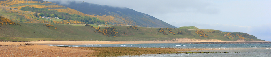
The road continues for 3 or 4 miles. I pass several turning off to the left, private driveways with warning signs, all heading in the direction of the sea. But I can’t walk along the coast. It is all private property.

So this is the famous New Forest. Not much coastal access here. I am disappointed.

Lepe Beach, cafe and trees, Ruth walks around the coast in The New ForestFinally, I come to a public road that leads down to the sea-shore. I see a group of walkers behind me – proper walkers with maps and walking poles. I stride ahead briskly. I don’t want the indignity of being overtaken again.

The road is narrow and busy. Cars pass to and fro, heading for the shore and back again. There are no pavements and I am uneasy about being hit by the car and glad when I arrive at the shore.

This area is labelled ‘Lepe Country Park’ on the map. There is a play area for children, set among tall pines.

sailing boats, silver sea, from Lepe Beach, Ruth's coastal walk It is great to see the sea again. Cars are parked and people are strolling. The sun is shining. There is a cafe and I sit and drink a cold drink.

Out to sea, over the Solent, I can see the misty outline of the Isle of Wight. Sailing ships pass to and fro. The sun is in my eyes, in the East. The sea sparkles and the ships are silhouetted against the light.

From here there is a footpath running along beside the sea wall. The tide is high and an occasional wave splashes up and sprays the path. I hold my camera against my right side to protect it.

Sea walk, Lepe, Ruth walking round the coast in Hampshire.

Ahead, a house juts out into the sea. This is a private residence and would make a wonderful home for an artist or a writer. I wonder who lives there and whether they ever grow tired of the view across the Solent.

Hampshire walk - Lepe Beach - Ruth's artist in Residence.And here is the same view painted by my wonderful ‘artist in residence’, Tim Baynes. [You can see more of Tim’s work on on this page.]

Lepe, view inland, New Forest, Ruth walks around the coast.

To my right, inland, there is lovely countryside with grazing cattle. A family are out walking. In the distance are the tall structures of the oil refinery and the single tall chimney of Fawley Power Station, where I walked yesterday.

sailing ships, silver sea, Solent, Ruth on her coastal walk.

There is a good breeze and ships pass to and fro. They sail close to the shore to navigate the narrow channel that leads into the mouth of Beaulieu River. I stop to take photographs. Today I have my zoom lens and am glad to have the extra freedom to choose the views I want to capture.

Millenium Light House, Lepe, Ruth's coastal walk. Hampshire.Above me, on the gently sloping bank, I see a lighthouse above the greenery. Later I learn this is the Millenium Light House, built in 2000. This lighthouse guides ships into the mouth of the River Beaulieu and towards the popular Bucklers Hard anchorage.

Most of the land adjoining the coast is private property. I catch glimpses of houses beyond the vegetation. Pampas grasses grow along the route – a strange, foreign plant to find on the English coastline.

Sadly, this is the only section of coastal footpath in the whole New Forest area. A shame.

Sea Walk, Lepe Country Park, Ruth's coastal walk, New Forest.

The footpath ends earlier than it should, covered by the high tide. I head up the bank and find myself on a road, yet again.

I am in a surprisingly good mood. There is no traffic on this narrow country road. It is a beautiful September day. The wind is warm. I can smell the sea close by and catch the occasional glimpse of shining water through the trees. I have several great days of walking ahead of me and I feel a pinch of excitement in my stomach – a holiday feeling.

The road winds around and turns the corner, leading up beside the Beaulieu River. Well, not exactly ‘beside’ the river, there are fields and private woods between the road and the water.

I reach the town of Exbury and was planning to stop here for lunch. But there are no obvious pubs. I pass an area with a steam train and consider going in – they must have a cafe. But it involves a detour off the road and I decide to keep walking.

In retrospect, this was a mistake. The sky clouds over and drops of rain begin to fall. I pull out my waterproofs and pack my camera and iPhone away. Just in time. Rain falls in a steady drizzle.

The next part of the walk is pretty miserable. I walk along a straight road in the rain. Traffic is heavy and there are no pavements. If caught with two cars passing me in opposite directions, I have to leap off the road and into a ditch. The road is straight. I am confined by trees. The grey rain falls around me.

Sometimes during my walks – not often, but sometimes – I wonder why on earth I am doing this. What possessed me to start walking? And why have I continued? And what is the point of it all? This is one of those days. I am walking along a boring road, in the dripping rain, dodging traffic. I am hot under my waterproofs, tired and hungry and nowhere near the sea, heading inland. What is the point to it all?

I think of other things and keep walking. I think of lunch and keep walking. I think of books I have read and music I have heard. I keep walking.

New Forest and oil refinery, Ruth's coastal walkSuddenly, I reach a place called Otterwood Gate and the scenery opens out. There is a car park and I sit on a tree trunk and eat a snack. Heathland stretches ahead of me and I can walk along a wide open patch of green grass by the side of the road. In the distance I see horses. Far across the heath are the tall chimneys of Fawley Oil Refinery – hidden from sight when I walked along the perimeter of the plant, but now obvious across the open heathland of the New Forest.

And ahead of me is a pub. I hope it serves late lunches.

When I reach the door, the way inside is blocked by a group of donkeys, sheltering in the lee of the pub to avoid the rain. I walk gingerly around behind them (is it true that donkeys kill hundreds of people each year?) Inside is dry and I enjoy a rest, a large glass of cider and a meal. By the time I have finished eating, the rain has cleared.

donkey and little boy, New Forest, Ruth's coastal walk. When I set off again, the donkey’s have moved from the door. A couple of adults are attempting to persuade a young child to stroke one of the beasts. He looks, understandably, rather doubtful about the enterprise.

I walk down the road and into Beaulieu.

There is a green space by a large tree with horses standing by the river and a few tourists taking photographs. The tide is out and Beaulieu is not at its best – with not enough water in the river, too much mud and stranded boats.

Beaulieu, with tide out, Ruths coast walk. New Forest.

From now on the sun starts shining – low in the sky and lighting up the trees with a golden glow. I walk back along the other side of river, heading towards the sea, through woods. This route is popular and there are plenty of people around.

Beaulieu River and boat, Ruth's coastal walk, New ForestBeaulieu River with boats, Ruth's coastal walk, HampshireThe leaves are just beginning to turn. The tide is coming in. The boats start moving about on their moorings as the water in the river rises.

I walk past families, couples, young children playing in the mud. Men admire my camera.

And, finally, I arrive at Bucklers Hard. This really attractive area has a pub that sells cream teas. They apologise – they have run out of butter. I don’t mind. Clotted cream will be fine with the jam. Who needs butter?

I sit out in the late afternoon sunshine and enjoy tea and scones.

Bucklers Hard, Ruth's coastal walk, through the New Forest

There were two disappointing things about today.

Firstly, the lack of access to the shore because of private property and no public footpaths. If the New Forest wants to maintain its reputation as a tourist destination, it really needs to do something about this.

Secondly, my Trip Journal app froze up yet again, kicked me out, and then told me I had only walked two miles and I lost all my iPhone photographs of the walk. So I decided to keep it switched off for the rest of this holiday. That will teach it!


Do donkeys kill many people each year?
No: according to www.snopes.com.
Yes: if you take the figures from Namibia and extrapolate them across Africa, www.donkeywelfare.com

Vital stats: miles walked = 12

Route taken:

Posted in 07 Hampshire | Tagged , , , | 12 Comments

66. Hythe, Fawley to Calshot

Entrance to Hythe Ferry, Ruth's coastal walk.Today I start my walk from Hythe Pier and I plan to travel southeast – to reach the sea-shore at Calshot.

I’m not looking forward to the walk today. Although I am on the edge of the famous ‘New Forest’, I am sticking to the coastline where the map shows a huge oil refinery and then a power station. These large industrial complexes lie between my route and the water’s side. Much of my walking today will be along roads. I am particularly dreading the A326; I anticipate this will be busy and, because it runs along the edge of the industrial area, I expect the scenery to be brutally unappealing. I don’t even know if there is a footpath.

It turns out that I am wrong.

seagulls in Hythe, Hampshire, Ruth's walk around the coast, UK.
Hythe is full of late holiday makers, strolling and enjoying the Saturday sunshine. A row of cheeky sea gulls line the railing along the water’s edge.

I am unable to follow the coast and walk along a quiet road. But as I leave Hythe behind, the countryside opens out and I have a wonderful view across marshy land to the edge of Southampton Water. Beyond, across the busy waterway where the Isle of Wight Ferry is passing by, I can see the wooded shore I walked along on my previous day of walking.

Southampton Water - View from Langdown, Ruth's walk around the coast.

The road turns inland and, reluctantly, I leave the shore behind. Over a railway line, I find a track leading off to the left. Here runs the official Solent Way.

wooded path - Solent Way - From Hythe to Fawley, Ruth's coast walkThe track winds through woods. To begin with, there are houses and the occasional vehicle. Further on, the track becomes a bridle way. There is a small bridge across a stream. Vehicles cannot pass along here. The woods are old, consisting mainly of beautiful oak trees. I hear a popping sound overhead and small objects are falling from the trees. At first I think someone is throwing stones. At me? Then I realise; it is acorns, falling out of the trees.

This is a beautiful walk. I enjoy it immensely. I meet a couple on mountain bikes and a woman with a horse, but nobody else.

Jesus is Lord - Solent Way, Ruth's coastal walkJust as I approach the end of this leafy lane, I come across a small building with an ugly temporary cabin attached. It is a small church. How strange!

From here, I join the main road – the dreaded A326. It is surprisingly pleasant.

A326 - surprisingly pleasant, Ruth's coastal walk past FawleyAlthough the main road is reasonably busy, there is a quiet residential access road running parallel to it, with wide pavements.

There are tall trees lining the road – so tall and thick, I am unable to see beyond them. although I know that the sprawling complex of the Fawley Refinery lies just on the other side of the trees, I can’t actually see any sign of it – no chimneys, no flares, no smoke – nothing.

At the end of the road is a roundabout and I bear left, continuing to walk along the outskirts of the invisible oil refinery.

To my right is open ground with park land and playing fields. Men are playing football. Girls are watching them. It is sunny and warm.

playing fields, Ruth's coastal walk

Past the playing fields, I turn off the main road, heading for the coast. There is a footpath marked on my map, beginning at a place called Ashlett, just the other side of the village of Fawley.

I walk through Fawley village. It is one of those quiet places where no large chain shops want to set up and the main shopping street, if you can call it that, has a mix of local shops. There is something refreshingly different and unique about such places. It reminds me of Bourne, in Lincolnshire. For some reason, here there are two wedding shops.

Through Fawley, I head down a lane signposted to Ashlett Creek. I am not expecting much, but come to a part of the road where the land falls away and I have a view of busy Southampton Water – large commercial ships and small pleasure craft.

Ashlett Creek, Southampton Water, Ruth's coastal walk

The road heads down and I reach the creek. This is beautiful. The tide is out and the creek is muddy, with ships and small tugs lying in the mud. There is an old mill. And a lovely pub, the Jolly Sailor.

Jolly Sailor Pub, Ashlett, Fawley, Ruth's coastal walk.

Families are sitting out, in front of the pub, enjoying the late afternoon sunshine, finishing off their lunches and enjoying cold drinks. It is very scenic and I am tempted to stop for a drink. But I have arranged to meet my husband (and his mother) in Calshot and I don’t want to be late.

horses on common land, Ashlett, Ruth's coastal walk through New Forest.Beyond the pub is an area of common land. I am now, according to the map, within the New Forest National Park. I come across horses grazing – the first of many horses I meet in the New Forest, roaming free.

Here there are foals with their mothers and I worry a little. I am not fond of large animals. Well, to be honest, I am frightened of large animals and I wonder if the horses will be protective of their young and resent my walking across their pasture. They trot over towards me but they are just being nosey.

There are lots of small creeks and a motley collection of sailing boats are moored in the mud. I stroll around by the edge of the mud, taking photos, and trying to work out where the footpath is. Meanwhile, the horses follow me, close behind.

Ashlett marina, Fawley, Southampton Water, Ruth's coastal walk, Hampshire.

I find a path and walk through bushes and trees. Ahead, I see the single tall chimney of the Fawley Power Station, rising above the vegetation. The path runs along the outside of the power station, passing between it and the sea-shore. There are huge fences marking the boundary of the station, with warning signs and, apparently, CCTV cameras.

Walking along shore in front of Fawley Power Station, Ruth's Coastal Walk.

But the land in front of the station is open and flat, stretching down to the water. The golden afternoon sunlight falls on the marsh and the grassland, and on the bright blue water beyond.

Fawley Power Station, Ruth's coastal walk.

I stop and take photographs. Today I am using a new lens on my camera, but it has no telephoto features and I am disappointed not to be able to use my zoom, particularly when I see, beyond Calshot Castle, the familiar white spire of Portsmouth’s Spinnaker Tower in the distance.

There is a haze in the air and the sunshine seems to bend around the structures of the Power Station – so it appears unsubstantial, almost transparent, in the weird light of this late afternoon. I experiment with different exposures on my camera, until I finally manage to capture the effect I am after.

bridge, Fawley Power Station, Ruth's coastal walk.After a while, I walk under the shadow of the tall chimney. Here there are mushrooms growing in the grass.

There is a creek running up the side of the plant and I walk across a strange little bridge – with high fences and a covered top, creating a tunnel effect. From the other side, I can’t see any intimation that this is a footpath, but it is.

Beyond the bridge, the footpath turns inland, heading back towards the road. But ahead of me is a wide track, well trodden, leading towards the beach at Calshot. In the distance I can see a row of beach huts, marking the edge of the beach.

towards Calshot beach huts, from Fawley Power Station, Ruth's coast walk.

On the other side of the beach huts is the beach itself – shingle. Lots of people are parked along the sea front or walking up and down along the promenade. There is somebody in the water, attempting to teach a woman how to kite surf; difficult because there is virtually no wind.

I hear someone calling me. My husband and his mother are sitting in the car, facing the sea, enjoying ice creams.

I arrange to meet them a little further on as I want to walk the last half mile along the sea, as planned. I walk along the shingle for a while until, as I grow tired, I head through the line of beach huts and walk along the coastal road.

To my right, across the fields, I get my last good view of the power station. With the sun sinking lower in the sky, the building looks ghostly. I take more photographs and finish this blog with my final image from this beautiful day of walking.
 Fawley Power Station, Ruth on her walk around the coastline.


Vital statistics: miles walked = 8
Route:

Posted in 07 Hampshire | Tagged , , , | 9 Comments