I said my last walk was ‘the best day of walking, ever’. I was wrong. Today is the best day of walking, ever. As we drive along the motorway, approaching Dover, the sun is shining and the air is clear. First thing I notice, when I see the sea, is the firm, definite line of the horizon.
“I wonder if we will be able to see France today?” I remark. “There is no haze.”
“Maybe,” says my husband, “but there is that island in the way.”
“What island?”
Then we realise. It’s not an island. We can see France. How many times have we driven to Dover to catch the ferry? And only once did we catch a glimpse of France. That was very early in the morning and my husband is convinced I dreamt it.
 I am very excited by a prospect of walking over the white cliffs of Dover, with France in view. How perfect!
I start from Dover seafront. Looking out, across the little beach, through the mouth of the harbour, I can see the outline of France. It looks so close. You could sail across and be there is a few minutes, or so it seems.
Walking along the promenade, I pass the end of the pier, over a bridge across the marina, and walk up the busy access road heading west.
This part of the walk is tedious, as cars and lorries roar past. I am relieved to find the footpath, branching away from the road, to the left. I walk in a tunnel of greenery. The traffic trundles past below. The path takes me steadily upwards and away from the road.
Below me are great views of Dover and I can see the harbour spread out, with the white cliffs of South Foreland (my route for the previous section of the walk) beyond. The sky is blue with great, fluffy clouds. The sea, multicoloured, sparkles below me. In the distance, I can see the blue outline of the French coast, with ferries and boats heading back and forth. I try to imagine what this area was like, thousands of years ago, when we were physically connected to France by dry land.

 As the path climbs higher, I can see the motorway below me. But I have a view that is invisible to the passing traffic, a fantastic view of the white face of Shakespeare Cliff, with a little beach and railway line far below. As I watch, I see people swimming in the sea (although they don’t linger long) and a little train hurtles along the line, disappearing into a tunnel through the cliff.
The path is steeper and I begin to puff. I pass allotments, perched on the side of the cliff. Apart from one cyclist, heading for the beach below, I meet nobody.
 When I get to the top, the path has been diverted – away from the eroding cliff edge. Part of a fence sticks out, almost into the abyss. A broken sign warns me of the edge, rather unnecessarily I think.

The path I am following is both the Saxon Shore Way and the North Downs Way.
Interestingly, as I continue walking, I come across little signs, each one indicating that there are poems written with this specific location in mind. I could listen to the poems by telephoning the numbers given on the signs. I don’t. I could be here all day.
But what a great idea! The Chalk Line Poems, by Ros Barber, can be read here or listened to here.
This is the highest section of my walk today. I can see the path ahead, stretching out across the cliff top. And beyond I can see Folkestone, below.

Dotted along the route are strange round pillar constructions. Later, I learn they are ventilation shafts for the railway tunnel, passing below. Further along, I meet a handful of other walkers, but surprisingly few people out and about on this beautiful day. I pass over a newish park area, called Samphire Hoe.

Over the top of the next rise (after a scramble up a steep hill and a divergence away from the cliff because of crumbling edges), I pass remains of war defences. There is a marvellous view back towards Dover and the harbour.

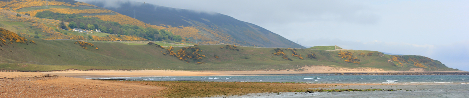
I can see Folkestone waiting below. Beyond is a flat spit of land, leading out to sea. On the end of this spit (not visible in the photo above) are some large rectangular blocks. I know this must be the nuclear power station at Dungeness. Further beyond, at the limit of my vision, I see more white cliffs, rising up above the flatness of Dungeness. Is this Beachy Head? I think it must be.
 There are lots of interesting ruins here – left over from World War II. I meet a group of young men who seem intent on climbing down a dark shaft and into a tunnel, that they believe lies below. They have a large flashlight but no ropes. I doubt whether they will get far.
 Further on, the ground opens out into a swathe of green grass. Somewhere below me, at the bottom of the cliffs, is a nudist beach.
The path becomes a track. This is Abbot’s Cliff. Here I come across a little plaque, telling me about the spider orchid. I have seen a lot of wild flowers on my walk today (the warm weather has caused premature flowering of plants), but I have no idea if I have seen a spider orchid or not. The plaque, being uncoloured, does not give me many clues.
In this area I see a large concrete structure with a tree growing out of it and covered in graffiti. It looks fairly new. I take little notice of it, but later realise it was one of the concave, concrete listening devices – a ‘sound mirror’, – used in the war to give early warning of the approach of enemy planes.
 After Abbot’s Cliff, I pass a wonderful white house in need of renovation, set in a huge garden, that forces me to turn inland. I meet a road, but a footpath takes me up to the cliff edge again. Now the path winds behind gardens and along an area of cliff that has slipped and is open to the public as a rather wild country park – called The Warren.
I am very high up. I see the pub at which I planned to have lunch. It appears derelict and some of the roof appear to be missing. Has there been a fire? I walk on.
My husband phones me. He has found a cafe, perched on the top of the cliff. We sit outside and have lunch – burgers and a cup of tea for me, soup and sandwich for him. The views are staggering. This is perfect. Much better than a pub.
 After lunch, I have a choice. Stay up on the cliff top, following the official coast path, or take a winding path down the cliff, to the beach below. A railway line separates the cliff from the beach, but I can see a bridge across the line. Hopefully, I can cross over. It will mean doubling back the way I have come.
I talk over the choices with a couple of fellow walkers, chance encounters on the cafe terrace. They elect to stay on the official path. I decide to head down to the sea.
The path winds down the slope, steep steps that zig zag down beneath a leafy canopy. I am alone. I soon lose sight of the cafe above. Bushes and trees arch across the path. It takes far longer to descend than I anticipated. Near the bottom I hear sounds, children are playing somewhere – I can see a rope swing in a clearing below. Further down still, and there are some tents, hidden in bushes. Young lads are breaking twigs, somewhere in the undergrowth. I don’t know if this is an official or an unofficial camp.
 I reach the railway line and follow the path, heading back eastwards, along the line, towards the footbridge. I hope this is accessible. As I approach, the path rises up a steep bank, away from the line and my heart sinks. Must I climb back up to the cafe?
But it is a false alarm. I can get onto the bridge after all.
As I cross, I stop to take photos of the railway line. To the east is the mouth of a tunnel. Strange, I think to myself, the tunnel appears to be lit up or I can see right through to the other side. There is light. Then, with a ‘whoosh’, a train emerges and rattles along the line, passing beneath my bridge and heading towards Folkestone.
 The beach here is empty and wild. There is a huge expanse of concrete at the foot of the cliffs – a large flat area that appears, superficially, to be a wide promenade – but is too unkempt. Later, I surmise this is part of the coastal defences to try to protect the base of the cliffs. The top has already slipped (forming ‘The Warren’ area above).
I head west, towards Folkestone. The concrete gives way to a beach. People are out, enjoying the late afternoon sunshine. There is sand here – mixed with shingle – but still sandy enough for children to build castles and dig for crabs.
At the end of the beach there is no way forward. The waves splash up against the rocks of Copt Point. A small path winds up the cliff and I head up, puffing slightly. Luckily the cliff is much lower here and I soon reach the top.
 I am on the edge of a putting green, perched above the sea. There is, incongruously, a Martello Tower in the middle of the green. I wonder if it is being used as a residential house.
I walk up the green, around the tower, and come across a proper promenade, bordering the sea, leading me down into Folkestone itself.
Folkestone is very pleasant. People are out, walking. I hear English, French, Spanish and other languages. There is a harbour with sailing boats, lots of mud (the tide is out now) and a strong smell of fish.

On the other side of Folkestone, is a wide shingle beach. The promenade stretches, unbroken, towards Hythe. Just above the prom, a new park has been created, Lower Leas Coastal Park. There are flowers, bushes, trees, children’s play equipment, chess boards, picnic tables and barbeque sites. I come across a large Spanish family, setting out tables and chairs for an evening meal.
This is a perfect evening. The air is warm. There is no wind.

The park ends and I follow the promenade as it passes through Sandgate and on towards Hythe. Leaving Sandgate behind, there is nothing now but shingle. The light is growing dim, clouds cover the fading sky. The path stretches ahead. Hythe looks distant and I have the illusion that I am making no progress towards it. A few cyclists and joggers over take me.

In the distance, at the end of low-lying headland, I can see the large bulk of the power station. This is Dungeness. I am heading there tomorrow. The land looks flat. The cliffs have gone.
 As I approach Hythe, the light is too bad for photography. But I can’t resist this sign – warning us not to touch Dave the Dophin, who turns out to be a ‘she’. Although I keep my eyes peeled, I don’t see her.
Vital stats:
Miles travelled = 12 miles
Blisters = 2
Dolphins seen = 0


")


 Now I reach the area of Oare Marshes, a nature reserve. A track joins the sea bank (the first road access since Conyer) and there are cars parked with people out, walking along the bank, with pushchairs and dogs. Inland there is a lake, surrounded by reeds, with ducks and swans.


