Stage 16. Harwich to Kirby-le-Soken

It is hot today. The weather forecast says it will get even hotter – maybe reaching 32 degrees. I have lathered on the sun block cream in anticipation. This gives me a white and slightly greasy appearance.

Half Penny Pier, Harwich - Ruth's Coastal Walk

The Felixstowe to Harwich ferry crosses Harwich Harbour and arrives at the Halfpenny pier. We arrive by car, having decided to drive there directly. The pier is quaint but I unable to take a good photograph due to the cars parked around it.

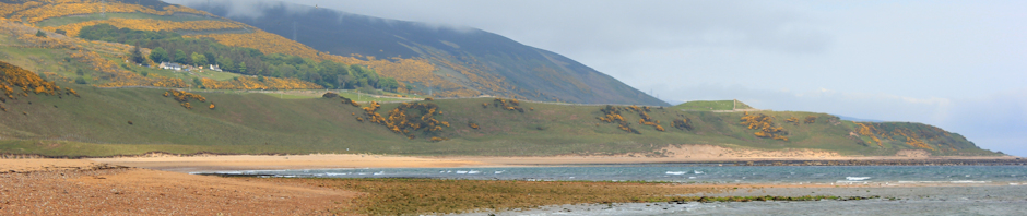
The sea front of Harwich is pleasant, with an old lighthouse and a promenade with strollers and beach huts. Bright coloured dinghies sail across the harbour, with the cranes and container ships of Felixstowe as a backdrop. A long breakwater marks the entrance to the harbour area. Despite signs that forbid this, there are fishermen out.

Dovercourt Lighthouse, in sea, Essex - Ruth's coastal walk

Further along are some interesting, old, renovated lighthouses; one on the shore and one rising out of the sea a few hundred feet offshore. They were restored in the 1980s.

Past this is “beach hut land” – mile after mile of beach huts. Unlike my previous walks past huts, and perhaps due to the wonderful weather, many of these huts are in use today.

Some distance along the coast and I reach a marshy area. The path follows the sea defence wall around the edge of the marsh and the way ahead is long, flat and straight. I meet a few dog walkers and some cyclists, but no serious walkers.

Long walk on bank, marshes near Dovercourt - Ruth's Coastal Walk

The path stretches ahead. The sun shines down. I am sweating. I get out my hat, which shades my face, and take frequent sips from the water bottles I am carrying. My face begins to take on the texture of sandpaper. Momentarily worried, I realise this is due to the wind-borne sand, sticking to my coating of sunblock. To be honest, I am a little bored after 10 mins of this walk – in the heat and with the monotonous landscape as my only company. I am reminded of my very first walk along the, seemingly, endless sea wall to the east of Kings Lynn.

View across marshes to sea, near Dovercourt, Essex - Ruths coastal walk

I walk fairly quickly. Mindful of the advice of John Merrill I concentrate on finding a natural rhythm. Having worn MBT footwear (Masai Barefoot Technology) in the past, I try to emulate the natural bushmen walking style that forms the basis of the MBT product. This involves allowing my foot to strike the ground beneath my body – rather than in front – with each stride. Rather surprisingly, I notice that this is now my normal walking pattern.
Hamford Marshes, Essex - Ruth's coastal walk
The main coastal path heads back inland, but I walk ahead along the footpath at the top of the sea bank, now running along the shoreline again. Here there is a small beach – pleasantly isolated due to its inaccessibility – with only a couple of fishermen. The sea bank curves round and heads inland again, skirting the marshes. This is the beginning of Hamford Water estuary. I will be seeing more of this estuary later today, as I need to detour around its mud flats and marshland in order to pick up the shore line again at Walton-on-the-Naze.

A couple of cyclists pass me, bouncing uncomfortably over the uneven terrain of the bank pathway. They look hot and sweaty. A few minutes later they return – looking even hotter.

David Cotton recounts how he was unable to follow the sea bank around this section of the estuary – because of the barrier warning you must detour around an explosives factory. Sure enough, I come to some fierce warning signs threatening prosecution under the Explosives Acts. I am not usually deterred by “Private Property” signs, but this is the strongest warning sign I have met up till now.
Signs warning of explosives - Ruths coastal walk UK

So, leaving the sea bank, I follow a track leading up a hill towards the B1414. Away from the sea breeze, the heat is relentless – more like Spain than England – and the air is hot and close around my face. My chest feels tight and I am having trouble breathing – the air feels heavy. I am relieved to get to the top of the hill and I rest for a few minutes in the shade of some trees by the roadside.

I was hoping to pick up a footpath here, or a cycle route, but there is no sign of either. Now, I turn left and am forced to follow the road into Great Oakley. There is no footpath. The road is busy with traffic heading to the coast. Cars travel past me at high-speed, some giving me wide berth but some passing within a foot of my body. I marvel at how inconsiderate car drivers can be. Do they expect me to jump into the ditch? I pass a driveway leading to, I presume, the explosives factory. There is no sign to indicate what the factory is, or, indeed, where the drive leads to, but there is a sign saying all matches, cigarettes and other inflammable materials must be left at the guard-house.
Ruth outside pub, Great Oakley - coastal walk
The pub is a welcome sight, just off the main road and near to the war memorial. It is very stuffy – and a little old-fashioned – within. The publican is sweaty and finding the heat trying. I order a cider, taking it outside to drink in the breeze. My husband, on his brand new racing bike, joins me. The food is very good – although our meals arrive at different times as my order is somehow lost.

Poorly maintained footpath, near Great Oakley, Ruth's coastal walkAfter lunch, I head downhill towards the estuary again. I follow a shady lane and then take a footpath across fields. The first section of the footpath is very badly maintained – being marked by a ridge of tall grass between two corn fields. I am sure this is the correct route and spot some flattened areas where other people have walked. It is hard going. The grass is even higher than the corn and the ends of the grass whip around my face. I develop a grass rash on my arms – the first time this has ever happened to me. I am hoping that there is no pollen left in the grass heads, dreading the onset of severe hay fever. I cannot see where I am walking. The ground is very uneven and I am fearful of stumbling and twisting an ankle.

Well maintained footpath - near Great Oakley, Ruths coastal walkAcross another road and into different farmland. Here the footpath is well maintained – the farmer has cleared tracts of land – and the going is much easier. I mentally thank this farmer for his kindness and common sense.

My thanksgiving is abruptly ended when I find myself in a fields of horses. Horses are marginally less fearsome than cows – but only marginally less. One of them snorts and comes towards me with a determined look in her eyes. Her two companions now begin harumphing and start a slow canter towards us. Oh dear. I am hot, tired and unlikely to be able to outrun these creatures. I stand still, heart pounding, then deciding to be firm, I say – in what I hope is a clear, strong voice – “I am not afraid of you.” The lead horse stops a few yards away. Her companions stop behind her.

Disappointed horse - chases Ruth on her coastal walkI continue following the path towards a style on the far side of the field. I hear the sound of horse hooves behind me and have to force myself not to stop. There is horsey breath coming over my shoulder. From the side of my eyes, I see the long nose of the first horse, perhaps a foot behind my shoulder. She stays there, walking behind me, all the way across the field. When I climb, somewhat triumphantly onto the style, she gives me a disappointed, accusatory look.

Later, I realise she probably thought I was coming to ride her, trotting meekly behind me as though she was on a long rein and hoping for an outing. How silly of me – to be frightened of a friendly horse.

I pass down tracks that run past some buildings. This must be Beaumont Quay – a mixture of farm buildings and small low-tech industrial units. There are trees and I enjoy walking in the shade.

Swimmers bathe at their own risk, sign, Hamford Marshes, Essex I reach the marshy edge of Hamford Water. This is, apparently, Swallow and Amazon country. Arthur Ransome lived around here and based his stories on these watery marshlands. I was excited about this but am strangely disappointed.

The tide is out. The marsh is flat, empty, muddy and – (well, what else did I expect?) – fairly marshy.

old boat in mud, Hamford Water marshes, Essex - Ruths walkAfter a short distance, I find the decaying shell of an old boat, quite a large boat, in an area where the sea no longer reaches. This area must have silted up. This is a change from the Norfolk and Suffolk coast line, where the sea is eroding the land. Here in Essex, the sea is being forced to retreat.

I pass through a butterfly sanctuary.

The path runs along the top of a bank, skirting and overlooking the marshes. In the distance I can see the sea and the cranes of Felixstowe. Not many people walk here. The path is overgrown and I cannot see my feet. I am grateful the grasses are dry. The walk twists and turns, following the edge of the marsh.

As the sun sinks, I become concerned about making my rendezvous in time. The meandering of the marsh bank creates a longer route than the map suggests. I quicken my pace to jogging rate; and I pray that I wont twist an ankle on the uneven, and still obscured, path. I feel surprisingly fit and well.

Meeting a farmer, I stop to talk to him. He is interested in my coastal walk and tells me Essex has a lot of shoreline because of all the twists and bends of the coast. After I leave him, I find it hard to get going again. My pace drops. My legs feel wobbly. My feet ache. This is hard work. My husband texts me – he has already reached our meeting place and is waiting for me.

Approaching Kirby-le-Soken, The Wade - Ruth's coastal walk.

Finally, I arrive at a place where the footpath is well trodden. There are people here, standing on the bank and looking across the marsh towards the sea and distant boats. A family is on the bank, enjoying the evening sunshine and having a picnic tea.

I leave the marsh bank wall and head down a track towards Kirby-le-Soken. The track is longer than I expected and I find this last 1/2 mile really hard work. When I reach the main road I look anxiously up and down. I don’t want to walk the wrong way – my legs are too tired for mistakes – and I can’t see a pub. I decide to turn right and, luckily, this is the right decision. Around a bend I see a pub sign and a man waiting for me. So nice to see my husband and I am very grateful for the comfort of the car.

Hamford Water - Ruths coastal walk, Essex


Vital stats:
Miles walked = 15
Av speed = 3 miles an hour
Blisters = only one!

Posted in 04 Essex | Tagged , , , , , , , , , , , , , , , , , , , , , , , | 12 Comments

Stage 15. Boyton Marshes, Bawdsey to Felixstowe

Today begins as a day of gloom, sogginess and thirst.

I am dropped off in Boyton and walk down a public footpath to meet the Suffolk Coastal Path along the river bank. The sky is grey and it is drizzling. The first thing I notice is that my back pack seems very light. Then I realise I have left my water bottles and snacks behind. Too late.

Old Pill Box, Suffolk Coastal Path, Boyton Marshes - Ruths coastal walkThe coastal path is a narrow track, following the course of the River Ore as it meanders parallel to the sea, before emptying into Hollesley Bay. This area is a bird sancturary, the Hollesby Marshes, managed by the RSBP. There are numerous old pill boxes here, in various stages of decay. To my right is farmland with cows. On the river are a couple of small sailing ships, overtaking me and heading out to sea. Beyond the river is the shingle bank, running all the way down the coast from Aldeburgh and, effectively, cutting of the village of Orford from the sea.

On the drive here, we noticed all roads lead to Orford. This was once an important port. But the shore line changed, as the shingle bank extended itself and rendered the harbour useless. Now, Orford is a tourist destination with a fine castle and a little quay, according to my husband. My trail has not taken me there, as the Suffolk Coastal Path effectively bypasses Orford to avoid the dead end of coastal land it has become isolated on.

Two miles of walking on the grassy bank; my lower legs are soaking wet. The sodden grasses, gently leaning over the path, are lovingly stroking my legs and depositing lashings of water on my trouser. And, worse still, I can feel my feet becoming damp. The dampness starts at the top, just beneath the laces, but then tracks down to my soles. My boots, now water-sodden, feel very heavy.

Oxley Marshes - Suffolk Coastal Path - Ruth's Coastal Walk

I meet no other walkers. There is just me, the river the grey sky and the wet grasses. It has stopped raining.

Shingle Street, Suffolk Coastal Path - Ruths coastal walk
I look forward to reaching the mouth of the river. Here is marked a place called “Shingle Street” on the map. I hope to buy water and a snack. Shingle Street deserves its name. The beach is wide shingle with a few clumps of plants. The houses look directly onto the shingle and my path runs in front of them. These are holiday cottages, many empty, but some with people sitting in their windows. I see an artist’s studio; all cluttered debris downstairs with empty wine bottles and unwashed plates, all organised and serene upstairs with easels set up facing the sea.

Sadly, there are no shops and not even a cafe. I walk on.

Martello Tower, Shingle Street, Suffolk Coastal Path - Ruths coastal walk, UKThe path takes me off the beach and I walk along the raised bank that borders the shingle beach. To my left is marsh and then shingle and sea. To my right is farmland. I pass a number of the round Martello towers, built to defend the coast during the Napoleonic wars. Many of them appear to be converted into dwellings. What wonderful – and unique – residences they must make.

The path reaches an area where the sea wall is being repaired. New fencing is being erected to protect the walker from a new sea defence of concrete slabs and boulders. I wonder how long it will last. There are a couple of workmen in yellow jackets and helmets, with a van.

I reach an empty car park. Here the path turns inland, following a track to the village of Bawdsley. I was hoping to find a tourist cafe or ice cream van here. Why is the place so deserted? Perhaps the grey sky and low clouds has kept people away. Perhaps the car park was built in hope that people would come. Whatever the reason, there is nobody here today.

On my way into the village I pass a primary school. A coach has just returned from an outing and the excited children are jumping out. Once out of the coach, they form a guard of honour, greeting each new coach leaver with a line of hearty “high fives”. They must have organised this themselves – the teacher hovers in the background but looks disapproving and is not encouraging the line up.

I turn left into the village. Surrounded by water, and with wet feet, I am very thirsty. I have been walking for three hours and have another hour before lunch time. In hope, I walk through the village. Surely a place with a primary school must have a village shop? I am disappointed to find nothing but houses. And annoyed that I extended this walk by an extra mile for no benefit.

I do find a bench, the first proper seat I have come across since I started this walk. I sit down and remove my sodden socks. I have dry ones in my rucksack and enjoy their feeling of soft dryness against my skin. Using tissues, I try to soak up some of the moisture inside of my sodden boots. Reluctantly, I put my newly dried feet back into the boots and continue. I enjoy a blessed 10 minutes of dryness, before the dampness creeps back in.

The path returns to the sea bank. But I decide to continue on the road, avoiding the wet grass. This is an official cycle route and I am passed by a number of single cyclists. I envy them their speed.

Then I reach Bawdsey Quay. This lies at the mouth of River Deben, separating Bawdsey from Felixstowe. There are numerous small boats dotted on the river, mainly moored. I know there is a small passenger ferry here and, as I see a small boat picking up a family from the jetty, I break into a run. But it is a river cruise, not the ferry.
“Just wave the bat,” says the captain. “And the ferry will come.”

I look. Attached to one of the wooden posts, and tethered with string, is a pole with a round end. This must be the bat.
I check my watch. It is two o’clock. My husband has not responded to my text messages and I suspect he is not waiting for me at the pub across the way, as planned. And the pub is probably about to stop serving food. While behind me is a welcoming cafe.
I head for the cafe. Access is by way of unmarked steps behind the building and an unmarked white door. The cafe is small and friendly. The food looks excellent – a limited menu but homemade and fresh. I have a wonderful cup of tea and a delicious scone.

Then, back at the jetty, I pick up the bat. Feeling a bit of a fool, I wave it wildly. Who am I waving it at? Where is the ferry? How do I know if I have been seen. I continue waving for a minute or so.

Felixtowe Ferry, Ruth's coastal walkThen I see it. A small motor boat, heading towards me. It fights against the fierce river current and appears to be going past me up river. Ah, I have made a mistake, this is not the ferry. But then, the boat turns inland and, with practiced certainty, butts up to the jetty. There is space for about 10 people and a bike. For this journey, I am alone. It costs £1.80 one way, £2.50 return.
The captain smiles at me.
“You didn’t think it was going to work – waving the bat – did you?”
“No, I didn’t.” I reply.

We weave across the river, avoiding moored boats, to a jetty on the other side. What a marvellous service. I thank the captain and take his photo.

At the pub I meet my husband. Yes, it has stopped serving food. We eat crisps and enjoy a drink.

The path leads along a wide promenade, running by the sea towards Felixstowe. I am not expecting much of Felixstowe and am pleasantly surprised. There are painted beach huts, fine houses with ornate balconies and a very long promenade -around four miles in length.
Felixstowe Promenade - Ruth's coastal walk UK

The beach itself is punctuated with high groynes, fixed onto the promenade wall in most places. This is an attempt to keep sand on the beach and appears to be moderately successful. There are people out, enjoying the promenade. A group of youngsters are doing complicated back flips, launching themselves off the promenade and rolling down the sandy beach as they land.

My feet are tired now. I stop and have some water – kindly supplied by my husband – and a muesli bar. Then onward, past the pier. The pier has very long, thin, supporting legs but very little appears to be happening on it. Compared to Cromer and Southwold, this is a boring pier to look at.
Felixstowe Pier, Ruth's coastal walk
There are English flags flying on the pier, and from most of the pubs and bars on the seafront, to celebrate the beginning of the football world cup in South Africa. The sun is beginning to break through the clouds. The sea is calm. In the near distance, sailing boats show white sunlit sails against the grey clouds on the horizon, while, in the distance, huge container ships make their slow progress out to sea.

At the end of the promenade, I head inland. Later I discover I could have stayed by the sea, walking on heathland, and this would have been a much more pleasant walk. Instead, I follow the official cycle route, through some residential streets and then down a long, boring road that runs behind the dock area, ending at the passenger ferry terminal. Here there is a stretch of shingle beach with a tea shop, seats to sit on and a great view over the estuary to Harwich. Felixstowe dock and the harbour extends up the river. This is a busy port

I would like to take the ferry to Harwich. There lies the next stage of my journey. But today, enough is enough. We are heading home.


Vital stats: miles walked = 14, new blisters = 1,
discomfort level = moderately high (due to lack of water).

Things I have learnt:
I must always check my kit before starting off.
And, Felixstowe is much nicer than I imagined it would be.

Posted in 03 Suffolk | Tagged , , , , , , , , , , , , , , , | 7 Comments

Stage 14. Aldeburgh through Chillesford to Boyton Marshes

Today is a day of forests, fields, pigs and hay fever.

Flag Irises, in marshy area - Ruths coastal walkUnable to follow the coastline today, I begin my walk along the official Suffolk Coastal Path, as it leaves the main A1094, leading out of Aldeburgh. This takes me through forest and across marshland. The sun is filtering down through the clouds as I pass through the trees. Squirrels race away from me. The marshland is aglow with yellow flag irises and, in some places, pink rhododendrons.

The path is well-maintained – grassy floor and just wide enough for a coach and horses. I feel I could be walking along a medieval road. The coast, on the other hand, is wilder, older – primeval.

I meet one solitary male walker, of a certain age, walking back close to the Aldeburgh road. From then on, I meet nobody for the next couple of hours until I reach The Maltings at Snape.

Pottery art works, Suffolk Coastal Path, Ruth's coastal walkAlong the path are pottery structures – art works – which I admire in the mottled light of the forest. They seem both modern and ancient. Further along, in Snape Warren, I see lines of cones on the ground. Apparently, these cones mark out giant drawings and were laid by school children at the instruction of an Artist. I cannot make out what the drawing is. Perhaps I need a helicopter.

I approach The Maltings across a marsh. This should be a good place for birds, but I see none. The sky has grown dark and I decide to wrap my camera in my fleece jumper at the bottom of my rucksack. As soon as I do this, a couple of beautiful swans appear.

The Maltings, Snape, Suffolk - Ruth's coastal walk
At The Maltings is a bridge, the first point across this river estuary from Aldeburgh. Some old sail boats are moored and the place is very scenic. I meet some people with binoculars and camera on tripod, heading out to the marshes. If they are looking for birds, they are going to be disappointed.

Art work - life size horse and cart - Ruth's coastal walkBeyond The Maltings, I see a huge cart horse and its loaded cart, standing patiently looking out to the marshes. It doesn’t move. After a while, I realise it is a statue – very realistic and slightly larger than life.

The path leads along the estuary itself. I enjoy being back alongside water. Then the path heads inland and I miss the first turning, but pick up the path again by heading inland along another footpath and trip back along a road. From here, the path is not so well-maintained. I follow signs down the side of a farmer’s fields. He has set up a low fence to protect his crops, but has not made the path obvious. I end up following a rutted, muddy track and realise I am in a field of pigs. Not sure if I am on the right track or not, I wander around the pig farm for a while.
Large pig on pig farm in Suffolk - Ruth gets lost on her coastal walk

Pigs are large. They make small burrows in the mud and roll in this, so they take on the colour of the ground. They are mainly sleeping, but as I pass the edge of their field, the nearest ones wake up with grunting snorts and stand, menacingly heads down, watching me. I notice the only thing that separates me from them is a single strand of electrified wire fence. Pigs are clever. Haven’t they learnt to jump this fence yet? I am even more concerned when I notice piggy footprints on MY side of the wire.

I spend some time walking in circles around the pig farm. Finally, I notice a coastal path sign again, and head in the right direction. The trail is still not clear, and at every fork in the track I am forced to consult the map and agonise about the right direction to take. This is not necessary. If the farmer resents people walking on his land then, surely, it is much better to keep the path properly marked. Otherwise, walkers have no choice but to bumble all over the place, trying to find their way.

I have seen nobody during my walk round the farm – just pigs. There is nowhere to sit down – the tracks consist of dried mud, churned up – possibly deliberately – by huge wheels. I am hot and thirsty and running late. My mobile phone signal is very poor, but I send my husband a text to tell him I am going to be late for lunch.

Forest path - Suffolk woodland - Ruth's coastal walkGoing across an arable field, I find a road and cross into forest. This forest walk should be enjoyable, but I am hurrying now and everything aches. John Merrill was right about finding your own walking rhythm. By pushing myself to go quickly, I accentuate every ache in my body and feel fatigued. Across another road and through woodland, I pick up a track. A snake slithers across the path and disappears into bushes. It is long, 2 or 3 feet, with a thick body. I think this is too large to be an adder and I hope it is a harmless grass snake.

The track leads straight to Chillesford and I feel relieved when I reach the pub. This turns out to be a rather nice restaurant. I feel embarrassed arriving in muddy boots, straight off a pig farm, but the young waitresses make me feel welcome. There is no sign of my husband. My phone is not working. I order a cider and wait for him. He turns up, just in time to order lunch – from a wonderful hot buffet with a great choice of main meals.

Ruth on her coastal walk, meets a spooky figure in a Suffolk field - scarecrow on tree stump?
After lunch, I continue along the Coastal Path, starting along a quiet lane and ending up along farm tracks. There are fields on either side. I see a strange shape in one of the fields – is it a tree trunk, a sculpture, or a scarecrow? I don’t know, but it looks really sinister.

This part of the walk is deserted and boring. Farm tracks lose their charm after the first mile or so. The sky is very grey and the light is too poor for photography. Rain could start at any time. However, I cheer myself up with thought I am heading back to the sea again.

I pass through a village called Butley Low Corner – really just a few houses at the end of a track road – and then reach a point where the path passes over a stile and tracks head straight up a hill. This must be Burrow Hill. I cross the stile and realise, to my horror, that I am in a field of cows. I hate cows. They are large and scary. I hurry up the hill, heart pounding from exertion and anxiety. The cows ignore me completely.

At the crest of the hill are wonderful views. I can see forwards towards the estuary and the Butley Ferry point, behind me is the route I have come along and inland are fields and distant farm buildings. I feel a sense of elation and achievement. It is only a shame that the weather is too bad for great photographs.
Boyton Marshes - view from hill - Ruths coastal walk

Butley Ferry Crossing - Suffolk, Ruth's coastal walk
Down the hill, I reach Butley Ferry crossing point. This is an ancient crossing point and now consists of a rowing boat – big enough to transport a bike – and is manned by enthusiastic volunteers at weekends. Today is Thursday and there is no ferry running. I knew this would be the case, hence my inland detour along the official Suffolk Coastal Path – running nowhere near the coast.

The official path now follows the top of the bank of the river. It is very overgrown here, just a narrow passage through the long grass. I cannot see my feet and hope there are no snakes. The river is to my left and Boyton marshes to my right.

I have discovered another hazard of field walking. I am sneezing and my eyes are itching madly. I could scratch them out. My one remaining tissue is soaking wet. Yes, hay fever has struck. I had been blissfully free of symptoms during my walks along the beach and carelessly not taking my medication. Now I am feeling the consequences.

There is a path leading inland from the riverside route. I come down off the river bank and follow this, leading through a wonderful marshy area, alive with birds. I see a heron, swans, geese, seagulls, wading birds with huge long, ridiculous beaks and rabbits. Then, passing up a farmer’s tracks, I reach a road. This is narrow with no pavement – only wide enough to allow one car – and, incongruously, I notice the back of a large white bus disappearing down it, brushing the bushes on either side. This narrow road leads into Boyton. Nervously, I start walking along the edge of the road and hope I don’t meet another bus.

Telephone kiosk in Boyton - Ruth's coastal walk
I reach the small village of Boyton and find the telephone box. This is my designated meeting place with my husband. Telephone boxes have become a useful meeting place as they are always marked on the maps and offer shelter from rain and hail.

I am 5 minutes late. My husband is nowhere to be seen. I manage to find a signal on my mobile and contact him. He is lost – the roads are short on road signs in this area. I sit on the grass – sneezing and crying – with hay fever in full spurt. Half an hour later he arrives.

This has been another great day of walking through varied scenery. Apart from the pig farm and my hay fever, it has been thoroughly enjoyable.


Vital stats:
Miles travelled = 12.
Average speed = 2 miles an hour
Wrong turnings = 2
Injuries from animals = 0

Posted in 03 Suffolk | Tagged , , , , , , , , , , , , , , , , , , , , , , , , , , | 4 Comments

Stage 13. Dunwich, Sizewell, Thorpeness to Aldeburgh

The car park at Dunwich is deserted this morning, apart from a solitary dog walker. The dog bounds onto the beach, all enthusiasm and wagging tail, then dashes back towards his master. “He wants you to keep up,” I remark, innocently. Affronted by this comment on his agility, the man tells me how he has Achilles tendonitis and is still under doctor’s orders to rest but is fed up with resting. I allow him to walk ahead of me.
translucent light on sea - ruth's coastal walk
The morning is beautiful. The sea is calm, dead flat and light grey. There is a milky haze on the horizon and I cannot tell where sea ends and sky begins. The light is pearly and the word “opalescence” comes to mind. It is the kind of light you see in Venice. Magical.

Shingle beach - makes walking difficult - Ruth's coastal walkI walk along the beach. It is all shingle – big loose stones – and the going is very difficult. On my right is a low cliff. Officially, the Suffolk Coastal Walk follows the line of the cliffs, but there is no sign of a path. I walk as close to the waves as I can, where the wetness of the stones seems to make them firmer. After a few minutes I am sweating. I overtake Mr Achilles and his dog. The dog bounds ahead with me for a while. When I look back, later, they have gone.

A few other dog walkers appear ahead of me and pass me, heading back to Dunwich. Now I am alone.

There is a sailing boat to my left, far out to sea. In this strange milky light, it appears to be floating in the sky. Ahead of me, the bay curves towards the ghostly outline of the dome of Sizewell power station, in the far distance. Behind me, the bay curves back to Southwold, becoming fainter behind me as I continue walking.

View along beach, Sizewell in distance, on Ruths coastal walk
I have been walking for an hour and seem to have made little progress. To cheer myself up, I have a drink of water and eat some chocolate.

I begin to think about my aches and pains. There is an ache on the outer aspect of my left hip. Because I am walking on slanting shingle, I put more pressure on my left leg. Walking slightly pigeon-toed helps to relieve the discomfort. Then I notice the blister under my right fourth toe is still troubling me. I popped it last night, which usually solves the problem, but it must have reformed with fluid overnight. I begin to notice a discomfort in the joint of my big toe, right foot, too. This gives a stabbing protest every time I walk over a big piece of shingle.

Being a medical doctor carries a penalty – hypochondria. My hip pain must be due to tronchanteric bursitis or early onset of severe osteoarthritis. My toe joint is obviously developing gout or, at the very minimum, bunion trouble. My mind dwells on all the problems that can interfere with mobility – plantar fasciitis, Achilles tendonitis, ankle arthritis, knee arthritis, hip problems, low back pain. Even shoulder problems, such as shoulder tendonitis or the evil frozen shoulder, could handicap me as I would be unable to swing my rucksack onto my back easily.

While I ponder the miracle of my apparent fitness, despite a multitude of possible ailments, time passes and I make my slow progress along the shingle.

I notice the remnants of buildings on the cliff. At one point, I see a whole section of roadway dangling down the slope – further evidence of the power of the sea.

After this, the cliff becomes lower and disappears. I see there are people ahead on the shingle, the first people I have seen since I left the dog walkers behind. I notice a “visitor centre” is marked on my map and I am coming to an area of inland marshes called Minsmere Level.

Path closed sign - coastal erosion - Ruth's coastal walkI leave the shingle beach and head inland, finding the track of the official Suffolk Coastal Path. Here a mystery is solved. There are notices saying the path to the North is closed due to cliff erosion. This explains why I couldn’t find an easy route along the beach. But now the path is welcomingly broad and the going is easy. My aches and pains improve.

Minsmere Level - bird watching paradise - on Ruth's coastal walk I meet people out walking, most of them armed with binoculars for bird watching. I notice that most people are elderly. This could be because it is June and everyone else is at school, work or university. Or maybe the hobby of bird watching only attracts a certain generation.

There are a number of hides around the inland lake. I sit in one, grateful for the rest, and watch the birds for a while. They are very noisy – squeaking and shrieking and calling to each other.

I follow the path just behind the dunes that line the edge of the shingle beach. Sizewell nuclear power station is looming ahead of me. After a while I draw level with the first large building of the power plant. Sizewell B. The white and blue colour – with the pale gleaming dome – are strangely appealing. The sun comes out. A sign informs me of the variety of wild life in the area. Also, it warns me, if I hear a siren sounding, I am to leave the area immediately. Just then I hear the jangling noise of an alarm bell coming from the plant, followed by a loud-speaker. Is this a siren? The voice on the loud-speaker says “Attention all personnel..” but I can’t make out the rest. After a moment’s hesitation, I decide to risk radioactivity and continue onwards.

Platform in sea, near Sizewell - Ruths coastal walkOut to sea are two platforms. They rise, surreally, out of the milky, dead calm sea. I have no idea what their purpose is, but the nearest one is a gathering place for seagulls.

After Sizewell B, I pass Sizewell A. This is a much less attractive building. My husband has told me the power station has been broken since March, but I can hear the hum of machinery. The buildings look clean and well-maintained. There are no windows and I can’t see any people working – they must be hidden deep within the buildings.

Beyond the power station is a small village and a car park. There are groups of walkers in the car park. They are all wearing the right gear, carry rucksacks and have poles. I wonder where they are going; the map here is crisscrossed with footpaths.

Vulcan Arms - pub sign - Sizewell, on Ruths Coastal WalkAt the pub I meet my husband and we have a surprisingly good lunch. The pub is called The Vulcan Arms and the sign is amusing – as it features the only three things in the universe called “Vulcan”. The pub is quiet. Apparently Sizewell workers are regularly, and randomly, tested for drugs and alcohol. This may not be good for the pub trade but is very reassuring for the rest of us.

After lunch, I walk along the top of the low cliff, following the Suffolk Coastal Path and overlooking the shingle beach.

I see swimmers in the sea and stop, along with a couple of strollers, to watch them. They are not young – fifty or sixty. Brave people.
Thorpeness, houses under threat as coastline erodes - Ruth's coastal walkRound the corner, I arrive at Thorpeness. This is a strange name for this rather upmarket seaside resort, sounding as if it should belong on the wild coast of northern Scotland. The first few houses, elegant and large, are being threatened by the sea. A tractor is out on the narrow beach and workmen in yellow jackets are inspecting manmade sea defences – huge blocks, rocks and wire. I wonder how long they will last. Beyond this, the bay stretches out in front of me and I can Aldeburgh in the distance.

I walk along the beach. There is sand below the shingle, firm enough to make walking enjoyable. A family is out and the youngsters are flying a kite while father builds a sand castle. To my right, the shingle rises into a low bank and I cannot see what lies on the other side, but , from time to time, dogs come bounding over, closely followed by their owners.

Groyne, altering beach shape between Aldeburgh and Thorpeness - Ruth's coastal walkI come across the first groyne I have seen for miles. This appears to be some sort of outflow pipe, rather than a true groyne. I notice how this single, manmade structure, alters the coast line. What would be one, wide, curving bay between Thorpeness and Aldeburgh, as a result of the concrete obstruction interrupting the natural drift of sand, becomes two gentle curving bays. I sit on the edge and eat the rest of my chocolate.

Sculpture on beach, Aldeburgh - Ruths coastal walkApproaching Aldeburgh, I see a strange object on the sand. Ah, this is a sculpture – featuring on the cover of the Ordinance Survey map of the area – and, apparently, loathed by the locals. I walk across the shingle to take a closer look. It is beautiful. I photograph it from every angle. There are words punched into the curving edge on one side. You have to walk around it to read them.

I walk along the path at the edge of the shingle. There is a car park here and a number people out enjoying the late afternoon sun.

Dog statue in Aldeburgh, Memorial to local doctor - Ruth's coastal walkWalking into Aldeburgh is a wonderful experience. The buildings are painted different colours and have weird, quaint architectural features. This town must have been built by people with a sense of fun. By a little boating lake, I notice a statue of a dog. This turns out to be a monument honouring a local doctor, who died in 1959, and his wife, also a doctor. I assume they were GPs. I wonder how many modern GPs will have a stature erected by their patients. Our society has become less appreciative and more demanding.

The main street is virtually traffic free. I stroll along it and take photographs – but unfortunately the light is not right to capture this place at its best, the sun is behind the town now. Standing on the sea wall, I notice a man on a bike coming towards me – ah my husband.

We walk to the end of the town. At this point, there is a Martello tower and then a huge, long spit of land – shingle and marshes – leads southwards. Access to the spit is denied and, in any case, the spit is a dead-end. There is no way to access the coast further down, as the coastal route is interrupted by the mouth of the River Alde, which turns into the River Ore, and runs behind the spit until it eventually turns and empties into the sea.

Tomorrow, I will be following the official Suffolk Coastal Path and taking an inland route.


Vital stats: 11 miles
Manmade Radiation exposure: 0
Solar radiation exposure: 8/10 – mild sunburn.

Posted in 03 Suffolk | Tagged , , , , , , , , , , , , , , | 4 Comments

Stage 12. Covehithe, Southwold, Walberswick and Dunwich

Today I wear my bright pink fleece jacket. If the beach is not wide enough to walk on, I may have to clamber on rocks. Bright pink should be highly visible against the brown rocks and grey sea – just in case I need to be rescued. What is the one thing more embarrassing then being rescued by the coastguards? Drowning.

Thatched church built in ruined abbey, at Covehithe - Ruth's coastal walkCovehithe has a strange little thatched church built, literally, in the arms of a ruined abbey. It is pretty, but there are a few houses here and no real feeling of a village community. With the sea encroaching every year, this little village is slowly dying.

The road comes to a dead end and signs warn me there is no access to the sea straight ahead. A man in rubber boots ignores the sign and walks on. I hesitate, tempted to follow him, but don’t want to find a dead end, so I follow the marked coastal footpath. This detours across fields. I see nobody but I notice fresh footprints – there are walkers ahead of me.

Swan cleaning its plumage, Covehithe Broad - Ruth's coastal walkThe path skirts marshland and lakes, Covehithe Broad, – the swans are busy cleaning their plumage in a methodical and dignified manner.

The shingle beach is wide and almost deserted. I notice the man in boots has emerged behind me. I see ahead of me – and eventually overtake – a group of 3 walkers with poles. Do poles make walking easier? I would like to know other people’s thoughts.

I walk past crumbling cliffs and fallen trees. I can’t resist taking photographs, wanting to capture some of the drama and sadness of this doomed area, as the land gives way to the tides and the greedy sea. Now I am alone on the beach. The tide is going out and leaves a small sliver of sand to walk on below the shingle. Like a misty ghost in the distance, I can just make out Southwold Pier. Ahead of me is a gently curving bay with cliffs at the edge. Will there be enough beach beneath the cliffs to walk on? I hope so. If my way is blocked, it is going to be a long, tiring trek back to my starting point.
Beach at Benacre - Ruth's coastal walk, Suffolk
I walk easily, only the sea for company. I feel a quiet joy. John Merrill, that great walker, advises you find the right rhythm of walking and walk without stopping. Stopping breaks the rhythm. I believe he is right. For this section of the beach, I walk without taking photographs and make good progress. I feel I could walk forever, without effort.

The beach narrows as I approach Southwold. The cliffs become higher. I reach a point where there are landslips lying in my way, leaving only a narrow stretch of sand between fallen rocks and the waves. Grateful for the way through, I walk onwards. There are a few houses perched on the edge of the cliff above me – only a matter of time before the inevitable happens. Already there is debris from fallen buildings at the foot of the cliff. I notice a couple of people on the beach, picking their way through the ruins.

Southwold Pier, in the rain - Ruths coastal walkNow I meet the beginning of Southwold promenade. It begins to rain. I shelter behind the brightly coloured huts that line the promenade until the worst is over. Walking onward I reach the pier. Here I stop to have a cup of coffee and, in this dry place, I phone my husband. He is out cycling and is thoroughly wet.

The rain stops and I spend a few moments enjoying Southwold pier and promenade. This is a very elegant, unspoilt resort. There are no amusement arcades, no tatty souvenir shops, no crazy golf – and the houses are very pretty. I walk along the promenade, passing a long line of cheerful beach huts. They have amusing names painted on them – “Lovely Jubbly”, “Gin in It”, “Ma’s Place”, “Nap Time” and, my favourite “Expensive Third Shed”.

Southwold promenade and beach huts - Ruth's coastal walk

When the promenade ends, I walk across dunes towards the river. Here I find Southwold harbour. I had wondered where all the fishing boats and sailing yachts were – and now I find them. The harbour is full of small craft and is beautifully untidy – clearly a busy, working port. There are sheds selling fresh fish and, further on, small cafes and a pub.
Southwold harbour - Ruth's coastal walk
My map showed a passenger ferry across the river, but the sign says the ferry stops between 12:30 and 2:00pm. It is, of course, 12:35 pm. I continue down the harbour road, knowing there is a bridge ahead. It takes me some time – I stop and take too many photographs of boats and boatsheds.

The bridge is a narrow pedestrian bridge; not pretty, just functional. There are fields on either side and I enjoy the walk back along the far side of the river. There are some jetties and a few boats on this side of the bank, but the main action is on the opposite bank.

Ahead I see the beginning of Walterswick and arrive just in time of lunch. I wait at the pub for my husband. He is, of course, at the other pub in the village. We meet up eventually. Sitting in the garden, the sun comes out. We dry out and enjoy huge platefuls of food – I have fish and chips with extra vegetables. And of course, a lovely cold glass of Aspell’s Cyder. Full of enthusiasm, I decide to extend my walk for a few miles further than planned and discuss a new rendezvous with my husband.

After lunch, I begin to follow the Suffolk Coast Path. It winds through some marshland, but I stick to the beach for the moment. Ahead of me the bay curves – despite the coast appearing as a straight line on the map – and I can see a distant dome. That must be Sizewell, tomorrow’s destination.

walking in woods, Dunwich Forest - Ruths coastal walk in SuffolkThe sun is hot and the beach is made of difficult shingle with big pebbles. Walking becomes hard. I decide to cut inland and follow the official Coast Path. This crosses some marshy area, with nesting birds on either side, and then enters woodland. The cool woods are a welcome change and, as the sun filters down through the trees, I take some photographs and enjoy the play of light and shade.

The path becomes a track. I see the occasional farm and, through the trees, glimpse a wonderful modern house – all light wood and huge glass windows. I disturb rabbits and, as the track skirts woodland, I pass fields of cows and sheep. The track takes me up a hill and I find the incline to be hard work. I am used to walking on the flat. I think ahead to how I will need to deal with hills and cliffs in Devon, Cornwall and, later, maybe, Scotland …..

Cafe at Dunwich beach - Ruth's coastal walkEventually, I reach the road and follow this into the village of Dunwich. I have read that Dunwich has lost most of its land into the sea and I was expecting to see some evidence of this, but there is no wreckage – just a low crumbling cliff when I reach the sea. Here there is a car park and I notice my husband’s car is here – our original rendezvous point. I am hot, thirsty and my feet are aching. So, I stop at the cafe and buy a cold coke. The cafe is just behind a shingle bank and I can see the beach and the wide bay curving back to Southwold.

Sitting outside, enjoying the view and the sunshine, I decide I won’t continue further today and I text my husband to let him know – I am ready to end today’s trek.


Vital stats: 11 miles in 6 hours.
Blisters: 1 new. 1 old
Rainstorms: 1

Things I learnt today: Southwold is a very pretty seaside town and is also the home of Adnams Brewery.

Posted in 03 Suffolk | Tagged , , , , , , , , , , , , , , , , , , , , | 9 Comments

Stage 11. Corton to Lowestoft to Benacre

Corton, finally I find a footpath to the beach, Ruth's coastal walk in SuffolkWhere is the beach access from Corton? I wander through a caravan site, perched on the cliff. If there was a way down to the beach from here, it has disappeared – dropped over the edge and fallen into the sea itself. So, I walk along the road. Although it is only 3 miles to Lowestoft, and the road is quiet, I am disappointed to be forced away from the coastline.

Warning signs, near Corton, Ruth's coastal walkI walk past a wooded nature reserve on my right and come across a small car park with a lane leading to the beach. As I reach the beach, I find two signs. One warns me that the path northwards is impassable. The other signs says “no longer designated as a naturalist/clothes optional area”. This is a bit ambiguous – does it mean that clothes are no longer an option here? I keep a good lookout but, disappointingly, I see no nudists.

The sky is overcast, but I feel joyful. My feet are comfortable and my rucksack feels surprisingly light. I must be getting fitter and stronger. Then I realise – I forgot my water bottles and, worse still, my chocolate.

The beach here is wide and I make my way across soft sand to the sea edge, where I walk along the firmer sand, making good progress until I reach the outskirts of Lowestoft. The northern approach to Lowestoft is not a pretty one. I pass derelict building on my right, set in what seems to be unkempt and partly-concreted wasteland. Then I realise it is an old, abandoned, static caravan site.

Battered sea defences, Lowestoft north shore on Ruth's coastal walkBeyond this, I come across destroyed sea defences and, eventually, warning notices telling me I cannot walk along the beach at this point. I take steps up to a wide, but featureless, promenade. This stretches out into the distance. I see a few people walking, with dogs. Nobody strolls along this promenade for any distance – except me.

I see a seal bobbing in the water.

Now I pass the outskirts of Lowestoft and, close to the promenade, there are ugly industrial buildings. Steps descend to a lower wall. I ask a couple of strollers if the path continues round. “Yes, and the man adds that I am about to reach the most Eastern point of the British Isles . Ah, I remember now, David Cotton’s website told me of this feature – I had forgotten.
Euroscope, the Eastern Cardinal point of the Britain and of Ruth's coastal walkRuth, standing at the Eastern Cardinal Point for the UKAnd here it is. A circle set in the floor, at the most easterly point of the UK. I take photographs and, setting the timer on my camera, even manage to get a photo of myself.

The coastal path is marked with street signs. It turns inland from here, through the streets of Lowestoft. I pass through the industrial area first. Workmen in yellow jackets and hard hats wave to me. I wave back. I come across the most Easterly Church in the British Isles and then I am at the top of a shopping street. I buy water and chocolate and continue down the street until I reach the bridge across the River Waveney.

Raised bridge, Lowestoft, with held-up fire engine, on Ruth's coastal walk.As I approach the bridge, a siren sounds and red lights flash. Startled, I realise that the bridge is about to close. I run across and make it to the other side before the barriers close. Cars and pedestrians are now queuing on both sides of the bank, waiting. I have barely time to get my camera out before the roadway is nearly fully raised. A different siren sounds. A fire engine is approaching, blue lights flashing. It has no option – it has to wait too.

Fountains on Lowestoft Promenade, South - Ruth's coastal walkI walk on and find myself on a very pleasant promenade. There are nice buildings, monuments and one of those fountains that spurts out from the ground. Children are running through the jets of water, shrieking as they get soaking wet. I use the public toilets – luckily I have 10p. Then I set off along the promenade, heading south. I see coastguards setting up flags on the beach. I pass under a very unimpressive pier structure.

Staying close to the waters edge, leaving the promenade and Lowestoft behind, I walk along an deserted beach, stretching out before me in one of those long deceptive bays. There is nothing much between here and Kessingland, my lunch stop. I meet a few walkers with dogs. To my right are low, crumbling cliffs. In one area, the cliff disappears into a gully, and I believe this must be a place endearingly called Crazy Mary’s Hole on my map. The beach is otherwise featureless and I experience that familiar feeling of disorientation.

Wide shingle beach near Kessingland - Ruth's coastal walkThe beach widens. The cliffs grow greener and lower. I come across a fenced off area of nesting terns between the sea and the cliff – I hear their calls. Now the beach curves convexly ahead. There is a narrow strip of sand to walk on. To my right is a wide shingle bank, high enough to prevent me seeing what lies beyond.

I walk in a confined world of sea, sand and shingle – unable to see far ahead as the beach curves away, unable to see what is happening landwards as the unforgiving shingle bank obscures the view.

Over shingle bank, towards Kessingland, on Ruth's coastal walkWhen will I know I have reached Kessingland? I check my Trip Journal App on my Iphone. With a GPS reading of my position, I can pull up a map. When this shows I am approaching Kessingland’s access road, I strike inland, struggling over the shingle and across an area of dunes. There is a promenade ahead with buildings and then I spot my husband, leaning against a fence waiting for me.

Unfortunately, the pub stops serving at 2.30pm, and it is now 2.45. We are unable to persuade them to change their minds and we have to snack on crisps and chocolate. At least I enjoy a good cider.

Setting off again, I walk along the Kessingland promenade until this ends and I follow a track along the edge of the wide beach. I reach an area called Benacre Broad. Signs warn me that I can only walk along the beach to Southwold at low tide. I believe the tide is high at 6 pm and it is now 4pm. The omens don’t look good. But the beach looks passable and I decide to risk it.

Fallen trees, near Benacre, Ruth's coastal walk and coast erosionThe walk is difficult now – narrow shingle beach and low, crumbling cliffs to my right. I come across drowned trees and fallen trees. There are clumps of fresh grass on the beach, newly fallen from the cliff. I pass an elderly couple, but otherwise see nobody. I reach an area where there is an inland lake and a bird hide.

The coastal path along the top of the cliff has disappeared and warning signs tell me the cliff is impassable. I later learn that this part of the coast is disappearing at the rate of several feet a year. I view the beach ahead of me –in the distance I see the beach becomes even narrower and the cliff grows higher. I can see spray splashing up onto the cliff face in the distance.

Cliffs towards Covehithe - nearly defeat Ruth on her coastal walkI hesitate. But I have come so far, I am reluctant to turn back. So I continue.

I am alone now. There is a narrow spit of rock between my path on the shingle and the cliff. The shingle narrows and disappears beneath waves. I climb onto the rock at the foot of the cliff. This “rock” turns out to be soft and, almost, feels like mud beneath my boots. It is sticky and slippery. I walk determinedly onwards.

Then I reach an area where the rock/mud bank has been washed away for a stretch of a few yards. There is no beach – only water and waves splashing up against the vertical cliff face. My mud/rock pathway continues a few metres away.

But, between me and the path is a few feet of nothing but cold water and surging waves. It might as well be a hundred yard gap.

There is nothing I can do. I can’t go forward.

Reluctantly, I turn back. My phone finally finds a signal and I let my husband know. I won’t be making it to Covehithe this evening – not by foot.

Back in the Benacre area, I pick up the coastal path as it heads inland. My husband is waiting with the car and my walk, for today, has ended.


Vital stats: 12 miles (2 of them in the wrong direction!), blisters = 1
Things I have learned: on the coast, the wrong time of tide can make the difference between success and failure.

If you are interested in coastal erosion and in finding out about the plans for sea defences in this threatened area, you can read the local Shoreline Management Plan.

Posted in 03 Suffolk | Tagged , , , , , , , , , , , , , , , , , , , , , , | 13 Comments

Stage 10. Caister to Great Yarmouth to Corton

Independent lifeboat station, Scroby Sands, Caistor on Sea - Ruth's Coastal walk Caister lifeboat station is an independent lifeboat service, manned by volunteers. Hopefully, I will never need their services. But the size of their station is impressive and reassuring. The wind is strong and the skies are dark. I walk past the station and begin the next section of my coastal walk.

Leaving Caister along the sea wall - Ruth's coastal walkI walk south along the top of the dunes, and then along the top of the sea wall. This is easier than walking on the soft sand, although I must keep my balance – a fall down to the dunes below could be nasty. I would like to reach Lowestoft today. I know it is the traveling that matters, not the destination, but I want to make good progress this weekend.

The sky is dark and it threatens to rain again. I really hope there will be no hailstorms today. The weather keeps people indoors and I travel undisturbed along my wall, past dunes and then past static caravan parks on my right. I can see the cranes of Great Yarmouth in the distance.

I pass a look-out post and reach the beginning of a tarmac road. Now there is a large holiday village on my right and people are beginning to emerge with children and push-chairs. There are bus stops along this road and in the distance I see a large red bus. After a while, the traffic on the road increases and I decide to head off to the coast again. There is a long stretch of dunes between the road and the sea. I walk across the dunes, following tracks that other walkers have made. There is fragile grass trying to grow on the dunes and I am surprised the public are allowed to roam freely on this delicate surface. During my walks along the North Norfolk coast, my route was often confined to paths to protect and preserve the dunes. I gather it only takes a few footfalls to destroy the roots of these fragile dune plants. Without the grass to bind the sand, the dunes are washed away. Without the dunes the coast is battered by the sea. And I have seen what erosion can do to the coast line.

Ruth's walk, approaching Great Yarmouth Britannia pier, from the NorthReaching the beach, the tide is still high and there is only a narrow strip of firm sand just above the water line. I walk carefully, keeping my eyes on the waves. I would rather not have wet feet again today.

There is a walker ahead of me. We near a pier and I notice the far end rises above the sand, high enough to pass under. The walker ahead appear to have disappeared and must have gone under the pier. Hesitating for a moment, I duck under the pier’s supporting beams.
Under the pier at Yarmouth - Ruth's coastal walk around the UKNow I am in a dark and private world. Beneath my feet the sand is wet, with a strong smell of salty sea. Above my head are dark timbers. To my left are angry waves, sloshing through the struts supporting the end of the pier. To my right the dark underside of the pier stretches above me and the sand rises steeply to up meet it. Ahead, through the timbers, I can see bright stretches of sea and beach. I linger here. The only sound is the crash of the sea as it rushes and sucks at the pier supports.

When I emerge from the underbelly of the pier, startling a fisherman on the beach, the sky seems much brighter. This is only an illusion. The weather is still dark and threatening rain. The beach is empty, apart from a couple of young girls and an elderly man with a paunch and a metal detector.

Great Yarmouth sea front - Ruth walks the UK coastI head across the beach to the sea front, stopping to take a photograph of the building lining the promenade. From a distance, the sea front looks elegant. As I get nearer, I see the usual mixture of ice cream stalls, souvenir shops and amusement arcades. There is the ubiquitous “train” carrying cold-looking people along the sea front. I admire the most elaborate crazy golf course I have ever seen – complete with pirate ships.

Great Yarmouth lies on a peninsula with the sea on one side and the River Yare on the other. In order to continue my coastal walk, I must cross the river at the Haven Bridge. I walk through the town, through a busy shopping centre. After so many miles of isolated beach walking, it seems weird to be walking with shoppers in this bustling situation.

The Haven Bridge is a lifting road bridge. I stop to take photographs of boats on the River Yare.
Boats on River Yare, from Haven Bridge, Great Yarmouth - Ruth's Coastal Walk
Now I have to walk along the far side of the river. This is impossible to start with, because this section of the river bank is given over to dock yards. I walk along a busy road and find it hard to enjoy this particular section of the walk. I am tired and resentful of my forced detour. Eventually, I find a path down to the dock side, where I can walk along the river towards its mouth. The rather brutal architecture of the docks begins to change. Here there are residential houses and ahead I can see attractive buildings ahead of me. I must be approaching Gorleston Point.

Body surfers on Gorleston beach - Ruth's Coastal Walk around the UKGorleston Point is lovely. There is an impressive Victorian-looking hotel with a bar and restaurant. I call my husband on my iPhone. I am hungry. While I wait for him to arrive, I sit on Gorleston promenade, watching people body surfing in the waves. Young men are trying to launch sailing dinghies, difficult with a stiff wind blowing on shore from the North Sea. Reassuringly, I notice a small, inflatable, rescue boat is drawn up on the beach.

We eat our lunch. My husband has excellent fish and chips. I have a disappointing hamburger.

After lunch, I walk along the velvet sand of Gorleston beach. This is the finest sand I have encountered, soft and pale. To my right is a wide expanse of pebbly beach, with a long promenade at the edge, behind this a low green bank with houses above. I walk past the end of the promenade and continue along the shore.
Gorleston beach - on Ruth's Coastal walk in Norfolk
When I reach Hopton-on-Sea, I begin walking along a stretch of concrete walkway running along the sea wall at the edge of the beach. This is easy. I will be Lowestoft shortly. Then I see a warning sign and a barrier- the walkway beyond Hopton is closed. The cliff is slipping and the walk is unsafe. The sign advises a detour. On my map, I find there is a public footpath marked along the top of the cliff and I scramble up a sandy area of cliff face. At the top there is a path, along the edge of a green meadow, and I set off along it.

Looking north from the cliff top, Hopton. Ruth's coastal walk.The views up here are wonderful.

But, before long, I come to an area where a whole section of cliff has slipped down, forming a V shaped hole in the cliff edge. The path has disappeared into this void. A group of youngsters are sitting on the grass and I ask if it is possible to continue walking to Corton along the top of the cliff. They assure me it is.

I walk around the gaping hole in the pathway. Further ahead there is an area of fenced off countryside and the coastal path runs along a narrow strip of land between the fencing and the cliff edge. Another sign warns me this path could slip at any moment. Very helpful! I stick close to the fencing and continue. At some point I notice my foot is getting sore. Today is the first day I have walked without applying blister plasters in advance. Worried that I might be brewing a blister, I remove my shoes and socks and apply a padded dressing to the sore area.

Now I reach a caravan park. A putting green separates the caravans from the cliff edge. Warning signs are spaced along the cliff edge. I notice a strange mounted platform with a bench, very close to the edge of the cliff and clearly intended for admiring the views. “That is not going to last long,” I think. Then I notice the platform is mounted on wheels and can be moved. Clever.

Disappearing path, towards Corton - Ruth's coastal walk, into SuffolkAfter a few hundred yards I leave the caravans behind and reach a field. This farmer must be losing parts of his land, slowly, as the edge of the cliff crumbles. I can see freshly fallen areas. In some places the path leads straight over the edge of the cliff. I stay as far away from the edge as I can, walking close to the growing crops. Then the path stops completely. Here is the edge of someone’s garden, fenced off, and the path used to continue around it. Now there is no way past the fenced off garden. The route has disappeared entirely. I am forced to turn inland, following a well beaten path along the edge of the field, back to the road.

Now I am walking down the main street in Corton. This is not a hardship as the road is very quiet. Corton has some rather up-market holiday properties and there are holiday makers strolling along the pavements. I am irritated by their slow pace. As I reach the end of Corton, I decide I have had enough walking for today. Lowestoft is still a few miles away. But I telephone my husband – dial-a-ride – and then wait for him to pick me up. He finds it difficult to identify the turn off the main road to reach Corton. As I wait, I finish my remaining bar of chocolate, eat the rest of my banana and empty my water bottles. Belatedly, I realise I have left Norfolk and am now in Suffolk.

Another eventful walk with an element of danger and uncertainty to it. Another milestone as I cross a county boundary. Another great day by the coast!


Vital Stats: distance = 11 miles. blisters = 0. counties walked in = 2.
Landslides = lots.

Posted in 02 Norfolk, 03 Suffolk | Tagged , , , , , , , , , , , , , , , , , , , | 5 Comments

Stage 9. Sea Palling to Winterton to Caister-on-Sea

This turns into a day of unexpected drama and wild storms. But the morning starts quietly enough.

Ruth's footprints from Sea Palling, coastal walk, NorfolkBank holiday weekend and the weather is suitably unpleasant. The tide is high and Sea Palling sea defences are partially submerged, with only the tops of their artificial reefs visible above the waves. Our B&B landlord has a nephew who was involved in making these rocky walls. He described how huge boulders were ferried on a large barge from Norway and dropped painstakingly into the sea to form the linear array of sea defences standing just offshore from the beach.

I walk south-eastward along the sand, glad to be here on this lovely beach – and looking forward to the day ahead. At this early hour, with the sky overcast, there are only a few families making their way onto the sands. I soon leave them behind and walk for the next two miles on empty beach with only my own footprints for company. I am loving this.

Seal near Sea Palling, watching Ruth on her coastal walkThen, suddenly, I see a dog’s grey muzzle in the water – a labrador I think – about 20 yards from shore. Its muzzle is pointing upwards and, with hair sleeked back on it face, it seems to be struggling to keep afloat. Then it disappears beneath the waves. My heart stops. I believe I have just seen a dog drown. For one wild moment I contemplate plunging into the cold sea. I stand, helpless and agitated, close to the breaking waves. Why was this dog swimming alone in this cold sea? Suddenly a grey shape surfaces. I notice large eyes, small ears and whiskers. I realise, with intense relief – it’s not a dog. It’s a seal.

For the next half hour, as I walk along the beach, I am watched by seals. They pop up a few feet from the shore, faces turned towards me, large eyes watching. When I pull my camera out, they wait until I have it aimed and focused – then, before I can get a decent shot, they slip back under the choppy waves, laughing at me. Sometimes they are in groups of two or three. I see old ones and young pups. One young one becomes particularly nosey. Watching me, it comes too close to shore and gets caught in the breaking waves. I see its small body rolling in the surf and hope it is not too bruised by the tumble of waves against the shingle.

Ahead of me I see the distant figures of people – families out on the beach, people walking, young lads fishing, kite fliers and joggers. This must be Horsey Gap. Some people have spotted the seals swimming and are pointing and laughing with delight.
People on the beach, Horsey Gap, Norfolk coast, Ruth's walk.
The wind is behind me and I did not notice the dark clouds until the first rain squall hits. I am glad I am wearing a rainproof jacket. I pull my hood up and bury my iPhone in an inner pocket. The rain is stingingly painful and, I suddenly realise, it is hailing. Hail stones bounce on the sandy beach around me. There is a flash and thunder rumbles across the sky. Almost by magic, the people on the beach disappear, running back from the sea through the dunes – probably to the dry safety of cars, parked unseen behind the sandy dunes.

The hail stops as suddenly as it starts. A few moments later the sun peeks out and, within a few minutes, my clothes are dry again. Enjoying the empty beach, I continue onwards and then another dark cloud covers the sun and stinging hail whips down across the sand again. Within a few minutes my trousers are wet. By now the beach has widened and, as the hail stops, I see people emerging from a car park ahead of me. I have reached Winterton-on-Sea.

Thatched round cottages, Winterton-on-Sea, Norfolk coast part of Ruth's coastal walk.This is where I am meeting my husband for lunch. So, I turn landward, walking along a narrow lane. I notice some pretty little thatched cottages, pastel colours and circular in shape, on the low hill overlooking the sea.

Suddenly the sky darkens again and the wind picks up. I know what is coming – more hail. As I approach the outskirts of the village, I spot a phone box. Shelter! I dash towards it, feeling the first smatter of hail against the back of my hood. Just in time. From the safety of the phone box, I watch the hail lash down with stones as large as small marbles. Lightening flashes and thunder crashes. The hail sounds like machine gun fire on my metal box. There is a stampede back from the beach and people run past clutching picnic boxes, windbreaks, umbrellas, towels and other paraphernalia. They look longingly at my phone box shelter – I feel quietly smug.

Then I see a cyclist on the road ahead. Ah, my husband. “Get in the phone box!” I call to him. He is worried by the lightning. Should we be in a metal box in a lightning storm? He hesitates, holding the door open. Hail stones bounce in. “In or out. I don’t care which. Just shut the door!” I shout. He gets in. I am damp. He is drier. He escaped the first two hail storms.

When the storm lessens, we head to the pub. I have two glasses of cider and a very large plate of asparagus quiche and salad. Truly delicious.

Walk along top of the Dunes, near Winterton, Norfolk, Ruth's coastal walk.After lunch, I walk down the access road to the beach. Then, seeking different scenery, I walk on top of the dunes that line the coast between here and Hemsby. I enjoy the vantage of a higher view-point and take some great photographs. Ahead of me stretches the coast and I believe that I am looking at Scratby and California Gap. My map, as usual, shows a straight line; but my eyes show two gently curving bays. In the sea ahead is a line of wind turbines – rising gracefully out of the sea and showing off their turning blades against the skyline. There are a few walkers on the beach. The sky is constantly changing, with threatening black clouds giving way to fluffy white and blue skies, then turning black again.

I grow tired of the constant up-and-down of the dune path and make my way onto the beach again. I pass two elderly joggers in shorts, grimly beating a path along the firm sands and keeping close to the breaking waves. I see a man in shorts and bare feet, with rugged face and unkempt hair, saluting the sea. His trainers hang from the back of his rucksack. He passes me and I try to catch his eye, but he avoids contact.

Storm clouds over the sea, Scratby, Norfolk. Ruth on her coastal walk gets wet.Then, suddenly, the sky is black again. I feel the familiar rat-a-tat of hail stones on my jacket. This time the hail is wetter than before and the wind drives hail stones and rain drops against the back of my legs. Like a miracle, everyone vanishes from the beach again. I walk alone through the pounding hail and rain. Soon my trousers are soaked, sticking to my legs in a very unpleasant manner. Now, worse, I can feel water running down my legs and realise there is water inside my boots. My toes are surrounded by soggy wetness. Yuck. I begin to worry. What will happen to my wet feet inside my boots – I dread more blisters.

Dry stones, beneath crumbly cliffs with warning sign, Ruth's coastal walk.Twenty minutes later and it is all over. The sun comes out fleetingly. I know my trousers will dry quickly, but my feet and boots are another problem. I see some large stones ahead, close to steps leading down to the beach. In the wind and sun, the stones are already dry and I sit on them. People are beginning to come down the steps from the car park above me and are setting up camp on the beach, with windbreakers, push chairs, buckets and spades. Putting off the moment, I eat a chocolate bar and drink some water. Then, off come my wet boots. I expect to pour water out, but the lining has soaked it up. The boots are damp but OK. My socks are sodden. I peel them off, along with my blister protection plasters which have come adrift. I wring out a large amount of water from these socks. I am tempted to sit here and let them dry out, but time is pressing and there could be more hail to come. So, reluctantly, I put my wet socks back on and lace up my damp boots.

Walking on, I follow the beach, with the wind farm on my left and the beginning of Caister-on-Sea to my right. There is no development on the beach, which remains unspoilt, but I glimpse caravan parks on the shore line behind the dunes. The beach has more pebbles here, less sand. I see a family returning along the beach wearing bright red waterproof capes. From a distance they look like a flock of exotic birds.

Ruth's coastal walk: road beside beach, leading to Caister-on-SeaNow I am walking on a tarmac road, running along the beach. There are no cars and the walk would be pleasant, but I am worrying about my feet. They are still very damp and I have lost my blister protection plasters. There are benches along the road, may of them bearing memorial plaques and some with bunches of dead flowers as a tribute. I am not sure if this is sweetly sentimental or mawkishly morbid. I am tempted to sit down again, but hurry on.

At the end of Caister is a large lifeguard station and, behind this, a car park. I arrive at the same time as my husband. It has been an interesting day – hail storms in May and seals.


Vital statistics: 13 miles, 4 hail storms, 0 blisters.
High point: the colony of seals near Sea Palling.
Low point: wringing water out of my socks.

Posted in 02 Norfolk | Tagged , , , , , , , , , , , , , , , , , , , , , , | 10 Comments

Stage 8. Mundesley to Happisburg to Sea Palling

Groynes at Mundesley, high tide. Ruths walk in NorfolkI begin my walk by joining the coast on the Western outskirts of Mundesley. The tide is high and the beach is covered. Even the groynes are under water for most of their lengths. With no beach, I am forced to walk behind the low wooden sea wall, between the wood and the low cliff. The shingle here is rough with large stones and the going is very tough. I am relieved to get round the corner and find some exposed sand.

Beach Huts, Mundesley, Norfolk Coast - Ruth's coastal walkI soon reach Mundesley beach, beginning with a row of colourful beach huts. There is some excitement in the air. The local rescue team is practising on the beach. One man, in wet suit and life vest, rushes into the sea. The other team members confer briefly and then run in to rescue him. They look cold – but enthusiastic.

Waves hitting the wooden sea defences, near Mundesley, Ruths coastal walkWalking eastward, I leave Mundesley behind. It is chilly. The sky is grey and threatening. The tide may be receding, but still hits the wooden sea wall with forceful waves. Ahead of me the beach forms a long curving bay and, at the end of the curve, just inshore, I see a tower in the distance. I consult the map to find out where the tower is. I would like a landmark to aim for. But the coastline on the map appears straight. I am confused by this and feel, unreasonably, anxious – are my eyes playing tricks on me?

According to my map, a long distance footpath, The Paston Way, runs along the edge of the beach, above the wooden sea wall. I decide to stick to the sand. I see no other walkers, neither on the sand or on the footpath. I soon loose sight of the tower.

After a mile or so, I reach the first sign of human activity – some steps leading up to a small village with caravans. A sign says this is “Cable Gap” – but there is no “Cable Gap” on my map. This adds to my feeling of disorientation. From here there is a wide concrete sea wall, making walking easy. I meet a few other people out walking, but they disappear quickly as spots of rain fall.
Cable Gap, Ruth's coastal walk, UK I continue along the featureless wall, curving away into the distance. I am not sure where I am. I seem to have been walking for ever along a wall with no end. Eventually, I climb up a some steps leading up from the wall and find, surprisingly, that I am peering over a low concrete wall at the end of a road, with houses on either side. A man is about to open up his small shop and I call out to him, asking where I am. He says, “Cable Gap”, but then helpfully adds, “Bacton”. This, at last, gives me a position on my map.

The cloud is dark and threatening rain. I pick up my pace along the wall. The plan is to meet my husband for lunch at the pub in Happisburgh and this must be 3 miles away still. Eventually, the concrete path comes to an end and the coast rises into a crumbly cliff. I am walking on the beach now, behind the end of the groynes. The cliff look unstable, with areas of landslip – a familiar sight on this part of the coast. I can no longer see far ahead along the beach, groynes obscure my way. The landmark of the tower has disappeared. I have no idea if the access to Happisburg still exists – or has it slipped into the sea? And I have no idea how I will know that I have reached Happisburg. The beach here is deserted. My iPhone has lost its signal.

I see some giant steps cut in the crumbling cliff with some young boys sitting at the top. They clearly want to come down the steps but are hesitating. Just beyond them I see a church tower. This must be the tower I saw earlier and, looking at my map, I realise I have reached Happisburgh. Surely there must be an easier way up the cliff?

Steps up to Happisburgh, Ruth is not lost after all. I continue walking. I clamber across ruined sea defences; great metal walls, twisted and battered by the waves. Then, round a curve, I find a strange sight. A metal tower, like a scaffolding tower, rises from the beach, a few yards away from the cliff wall. There are steps running up inside the tower and a gangplank leads from the top of the tower, across to the top of the cliffs. These must be the access steps to Happisburgh.

A woman with small children is sitting on the beach. I ask her if this is Happisburgh and she confirms I have arrived and, very politely, corrects my pronunciation. Apparently Happisburgh is pronounced “Hayesboro”.

At the top of the steps I meet a young woman about to come down. She has had a moment of vertiginous anxiety. The scaffolding tower appears even more precarious from the top and the steps are made of metal grills, with the beach clearly visible below every footstep, giving the unfortunate illusion you are walking into empty space. I give her a reassuring smile, “It is safer than it looks”.

Happisburgh beach from top of the steps, Ruth's coastal walkThe view from the top is wonderful. And, my mobile phone is working again. I walk across a field and through a caravan park, towards the church. The pub, The Hill House Inn, is a welcome sight. No sign of my husband – turns out that there are two pubs in Happisburgh – but he arrives eventually. We sit outside and enjoy a good meal.

Setting off again after lunch, the tide is out and I take time to enjoy the grand view from the top of the strange steps.

Abandoned house, on cliff at Happisburgh - coastal erosion on Ruth's coastal walk in NorfolkDown on the beach itself, I walk eastwards through a dramatic landscape of battered sea defences. I thought I had seen the worst of the cliff erosion, but here I am shocked to find back gardens sliding into the sea, garden sheds lying on the beach below and shattered houses with empty windows, abandoned to their fate. Huge boulders have been dumped against the crumbling cliff, in an effort to hold back the tide. This leaves a small sliver of beach to walk along and, if the tide was in, it would be impossible to continue my walk along this stretch of beach, strewn as it is with boulders and debris. I stop and take photographs.
Ruined sea defences, Norfolk coast, Ruths coastal walk

Round the corner and I am walking on a lovely wide stretch of empty beach. There are a few dog walkers out and people flying kites, but the beach is relatively empty. After a mile or so, a good solid concrete sea defence wall begins. The lower part of the wall is stepped and I walk along this covenient pathway. Every so often there are gaps in the wall for beach access and I notice these gaps have floodgates embedded in them. The cliffs on my right grow lower and turn into dunes. Drifting sand covers the concrete pathway and, in some places, covers the wall itself.

My husband walking to meet me on Sea Palling beach, Ruth's coastal walk
I come to a point where the beach turns abruptly southwards and see, in the distance, my husband making his way towards me. He has driven ahead and is walking back along the beach to meet me. The sky has been grey all day, but suddenly clears. The sun is shining and, as I turn southwards to follow the beach, I see a wonderful sight. This is Sea Palling beach, a wide expanse of clean sand that stretches as far as I can see ahead. A hundred feet or so off the shoreline are rows of sea defences, consisting of short lines of large rocks running parallel to the beach. Between each line of boulders is a wide gap. Where the gaps exist, the waves have created natural horse-shoe shaped bays in the sandy beach. With the sunshine, the long stretch of clean sand and the blue sea, I feel as if I have stumbled on a tropical beach.

I find a wonderful beach at Sea Palling, Ruth's coastal walk

We pass a few sunbathers and head for the little lifeguard station which marks the beach access from the village. There are kids cycling and familes strolling. We stop at a little cafe and have a cup of tea, before setting off for home.

On this walk today, I have seen the ugly results of cliff erosion and the twisted evidence of the damage the sea inflicts, defying our attempts to tame it. This wonderful little resort, with its beautiful beach, has come as an unexpected and beautiful surprise – a perfect end to an interesting day.


Vital stats: 11 miles. 6 hours (including lunch and photography stops). Blister count = 0.


Interested in coastal erosion and the history of the attempts to hold back the sea on this part of the Norfolk Coast? Read this article, “Why Canute failed” on the Marinet website.

Posted in 02 Norfolk | 13 Comments

Stage 7. Sheringham to Overstrand to Mundesley

Today I am walking alone. My husband is bored with my 2 mile an hour pace and has decided to do some cycling instead. My first problem this morning becomes apparent as I change into my walking shoes. We have driven into Sheringham and I discover I have left my walking socks at home. We pop into a nearby shop and I buy the best cotton mix socks I can find. The socks are black, fluffy and man-size – but better than nothing.

I begin walking along the Sheringham Promenade, then along a raised concrete path with beach huts. There are cliffs to my right. To the left, groyes stretch across the beach. There are children playing in the sand and the tide is high.
At the end of the concrete path, I continue walking along the raised concrete sea wall. This is not an official walkway and I am soon alone. The wall ends and the drop down to the beach is too great, so I clamber down on the landward side. Now I am forced to walk behind the high wooden sea defence. The ground is rough with large pebbles, stones and boulders. The cliffs to my right are crumbling.

After a while, the high wooden sea wall on my left begins to deteriorate and I soon find I can clamber through the broken wall, onto the beach again. This is better. The high part of the beach is covered in large pebbles, but the tide has gone down and exposed firm sand – perfect for walking on. There are no people here, only gulls, perched on the groynes. In some places there are 20 or 30 of the birds. They squabble among themselves and vie for the best perches.

As I round a curve in the coastline I can see Cromer pier in the distance. The sun is shining, the sky is blue and it is a glorious day.
Ruth's coastal walk, approaching Cromer Pier
I reach Cromer sooner than I expected. The pier stretches across the beach and, before the pier, the promenade begins as an un-promising concrete path with beach huts along it. There is a small children’s amusement park with a helter skelter and roundabout, icecream shop and toilets. Now I reach the pier itself. It is nicer standing on the pier; clean wooden planks, open walkway, nice restaurant at the entrance, welcoming benches and very few people. There is a theatre at the end of the pier and sweating people, dressed in black, are pushing trolleys with equipment down the pier towards the theatre. I sit on a bench and eat a banana, watching them work.

The town of Cromer rises up on the low cliff behind the pier, with some imposing looking Victorian buildings, it looks a pleasant place. The pier overlooks the beach and there are families out, playing in the sand.

My husband is supposed to meet me here for lunch, but it is too early. I manage to get hold of him on my iPhone – the pier is the first place I have managed to get a signal since I set off this morning – and we plan to meet further on, at Overstrand.

Continuing along the short Cromer Promenade, I arrive at the eastern end where there is a museum and fishing boats pulled up on a slipway. I follow the sea wall, passing more beach huts – all locked up. Where the concrete path ends, I look ahead along the beach and see ruined groynes and battered sea defences, with high crumbling cliffs.

There are a few dog walkers out and fishermen, otherwise the beach is deserted. I walk for an hour, alone.

Eventually I see a concrete slipway ahead and recognise my husband standing waiting patiently for me.

This is Overstrand and the way up to the village is a very steep path. We came here with our first child when she was in a pushchair – my husband remembers pushing her down this path.

At the top is a wonderful seaside cafe. We sit in the garden in the sunshine, overlooking the sea, and eat good food.

The official Norfolk Coastal Path heads inwards at this point. I have checked the tides and I believe it is possible to walk to Mundseley along the beach at low tide, so I plan to stay on the coast. After lunch I set off Eastwards, leaving the groynes behind and crossing a very remote stretch of beach. There is nobody here at all. Nobody. On my right are crumbling cliffs with no way up. If you were caught here with a rising tide, it would be difficult to escape the waves. In the distance I see groynes again and I know, from the map, that I must be approaching Trimingham, just north of Mundesley. I pass a group of 3 fishermen, the first people I have seen for over an hour. At Trimingham, an access path down the cliff is marked on my map. But it must have crumbled into the sea. The beach is deserted. There are no footprints in the sand.
I feel somewhat anxious. According to David Cotton, who walked this section in 2002, “In places (particularly just to the north of Mundesley) the groynes were quite difficult to get past …”. If it turns out that my route ahead is blocked, I will have a very long walk back and I am feeling increasingly tired. I consider returning to ask the fishermen how they gained access to the beach. The cliffs are very crumbly with obvious landslips in many places and, although it would be possible to attempt the climb, I can’t see a route where the earth looks firm enough to try.

Now the groynes are very large – as I feared – with one end in the water and the other end embedded in a wooden sea wall, 5-6 foot high. To my relief, I find it is possible to pass through the wooden sea wall, broken in many places. I walk on the other side of the sea wall, over rough ground strewn with fallen cliff debris, but safely bypassing the groynes. I notice footprints on the sand. Other people have been walking here, and recently. I feel relieved and continue onwards.

I see a couple of people with dogs. They seem surprised when I greet them with enthusiasm and ask if there is an access point nearby to leave the beach. “Just round the corner!” they reply. And so it is. I come across more people, walking dogs and strolling across the beach. A small access road with parked cars meets the beach and leads up from the shore, past a caravan park, to the main coastal road. I discover I am on the outskirts of Mundesley. Luckily, I have a mobile phone signal again and I can call my husband. He is out on his bicycle and is lost. I sit by the Mundesley sign and eat everything left in my rucksack, waiting for him to arrive to pick me up.

Later, I take off my shoes and socks. To my horror, I see my feet have turned black and hairy. Then I realise – my new socks have left black fluff behind.


Vital stats: 10 miles and 4.5 hours. I am picking up speed! No new blisters.

Posted in 02 Norfolk | Tagged , , , , , , , , , , , , , , , , , , , , , , , | 12 Comments