[Note: since I wrote this post, this section of the path has become much easier to navigate. Please see the update at the end of the blog.]
You may not think that Basildon would feature on a coastal walk. But, as I consult the map, I realise that is where my route must take me.
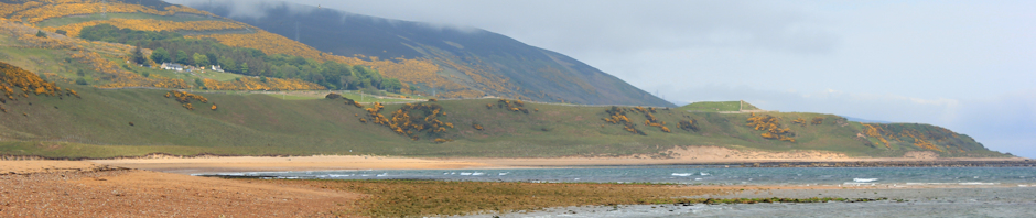
 From Southend, I walk along a well trodden footpath, following the coastal bank that runs along the side of Benfleet Creek. This creek leads inland to Basildon. On my left I pass Two Tree Island, a great bird spotting place, and then Canvey Island.
The path becomes a wide track, gravel to start with and then grass. The walking is easy and pleasant. I meet dog walkers and some serious backpacking walkers with maps dangling from their necks in waterproof pouches. There is no need for the waterproof pouches; the sky is overcast but the clouds are light in colour and there is no hint of rain.
Wild geese and ducks fly past me, flying low across the marshes and heading up the creek. I take a photograph, panning the camera to keep the geese in focus while blurring the landscape.

Across the creek, on Canvey Island, I see residential buildings and some industrial buildings beyond.
 To my right is a good view across marshes and fields to the railway line. Frequent trains rumble past – carrying commuters, shoppers and sightseers. Beyond the railway, the land rises to become a ridge. I see the ruins of a castle.
As the creek narrows, the path runs through a pretty marina, where small sailing ships are moored.
The public right of way is not very clearly signed, but crosses the marina and emerges along the bank at a point where there is a barrier across the creek. The barrier is part of the flood defence system and, just beyond, a very busy road crosses the river. The change from countryside to urban environment is sudden and takes me by surprise. This is South Benfleet.

I cross the road and continue along the bank of the narrow creek. The water looks dirty – complete with floating plastic bags and sunken shopping trolleys; more like a river than a creek. Although the footpath continues alongside the water, I can see from the map that it comes to a dead-end further along. I need to find another route. Turning inland, I pass under the railway line and find a nicely paved footpath that runs along the edge of playing fields, hugging the north side of the railway.
 Beyond the playing fields I see, with some dismay, that the footpath disappears into a narrow alleyway, running behind garden fences and bordered on the other side by overgrown bushes marking the edge of the railway. The path is narrow, two to three feet wide at most. The fencing is in various stages of decay. The bushes arch across from the gardens, meeting the overgrown growth on the railway side and forming a dark green tunnel.
I hesitate outside the dark mouth of this gloomy path. I can see dog excrement, plastic bags, discarded crisp bags and cigarette butts. A few yards inside and there is a bend, beyond which the path disappears into an even darker tunnel.
For the first time on my whole journey, I feel very uneasy. For a change, I am not concerned about tides, or mud, or even snakes. It is the thought of meeting other human beings in this unpleasant, dark place that worries me.
Well, I have to continue.
So I walk, as quickly as I can, into that dark, green, gloom.
After a few bends the ground is cleaner – less dog excrement and less litter – but the path becomes more overgrown. There are nettles and brambles reaching across the narrow walkway. I wish I had a stick. But at least I am making progress. And I meet nobody.
Emerging, blinking, into open land, I am relieved at having passed unscathed from the gloomy alleyway. I find myself in a field. How wonderful to be out in the open, in a familiar, rural environment.
Then I see the horses. I am nervous of horses. Or should I say, I was nervous of horses. In my relief at my safe passage through the alley, I greet them like old friends. They wander up to see if I carry anything interesting in my rucksack and then, disappointed, wander away again.

At the end of the field, I cross broken styles and find a track leading under a busy road, the A130. There are a number of footpaths to choose from. My plan is to arrive in Basildon for lunch. I try to find a path with a signpost for Basildon, but can’t find one. Eventually, I choose a path that runs along the righthand side of the railway track. This should be the right way, according to my map. I am a little confused because this path is signposted as leading to a church, not to Basildon.
 After a mile or so, the footpath emerges into a small churchyard. The sun comes out and I find myself in a wonderful place. St Margaret’s Church is very ancient, full of history and nestles in a beautiful, peaceful setting. I sit on a bench, in the sunshine, and have a drink and snack. What a fantastic place this is.
From the church, the footpath continues along the railway line, through fields with more horses and behind the back gardens of more residential houses.
I can hear the roar of traffic. This must be Basildon.
Emerging onto the A13, I am surrounded by noisy roads, flyovers, slip roads and rushing cars. Telephoning my husband, we find each other in an underpass. He has been unable to find a pub nearby and, therefore, we head for the large M of a MacDonald’s sign. On the way we spot a small cafe. We sit inside and have a good lunch.
After lunch, finding the footpath again is difficult. I walk back and forwards along the road near the station. Finally, I realise the path runs through a yard. There are parked lorries and vans. I feel distinctly out-of-place, marching through this yard with my walking gear on.
 Now the path winds through wasteland. Signs tell me this is not public land, please keep to the footpath. The belly of a large flyover rises to one side of me. There are workmen up on a platform, inspecting the underside of the flyover. I wonder what they are looking for. Cracks? We always assume these structures are safe and solid when we pass over them in our cars.
Crossing the railway line, I emerge into a large open space. This is a huge nature reserve, spread across Vange Marshes, the marshy land at the end of an estuary leading up to the edge of Basildon and finishing here. There are public footpaths crossing the marshes and free right to roam.
 I stick to the edge of this marshy area, following the footpath that runs around the perimeter. As I continue further, the footpath signs become increasingly faded and the styles become increasingly decrepid. Eventually, the path disappears altogether – and I wade through long grass, following what I hope is the general line of the footpath.
Worried about snakes, I put on my gaiters. These make my legs hot, but will protect me from adder bites – I hope.
Finally, I reach a track. Good. This is on my map. Now I am looking for a footpath that crosses farmland, leading to Fobbing Marshes. I can see no sign of the footpath I am searching for, although another footpath is marked, leading along the track and then into marshland – but this is not the one I want.
Walking courteously around the edge of the field, I find the point at the far side of the field where the footpath should emerge. Here there is a stream running through a deep ditch and a rotten plank is laid between the banks and gives me a means of crossing the water. I assume the presence of this wobbly “bridge” means I am on the footpath. But there are no signs indicating that my assumption is right.
I continue along more ploughed fields, heading south and keeping parallel to the ridge of high ground I see running to my right. I can see the church spire of Fobbing church, my final destination, ahead of me. I can even hear the church bells ringing. But the footpath, so clearly marked on the map, is still invisible to me. The fields are intersected with long hedges and ditches. Walking in a straight line is impossible. Growing tired, I become reluctant to walk farther than absolutely necessary.
Now I see a tractor and trailer coming up behind, heading towards me. There is a young man driving it. My spirits lift. He will be able to tell me where the footpath is.
As he draws near, I wave to him. He waves cheerily back – and passes me. Disappointed, I set off after him. He stops the tractor ahead and maneuvers it around so it is at right angles to me. Ah, he is waiting for me to catch up. I break into a jog.
But I made a false assumption. He hasn’t seen me running up behind him. Now the tractor sets off at high-speed across the field and a spray of brown material comes from the back of the trailer.
Manure! He is spreading manure!
The brown stuff is blown by the wind and heads straight towards me. Luckily it is dry powder, not wet mulch, but it coats my sweaty face and arms in a brown dust. Yuck!
I watch the tractor disappearing to the far end of the long field and make a decision. I have had enough of agriculture. I have had enough of tramping around trying to find a non-existent footpath. I have just had enough.
Following the edge of the field, I turn westwards and make for the ridge of high land. I can see residential houses here and the flash of a car passing along a road that runs along the top. Luckily I find a track with a bar gate at the end. The last part of the walk is easier, albeit uphill, and I can climb over the gate into the road.
 The walk along the pavement is easy. There are great views over the valley and the marshes, with the distant structure of the oil refinery in the distance providing a dramatic backdrop to the open green ground in front of it.
I stop and take some photographs. Unfortunately, the light is poor. I notice very clear signposting of footpaths from this road to the West, but not to the East – where my path was supposed to run.
The church bells are still ringing and this joyful sound becomes louder and louder as I walk, until, with relief, I arrive at Fobbing church. My husband’s car is parked by the church, but the car is empty. I can see his car alarm is flashing, but the noise – if there is one – is drowned by the sounds of the bells pealing.
I walk round one side of the church to the entrance porch. The is no sign of activity outside the church; only the noise of the bells inside. No sign of my husband either. I try to phone him but, although I know he has answered, we cannot hear each other because of the noise. I text him. “I am at the church”. He texts back, “So am I.” I continue walking round. Still no sign of him. Are we both circling the church in the same direction trying to find each other?
Eventually I text him “Stand still!”. Walking around the corner of the church again, I find him.
My husband has had a problem with his car alarm. It sounds continually as we drive off, passing a police car on the way. Luckily the noise of the faulty alarm is drowned by the pealing bells.
Later I try to report the problem with the footpath.
Who is responsible? The footpath crosses from Essex into an area controlled by Thurrock Council. As the point at which I lost path is just inside the Thurrock area, I report it to Thurrock council and give them a map reference. Unfortunately, they take the map reference as a single point, rather than an area – and deny responsibility as this point lies in an area for which Essex County Council is responsible.
Perhaps I should have pursued this, but life is too short and I have walking to do ….
Vital stats = ?
For the first time, my Trip Journal app lets me down. It reports a 5.8 mile walk. I know I have walked farther this this. So out comes my piece of string and the OS map.
According to the map, miles walked = 10
September 2014 Update: Basildon to Fobbing
This section is now covered by the new Thames Estuary Path. I haven’t been back to walk the route, but would expect it to be well signposted.
- Details of the Thames Estuary Path can be found at thamesestuarypath.co.uk
- And the relevant map is section 3, Stanford to Pitsea.
Poor Basildon gets bypassed altogether!


